.svg@webp)
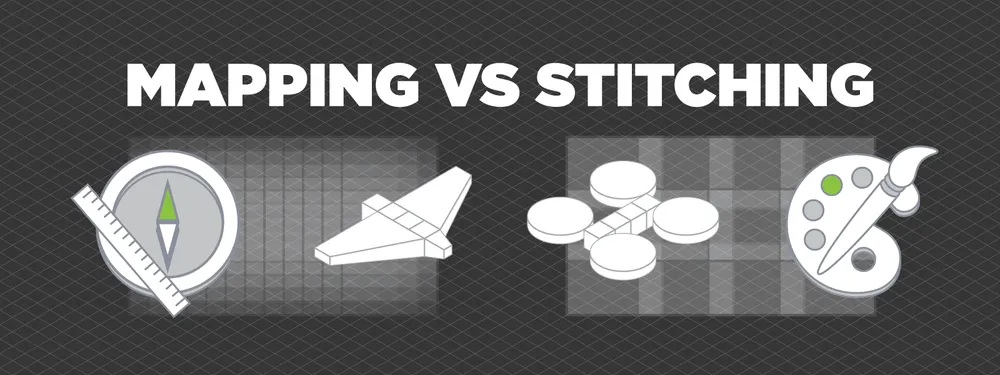
Aerial Mapping vs. Stitching
 Lukas
Zmejevskis
Lukas
Zmejevskis
Mapping and photo stitching are two different methods of acquiring top-down orthophoto imagery of a given area. This article will explain the main differences between these two methods and their results. Some direct indications will allow us to differentiate and define what we call photo stitching and how aerial mapping is different.
Short Glossary
First, let us define some commonly used terms when talking about top-down aerial photos:
- Aerial photo – any photo made from an aerial vehicle;
- Nadir aerial photo – aerial photo made while facing directly down;
- Orthophoto, orthomosaic, top-down panorama – a combined image of many overlapping aerial nadir photos;
- Orthorectified orthophoto – is an orthophoto image with a corrected perspective. It means an orthorectified image looks the same (as if viewed directly from above) in all areas;
- Control points (in this article) – points on a photograph, designating a clearly defined visual feature used to link many images together;
- Drone mapping – is the most common form of aerial mapping.
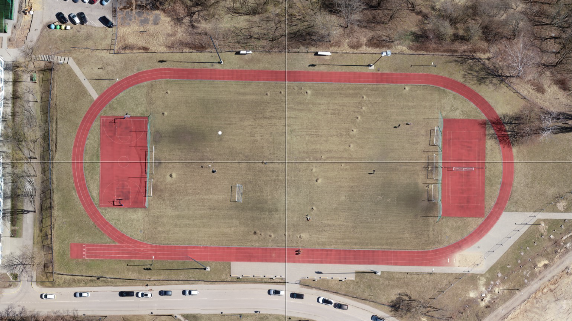
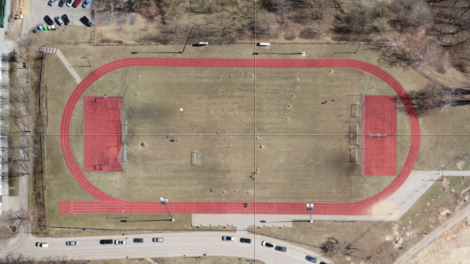
Non-orthorectified vs orthorectified aerial imagery
Photo Stitching
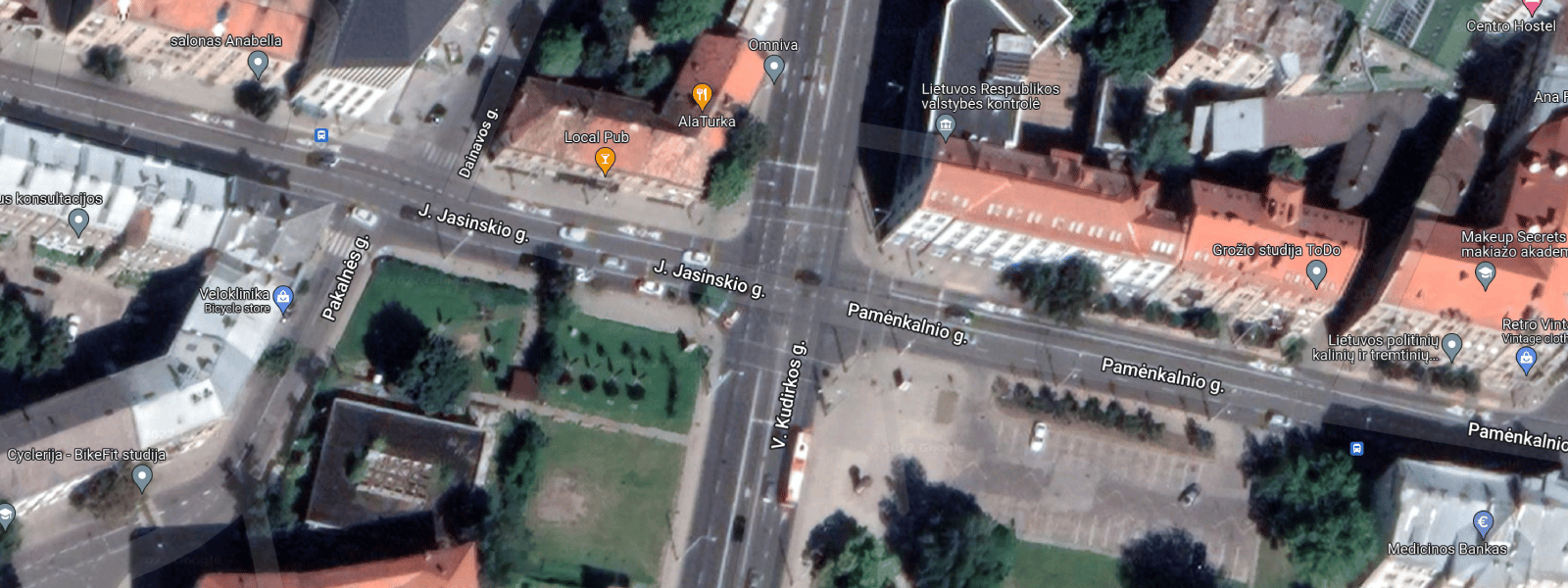
Photo stitching – is a process during which the graphical content of the photos and overlap connect them into a continuous top-down panorama. For photo stitching to work, a sufficient amount of overlap is required. Stitching can work from as little as 10 percent overlap if the overlapping areas are full of graphical features for algorithms to create control points. Recommended safe overlap value is 30 percent to ensure good panoramic stitching in most cases. The result is a stitched and blended image that should not have visible seams or discolorations.
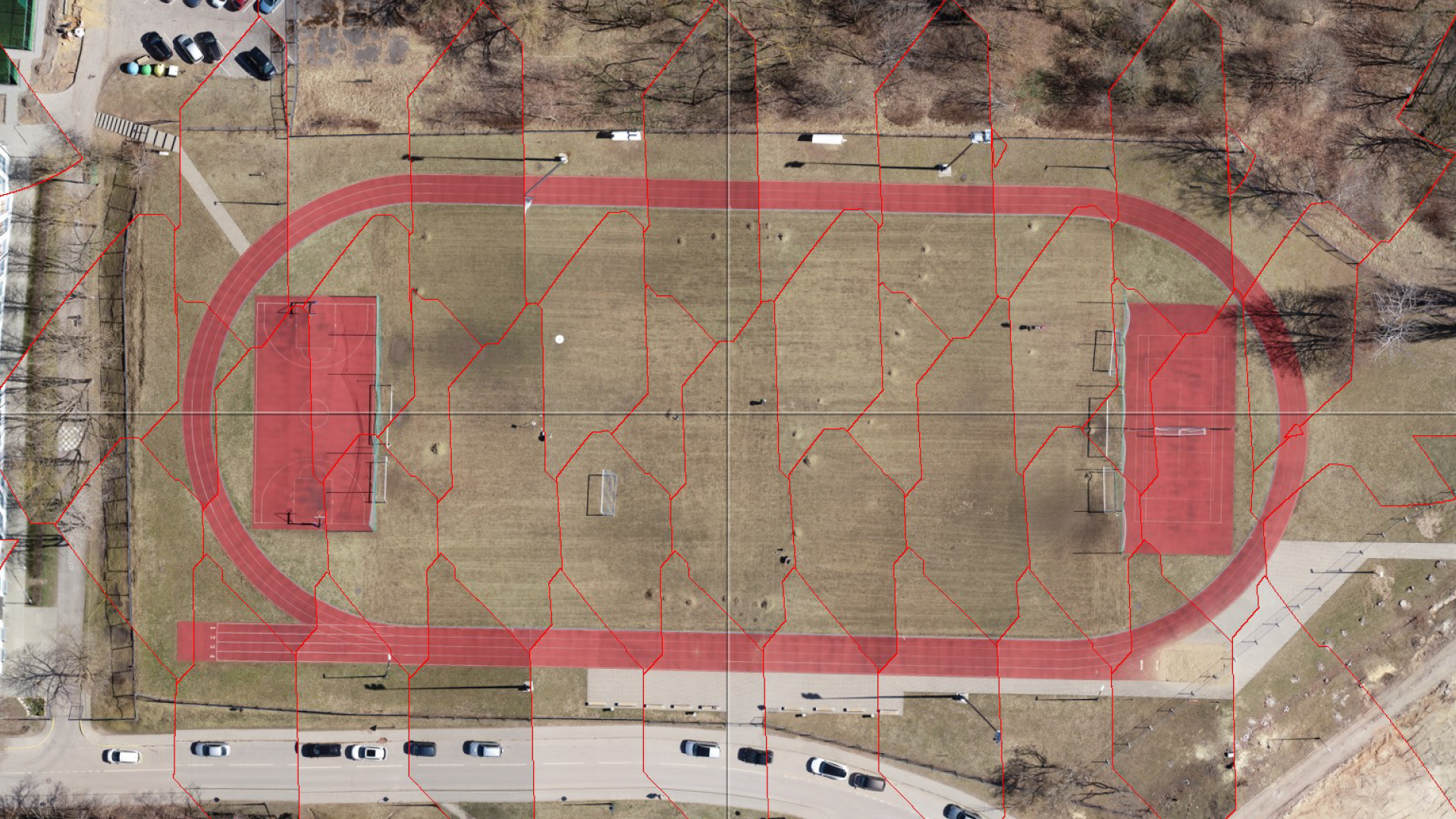
Orthomosaic image containing 45 photos blended together
Aerial Mapping
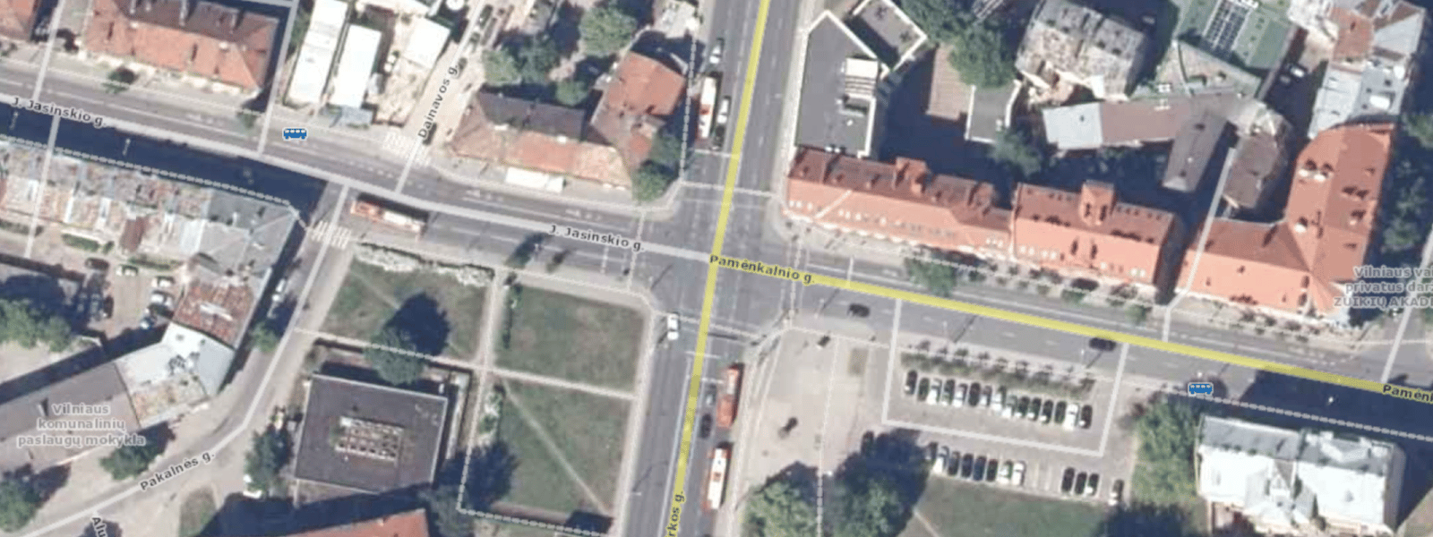
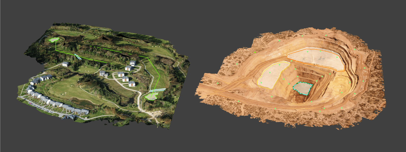
Aerial mapping is photogrammetry. A proper mapping process requires 80 percent overlap, takes much more time to complete than stitching, and provides more results. Photogrammetric algorithms undistort the input images to high precision, making the input data free of geometric distortions. Photogrammetry algorithms also need many more control points than stitching. At the same time, GPS and camera orientation photo metadata allow scaling the project accurately. A successful mapping process creates an entire photogrammetry project containing 3D point clouds, 3D mesh, and DEM surfaces. 3D surfaces have textures and orthophoto, which are orthorectified.
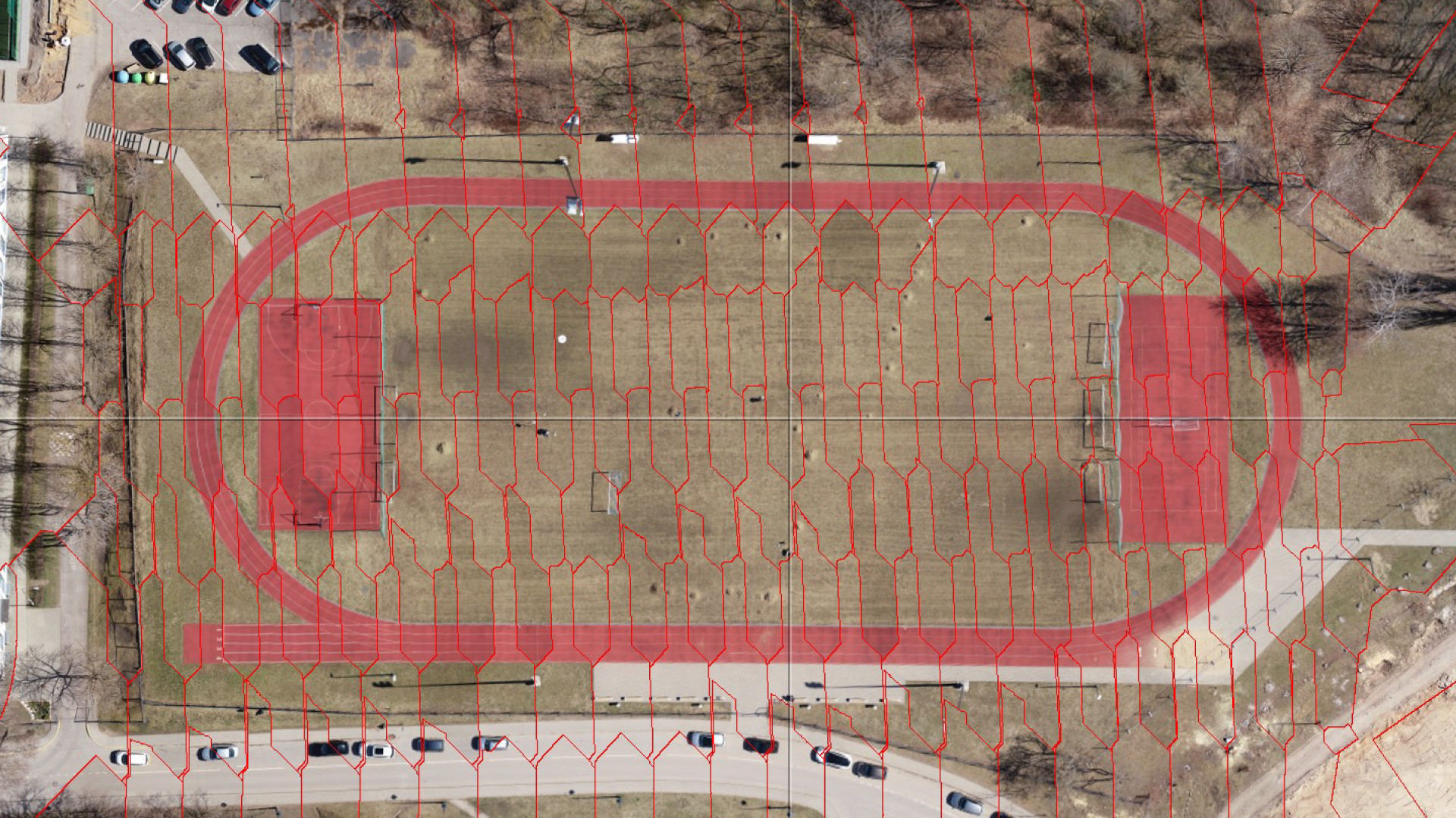
Orthomosaic image containing 179 photos blended together
Aerial Mapping Data
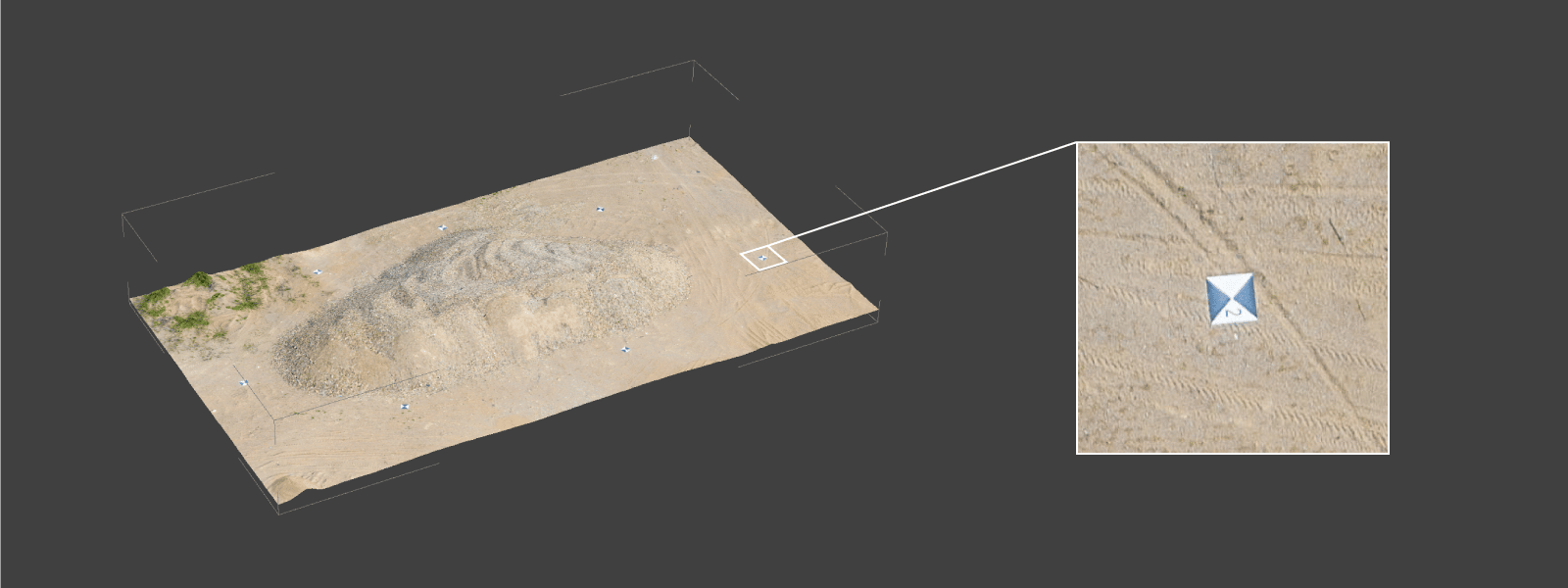
Aerial mapping workflows also encompass external data collection and processes to improve mapping accuracy. Most commonly, additional data for mapping cases are ground control points, flight tracks, and procedures such as PPK corrections.
Use cases
Stitched top-down panoramas have use cases in more art-related areas or for rough visual inspection when measurements and precision are not required. Moreover, panoramic stitching software can create panoramic images in mere minutes.
Accurate orthorectified images and 3D surfaces are obtained through aerial mapping only. Long photogrammetric computation provides high precision and enables measurements. There are endless use cases for aerial mapping, from mining to construction, surveying, monitoring, and conservation, to the architecture, heritage, and entertainment industry. Using aerial photogrammetry can increase safety and efficiency in these industries. At the same time, drone mapping provides results that might be unachievable otherwise.
Conclusion
Both photo stitching and drone mapping have their respective advantages and added value. While drone mapping requires a lot more skill and time to do, it provides much more results compared to simple photo stitching. Pixpro photogrammetry software is a tool for drone mapping. Try our software for free here and explore aerial mapping now.
Photographer - Drone Pilot - Photogrammetrist. Years of experience in gathering data for photogrammetry projects, client support and consultations, software testing, and working with development and marketing teams. Feel free to contact me via Pixpro Discord or email (l.zmejevskis@pix-pro.com) if you have any questions about our blog.
Related Blog Posts
Our Related Posts
All of our tools and technologies are designed, modified and updated keeping your needs in mind

Accuracy of Your Photogrammetry Project
Accuracy in photogrammetry is a multifaceted point of discussion. We can talk about absolute, relative, or even geometric accuracy, to name a few. No tool or technique can really prove anything beyond reproach.
Buying a Used Drone - Mavic 2 Pro in 2024
Buying used gear is an excellent way to save money and obtain something that may not be on sale anymore. With drones reaching the 4th or 5th technological generation, the used drone market is becoming more extensive.
Photogrammetry Processing - Common Hardware and Software Issues
Photogrammetry requires complex processing and data crunching to turn photos into 3D models. We need a powerful machine to run the software and all its processes. Not only that, but the software within our machine may impact the performance of photogrammetry software in various ways.
Ready to get started with your project?
You can choose from our three different plans or ask for a custom solution where you can process as many photos as you can!
Free 14-day trial. Cancel any time.