.svg@webp)
Handheld Photogrammetry with a Drone
 Lukas Zmejevskis
Drones are cameras with wings and propellers. The aerial perspective often makes a drone their first dedicated imaging device for many people. Drones also provide a utility that has changed aerial mapping surveying forever. It is common for people or businesses to own a drone but not a dedicated camera for their photogrammetry needs. It leads to a situation when your drone is your best camera. But what if you do not need to spin up those motors for low-altitude photos? Most drones can be used as good terrestrial cameras as well.
Reasons to Handhold a Drone
The obvious question is - why use a drone handheld instead of flying? There are a few reasons to do so if you do not need the flight capability to reach certain spots:
- Energy conservation. A drone lasts quite a lot longer if the motors are not spinning. Suppose you do a lot of videos or photos for photogrammetry. In that case, you can take a lot of terrestrial handheld shots without even making a dent to the battery life.
- Noise. Drones operate quietly without propeller spin and can be outright unusable at lower altitudes due to noise alone. You may look peculiar by carrying a drone and taking pictures, but flying close to the ground will guarantee all kinds of attention.
- Safety. Flying near the ground makes drones much more of a safety hazard for people, animals, and objects. Just carrying around like a camera will be safer for everyone around you and the device itself.
- Precision. It is much easier to control the drone when physically holding it than with the remote control sticks.
- Speed. Carrying a drone does not tie you to the inertia and acceleration of a drone in flight, which can significantly decrease the time spent moving around your subject.
- Consistency. Using a drone instead of a different camera when combining aerial and terrestrial photos provides consistency and full data compatibility. Processing two or more cameras simultaneously in a single photogrammetry project only introduces more opportunities for something going wrong or visual inconsistency due to quality, color, and other differences.
Reasons Not To
Arguments for using a drone as a handheld camera are clear. Here are some arguments against it:
- Carrying a drone is physically much more demanding than just letting it fly, not to mention the awkward ergonomics of simultaneously holding a drone and a remote controller in your hands. That said, there are solutions to make it easier, such as straps and carrying handles.
- Some drones can overheat when operating, not in flight. Many drones have internal fans, and cooling is adequate for most situations, even when not in flight. But one of the most popular drones on the market - the DJI Mini 3 and 3 Pro does not, and it will overheat eventually.
- Gimbal stabilization feels off when operating the drone handheld. The camera gimbal is designed to work in flight and might feel odd. In addition, it does not dampen any sudden movement, such as steps. Keep this in mind to avoid motion blur in the photos.
- GPS inconsistency. Holding a drone near a high level provides a much worse GPS signal than a regular flight high above. The inconsistent GPS data gets written to each photo you take, which might confuse photogrammetry software during processing. Generally, it should be fine if aerial photos with good GPS data are combined.
- You may look conspicuous walking around with a drone. For some, it could be more suspicious than just flying it.
About the Process
Now that we got our pros and cons out of the way, we can describe the process itself. Conceptually it is as simple as walking around with your drone and taking photos with the app. The only thing that may need some time to adjust to is the gimbal operation. The gimbal tries to keep the camera as steady as possible and may seem unresponsive to direction changes. It can seem floaty and move even if you are not. It quickly becomes a non-issue with some practice. Just be sure to avoid camera movement during a long exposure time.
Photo capture can be an automatic timed shooting or a manual triggering. Suppose you synchronize your walking and pointing the drone with a three- or four-second timer. In that case, you can still work quickly without worrying about pressing the shutter button.
Manually pressing the shutter button is more flexible but requires always holding the remote controller. It becomes an issue if you need to have your drone high above your head or low to the ground, as it becomes tiring quickly with a single hand.
Otherwise, all basic photogrammetry principles apply as usual. Eighty percent overlap, good photo quality, excellent subject coverage, and oblique angles if necessary - just as with any other photogrammetric scan.
3D Scan Example
We made an almost “worst case scenario” example combining terrestrial handheld photos made with the same drone. Our subject is an old building surrounded by trees and other obstacles limiting flight and general walking accessibility. The sky was heavily overcast, with some change during the shoot, and the GPS signal was weak even when flying. GPS signal inconsistency introduced irregular patterns upon photo upload into Pixpro.
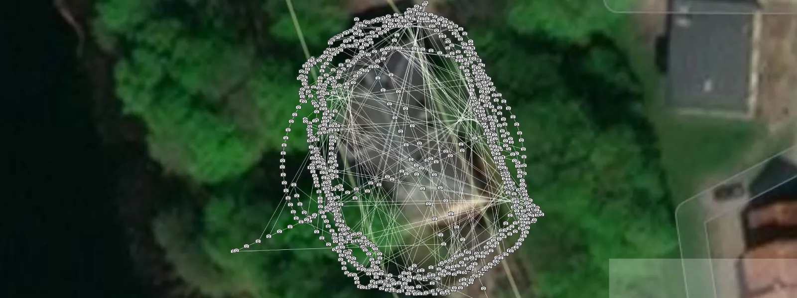
We made a few perimeter passes, holding the drone low, below hip level, and high above the head. In these two, the camera faced building walls directly, and we added one additional perimeter with the camera pointing upwards.
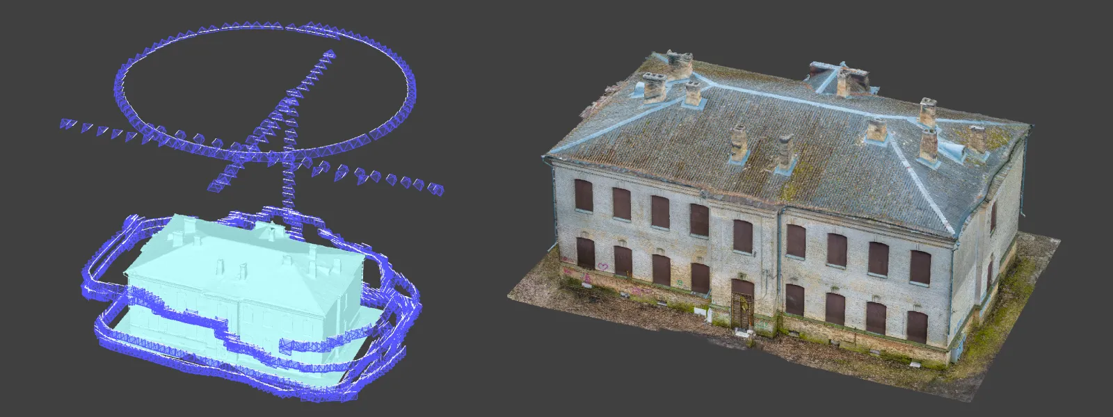
Then we tried flying low altitude perimeters, avoiding trees. One perimeter flight with the camera pointing directly at the building and one with the camera pointing downwards at an angle.
We added an orbital scan from above for the roof, and a single row passes from all sides of the building. Additionally, we made a final vertical pass for the facade part to connect all photos. We took 1189 photos using the S mode on the DJI Mavic 3 set to 1/240th of a second shutter speed, f2.8 aperture, and auto ISO.
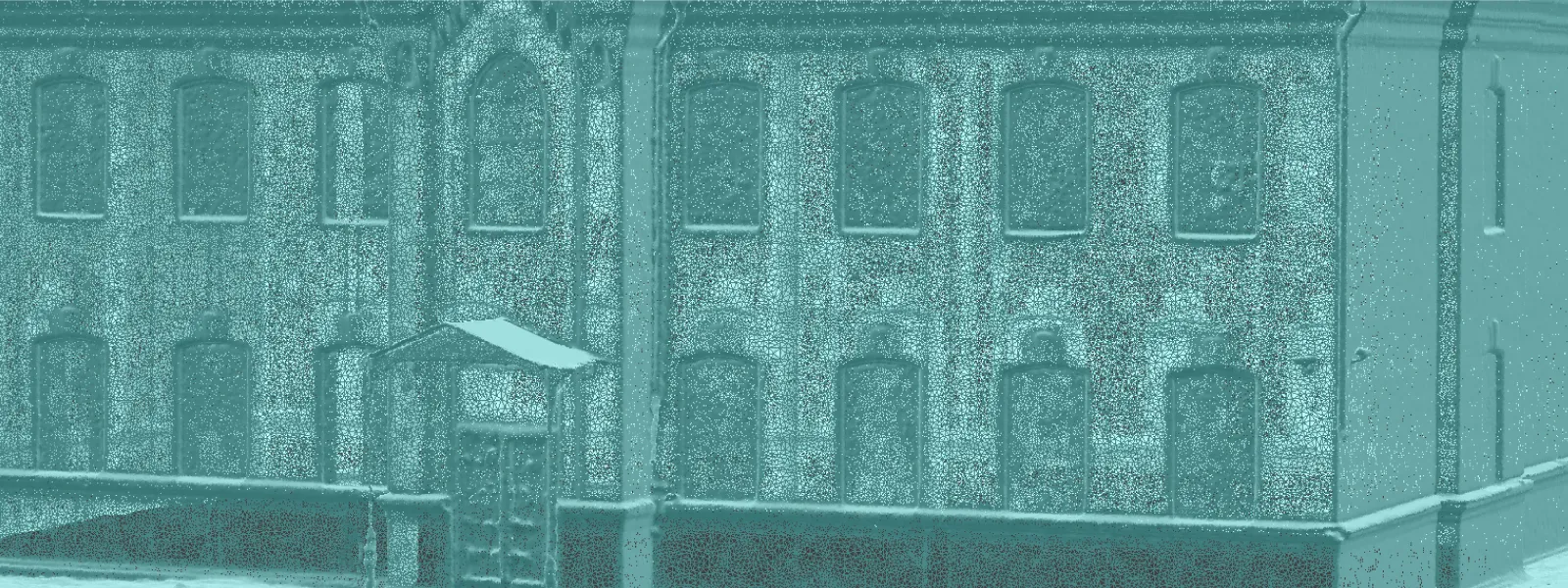
We took photos in raw format and processed them in Adobe Lightroom. White balance, exposure, shadows, and highlights needed some adjustments to make a more consistent look for all photos. Finally, all images were uploaded into Pixpro and processed all at once.
Conclusion
Even if it may seem odd initially, hand-holding your drone and taking pictures is a viable technique for many scenarios. We can use it for places that pose a danger when flying, indoor spaces, and times when we need to be more discrete or save energy. If you are into photogrammetry and 3D scanning, eventually, you will encounter an object that will significantly benefit from having consistent aerial and terrestrial photos from the same device in the same photo set.
Photographer - Drone Pilot - Photogrammetrist. Years of experience in gathering data for photogrammetry projects, client support and consultations, software testing, and working with development and marketing teams. Feel free to contact me via Pixpro Discord or email (l.zmejevskis@pix-pro.com) if you have any questions about our blog.
Related Blog Posts
Our Related Posts
All of our tools and technologies are designed, modified and updated keeping your needs in mind

Accuracy of Your Photogrammetry Project
Accuracy in photogrammetry is a multifaceted point of discussion. We can talk about absolute, relative, or even geometric accuracy, to name a few. No tool or technique can really prove anything beyond reproach.
Buying a Used Drone - Mavic 2 Pro in 2024
Buying used gear is an excellent way to save money and obtain something that may not be on sale anymore. With drones reaching the 4th or 5th technological generation, the used drone market is becoming more extensive.

Photogrammetry Processing - Common Hardware and Software Issues
Photogrammetry requires complex processing and data crunching to turn photos into 3D models. We need a powerful machine to run the software and all its processes. Not only that, but the software within our machine may impact the performance of photogrammetry software in various ways.
Ready to get started with your project?
You can choose from our three different plans or ask for a custom solution where you can process as many photos as you can!
Free 14-day trial. Cancel any time.
Welcome to Pixpro
Sign in
And access your account.