.svg@webp)
Pixpro Software 1.6.5 is Here
 Lukas
Zmejevskis
Lukas
Zmejevskis

A new version of Pixpro photogrammetry software is here, and it brings new features, improvements, and fixes. Let’s go through them.
New Wizard Workflow in Pixpro Software
We added a new wizard-type workflow for creating cloud computation and local projects. Now we can create Pixpro projects on a step-by-step basis. The wizard also includes hover tooltips with detailed information.
Also, a new home screen containing recent projects with layer icons will greet you upon opening the software. The layer icons represent what layers are present in each project.
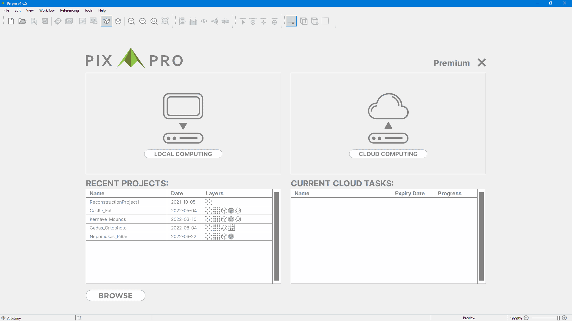
The right portion of the home screen is for current cloud processing tasks. You can press the X button to quickly cancel the job or click on the cloud computation task to monitor it. We hope the wizard workflow will be an even quicker and more intuitive way of creating your photogrammetry projects.
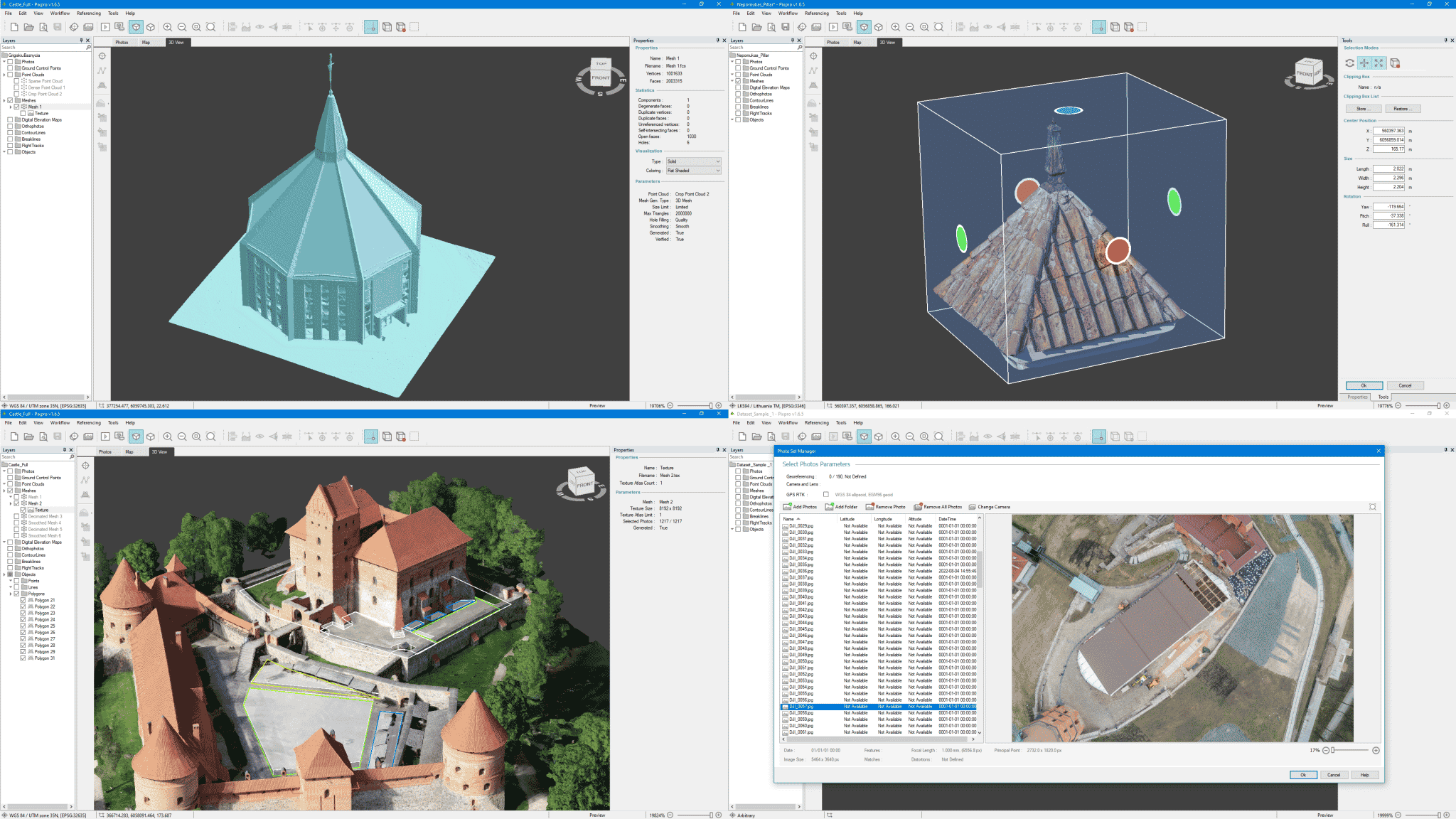
Manual Project Referencing
We are expanding our referencing options and adding manual referencing tools for 3D modelers. We have added a new panel called Manual Referencing which contains:
- The ability to do manual 3-dimensional translation using known origin points and coordinates.
- Scaling option – by drawing a known distance and thus scaling the project.
- Rotation option – you can rotate the entire 3D space with a rotation sphere or by entering numerical rotation values.
- Direction selection by plane – for uprighting unreferenced 3D scans by selecting a ground plane,
- Direction selection by axis – for uprighting unreferenced 3D scans by choosing a vertical axis.
Using these tools, you can bring your 3D scenes and assets close to real-life dimensions and orientation for further use. We made them as efficient and easy to use as possible. An example of manual referencing tool usage in the video below:
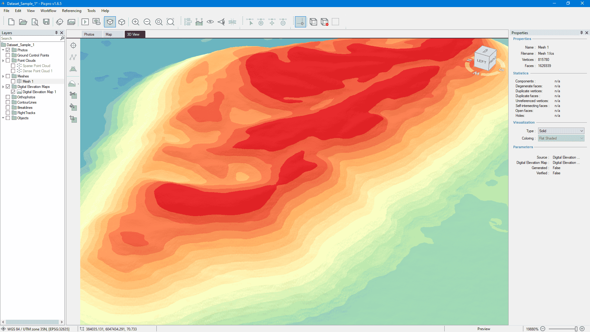
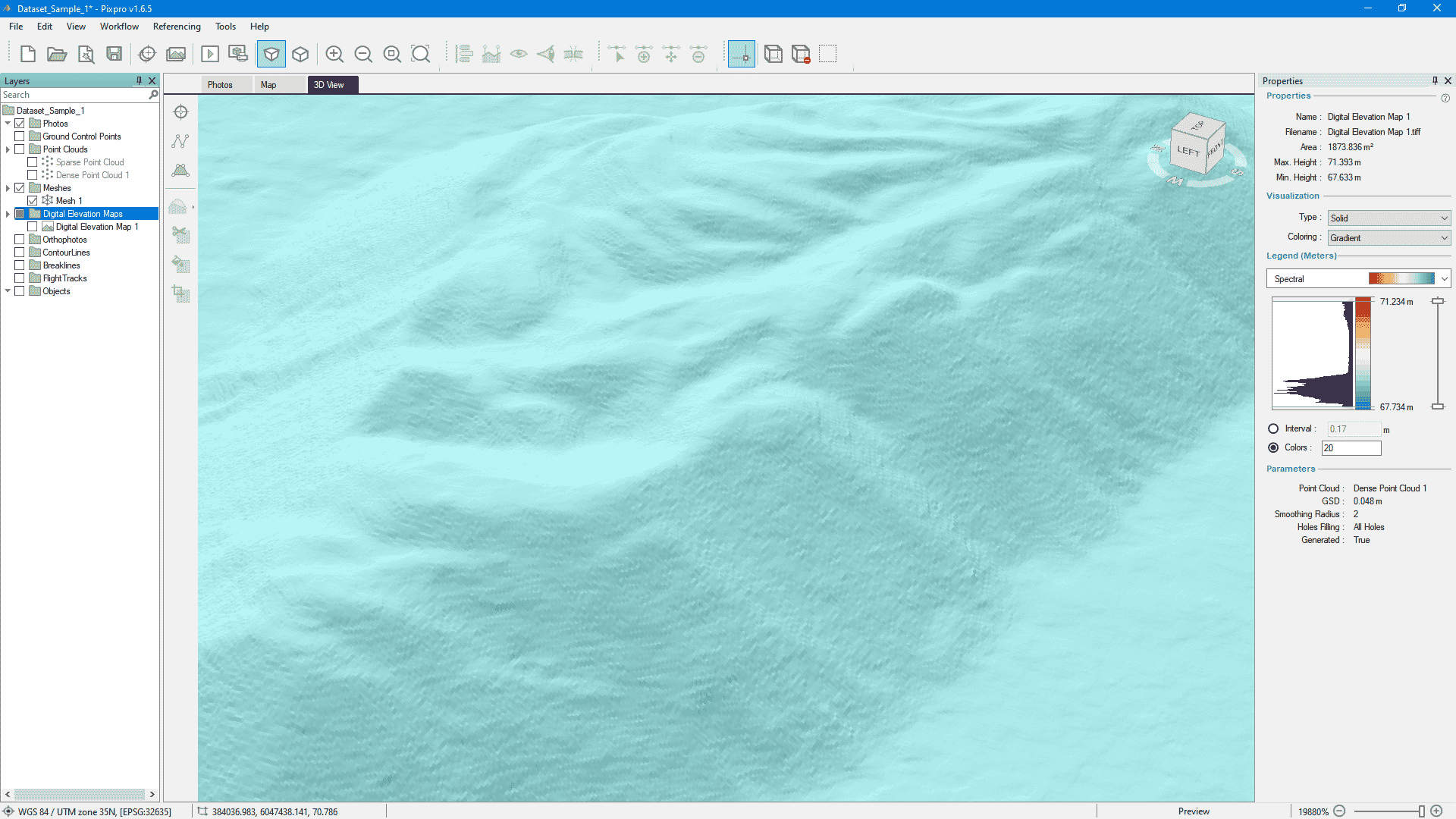
Creating a 3D Mesh Surface from a DEM
We are adding a particular functionality that we learned from mining industry partners – 3D mesh creation from a digital elevation map. It allows having a raster image represented in actual 3D mesh form for further use in 3rd party software.
Other Pixpro Software Improvements in 1.6.5:
- Better 3D visualization – we are updating the visualization engine, so objects in the 3D view look better without any added performance or usability drawbacks.
- Tree view updates – our layer tree view now contains a search bar, multiple selection support, and performance improvements. These are for those who like to have hundreds of objects and layers in a single project.
- RTK flight track support. Now RTK level data is appropriately used during flight track import, and geoid corrections are applied.
- DXF format added to dense point cloud export formats.
- And finally, dozens of bug fixes and under-the-hood improvements.
You can try the new Pixpro software now and enjoy free photogrammetry for 30 days. If you have already used up your free month before, contact us via any of our support channels, and we can reset the trial for you, free of charge!
Photographer - Drone Pilot - Photogrammetrist. Years of experience in gathering data for photogrammetry projects, client support and consultations, software testing, and working with development and marketing teams. Feel free to contact me via Pixpro Discord or email (l.zmejevskis@pix-pro.com) if you have any questions about our blog.
Related Blog Posts
Our Related Posts
All of our tools and technologies are designed, modified and updated keeping your needs in mind

Accuracy of Your Photogrammetry Project
Accuracy in photogrammetry is a multifaceted point of discussion. We can talk about absolute, relative, or even geometric accuracy, to name a few. No tool or technique can really prove anything beyond reproach.

Buying a Used Drone - Mavic 2 Pro in 2024
Buying used gear is an excellent way to save money and obtain something that may not be on sale anymore. With drones reaching the 4th or 5th technological generation, the used drone market is becoming more extensive.

Photogrammetry Processing - Common Hardware and Software Issues
Photogrammetry requires complex processing and data crunching to turn photos into 3D models. We need a powerful machine to run the software and all its processes. Not only that, but the software within our machine may impact the performance of photogrammetry software in various ways.
Ready to get started with your project?
You can choose from our three different plans or ask for a custom solution where you can process as many photos as you can!
Free 14-day trial. Cancel any time.