.svg@webp)
The Importance of Shading in 3D Photogrammetry
3D object reconstruction from photos with the help of photogrammetry based software solutions is here. The analysis of the 3D object is easy and requires only few steps, although unforeseen obstacles may occur anytime.
Photos quality is the core when talking about analysis of 3D models. It is important to know how to take pictures properly (exposure settings, overlap, focus, motion blur) and how to deal with the surrounding environment.
Visualization tools to eliminate obstacles
Pile that is surrounded by high trees can result in very picturesque 3D model, though making the analysis of it might be tricky. While working with objects that have vegetation, the analysis may be difficult because of cast shadows or the fact that the object is obscured altogether. One of the ways to avoid shadow influence, is to make pictures while the sun is in zenith.
Shadow areas eliminated by shading
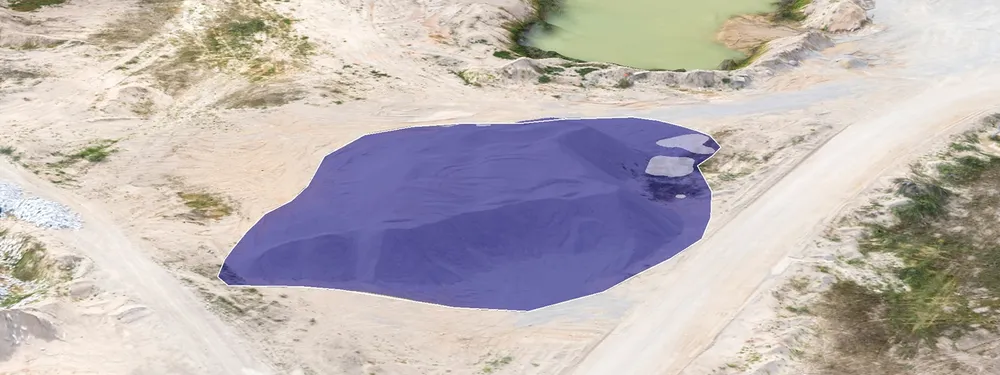
The picture below perfectly depicts the common situation with the shadows. The stockpile in it is difficult to detect as the major part of its contours and surface perfectly merge with shadows. Taking a better look, the stockpile, as well as its obscure contours are hard to notice.
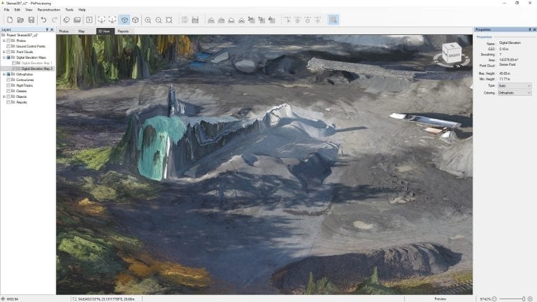
Photogrammetric digital elevation map
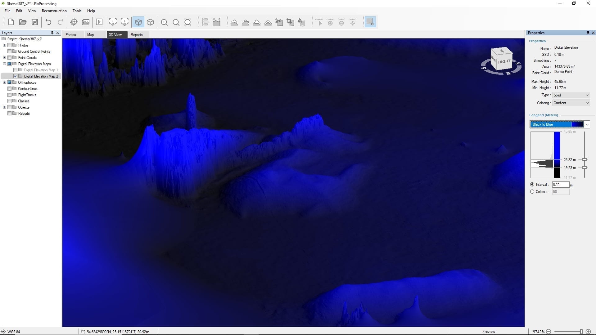
In such situations DEM (Digital Elevation Model) is irreplaceable feature. DEM layer is useful for quick and unlimited visualization of surface relief and object analysis. This feature eliminates all the possible interference and accurately reflects object height according to its coordinates, captured when taking photos. In this case, the accurate surface of the object is recreated.
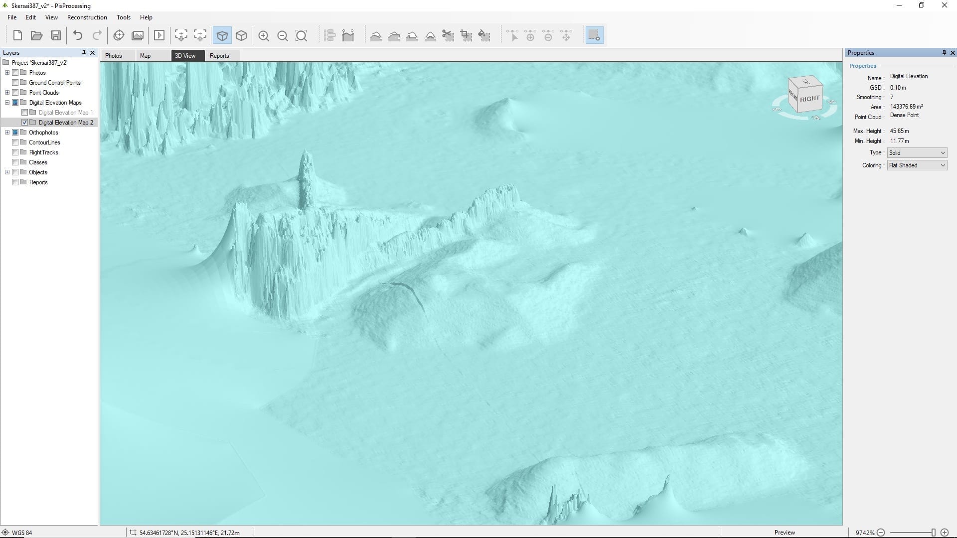
Therefore, DEM is mainly used for object analysis. Pixpro software offers a wide range of shading options, that are very useful features, when it comes to the different DEM shading methods. By changing them, one can clearly see that the object exists. For example, flat shaded coloring mode already gives clearer idea where the actual pile perimeter is.
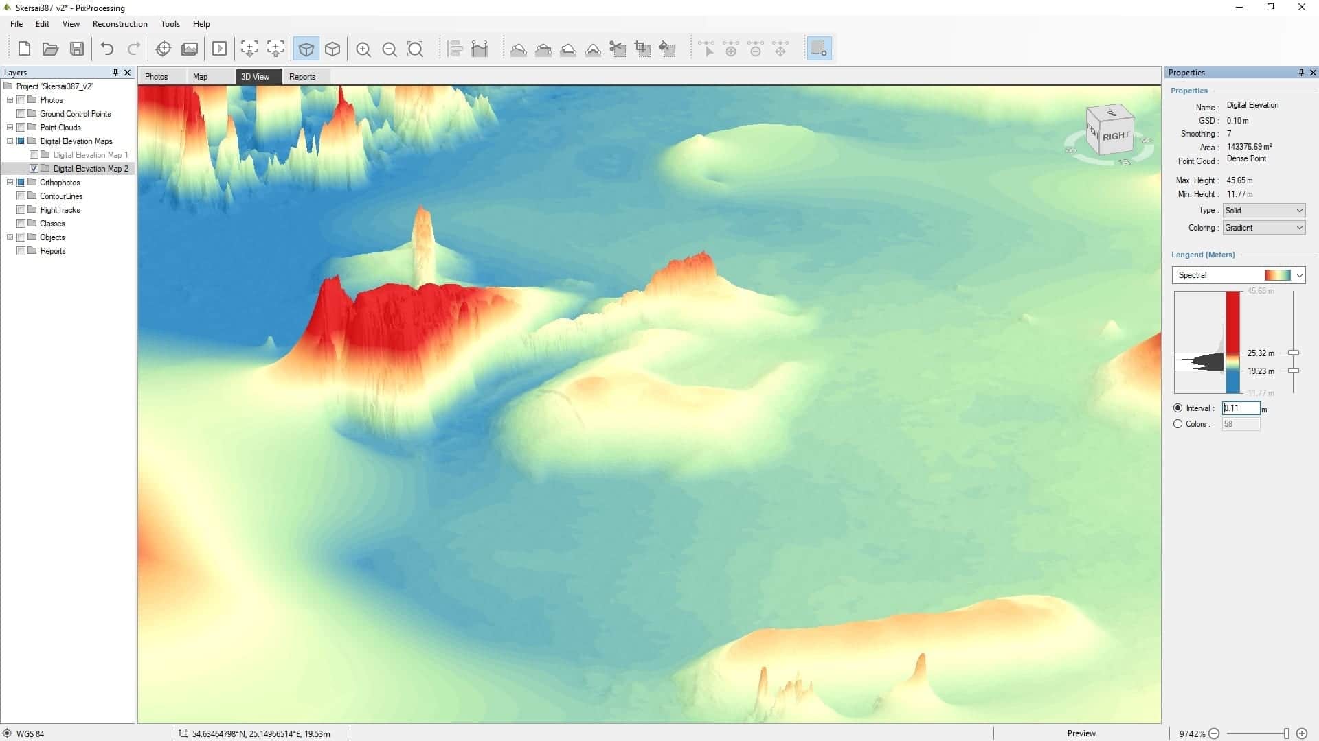
Even more visually appealing options are the gradient coloring ones, especially the spectral. Because of its 3D view, it lets user to clearly see the height change and identify possible contour lines.
The range of the colorfulness options gives user possibility to extract more visualization effects such as highlighting the small details and elements of the object. When the object is clearly seen, we can easily mark it and make further calculations.
Analyzing the digital elevation map in Pixpro
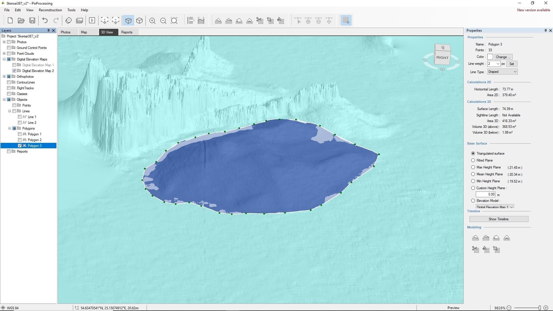
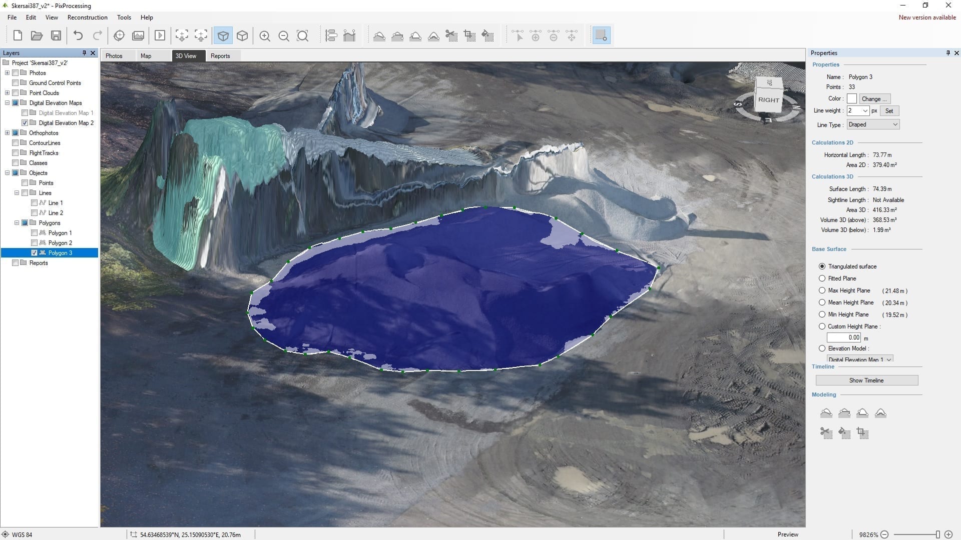
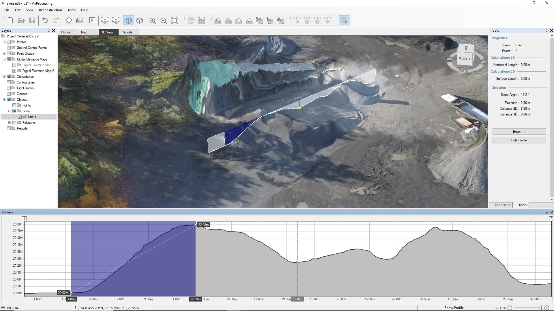
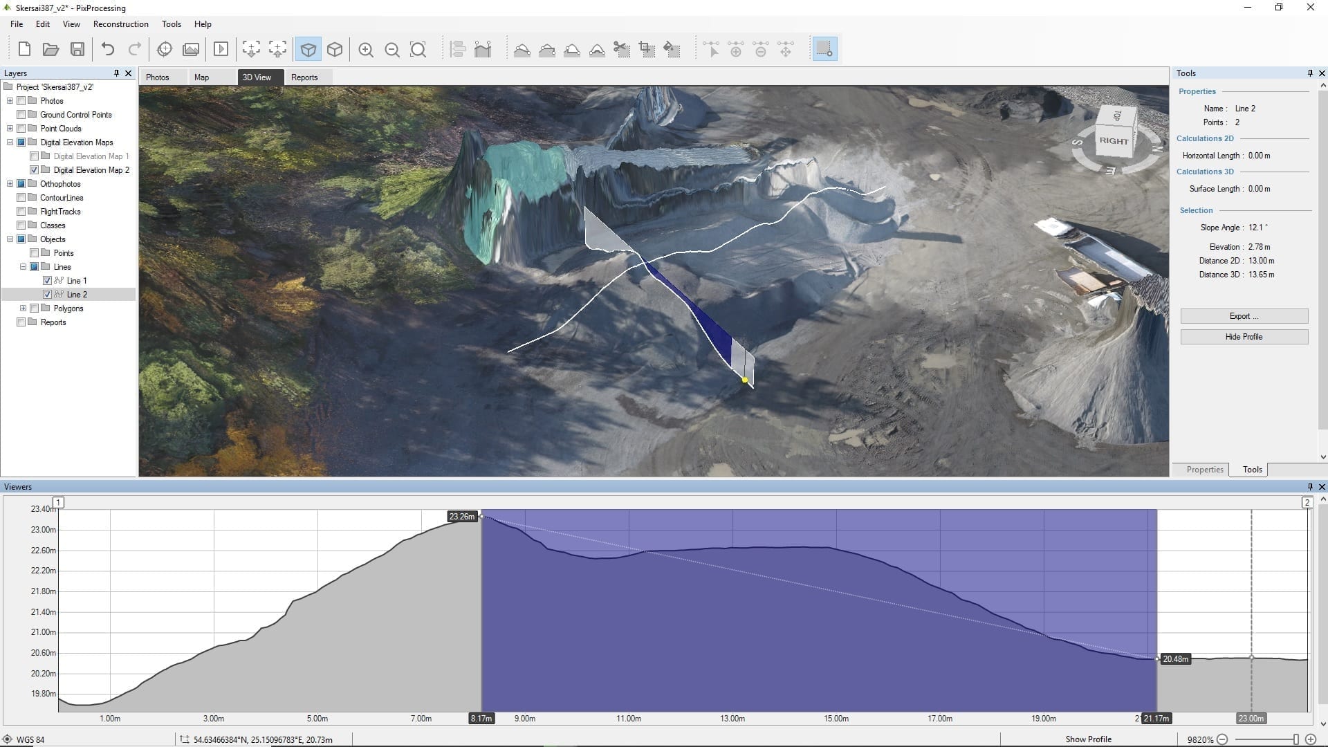
Having clearly identified stockpile contours, it is possible to proceed the stockpile analysis. The polygon feature enables to select the needed object and calculate its volume. It is also possible to see how the stockpile is seen in different shading, leaving the selected polygon as the starting point.
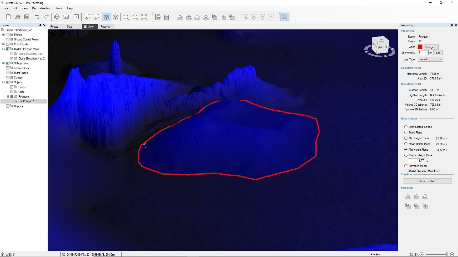
Knowing the volume, we can even analyze the shape of the object. Profile feature enables you to get precise information on the object structure (height, distance, angle, etc) at any position. When putting the line alongside the object and checking the profile of the indicated line, it is possible to see the fluctuation of the surface. Talking about this specific stockpile, the highest point is 2,96 m.
Digital elevation map shading and analysis – a powerful tool in Pixpro
Pixpro software possesses a wide range of features that speed up and facilitate the daily analytical work as well as provides essential information for effective business management. By choosing photogrammetry based software it is important to pay attention to its ability to handle various possible unforeseen situations.
After all, we can not always avoid the shadows or the darkness – for various reasons non-ideal conditions have to be overcome or adapted to. For example, the rain may stop only when the light is fading and unacceptably long shadows may appear. This makes orthophotography images look too dramatic and technically not that useful. Shadows may show quite a different picture hiding some useful information in it. For this reason, various DEM shading options are very important features in photogrammetric software.
Pixpro has many shading options that lets user to change the structure of the surface, the colors, its development and so on. It facilitates work with small objects that are difficult to evaluate because of the shadows or other inconvenient situations.
Related Blog Posts
Our Related Posts
All of our tools and technologies are designed, modified and updated keeping your needs in mind

Pixpro Software Update - Version 1.7.5
e bring a small update with some minor changes and our first foray into multispectral imagery. Our philosophy is to keep the interface and user experience stable while introducing the ability to change things on demand.

Pixpro Tutorial Videos Part 1 - Essentials
Our Pixpro photogrammetry software is relatively easy to use, but everyone needs a starting point. We created a series of short videos that demonstrate how to begin using Pixpro even if you have never used the software before.

Accuracy of Your Photogrammetry Project
Accuracy in photogrammetry is a multifaceted point of discussion. We can talk about absolute, relative, or even geometric accuracy, to name a few. No tool or technique can really prove anything beyond reproach.
Ready to get started with your project?
You can choose from our three different plans or ask for a custom solution where you can process as many photos as you can!
Free 14-day trial. Cancel any time.