.svg@webp)
When Interactive Histogram becomes an Irreplaceable Feature

There are cases when performing object analysis using photogrammetry based software, the large or tiny objects are difficult to evaluate. It happens because the objects are often imperceptible. Therefore, histograms are one of the most useful features to showcase the height variation of the object. Different shading of DEM is a must to have feature in software that creates and visualizes DEMs.
Digital elevation map shading options
Pixpro software provides 3 categories of shading:
- Gradient;
- Orthophoto;
- Flat shaded;
Each option is used in different situations.
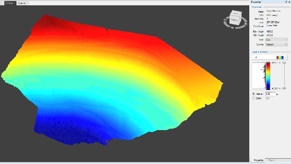
Gradient elevation map shading feature
Gradient shading allows user to choose from numerous available styles to get the desired outcome. Besides the ability to select the most aesthetically pleasing or regionally most used shading option, user can choose particular one that most accurately fits the theme of the subject (for example, reds scale for sandstone piles or greens for grassy hills).
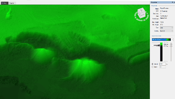
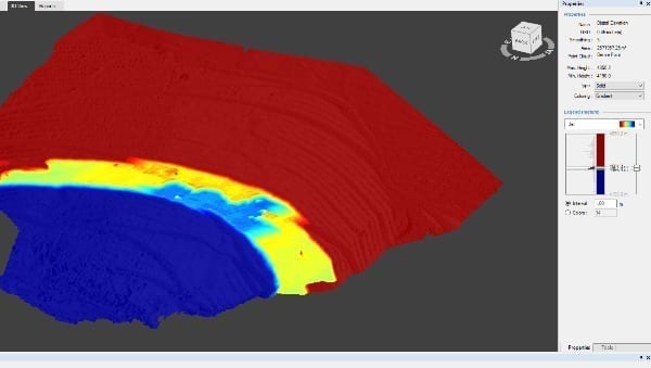
Three – color heat scales allows visually intuitive representation of extremely high elevation differences.
The ability to choose the shading interval helps to control the smoothness and clarity of DEM. For instance, having very small and fine intervals result in a smooth and visual representation (image above).
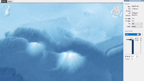
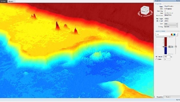
Having large interval enables user to quickly calculate heights and its differences without even doing any measurements. For example, the image below has 50-meter intervals.
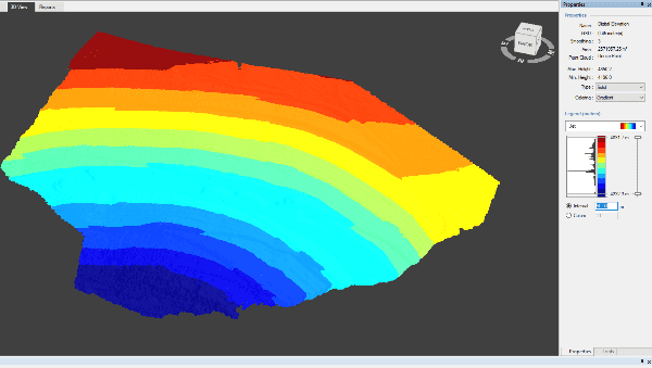
Besides having the ability to choose the gradients in Pixpro software, user can also choose where to apply the shading in histogram. This means that no matter what is the overall DEM, its height differences and shading can be applied to a small portion of the objects to quickly visualize the smaller ones located in the same DEM. Bellow a small portion of the DEM shaded:
Orthophoto shading option on a surface
As the name implies, orthophoto projects the photographic data on the DEM thus showing the most realistic possible 3d model with textures taken from the photographs.
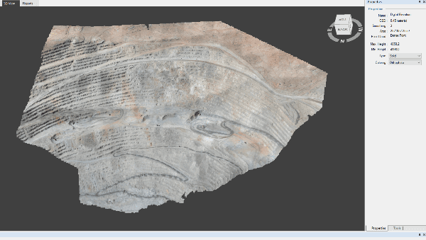
This shading option most accurately represents the real world at the time photographs were taken and enables user to operate fully visually. One can place contour lines according to “reality”. For example, one sees a water body and places that contour line around it. Or sees a different rock layer and marks it with a contour line, or starts measuring from that point.
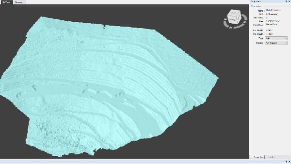
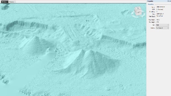
Flat shading on a surface
Flat shaded is a monochrome option with different shades of the same color. This is the best for seeing the DEM most clearly. Small objects become more visible, slope angles more clearer and textures do not distract or confuse in any way.
Visualization of digital elevation maps redefined
With Pixpro software one can easily get a better visualization of the object elements in the selected height level. You can adjust:
- Colour ramp palette;
- Colour change scale;
- Texture options.
The shading option is a crucial feature for dealing with converging objects as it quickly accentuates the surface irregularities. Min and max height value selection of the histogram enables a better visualization of the object elements in the selected height level.
Related Blog Posts
Our Related Posts
All of our tools and technologies are designed, modified and updated keeping your needs in mind

Pixpro Software Update - Version 1.7.5
e bring a small update with some minor changes and our first foray into multispectral imagery. Our philosophy is to keep the interface and user experience stable while introducing the ability to change things on demand.

Pixpro Tutorial Videos Part 1 - Essentials
Our Pixpro photogrammetry software is relatively easy to use, but everyone needs a starting point. We created a series of short videos that demonstrate how to begin using Pixpro even if you have never used the software before.

Accuracy of Your Photogrammetry Project
Accuracy in photogrammetry is a multifaceted point of discussion. We can talk about absolute, relative, or even geometric accuracy, to name a few. No tool or technique can really prove anything beyond reproach.
Ready to get started with your project?
You can choose from our three different plans or ask for a custom solution where you can process as many photos as you can!
Free 14-day trial. Cancel any time.