.svg@webp)
Weather Conditions for Aerial Photogrammetry – What to Look Out For?
 Lukas
Zmejevskis
Lukas
Zmejevskis
Weather conditions for your drone flight are a variable you can not control. But you can monitor the ever-changing skies, predict the immediate conditions and choose your battles carefully. Adapting to different wind and lighting conditions requires skill, alertness, and experience. With each aerial photogrammetry assignment, the photogrammetrists job is to deliver a high-quality image set that will yield results in the software. Let’s discuss how different weather conditions hinder or help you to achieve these results.
Lighting Conditions = Image Quality
Time of Day
For taking high-quality photographs – light is an essential factor. Generally, you cannot get high-quality photos in low light conditions, even with the latest and most excellent drones. Dim light conditions require high camera sensitivity, which introduces noise and lessens the detail. It eliminates periods when there is not enough sunlight to work – night, dusk, and dawn. Sunrise and sunset conditions also mean long shadows and large shadowy areas with insufficient light. So we recommend avoiding these time of day conditions.


Only in sporadic cases of aerial photogrammetry can we get enough artificial light and ignore natural light conditions, so we will not be delving into that.
Clouds
But the time of day is not weather, and therefore can be chosen. Pesky clouds are the second most influential factor in how much light reaches the subject of aerial photogrammetry. Thick cloud cover can reduce the amount of light to what we could almost consider low light conditions. Still, the thick clouds bring rain and thunder, which would be the immediate problem. A consistent, thin cover of clouds gives the best possible conditions for aerial photogrammetry. If you see the light gray skies outside without a patch of blue without rain – get out and make the best aerial scans you can.
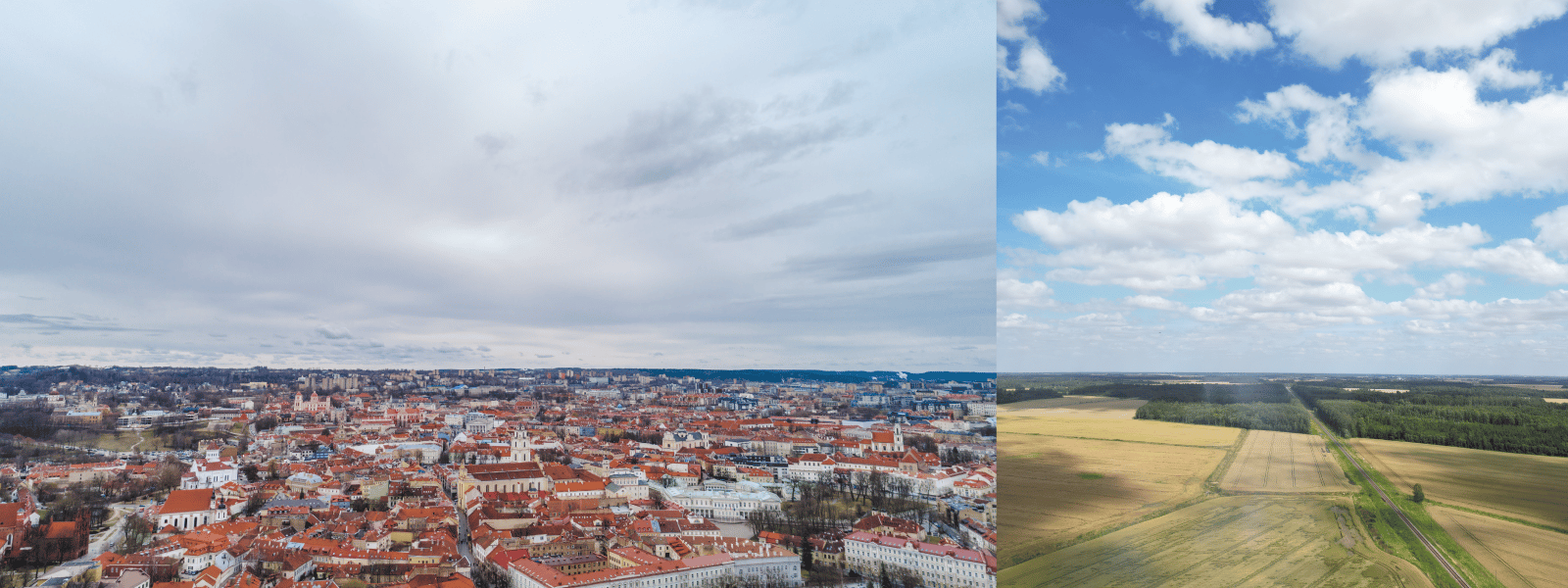
The most problematic kind are the scattered fast, moving clouds which cast shadows onto your subject some of the time. At the same time, direct sunlight is present in between. It is especially troubling for those scanning large areas and looking for high-quality orthophoto imagery. Here are a few tips on how to deal with these conditions:
- Use semi-automatic image exposure settings. Dynamic conditions mean you cannot fix your exposure to a single value. Let the camera determine the exposure automatically using shutter priority mode.
- Take RAW images. RAW image format provides much more flexibility during post-processing. Suppose the camera fails to expose or white balance the photo. In that case, you have much more latitude to adjust and make all the images quite similar.
- Use post-processing algorithms in the photogrammetry software. Pixpro has a color correction algorithm for orthophoto generation that will attempt to blend the image seamlessly and hide the changing conditions.


To get the best results – use all three tips in combination. Additional post-processing skills may be necessary, but for professional photographers and photogrammetrists – this is a must.


Fog
Fog is another factor that might deter you from making photogrammetry scans. Fog usually forms when the moisture level hits the condensation point at the ground level, most often in the morning or the evening. Still, if you encounter fog during “working hours,” there is nothing you can do about it besides waiting until the fog clears. Rising temperature and windy conditions dissipate the fog quickly.
Flight vs. Wind
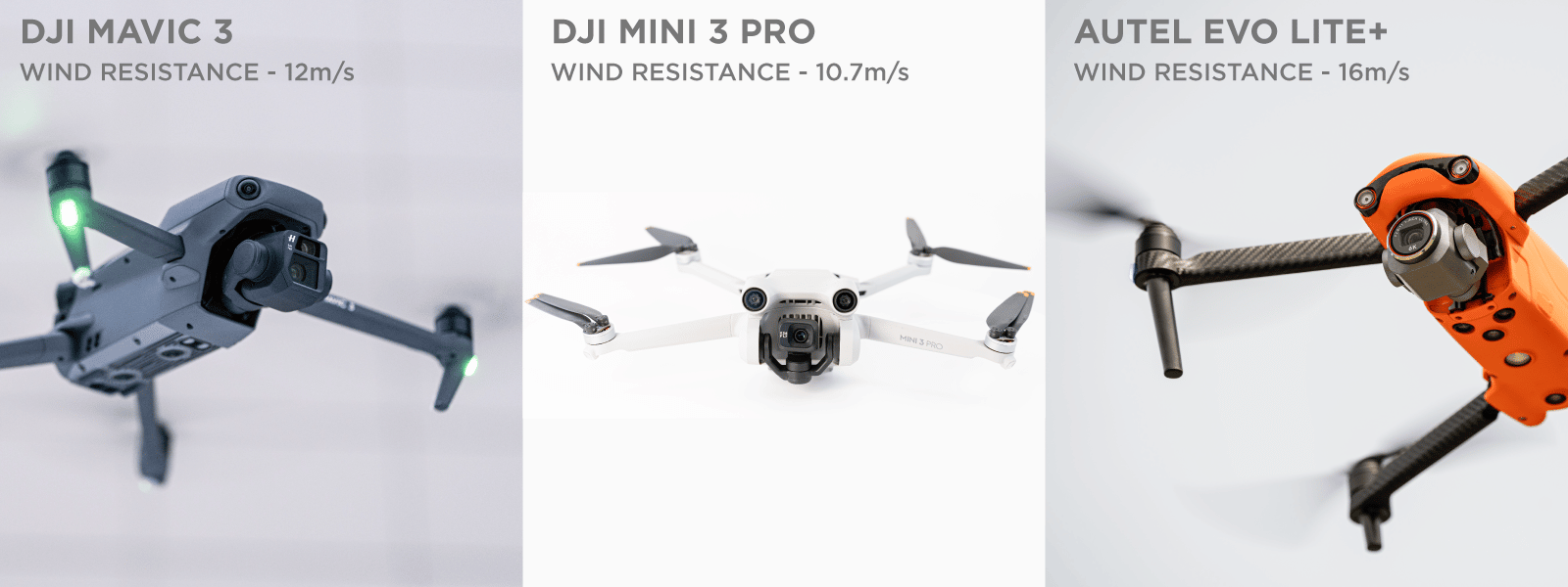
Now we must look at flight efficiency and safety. Strong winds make it impossible to fly with most drones. But how strong? That depends on the wind resistance rating of your drone. Let’s take a look at the two most popular new drones on the market:
DJI Mavic 3 – specifications state a wind resistance of 12 meters per second.
DJI Mini 3 Pro – specifications state wind resistance as 10.7 meters per second.
In our testing, we determined that these specifications are technically correct. Still, if you try to fly against a 12-meter wind with the Mavic 3 – you will barely be able to move forward. These resistances are applied correctly if the drone is hovering, so for flying tasks, we recommend subtracting 33 percent from each specification to be safe. It makes the rating closer to 8 and 7 meters per second, respectively. Similar numbers apply to most consumer-grade quadcopter drones from DJI, Autel, and others. Only the largest copters and fixed-wing drones might have drastically different tolerances. Always consult the manufactured provided manual and specs but take them with a 33 percent grain of salt, as mentioned before.
If the wind direction is variable, this worsens the situation, and we should respect wind tolerance limits even more. Additionally battery drain is exaggerated during aerial photogrammetry flights in windy conditions, so your drone will not last as long as usual.
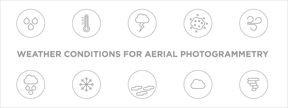
Other Conditions for Aerial Photogrammetry
Let us take a look at an additional set of weather factors that we must consider:
Rain – even if your drone has an IP rating, you probably should not fly in rainy conditions unless the rain is extremely weak and intermittent. But the water damage is not the primary concern – a camera with droplets is. If a drop of water lands on the lens – all subsequent photos can become useless for the 3D reconstruction.
Snow – the same things apply as mentioned above. Fogged-up or frozen lenses will not provide clear images for photogrammetry. But the lightest snow conditions will not cause a problem on their own.
Moisture – even 90 to 100 percent moisture levels that do not produce fog or rain are not a problem for most drones. Drones generate tons of air movement, which cools and dries the components. Only excessive repeated use in extreme environments may damage lesser UAVs.
Temperature – most drone manufacturers specify the operating temperatures of their products. We found that these temperatures are generally correct, with some built-in leeway and protections. We recommend checking the operating temperatures of all drone components and acting accordingly, as they might differ. An overheated remote controller is a non-flying drone.
Lightning – do not fly if there is a possibility of lighting in the area, even if the storm clouds seem small or far away. A high-flying electronic device may attract lightning even if it is not grounded. You might be in danger as well.

Dust – dust storms can permanently damage the equipment and the gathered image quality. We do not recommend flying during any dust storms, however mild.

Extreme weather conditions – tornados, hurricanes, storms, etc. For obvious reasons, we do not recommend flying in these.
Monitoring the Weather for Aerial Photogrammetry
Now that we know what to look for, the question is where. There are two main categories of weather information – real-time monitoring and forecasts. The longer the forecast – the less accurate it is – keep that in mind. We recommend trusting no more than three-day predictions in places where the weather is more dynamic such as temperate and continental climate zones.
For real-time monitoring at a regional and global level, we recommend the visually appealing service at https://www.ventusky.com/. For more local weather information, you should look at your national services, which provide real-time meteorological station information and real-time radar data. Also, specific applications dedicated to drone pilots and weather conditions might provide more detailed safety information. And, lastly, do not forget to look at the sky yourself. On average, you can see 200 – 100 kilometers of clouds in any direction. Reading weather maps and making forecasts is an art on its own. We shall explore this more in future articles.
Conclusion
With the proper knowledge and tools, you only need planning skills and flexibility for consistently successful aerial photogrammetry flights. Please get to know your equipment and its limits, and find your favorite weather monitoring tools and services. For you, as a drone pilot, the ever-changing weather conditions should be less intimidating by now.
Photographer - Drone Pilot - Photogrammetrist. Years of experience in gathering data for photogrammetry projects, client support and consultations, software testing, and working with development and marketing teams. Feel free to contact me via Pixpro Discord or email (l.zmejevskis@pix-pro.com) if you have any questions about our blog.
Related Blog Posts
Our Related Posts
All of our tools and technologies are designed, modified and updated keeping your needs in mind
No. 1 Mistake You Are Making in Photogrammetry Right Now
As photogrammetry software developers, we need to troubleshoot multiple projects from our clients every week. The number one mistake, especially when making measuring projects, is using redundant photos. These photos can appear for a few reasons, which I will describe, and they can be quickly dealt
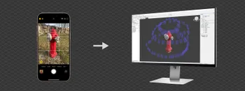
Classic Photogrammetry with an iPhone
Photogrammetric 3D scanning can turn a bunch of regular photos into a 3D model or a scene. So, we only need a camera and some knowledge of how to take photos. In the previous article, we tested the latest iPhone camera with a few different apps.
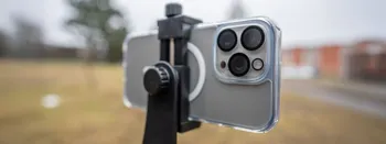
Manual Photography with iPhone 16 Pro Max - Android/Windows User Perspective
Adage as old as touchscreens on portable devices tells us that the best camera is the one you have. We have the luxury of having cameras everywhere we go because we are dependent and addicted to smartphones.
Ready to get started with your project?
You can choose from our three different plans or ask for a custom solution where you can process as many photos as you like!
Free 14-day trial. Cancel any time.