Pixpro 1.7.0 Update - Multi-Camera Support and Point Cloud Editor
 Lukas Zmejevskis
We are rolling out a new update for the Pixpro photogrammetry software, bringing new features for our users. In this blog post, we will discuss the two major updates - multi-camera support in a single project and a new point cloud editor and mention all of the other minor improvements that the new version brings.
Multi-Camera Reconstruction
Pixpro now supports running 3D reconstruction made from multiple different cameras. The most common use cases would be combining drone photos with terrestrial shots made with a handheld camera or combining two focal-length lenses for indoor and outdoor scanning.
Now, Pixpro software will recognize the different cameras and treat them individually regarding intrinsic values while providing a cohesive 3D scene containing all the captured data.
Camera Manager
The multi-camera support required us to revamp the system and how the software treats camera intrinsics. The development led to the new Camera Manager. This entirely new module also brings a new calibration feature for advanced users.
Intrinsic values are fundamental for consistent and high-quality reconstruction; they provide a starting point for the software to run the 3D reconstruction. Each sensor and lens combination has unique intrinsic values. With the new camera manager, you can easily access and manage these values if you need to.
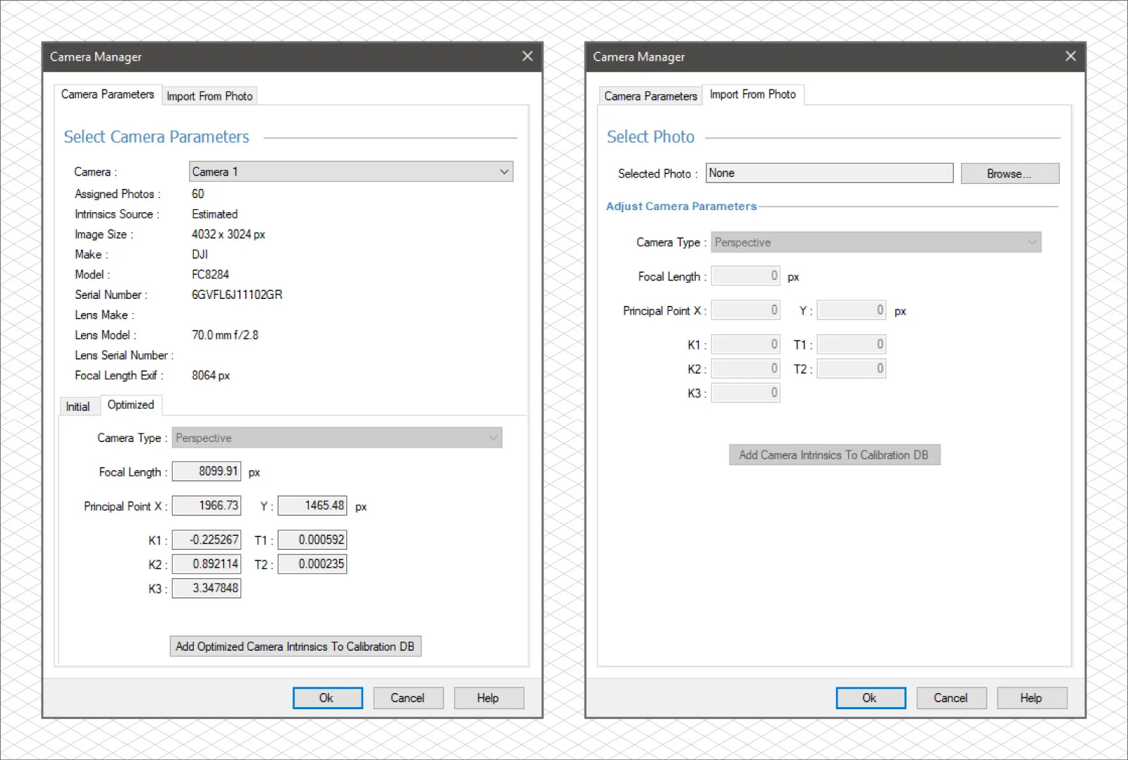
While Pixpro has a database of many cameras and drones, you may want to consider adding your unique cameras. With the new camera manager, this has become as easy as pressing one button if we complete all initial steps. In the following article, we will dive deeper and provide a guide to make your unique camera calibration.
Dense Point Cloud Editor
In Pixpro now you can select and delete dense point cloud points in a straightforward but flexible method. The workflow is identical to drawing a polygon in the 3D view. However, instead of getting a polygon object layer, you will get a selection. We made a short video explaining the basics:
The editor provides precision where the clipping box might not be enough. When used with the clipping box, it will provide a means to delete any unwanted points on the point cloud. The new tool can give you the cleanest project possible for precise measurements or aesthetics.
Other Features and Improvements
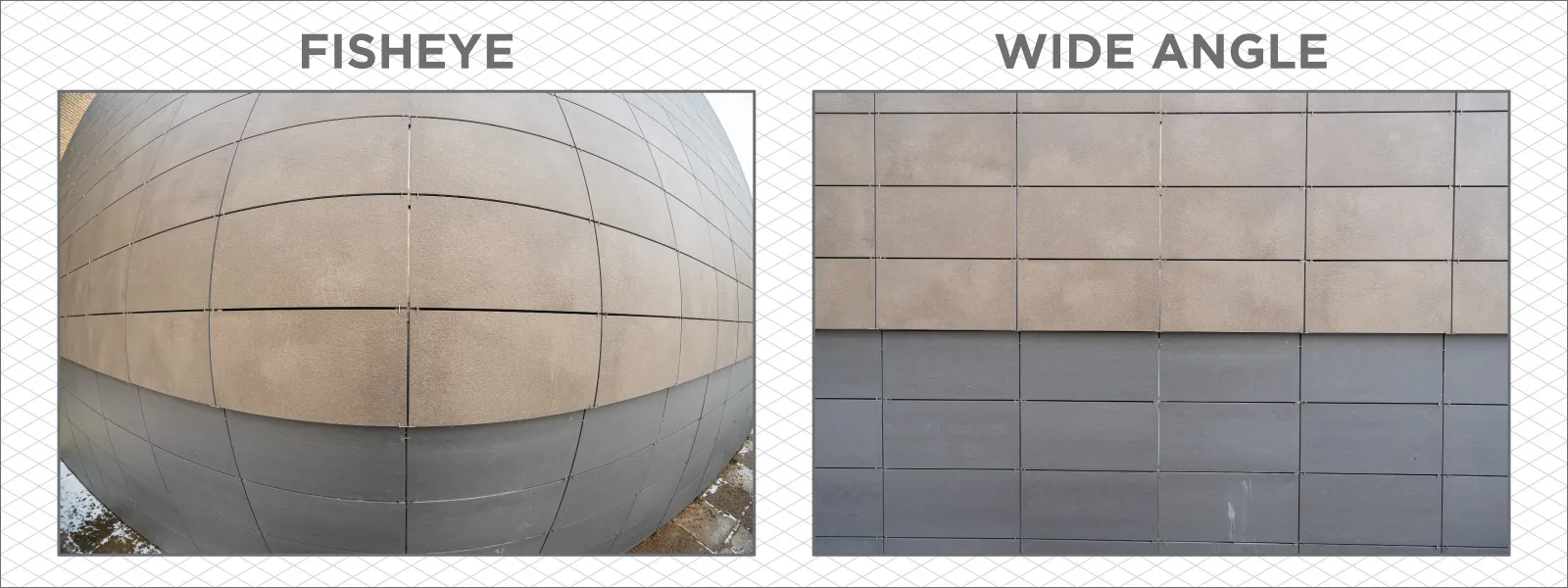
Fisheye camera support: Pixpro now supports cameras that use fisheye lenses.
GPU usage optimizations: layer generation performance improvements, especially for AMD GPU users.
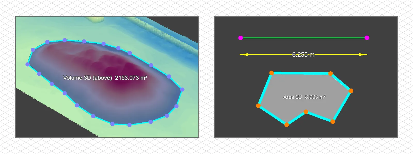
New graphical features: now, we can display arrows and measurements on the 3D view and change vertex colors and radius on lines and polygons.
Flight tracks feature update: now the flight track information works as camera positions for better 3D reconstruction and georeferencing.
Various quality of life improvements: search box in the coordinate system selection, status refresh button and cloud project failure indicators, GCP import improvements, XYZ coordinate order selection, and others.
Conclusion
There are quite a few more improvements under the hood and things to fix and improve upon. We will continue to develop and update our software. You can try out Pixpro for a free 14-day trial without any limitations to features or processing options. If you have exhausted your free trial earlier and wish to renew it, contact us via info@pix-pro.com, and we can restore your trial without any cost.

Photographer - Drone Pilot - Photogrammetrist. Years of experience in gathering data for photogrammetry projects, client support and consultations, software testing, and working with development and marketing teams. Feel free to contact me via Pixpro Discord or email (l.zmejevskis@pix-pro.com) if you have any questions about our blog.
Related Blog Posts
Our Related Posts
All of our tools and technologies are designed, modified and updated keeping your needs in mind
Pixpro 1.7.11 - Seamless Model Sharing
We are keeping the development cycle relatively short these days, so here is a new update to our photogrammetry software. Update 1.7.11 brings improvements related to our cloud service.

Pixpro Version 1.7.10 - New Feature - Inspections
Another new Pixpro version is here, and it brings a singular new feature - an inspection module. Inspections are a large part of photogrammetric scanning because it is the most convenient and long-lasting way of visual remote sensing.

Most Asked Photogrammetry Questions Part 4 - Pixpro Support Picks
I help my team support Pixpro photogrammetry software users on a daily basis and often get forwarded more technical or specific questions. This gives me a good idea of what people ask the most, so I am writing these blog posts to get ahead of many questions.
Ready to get started with your project?
You can choose from our three different plans or ask for a custom solution where you can process as many photos as you like!
Free 14-day trial. Cancel any time.
Welcome to Pixpro
Sign in
And access your account.
.svg@webp)