Pixpro Version 1.7.7 - Batch Processing and New Measurements
 Lukas
Zmejevskis

We are bringing another update to Pixpro photogrammetry software. This article will describe the new features in the 1.7.7 version and the minor tweaks we made in the previous one. Highlights of the latest updates are batch processing, new measurements, object drawing improvements, performance improvements, and other minor fixes.
Previous 1.7.6 updates
We did not do a dedicated article for this version, as there were only a few notable changes. We will summarize them here and then move on to the current version updates. Things added in the previous version, in no particular order:
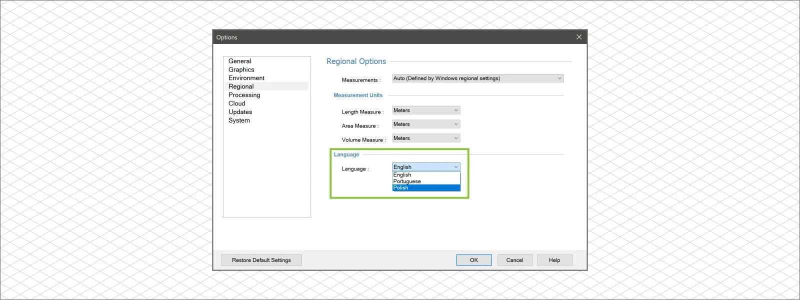
1. Polish language for the software.
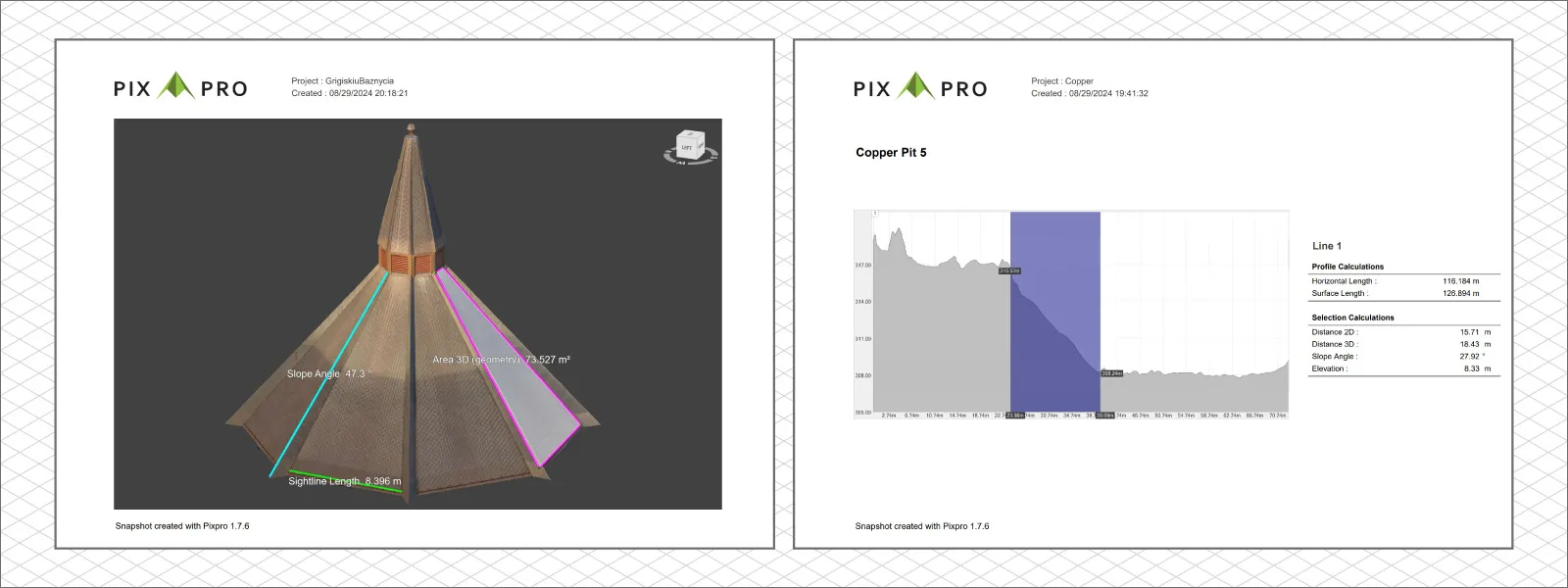
 2. Snapshots now can include Polygons and Line profiles.
3. Snapshots now can consist of several measurements from polygons and lines.
 4. Multiple polygon measurement values can now be exported as a CSV file.
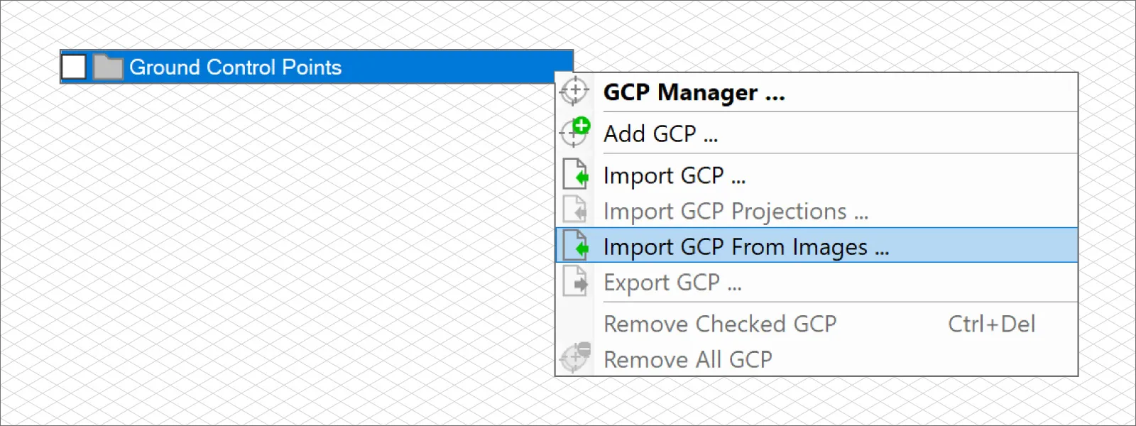
5. GCP creation from images.
 6. 11 notable bug fixes and countless minor ones.
GCP creation from images may seem strange, but we used this technique several times with an RTK drone. An RTK drone is a rover that stores accurate GPS data in the photo metadata. Hence, for convenience, we can intelligently extract such data. To get more in-depth, read our previous article, where we employed RTK drones in such a way and used these unique features in our software:
How to use an RTK Drone as a GNSS Rover?
RTK Drone Photos for Ground Control Points
New features in 1.7.7
The current Pixpro photogrammetry software version is 1.7.7, and here are the new things we are introducing with it:
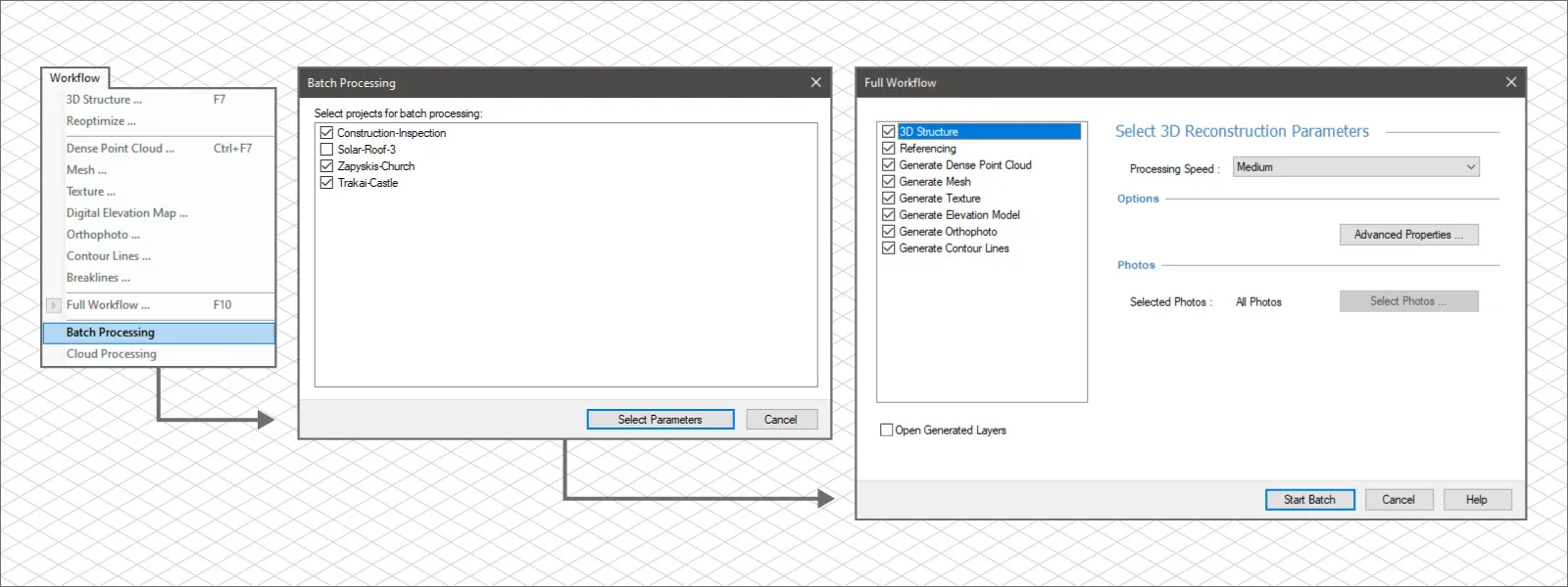
1. The highlight feature is batch processing for multiple projects. With this feature, you can launch the processing of many projects with numerous layers without being present near the computer or using command-line tools. It is an automated sequential full workflow job queue for as many projects as you need.
 2. Undo/Redo for object drawing and DEM leveling tools are now available.
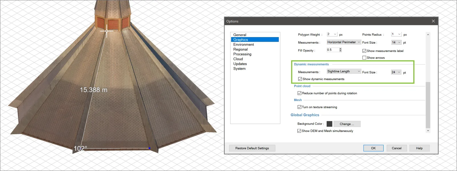
3. Line and polygon drawing displays angle and line length in real-time on the 3D view.
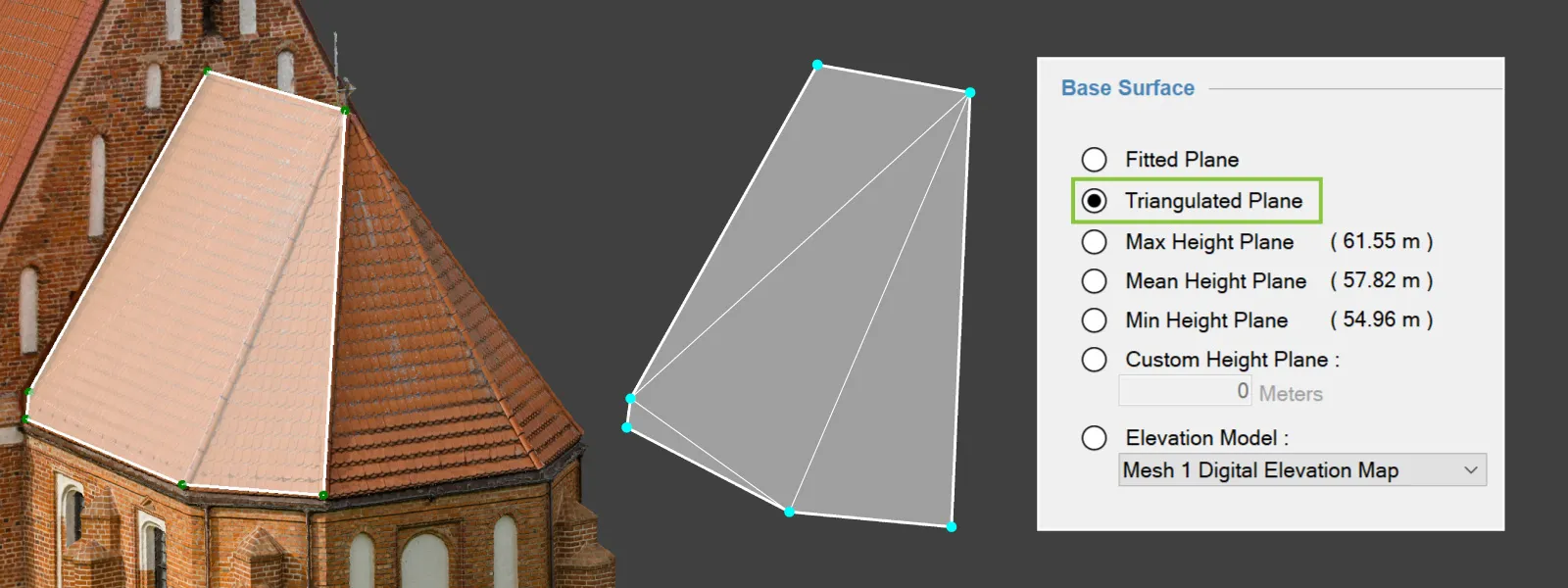
 4. A new type of base plane has been added: triangulated. It is a virtual surface triangulated between the input vertices. This plane will not be flat but more of a low polygon surface. The triangles making up the plane are shown in the 3D view.
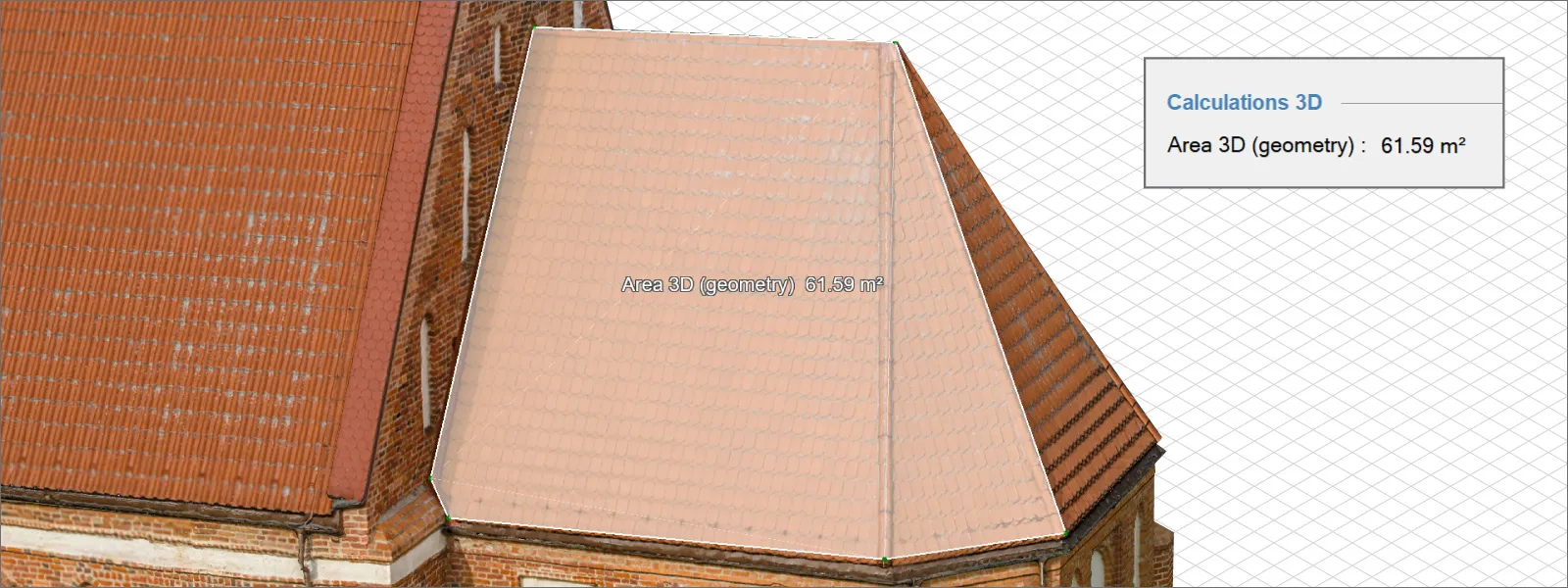
 5. New measurement - Area 3D Geometry. This will be the area measurement of the same surface as the triangulated plane without taking the model surface into the calculations. That measurement is now called Area 3D Surface.
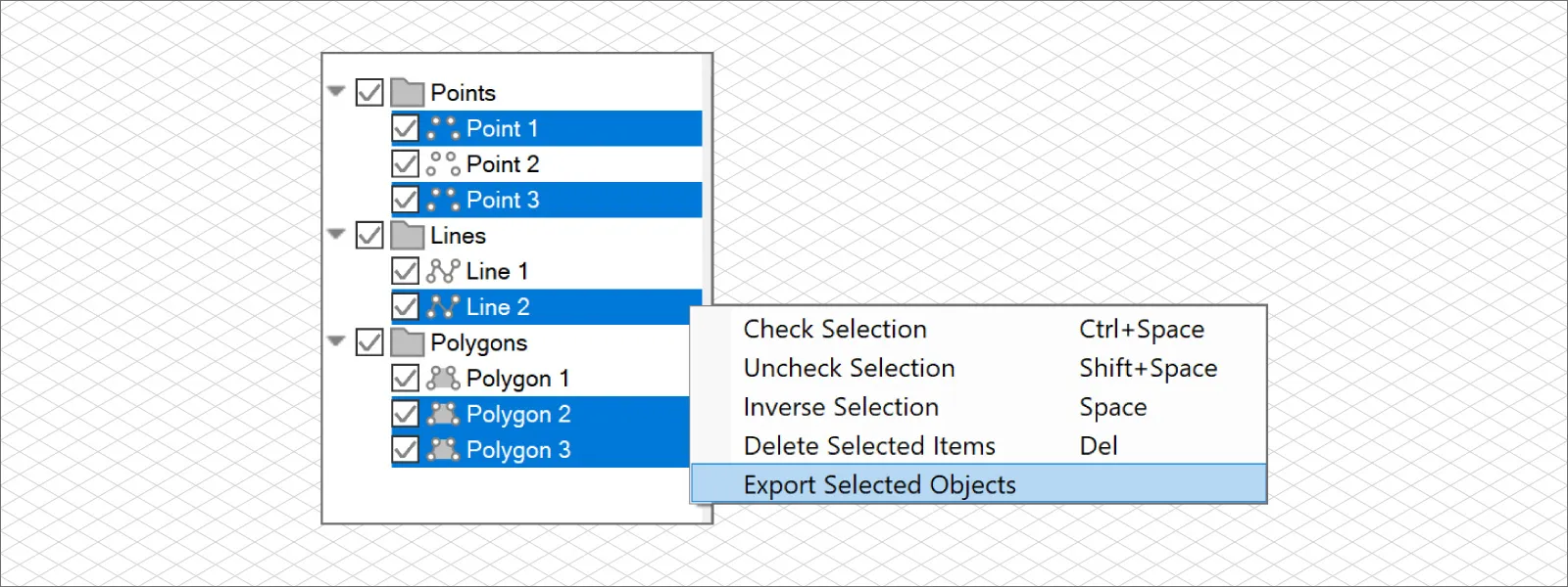
 6. Multi-selection export is now available for objects. If you choose to export an object and multiple objects are selected, all of the selected objects will be exported.
 In addition to these features, polygon editing has been streamlined, the cloud wizard has improved with clear prompts when you can and cannot close the software, and Pixpro has become less sensitive to network adapter changes, which may impact hardware ID and, therefore, license activations. Finally, as always, there were bug fixes—19 notable bugs and quite a few minor ones.
Conclusion
With every Pixpro release, you can refresh your free trial and use the software for another 14 days. If you are a returning trial user, contact us via email, and we will refresh it for you. Our continued improvements may give you something other software lacks at a great price. If you want to try out our software but can not use a credit card, you can also contact us at info@pix-pro.com individually, and we can provide a trial without one.

Photographer - Drone Pilot - Photogrammetrist. Years of experience in gathering data for photogrammetry projects, client support and consultations, software testing, and working with development and marketing teams. Feel free to contact me via Pixpro Discord or email (l.zmejevskis@pix-pro.com) if you have any questions about our blog.
Related Blog Posts
Our Related Posts
All of our tools and technologies are designed, modified and updated keeping your needs in mind
Pixpro 1.7.11 - Seamless Model Sharing
We are keeping the development cycle relatively short these days, so here is a new update to our photogrammetry software. Update 1.7.11 brings improvements related to our cloud service.
Pixpro Version 1.7.10 - New Feature - Inspections
Another new Pixpro version is here, and it brings a singular new feature - an inspection module. Inspections are a large part of photogrammetric scanning because it is the most convenient and long-lasting way of visual remote sensing.

Most Asked Photogrammetry Questions Part 4 - Pixpro Support Picks
I help my team support Pixpro photogrammetry software users on a daily basis and often get forwarded more technical or specific questions. This gives me a good idea of what people ask the most, so I am writing these blog posts to get ahead of many questions.
Ready to get started with your project?
You can choose from our three different plans or ask for a custom solution where you can process as many photos as you like!
Free 14-day trial. Cancel any time.
.svg@webp)