.svg@webp)
Photogrammetry Software for Drone Mapping, Surveying & 3D Scanning
Professional photogrammetry for everyone. Measure easily in 3D.
Free 14-day trial. Cancel any time.
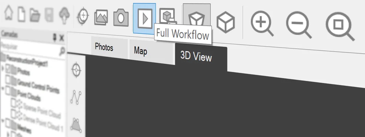
With a Press of a Single Button
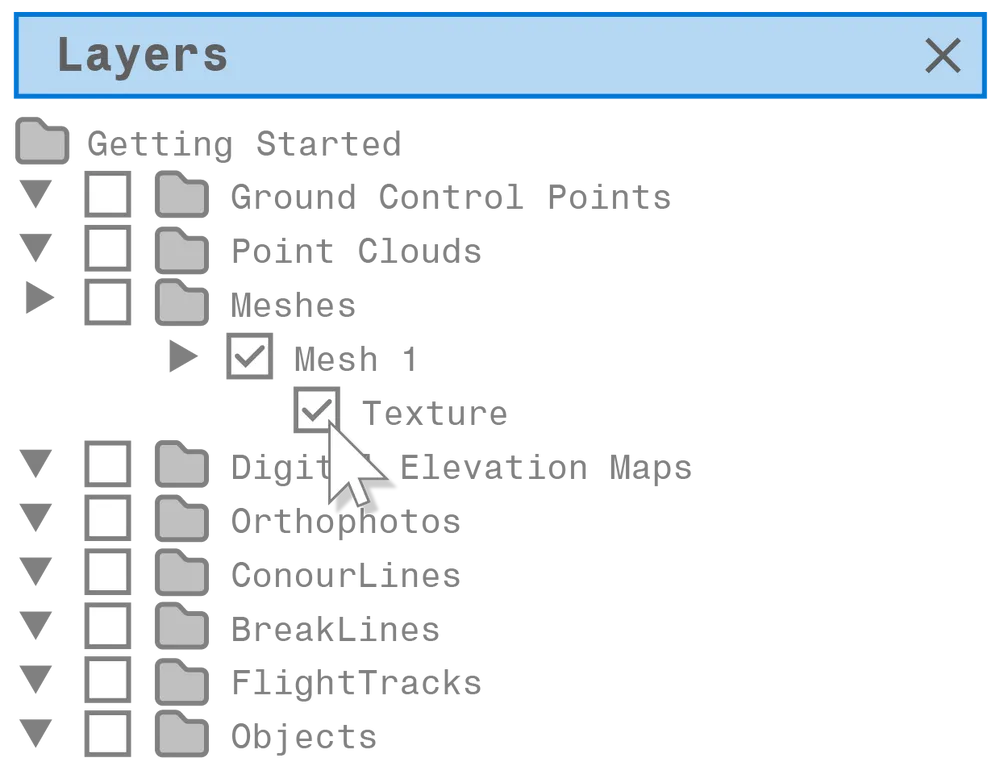
Pixpro photogrammetry software uses our proprietary engine to create point clouds, 3D models, orthophoto, and other layers. In Pixpro software, you only need to press a single button to begin - the software will generate everything for you. All you need to do is input photos made for a photogrammetric 3D scan and wait until the processing is complete.

Quick to Learn, Easy to Master
Pixpro is the most user-friendly photogrammetry app on the market. The interface is clean and simple, based on an intuitive layer system and non-destructive editing. You only need a few hours of experience to become an advanced Pixpro user and fully take advantage of photogrammetry.
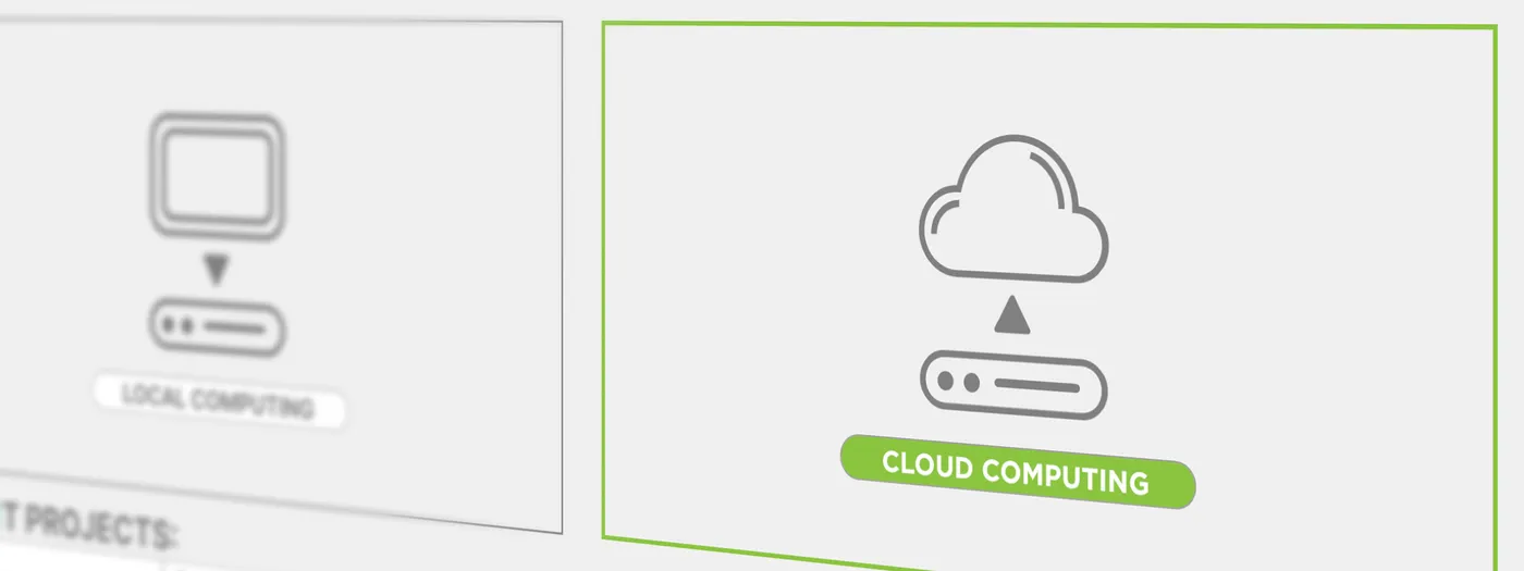
Cloud and Local Computing
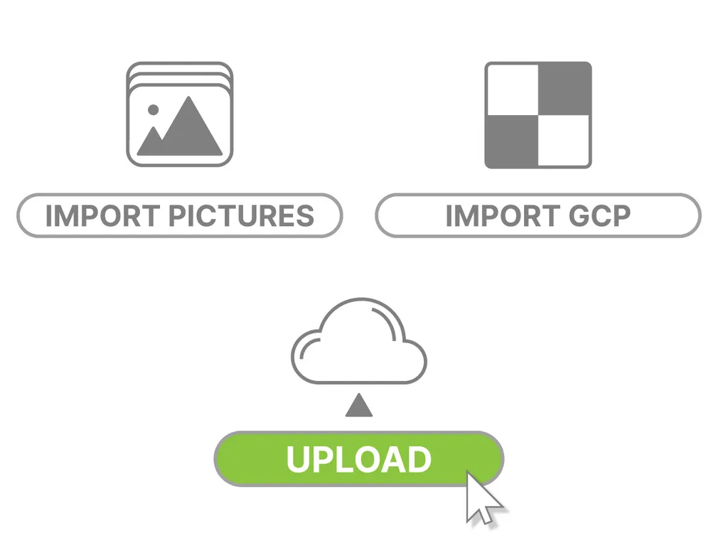
Our photogrammetry software is available with cloud and local computing. You can rely on your own Windows PC to process the data or upload it to our secure servers and get the same result without using your resources. Cloud computing also supports ground control points without any limits.
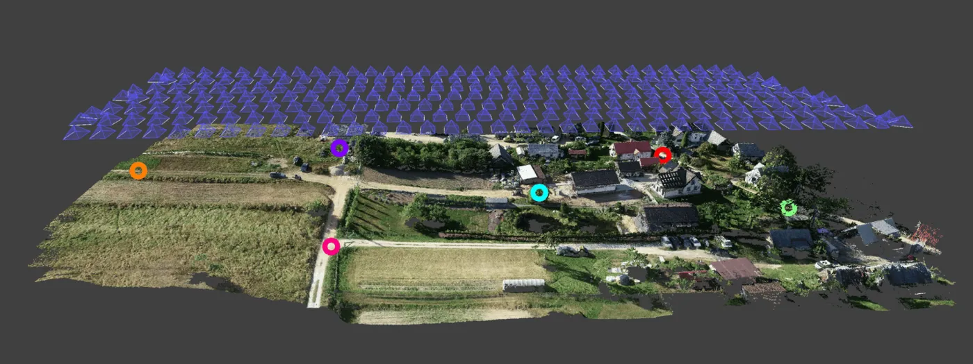
UAV Mapping
Professional features for UAV mapping - ground control points, flight tracks, and RTK support. Pixpro offers high precision for professional drone mapping and can take advantage of accurate referencing data. Combined with optimal workflows and an easy learning curve - Pixpro is the most efficient solution overall.
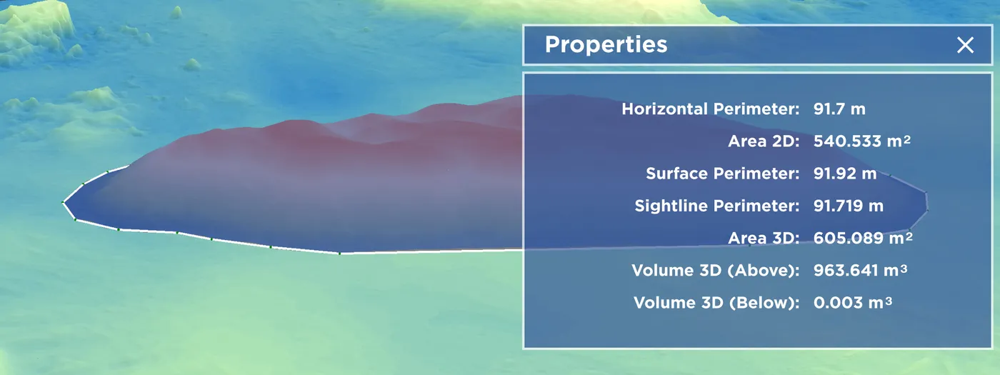
Fast & Easy Measurements
Measure your 3D scene. Measurements are a strong suite in Pixpro. You can measure any coordinates, lengths, and volumes on your 3D model without waiting for additional processing. All measurements exist as point, line, and polygon layers that can be edited and revisited at any time.

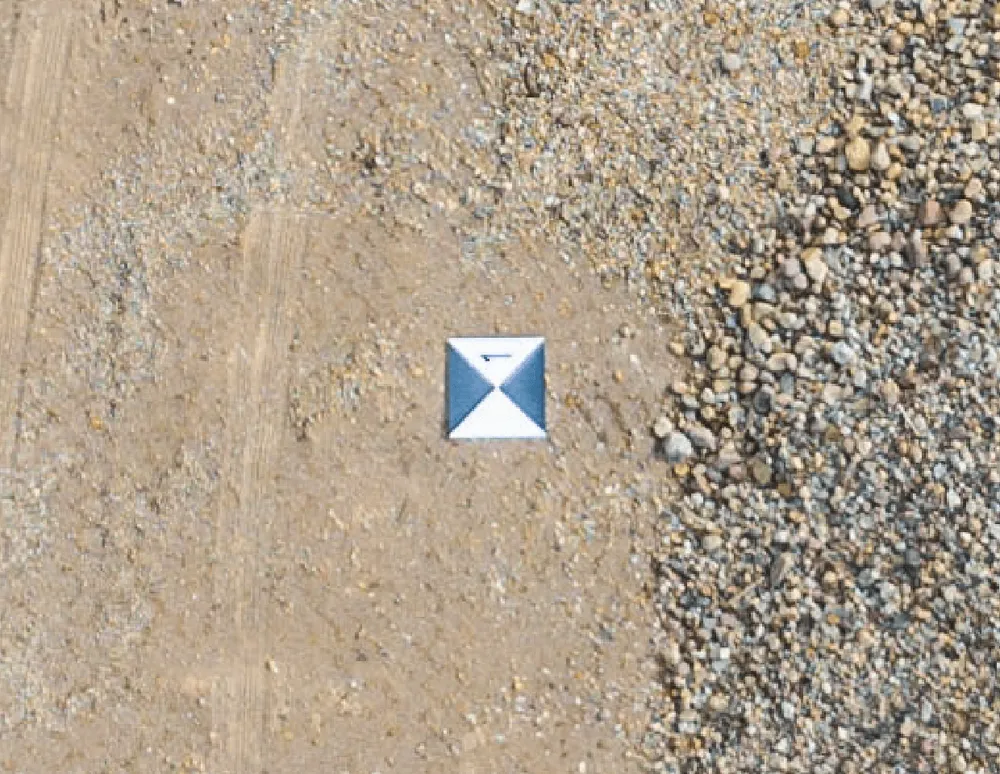
PIXEL PRECISION
Precision and inspection are ingrained in Pixpro. Every measurement can be precise to a single pixel on each photo. You can quickly and reliably draw pinpoint accurate measurements by projecting them in pictures. Each image with its projection is also a tool for inspection, limited only by the quality and resolution of the photo itself.

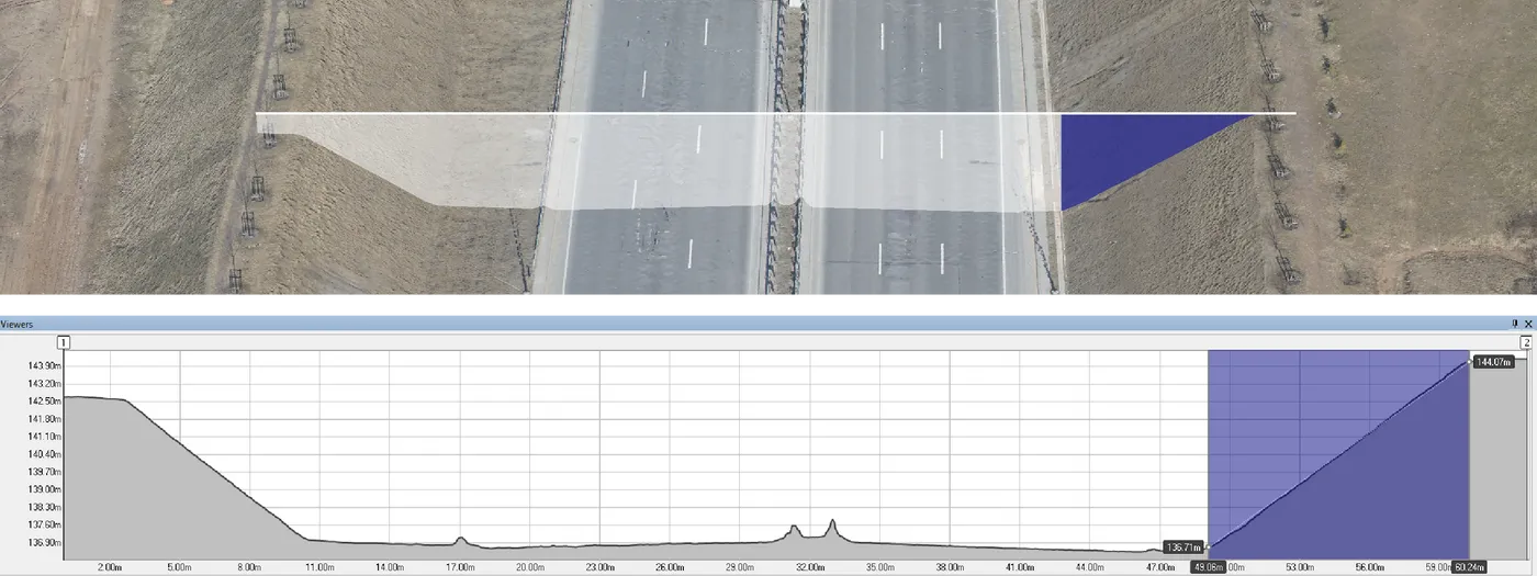
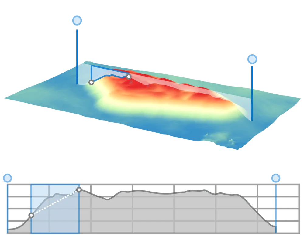
Profile Measurements
Profile visualization and measurement. In addition to measuring in the 3D scene and photos, Pixpro can display a profile of any drawing. This profile is interactive and supports intuitive measurements with a real-time representation in the 3D scene. A reliable tool for surveyors and has many use cases.
Flexible Referencing
Pixpro photogrammetry software supports all coordinate systems alongside local and arbitrary coordinates. You can convert project workspace anytime, and you can create your custom local grids. Manual referencing options to scale and orientate 3D models are also an option if referencing data is unavailable.


Works Well With any Photos
Pixpro is optimized for drone mapping but works well with any photos. Pixpro supports images made with any drone, camera, or smartphone. From small 3D objects to vast field scans, you can process everything. From surveyor to 3D artist - Pixpro photogrammetry software will provide the necessary results.

In-Built Post Processing
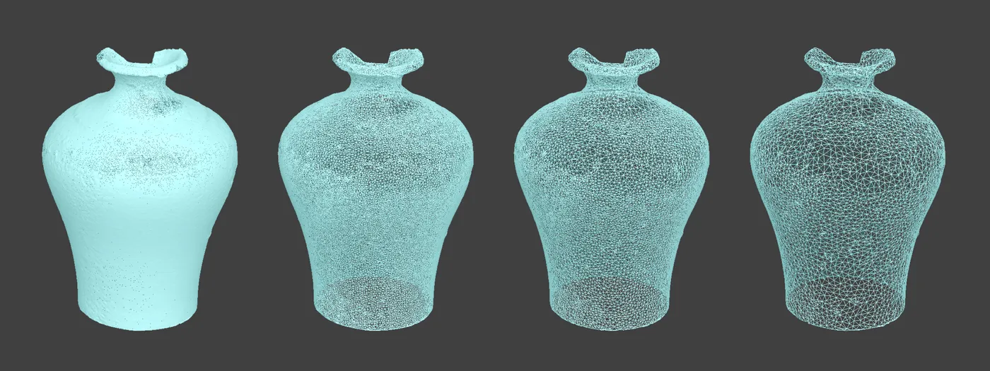
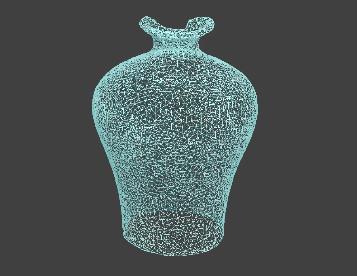
Our software has post-processing features to refine results - smoother 3D point clouds and 3D models in Pixpro. No third-party tools are required to edit and improve on layers generated directly in our software. Smoothing, filtering, and decimation tools work fast and improve results for further export or data analysis at the user's discretion.

Unique Features for Data Analysis
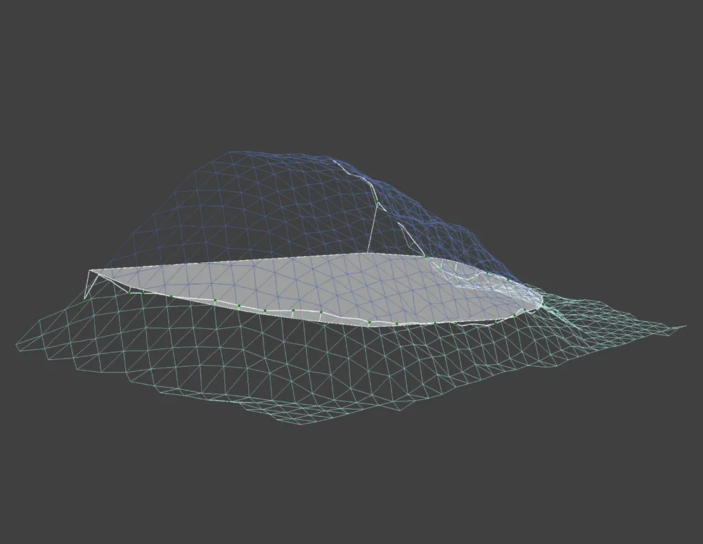
The Pixpro photogrammetry app has unique features for data analysis. Sight view tools allow simulating line of sight and obstruction zones on a DEM surface. Digital elevation map editing tools can simulate surface changes, and a timeline enables comparing many surface volumes in a single project.


Unlimited export options
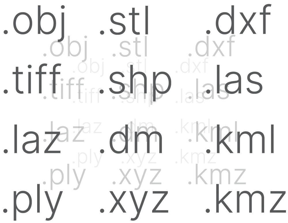
Any data generated or drawn in Pixpro is available for export in all the most popular file formats for point clouds, 3D models, and raster images. Export options contain all needed variables to maximize compatibility with 3rd party 3D modeling software, surveying, cad tools, and hosting platforms.

Import, Compare, Process
Pixpro software supports data import and further processing. You can import point clouds, surfaces, and 3D meshes from other projects, compare them, and even run more processes. Vector objects with coordinates such as points, lines, and polygons are also available for import.
Works On any Windows PC
Pixpro photogrammetry software works on any Windows PC and can use any Nvidia, AMD, or Intel GPU for processing. Local computing requires average-grade hardware. However, anyone can view and work on a Pixpro project on any basic laptop or computer. Projects are not tied to a single user and can be shared

Ready to get started with your project?
You can choose from our three different plans or ask for a custom solution where you can process as many photos as you like!
Free 14-day trial. Cancel any time.