.svg@webp)
Pixpro Features
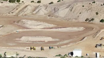
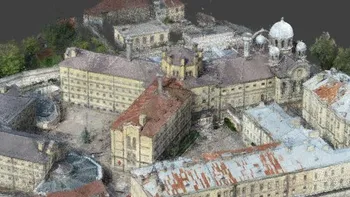
Highly Detailed 3D Terrains
The object visualization in a 3D mode has never been so easy – no matter the size of the object, enjoy the navigation through different dimensions without losing even the smallest detail.
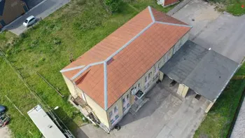
Photo Manager
Wide range of photo management options enables the user to process the photos acquired by any camera. With Photo Manager you can easily inspect, remove or add the photos for further data processing.
Advanced Data Export
Pixpro supports quite a few export formats for dense point clouds, elevation maps and meshes. During the export down-sampling and various coordinate systems can be selected for maximum compatibility with other solutions.
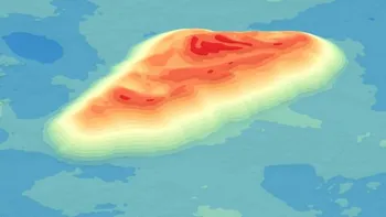
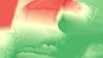
Interactive DEM Histogram
Digital Elevation Maps can be shaded with different colors and different color ramps to adapt each option to the scanned surface. Any surface can be represented accurately in Pixpro.
DEM Surface Editing Tools
Digital Elevation Map can be edited for cleanup or simulation purposes. Terrain features can be leveled, missing surfaces can be filled and modified. Unlimited and non-destructive editing is quick and easy in Pixpro.
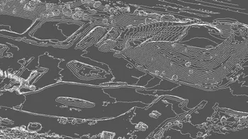
Contour-line Generation
Contour-line map can be generated for any DEM surface. Contour-lines can have custom height values and can be offset while being represented in 3D.
Single Contour-line Drawing
Obtain all possible 2 dimensional measurements quickly and easily. Dense point cloud, elevation map and mesh can be measured.

2D Measurements
In Pixpro a single contour-line can be drawn by the user. Contour-line can just be placed with real time preview on the entire project area. It can be converted to a polygon as well.
3D Measurements
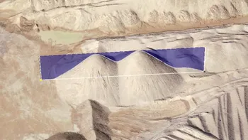
Obtain all possible 3 dimensional measurements quickly and easily. Volumetric measurements are done on the digital elevation map in real time.
Profile Measurements
Use any line object to view a terrain profile. The profile itself is interactive and can be measured.
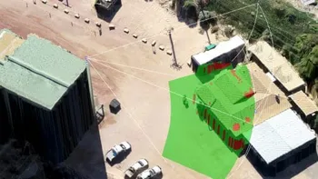
Direct Sight Functions
Pixpro’s direct sight functions help to evaluate 3D scene features that will result in obscured sight zones from a particular point of view. Perfect for security and safety applications.
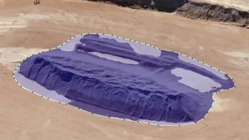
Dense Point Cloud
Dense point cloud - the key element in creating a 3D environment from the original 2D photos. In Pixpro various density point clouds can be created, to achieve desired processing times and results.
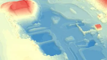
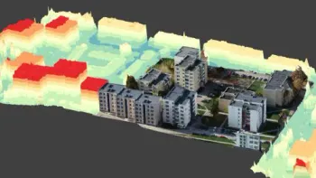
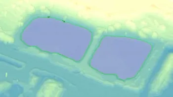
Digital Elevation Map
Digital elevation map provides terrain information as a height map. DEM layer is useful for quick and unlimited visualization of the scanned surface. Many shading options as well as cropping and hole-filling options enable you…
Ready to get started with your project?
You can choose from our three different plans or ask for a custom solution where you can process as many photos as you like!
Free 14-day trial. Cancel any time.