.svg@webp)
Surveying Trends in the Mining Sector
The quickly evolving innovations in the geomatics sector are bringing previously unforeseen possibilities that will provide a major boost to mine surveyors and the whole industry. Surveyors fulfill an essential role since they provide indispensable information to all the other mining disciplines. Surveying trends suggest better efficiency and safety for the future.
While basic principles of surveying may have remained unchanged throughout the ages, the instruments have not. General technologies in mine surveying today include terrestrial laser scanning, lidar, airborne photogrammetry, drones. Let’s talk about the latest surveying solutions in the mining industry.
Terrestrial laser 3D scanning
Surveying in the mining industry, both in open-pit and underground mines, often goes hand in hand with terrestrial laser scanning (TLS), which is deployed to verify the spatial changes of mining works. Thanks to its high point density and high accuracy, TLS is a very suitable surveying technique for monitoring movements and deformations.
In mining specifically, terrestrial laser scanning has the potential to be used for a wide range of applications: monitoring and documenting the progress of underground mining works, assessing the stability and in turn worker health & safety at mining sites, monitoring deformation and convergence, calculating volumes, providing supplementary evidence (in the case of accidents or damage) and so on.
Airborne 3D and portable laser scanning
Another method of capturing the mining environment – airborne laser scanning. It offers great opportunities for the mining sector, as it is able to acquire millions of points per square kilometer.
A more recent trend is the use of portable laser scanners, which are particularly eligible for the challenging mining environment. Handheld laser scanning is an ideal solution thanks to its ease of use, and some lightweight and compact scanners can also be mounted on mobile platforms.
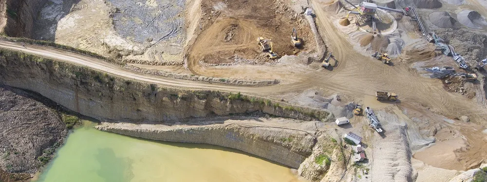
Drones and photogrammetry
A growing number of mining companies are working with UAVs. These are equipped with digital cameras to provide high-resolution aerial imagery, which is then further processed to produce highly precise orthophotos, point clouds and 3D models. Drones can also play a role in improving the safety of workers underground by providing information about the above-ground situation. Surveying trends predict drones to be indispensable tools in the mining industry.
Drones are an indissoluble part of photogrammetry. Therefore, photogrammetry is a software that recreates a precise object 3D model by performing photogrammetric processing of digital images.
Related Blog Posts
Our Related Posts
All of our tools and technologies are designed, modified and updated keeping your needs in mind

Stockpile Volume Measurement With Drone Photogrammetry: A Practical Guide
Measuring a stockpile sounds trivial until you actually have to do it on a real site. You need a number you can defend at the end of the month, and you would rather get it without sending somebody to climb up a 10 meter mountain of gravel with a GPS pole.
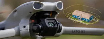
DJI Lito X1 for Photogrammetry
Can the Lito X1 be used for photogrammetry? Yes it can. Can it produce good results? Yes it can. How to do it? Yes it… well, that is what the rest of this article is for.
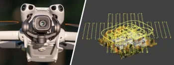
DJI Mini 5 Pro For Photogrammetry – Aerial Scanning With Pixpro Waypoints
DJI Mini 5 Pro is a 250-gram flying camera equipped with a 1-inch type sensor. Nine years ago, the Phantom 4 Pro was released as the first consumer drone to feature the same sensor format.
Ready to get started with your project?
You can choose from our three different plans or ask for a custom solution where you can process as many photos as you like!
Free 14-day trial. Cancel any time.
Welcome to Pixpro
Sign in
And access your account.