.svg@webp)
A Short History of Photogrammetry: From Balloons to Drones
 Lukas
Zmejevskis
Lukas
Zmejevskis
The Short Version
If you only have a minute, here is the whole thing in five lines:
-
Photogrammetry is about 170 years old. It predates the airplane and is far older than the computer.
-
The method appeared twice, separately: with Aimé Laussedat in France in the 1850s, and with Albrecht Meydenbauer in Germany, who coined the word in 1867.
-
The first aerial photos came from balloons and kites, and for a brief, glorious moment, from pigeons wearing tiny cameras.
-
The core idea never changed: photograph something from enough angles and you can measure it in three dimensions. Only the cameras and the math got better.
-
Today a phone or a small drone plus software does what once needed a military officer, a balloon, and a room full of optical machines.
 Older Than the Airplane
Photogrammetry feels like something the drone era invented. It did not. The idea of pulling measurements out of photographs is roughly 170 years old, which makes it older than the airplane and a lot older than the computer. People were doing it from hot-air balloons and glass plates back when the real risk was the balloon.
 The interesting part is how little the core idea has changed. Take overlapping photos of something from different angles, work out where the camera was for each, and you can rebuild it in three dimensions. That one sentence describes a 19th-century officer with a balloon and a modern laptop equally well. Only the tools got better. These are the pillars of how we got from one to the other. If you want how it actually works rather than where it came from, start with Photogrammetry 101.
It Started With Maps and Buildings
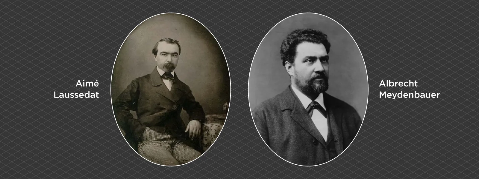
Two people get the credit, working separately and about a decade apart. Aimé Laussedat, a French army officer, began using terrestrial photographs to make topographic maps in the 1850s. He is usually called the father of photogrammetry, and he was stubborn enough to lift his cameras on kites and balloons to get a better angle. He called the method metrophotographie.
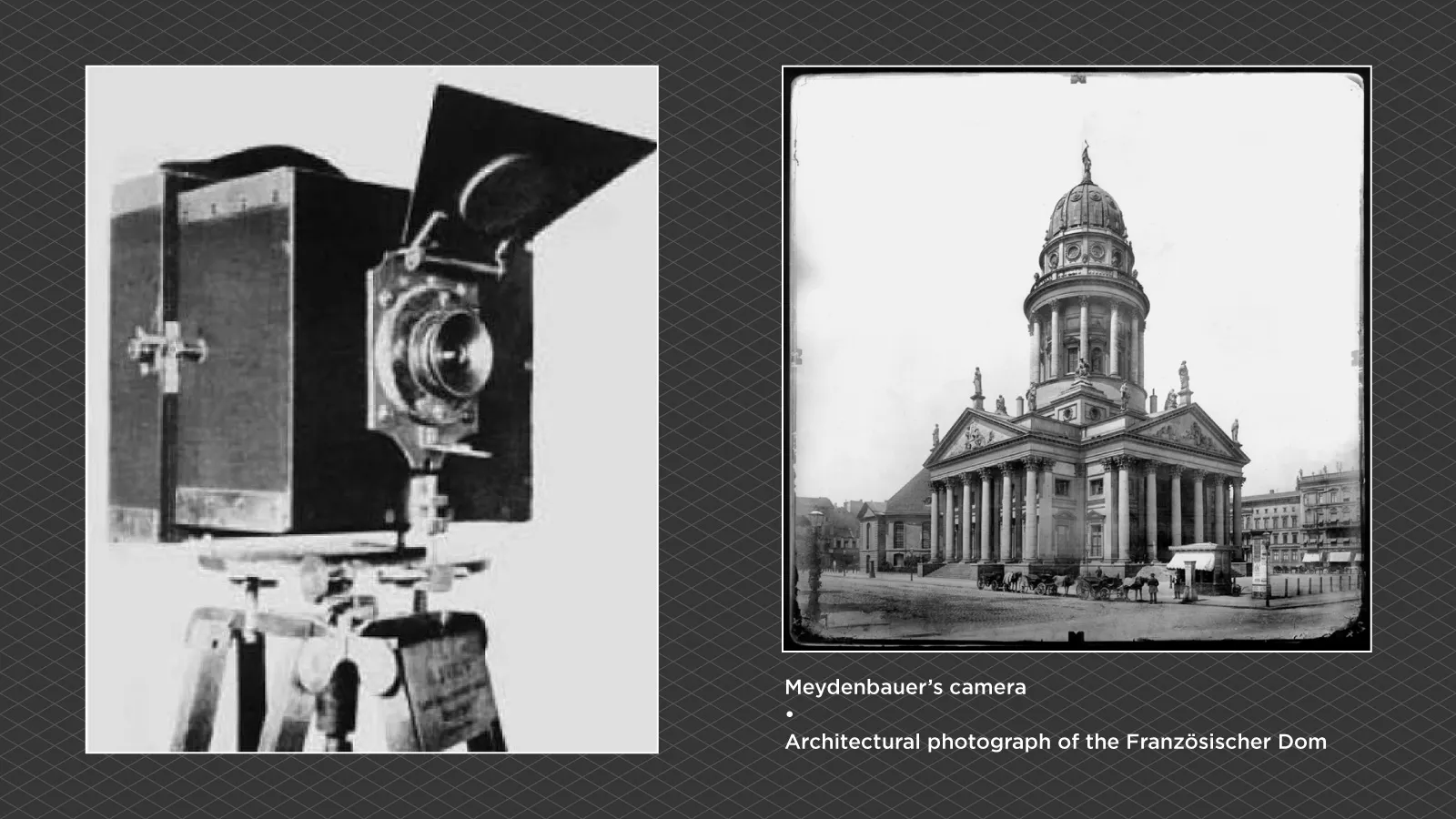 In Germany, the architect Albrecht Meydenbauer was doing something similar to document buildings, reportedly after nearly falling off a cathedral while measuring it by hand and deciding there had to be a safer way. In 1867 he coined the word we still use. Photogrammetry comes from the Greek for light, drawing, and measure, so it means something close to measuring by drawing with light. Meydenbauer later founded a state institute in Prussia in 1885 to document monuments this way, which is why precise records still exist for some buildings that do not.
 Getting the Camera Off the Ground

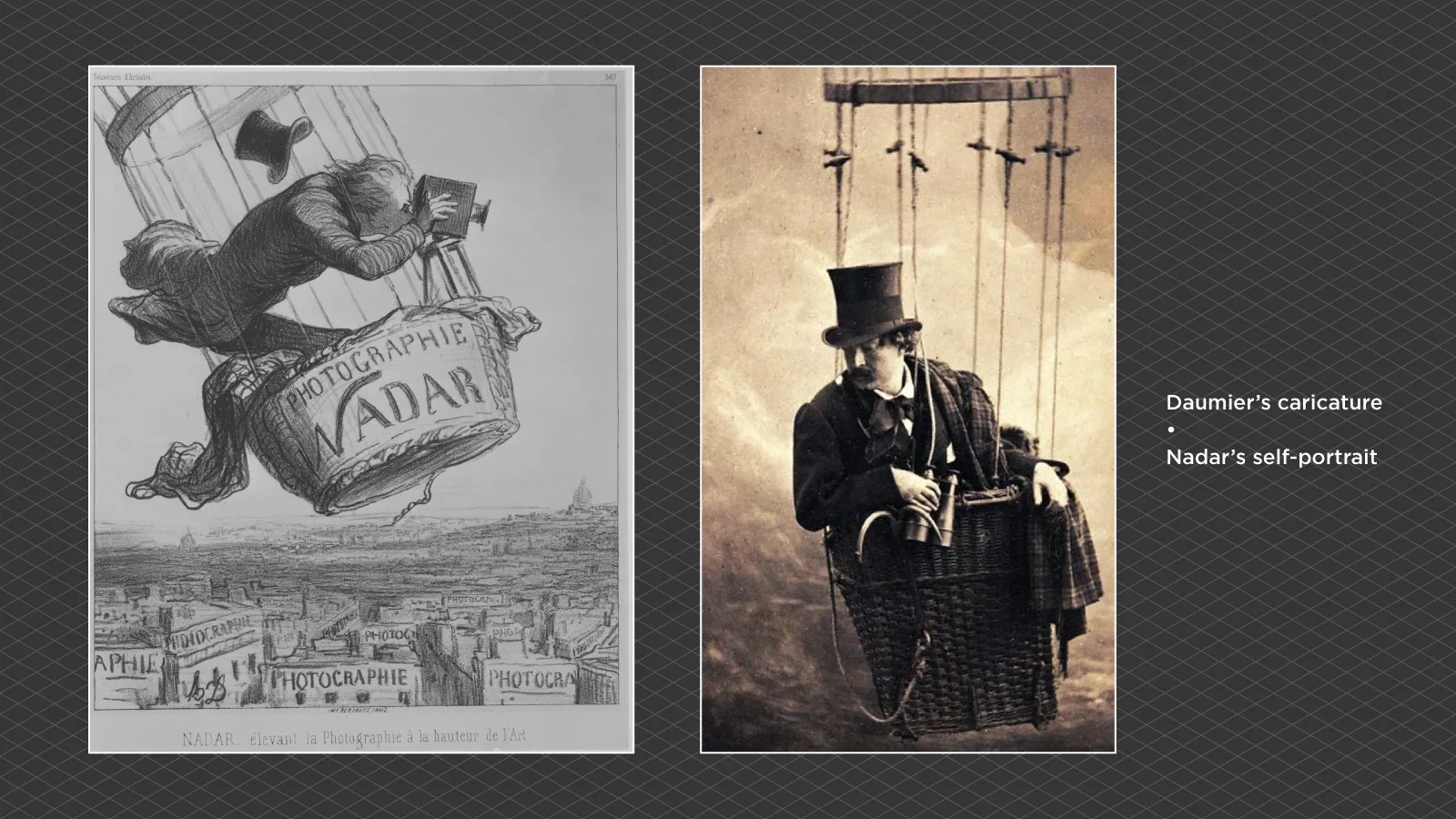
The first aerial photograph came in 1858, when the French photographer Nadar shot the village beneath his tethered balloon. None of those earliest balloon photos survive, which is a genuine loss, but the idea stuck. Wherever there was a view from above, someone wanted a camera in it.
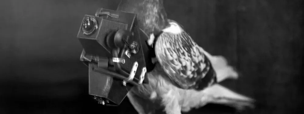
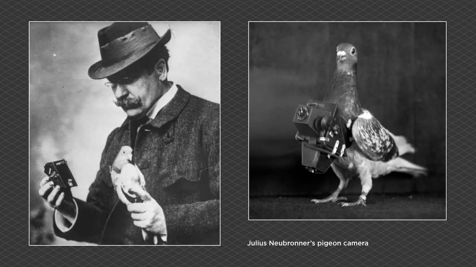
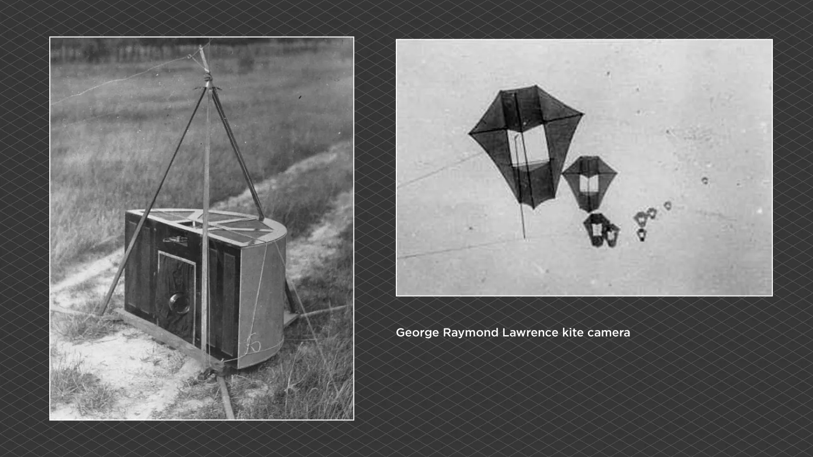 The most charming chapter is the pigeons. In 1907 a German apothecary named Julius Neubronner strapped small time-triggered cameras to homing pigeons and more or less invented lightweight aerial imaging by accident. The patent office turned him down at first, on the reasonable suspicion that he was making it up, then granted the patent once he produced the photographs. Birds aside, it took the First World War to make aerial photography serious. Reconnaissance needed huge numbers of overlapping images, and that demand pushed the technique from a curiosity into a discipline.
 The Machine Age
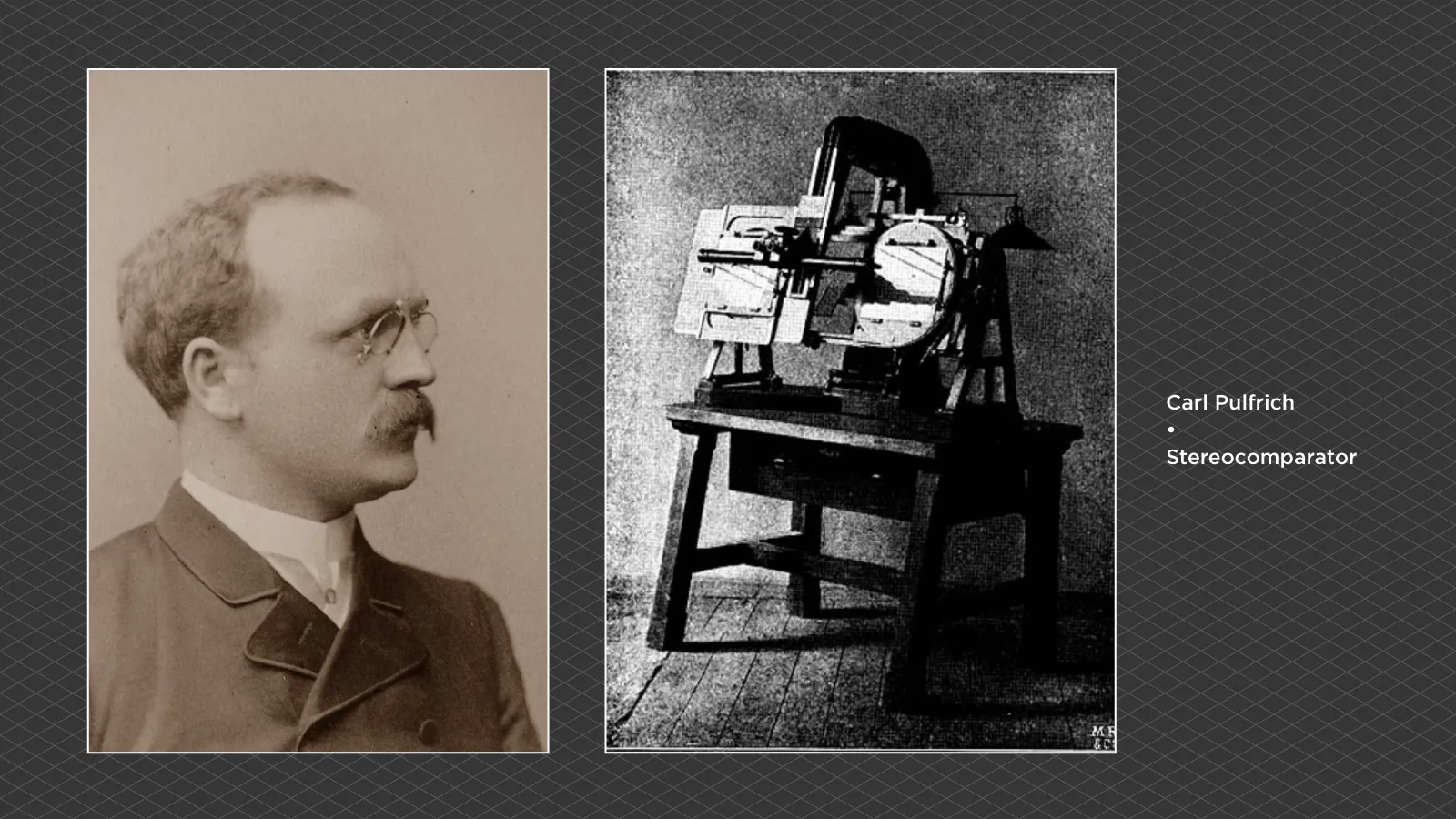
For the next half century, photogrammetry was a story of heavy, beautiful machines. The breakthrough was stereo. Two photos of the same scene from slightly different positions carry depth, the same way your two eyes do. In 1901 Carl Pulfrich built the stereocomparator, the instrument that let an operator measure that depth precisely, and he is remembered as the father of stereophotogrammetry. The first stereoplotter followed in 1908.
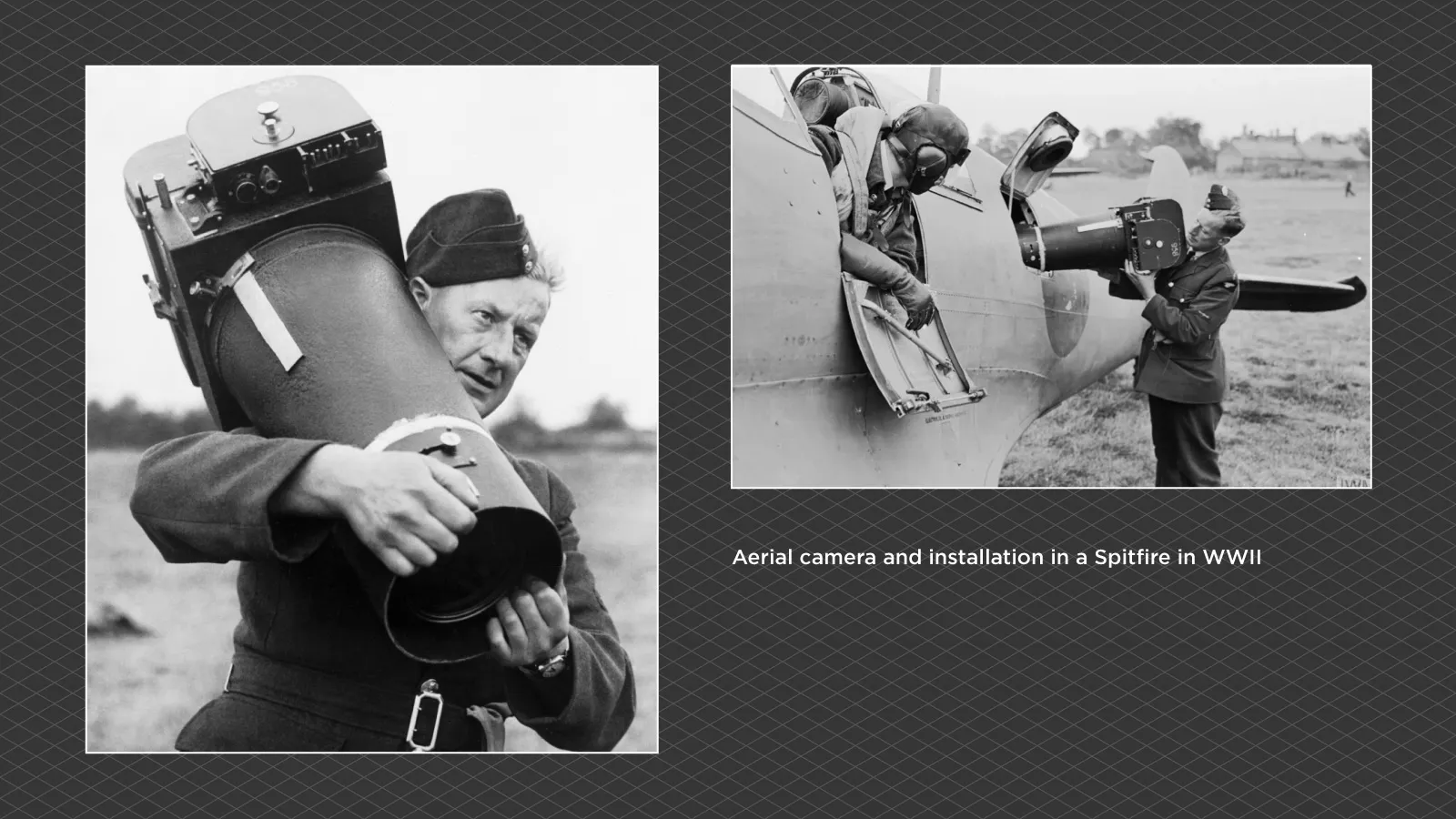
 After that, mapping meant a trained operator at an optical-mechanical machine, staring at stereo pairs and tracing terrain by hand for hours at a time. It was slow, skilled, patient work, and it produced most of the topographic maps of the 20th century. The Second World War, like the first, poured money and urgency straight into it.
 Computers Take Over
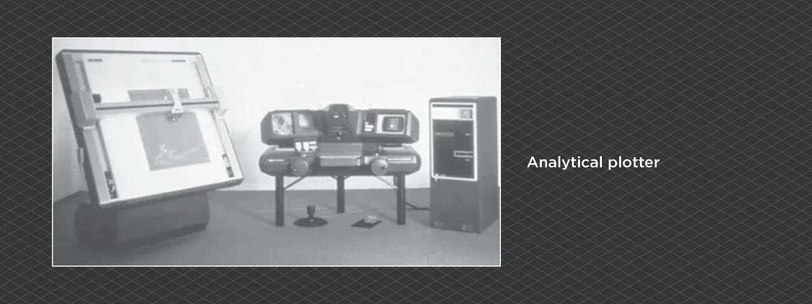
The math behind photogrammetry was always punishing, so the moment computers could carry it, they did. In the late 1950s Uki Helava invented the analytical plotter, which swapped gears and optics for equations and a computer. By the 1980s the images themselves went digital and the machine quietly became software.
 The leap that matters most for the rest of us came from computer vision, not surveying. In 2006 a project called Photo Tourism, later turned into Microsoft's Photosynth, showed that a computer could take a messy pile of ordinary photos, work out where each one was taken, and reconstruct the scene on its own. That capability, Structure from Motion, is the reason modern photogrammetry feels like magic. You no longer have to tell the software anything about your camera positions. It works them out for you.
Photogrammetry Today
Which brings us to now. The two things that always held photogrammetry back were getting a camera into the right positions and doing the math. Drones solved the first. Cheap, sharp sensors and automatic Structure from Motion solved the second. The officer, the balloon, and the desk-sized optical machine have all collapsed into a folding drone and a piece of software.
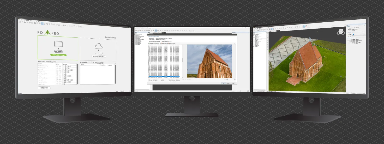 That software is where Pixpro comes in. You hand it your overlapping photos, from a drone, a phone, or a proper camera, and it runs the reconstruction that used to take a trained operator and a machine the size of a desk. Pixpro Waypoints will even fly the capture for you. The whole arc, from Laussedat's kites to a one-button workflow, ends with most of the hard parts quietly removed. What comes next is already being argued about, and Gaussian splatting is the current contender, but that is a separate story.
What Actually Changed
The technology in this story changed beyond recognition. Glass plates became sensors, gears became code, balloons became drones. The idea underneath never moved. Photograph something from enough angles, with enough overlap, and you can measure it in three dimensions. Everything since the 1850s has just been people making that easier.
So the next time a scan finishes in a couple of minutes on your laptop, spare a thought for the officer with the balloon and the apothecary with the camera-carrying pigeons. You are doing the same thing they were. You simply have better toys.
Photographer - Drone Pilot - Photogrammetrist. Years of experience in gathering data for photogrammetry projects, client support and consultations, software testing, and working with development and marketing teams. Feel free to contact me via Pixpro Discord or email (l.zmejevskis@pix-pro.com) if you have any questions about our blog.
Related Blog Posts
Our Related Posts
All of our tools and technologies are designed, modified and updated keeping your needs in mind

Photogrammetry Settings: A Practical Capture Checklist
This is a practical photogrammetry settings checklist built around that: the camera and drone settings I actually use, how to handle overlap and flight patterns, what to check before you start, and a cheat sheet at the end you can screenshot.

Top 10 Photogrammetry Misconceptions Part 2 – Advanced Myths
A while back I published a list of the most common photogrammetry misconceptions I kept running into. That post focused on the basics: gear, megapixels, settings, and other things beginners often get wrong.
What Actually Affects Photogrammetry Accuracy?
Photogrammetry accuracy is one of those topics that seems straightforward at first. You take photos, run them through software, and expect accurate results. In reality, it does not quite work like that.
Ready to get started with your project?
You can choose from our three different plans or ask for a custom solution where you can process as many photos as you like!
Free 14-day trial. Cancel any time.