Most Asked Photogrammetry Questions - Our Answers Part 1
 Lukas
Zmejevskis

As software developers, we receive excellent feedback and questions from our existing and potential clients. Their questions range from what hardware to buy for photogrammetric processing to the best technique for a particular scanning scenario. While we do not know all of the answers,- we can provide a good deal of information and are aware of the most common questions from our users. This article is dedicated to the top 10 frequently asked questions about photogrammetry in general.
Top 10 Frequently Asked Questions About General Photogrammetry
If you are interested in photo-based 3D scanning - these are the questions you may ask at the beginning. We gathered these from our experience in client support and training. These are the top 10 questions we get in no particular order:
1. What is photogrammetry used for?
Photogrammetry is for digitizing the real world. It can be a small object we wish to have in 3D form or an entire city we could explore in virtual reality. Gaming and VFX industry, map makers, surveyors, scientists, and public services use photogrammetry daily. There are dozens of different industries and hundreds of use cases that can benefit from having a digital twin in a 3D environment on a computer.
2. How does photogrammetry work?
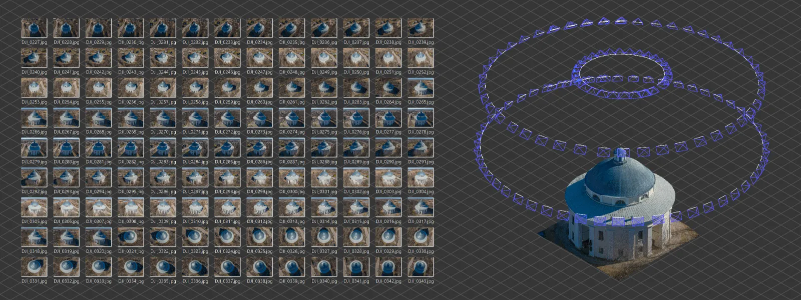
The software analyzes each image and finds unique bits of small details, which we call features. Those details get matched up with adjacent overlapping photos. Due to the perspective change between the images, the software can calculate the depth information for each photo. Depth information from multiple images results in a fully realized 3D model.
For more in depth, but keeping it simple explanation - read this wiki article on Structure from Motion (SfM).
3. What photos can you use for photogrammetry?
We can use any photos that are high quality and were taken following photogrammetry capture principles. Coverage, overlap, and high quality.
4. What drone or camera is the best for photogrammetry?
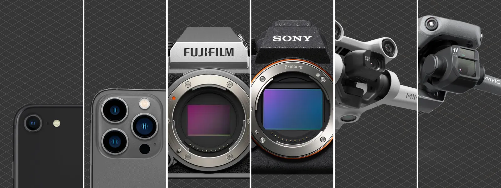
A competent one. You need to be able to obtain high-quality photos. If you can - you are using the right equipment. If you can not - we must analyze what precisely is causing the issue. In practice, any good camera, smartphone, or photography-oriented drone (not a toy) will do the job with the proper technique.
 5. What can we scan using photogrammetry?
We can scan anything that has stable visual features. We can not scan water, glass, or immaculate textureless surfaces. Perfect patterns and moving subjects also fall outside photogrammetric scanning capabilities. Otherwise, we can scan anything we can take pictures of.
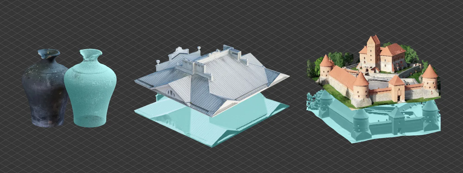 Read more: Exploring the Expectations and Limitations of Photogrammetry
6. What is the best overlap for photogrammetry?
80 percent for the subject of the scan. For aerial scans - there is no reason to use different side and front overlap. Best results are often achieved with 80 percent overlap.
7. How do we define high image quality?
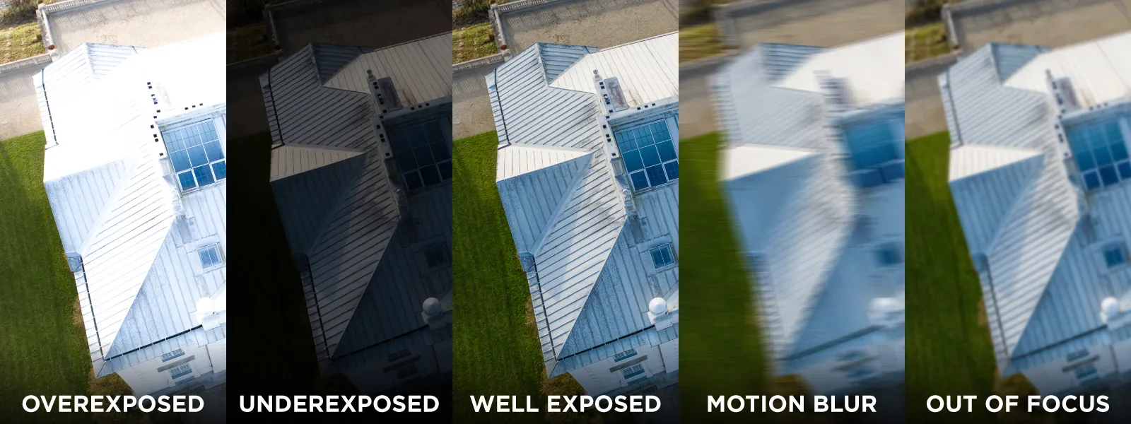
We consider a photo to be high quality when it is properly exposed and not blurry. Proper exposure means the image is not too dark or bright, and our subject is clearly visible. Blurriness in a photo may come from motion blur, when we move too quickly for the shutter speed we use, or from being misfocused. Noise in the picture is also considered a factor of overall photo quality. Still, it is less critical than exposure or sharpness.
Read more: Raw Photo Processing for Photogrammetry
8. What can you measure with photogrammetry?
Any 3D scene that was successfully reconstructed and has referencing information we can measure. Referencing means that the scene connects to the scale or position in the real world. With aerial scans, drones add GPS coordinates to photo metadata, which enables measurements. We can also use scale bars or ground control points if that is not the case.
Read more: Referencing in Photogrammetry - Important Basics
9. How accurate is photogrammetry?
The most complicated question we get. It is hard to answer because accuracy can have varying definitions for many people, and dozens of factors influence the accuracy of a 3D scene. The most crucial factor is the quality of 3D reconstruction, which directly depends on the input data - photos. Well-made photo sets will provide excellent accuracy. The second most crucial factor - referencing. High-accuracy referencing will provide an accurate scale for measurements and positioning on the map. With these factors under control - photogrammetry can provide outstanding accuracy, with deviations in fractions of a percent.
Read more: Relative vs Absolute Accuracy in Photogrammetry
10. What is the difference between 3D point clouds and 3D meshes?
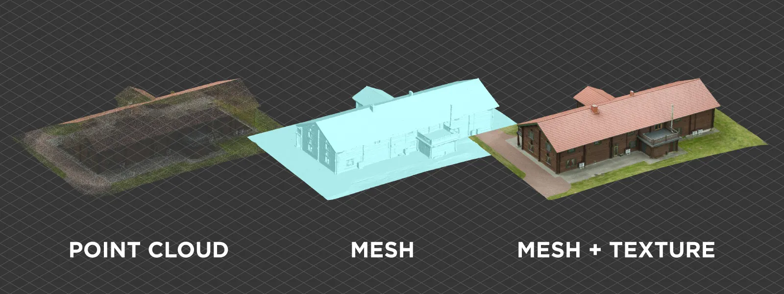
A 3D point cloud is a cluster of discrete points in a 3D space. A point cloud is often used as input data for generating surfaces. A 3D mesh is a solid surface made up of triangles. 3D mesh becomes an actual 3D model when it has texture - the realistic coloring of the scanned subject.
Conclusion
These are our opinionated and educated answers to these questions. If you have any more detailed questions - do not hesitate to contact us or comment below. There are no band questions, and we aim to bring photogrammetry to all who may benefit from it. We will do more parts of these FAQ-type blog posts in the future - the next one will be more geared toward our software.

Photographer - Drone Pilot - Photogrammetrist. Years of experience in gathering data for photogrammetry projects, client support and consultations, software testing, and working with development and marketing teams. Feel free to contact me via Pixpro Discord or email (l.zmejevskis@pix-pro.com) if you have any questions about our blog.
Related Blog Posts
Our Related Posts
All of our tools and technologies are designed, modified and updated keeping your needs in mind

Photogrammetry 202 - Pixpro Blog Index
In our final blog post of the year, we are indexing Pixpro photogrammetry blog posts from the last two years. After publishing regularly for a while, things tend to scatter: posts about workflows, Pixpro features, hardware tests, random experiments, use cases, comparisons.
Travel Photogrammetry - More Fun than 2D Photos
Sometimes a 2D photo does not do justice to a moment or a place, and you wish you had something more… dimensional. Something that captures shape, texture, and the little details that flat images tend to flatten even more.
Budget in Photogrammetry - Affordable to Medium to Premium
Photogrammetry, like many other professions, hobbies, or disciplines, can have different budget tiers. In this article, I will provide my opinion on what I consider to be photogrammetry gear, ranging from affordable to premium to high-end tiers.
Ready to get started with your project?
You can choose from our three different plans or ask for a custom solution where you can process as many photos as you like!
Free 14-day trial. Cancel any time.
.svg@webp)
