.svg@webp)
Baseplanes in Photogrammetry
 Lukas Zmejevskis
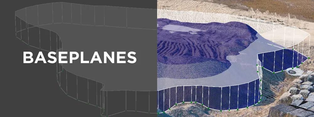
Baseplanes are a fundamental part of any volumetric measurement system. Each photogrammetry software has to deal with selecting, approximating, and modifying a base plane to allow the user to get an accurate volume measurement. This article will look at Pixpro photogrammetry software, what baseplanes it provides, and how to use them. However, these concepts will apply to any photogrammetry software you plan to use for volumetric measurements.
What is Baseplane
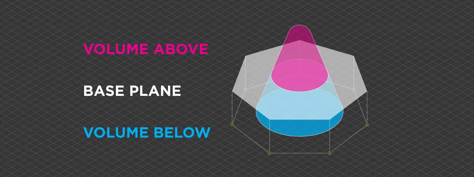
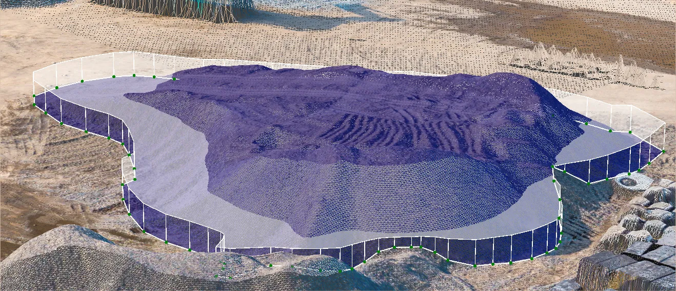
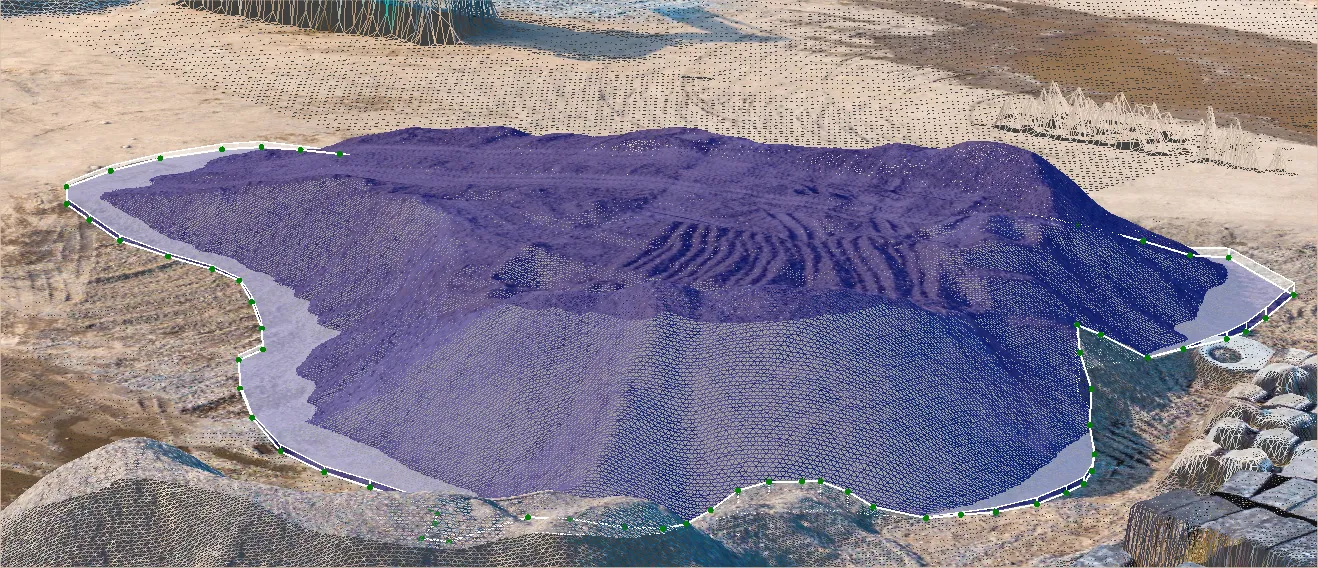
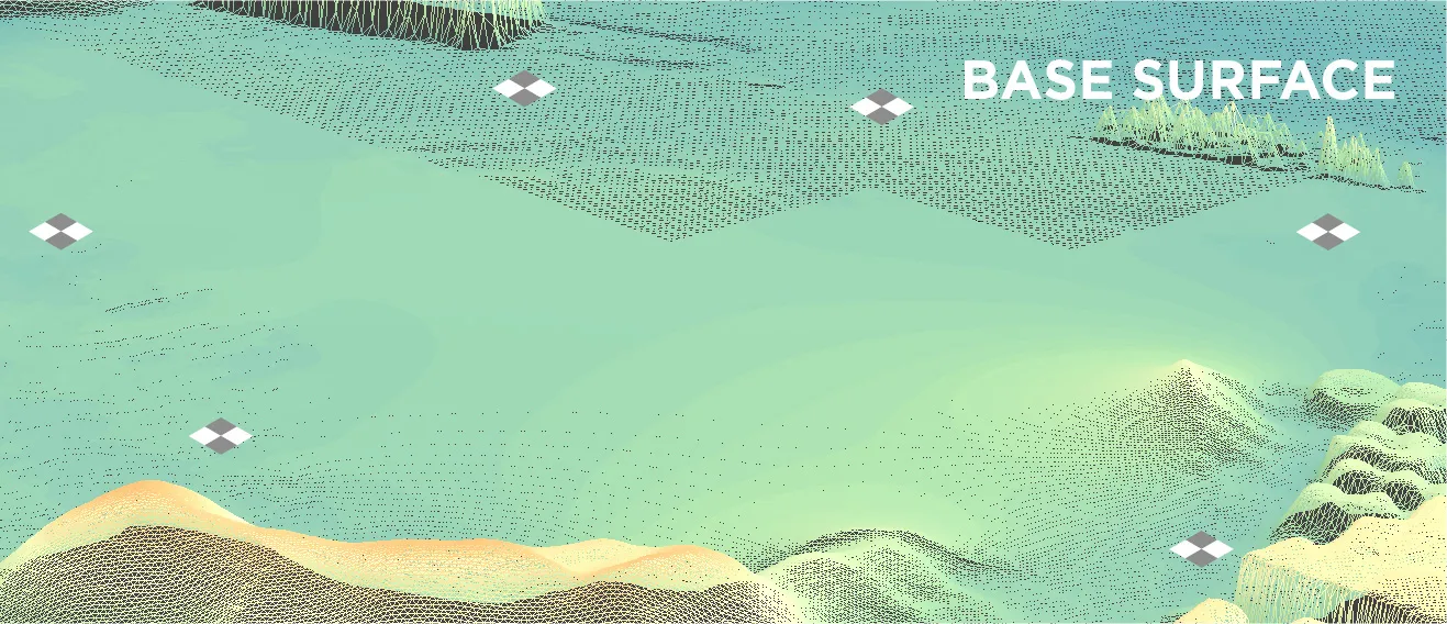
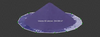
Baseplanes are planes in 3D space used to designate a flat plane in an area, from which the software calculates the volume on the Z axis (vertically). Everything above the plane is positive volume; everything below - is negative. Baseplanes are generally a part of a polygon that can be drawn or imported into the software. Changing the type of a baseplane will not affect the area encompassed by the polygon, only the volumetric measurements of said polygon.
Pixpro always adds a baseplane to a polygon to show preliminary measurements. These measurements update instantly if a different base plane is selected. An exception is the Elevation model plane, which takes longer to calculate. Baseplanes are also visualized in the 3D view to understand their positioning. Finally, the estimated or entered altitude value can be found beside the plane selection. Knowing these features, we can look deeper at what types of planes we can select.
Baseplanes in Pixpro
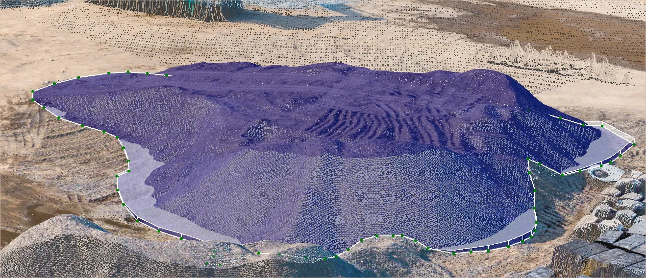
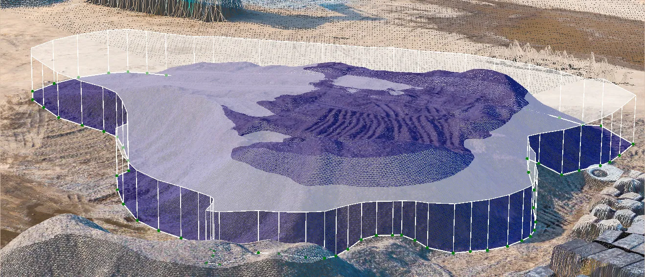
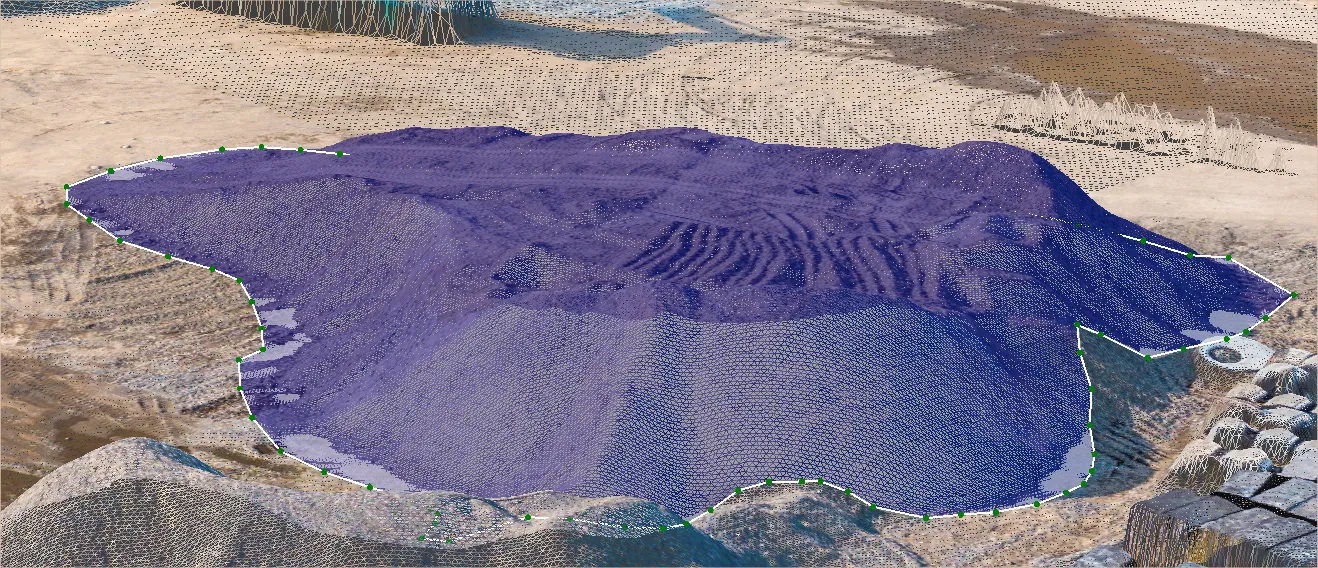
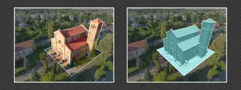
Our photogrammetry software uses polygons to make volumetric measurements by drawing them on a digital elevation map. Each DEM is made from a dense point cloud and can use a different gradient color scheme or an orthophoto image. Once we draw a polygon, there are six types of baseplanes to choose from:
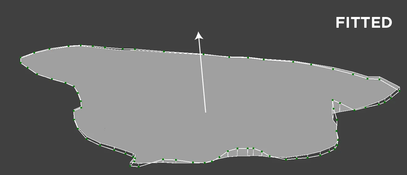
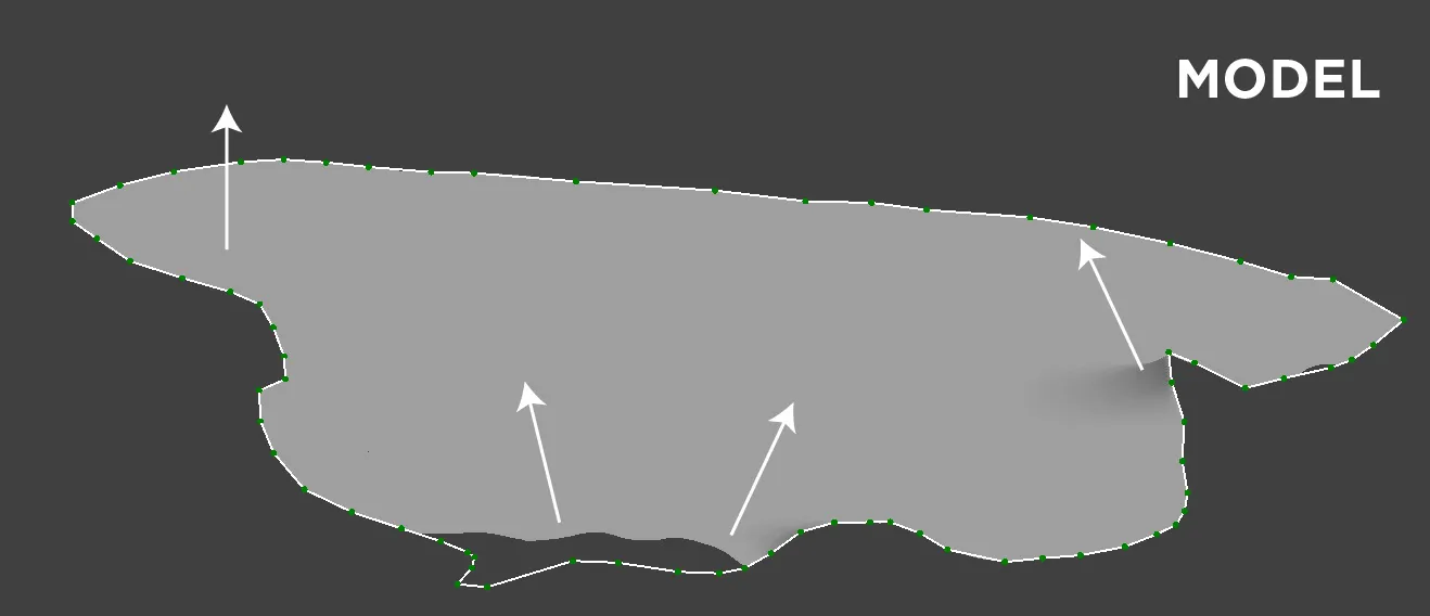
Fitted plane. It is the most commonly used base plane. It considers all of the points - vertices used to create the polygon. This plane is flat but not perpendicular to the approximated gravitation vector. Fitted planes’ angles will depend solely on the position of each vertice. In many cases, this is the best type of baseplane to use as it provides reasonably accurate results quickly.
Max Height plane. This plane is calculated according to the highest vertice used to draw the polygon (a vertice is a point on the perimeter, at least three vertices are necessary to form a polygon). This plane is flat and perpendicular to the gravitation vector.
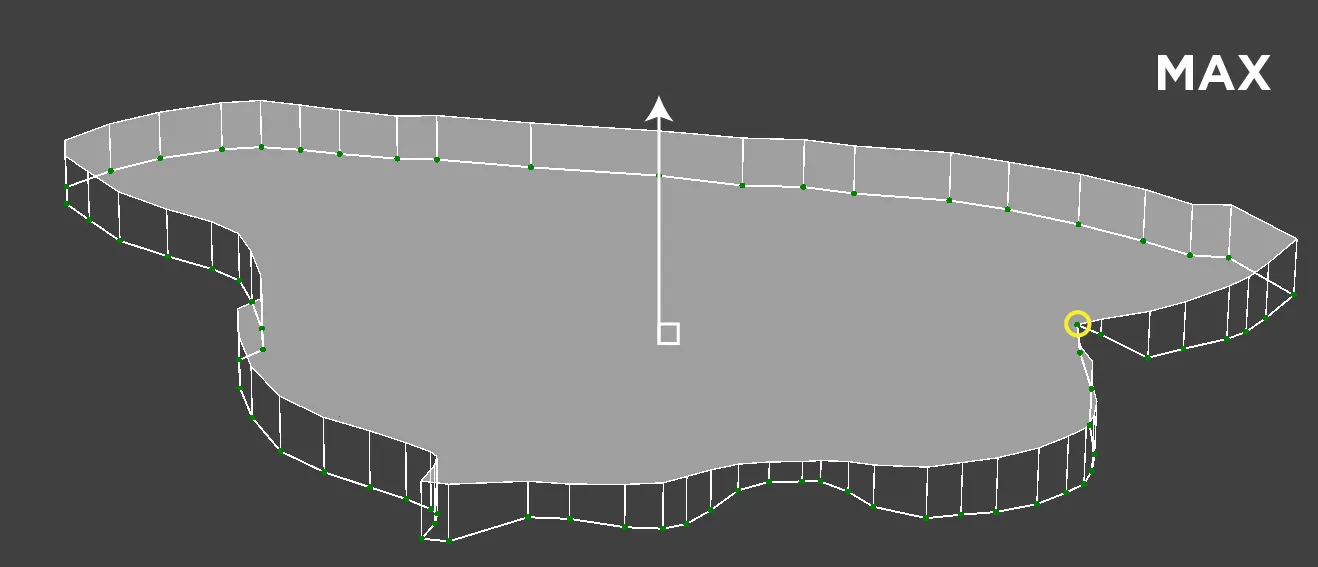
Mean Height plane. This plane is calculated using the average altitude of all points to draw the polygon. This plane is flat and perpendicular to the gravitation vector.

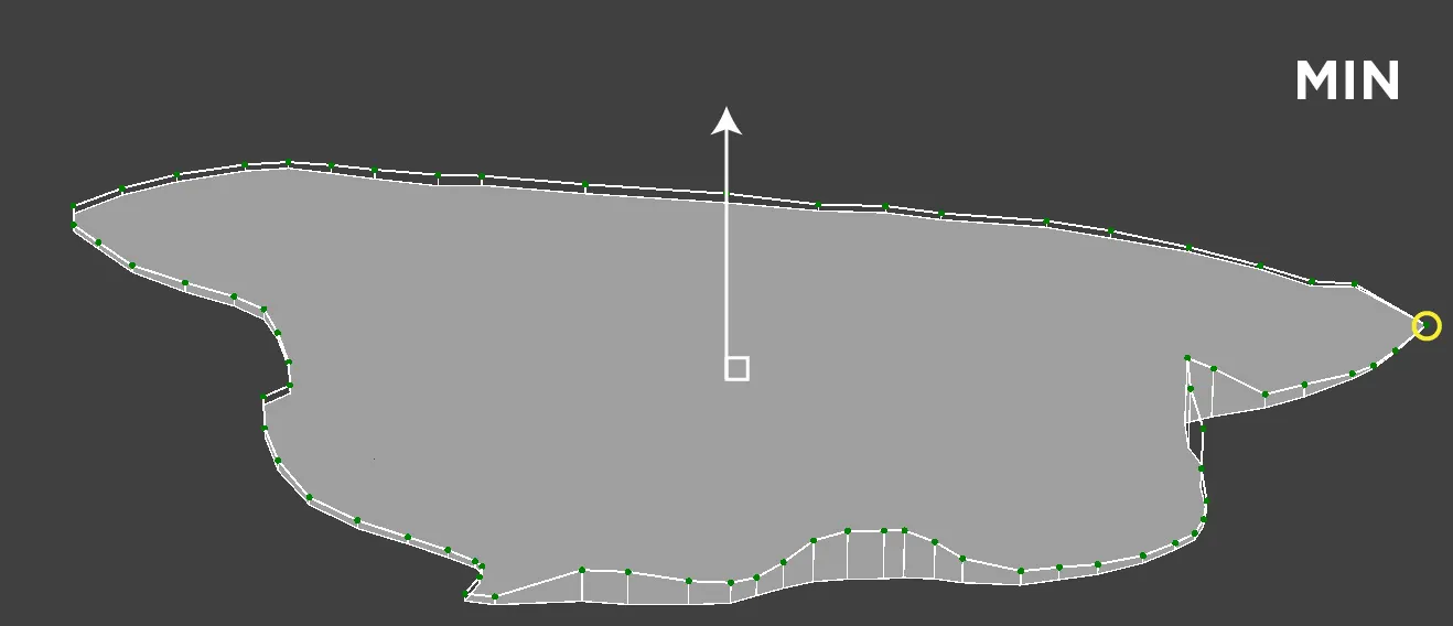
Min height plane. The minimum height plane is calculated using the lowest vertice to draw the polygon. This plane is flat and perpendicular to the gravitation vector.
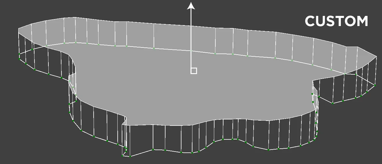
Custom height plane. This plane can be added at any specified altitude by the user. This plane is flat and perpendicular to the gravitation vector.
Elevation model plane. The most accurate and the most complicated to use type. It uses a previously generated or imported surface as the plane inside the polygon. Technically, it can be of any shape or angle and provide the most realistic volumetric measurements. This option is visible only if two or more digital elevation maps are present in the project.
Using Elevation Model Baseplane
As mentioned above, the elevation model is the most complicated to use in a project. The basic concept is clear - you need to have another surface as a base surface in the same areas as the polygon. However, the execution of such a measurement requires precision and consistency:
- Both surfaces must have accurate georeferencing data. We recommend having plenty of professional GCPs in each project for such a purpose.
- Alternatively, the surfaces can come from the same source point cloud but with some modification to the DEM surfaces.
- Both surfaces should have the same GSD value and coordinate system from the beginning.
- Both surfaces should come from point clouds that have the same quality settings and coordinate systems used to make them.
- Point clouds and surfaces for this purpose should come from similar, high-quality 3D scanning patterns made with the same camera.
Only by ensuring these factors can we confidently say that the only variable is the scene itself. Everything else is consistent and unchanging. It may sound hard initially, but consistently high-quality results are the bread and butter for professional surveyors. Once you get the workflow downs, it is just a matter of repeating everything. All that remains is to draw the polygon precisely around the subject on which we need to measure volume and select the correct base surface layer when selecting the baseplane.
Conclusion
If you strive to get accurate volumetric measurements - baseplanes are the most critical concept to understand and control. Using the wrong base plane can result in wildly different measurements that may cause inconvenience or damage if you make decisions using false data. Also, we must understand the limitations of baseplanes and carefully select the correct type of baseplane for each use case. But when we are ready, we can take advantage of one of the most powerful features of photogrammetry - volume measurements. Nothing can replace the ability to accurately measure material or space with the efficiency and safety of photogrammetry.
Photographer - Drone Pilot - Photogrammetrist. Years of experience in gathering data for photogrammetry projects, client support and consultations, software testing, and working with development and marketing teams. Feel free to contact me via Pixpro Discord or email (l.zmejevskis@pix-pro.com) if you have any questions about our blog.
Related Blog Posts
Our Related Posts
All of our tools and technologies are designed, modified and updated keeping your needs in mind
Surface Comparison Part 2
You can compare surfaces with a high level of precision even without accurate RTK GPS data. In the first part of this article, we create artificial GCPs from a base project to use in another project for referencing.

Pixpro Waypoints v2 - Orbitals and Height Offset for DJI Drones
Pixpro Waypoints is a service for consumer DJI drone users that provides consistent and automated flying for aerial photogrammetry purposes. For now, we had the essential single grid flight only, which is the bread and butter for making orthophoto images and terrain scans.
Overlap Between Different Perspectives
Photogrammetry can be simple and rigid or complex and adaptable. Combining different scan patterns adds complexity to the work but improves detail and coverage. We often use examples of combined flights, of which the orbital + nadir grid is a classic. They provide great 3D structure while being easy
Ready to get started with your project?
You can choose from our three different plans or ask for a custom solution where you can process as many photos as you like!
Free 14-day trial. Cancel any time.
Welcome to Pixpro
Sign in
And access your account.