.svg@webp)
Photogrammetry. Art or Science?
 Lukas
Zmejevskis
Lukas
Zmejevskis
From the very dawn of image capturing, documenting the world around us became a distinctive field of human activity. Eventually, this activity evolved into the science of mapping and photogrammetry. Thus, the story of two-dimensional photos transforming into a digital 3-dimensional object began. So, what is photogrammetry?
Traces of the Past
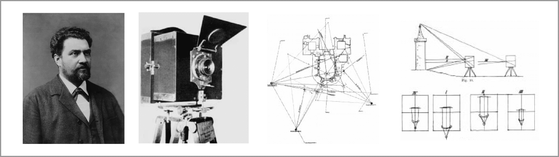
First, mapping as a science made the first step in the 19th century with the incentive of a young architect Albrecht Meydenbauer. His efforts in pioneering photo capture for cultural heritage preservation and documentation, first steps for photogrammetry were laid. Capturing a set of photos and transforming them into a highly accurate surface reproduction became the science and art of photogrammetry. Accuracy, detailedness, and the ability of imagery to bring the most effective basis for surface calculation is the core of photogrammetry.
The Types of Photogrammetry
Photogrammetry as an independent science is based on intelligent algorithms for 3D reconstruction, measuring, and further processing. Basically, the task is to acquire the 3-dimensional measurements and 3D digital visuals from 2-dimensional image data.
As the science of surface exploration, photogrammetry can basically be divided into two main branches – metric and interpretive. Metric photogrammetry deals with calculations based on photo processing and georeferencing where necessary. Hence, we get precise size, shape, volume, and position measurements on the earth’s surface or in a definite space. It is applied in terms of digital analysis of the object’s change, progress, or dynamics.
The second one, i.e., the interpretive, is more targeted at the reconstruction of neat patterns, shadings, surface structures, reliefs, and colors to reveal the object’s complete visual semblance. Therefore, the science of photogrammetry covers many different fields of human activity for even more productive visualization.
The Growth of Photogrammetry
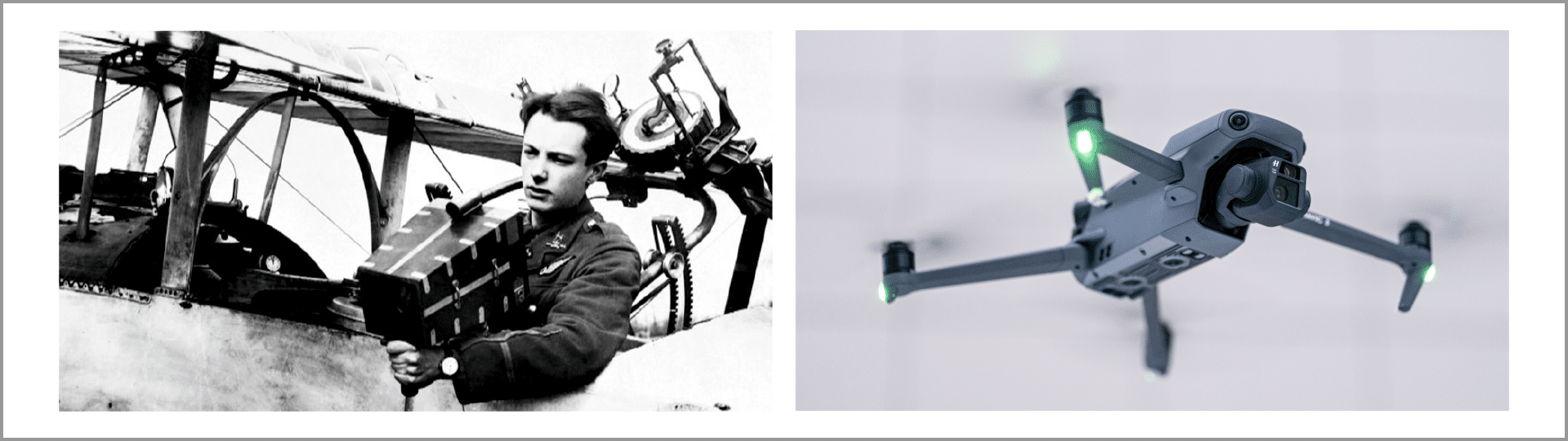
The combination of projective geometry, methods of automated picture analysis, and even artificial intelligence allows the unrivaled growth of this field of science to thrive as tech and digitalization develop. Significant progress of digital photography and unmanned aerial vehicle technology evolution empower people to process digital data as accurately as never before. Meanwhile, scientists constantly refine automated reconstruction methods to gain more precise 3D structures.
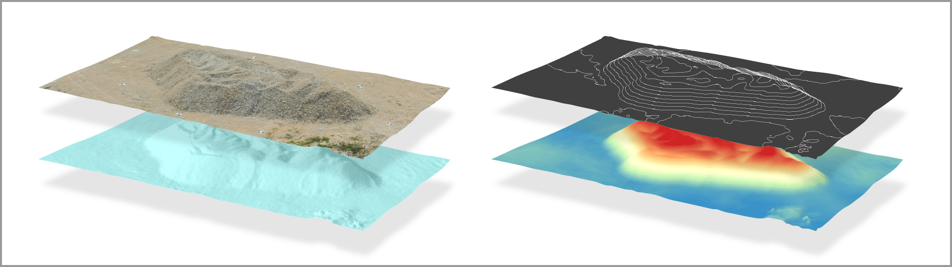
During the last decade, Structure from Motion (SfM) has been developed as a new field of photogrammetry science to explore the automated methods of visual reconstruction. This branch of photogrammetry enabled the large-scale processing of vast volumes of high-quality photos. Photogrammetric methods produce such 3-dimensional entities as:
- dense point cloud
- 3D mesh,
- texture,
- digital elevation map (DEM),
- orthomosaic, etc.
The scientists strive to improve the digital data processing speeds, refine the algorithms, and employ artificial intelligence. This helps to lessen or eliminate technical limitations which arise from the shortcomings of the capturing and processing equipment (UAVs, cameras, etc.) to enhance the precision of digital products and the capabilities of the photogrammetric software. Thus, the challenges of the reconstructed 3-dimensional products’ quality rely on intelligent solutions and the quality of tech employed.
The Precision of Photogrammetry
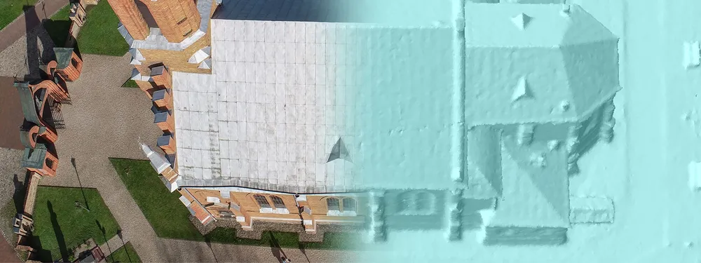
The photogrammetric process implies employing the principle of triangulation of the points from capturing overlapping aerial or close-range images. From here on, the photogrammetric software analyzes each photo to acquire each point’s projective intersections. The algorithms distinguish the keypoints on which further 3-dimensional reconstruction of an object is performed.
To dig deeper, the notion of a keypoint is crucial in all levels of data acquisition from digital photogrammetric products. To get accurate visual volumes, we need some definite precision in extracting the coordinates of a material object. The more accurately the equipment captures the coordinates (i.e., the accuracy of georeferencing), the more precise the keypoints will be.
The accuracy and precision of the 3D products rely on the potential of the tech we employ. For example, a better camera lens may lead you to a more realistic reconstruction of the material object.
Art and Science of 3D
So, where does the art of 3D visualization start? Put it simply, the answer is as follows – at the very first step of your choice, i.e., the aim of reconstruction, the equipment you use, and the software you put all your bets on. The photogrammetry software is very widely applicable. First, we see the art of reconstruction arising from the historical reconstruction of architecture, pieces of art and relics, unique sculpture 3D models’ to admire, and much more. And that is just a starting point. From the mapping and architectural preservation, we continue the proud pace throughout absolutely differing fields unified by the name of this promising science:
- engineering applications,
- mining solutions,
- geodesy explorations (e.g., excavations, archeological examinations, etc.),
- manufacturing,
- preservation and quality control (e.g., assurance of the safety of the closed mines and quarries),
- forensic investigations (e.g., crime scene reconstruction and surface data analysis).
Even more stunning, the application of photogrammetry in meteorology brings a whole new opportunity to analyze the environmental changes, surface movement, and relocation of objects in the investigated areas.
For more applications of the photogrammetric software, tour our articles on how PixPro software may help you facilitate your everyday work.
Photogrammetry – a Tool for Everyone
The art of retrieving calculative data helps us achieve unlimited results when applied insightfully. Working on any photogrammetric project implies gaining accurate data to obtain spectacular 3D results. It opens a broad spectrum of possibilities to generate precise calculations, volume and linear measurements, elevation evaluation, precise digital representation, and many more.
For less practical yet impressive results, we have artists of the digital age with their collections of the 3D models: pieces of art, sculptures, rare relics, and antiquities, as well as simple everyday objects to admire. We may have a peep and immerse ourselves in historical reconstructions and archeological artifacts merely for curiosity and pleasure. That is the beginning of human perception delving into the possibilities of a digital world created with photogrammetry.
Photographer - Drone Pilot - Photogrammetrist. Years of experience in gathering data for photogrammetry projects, client support and consultations, software testing, and working with development and marketing teams. Feel free to contact me via Pixpro Discord or email (l.zmejevskis@pix-pro.com) if you have any questions about our blog.
Related Blog Posts
Our Related Posts
All of our tools and technologies are designed, modified and updated keeping your needs in mind

DJI Drone Settings and Features - DJI Fly App Extensive Guide Part 1
The best flying cameras on the market today are DJI drones. They are the best tools for video, photo or 3D photogrammetry scan creation. However, the tool is only as capable as the user.
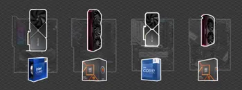
Building a PC - Tips and Hardware for mid-2024
A year has passed since our last article about building a workstation PC, so it is time to revisit the market to see what has changed.

Pixpro Waypoints v2 - Orbitals and Height Offset for DJI Drones
Pixpro Waypoints is a service for consumer DJI drone users that provides consistent and automated flying for aerial photogrammetry purposes. For now, we had the essential single grid flight only, which is the bread and butter for making orthophoto images and terrain scans.
Ready to get started with your project?
You can choose from our three different plans or ask for a custom solution where you can process as many photos as you like!
Free 14-day trial. Cancel any time.