.svg@webp)
The Diversity of Photogrammetry
 Pixpro
Team
Pixpro
Team
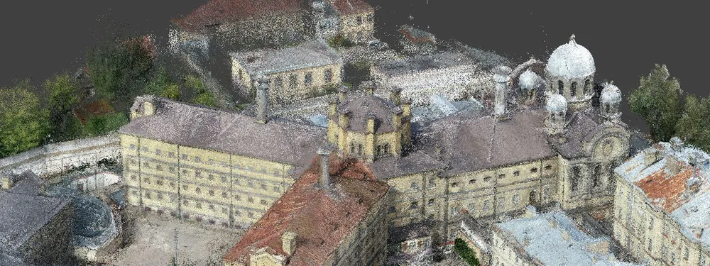
Photogrammetry is a 3-dimensional measuring technique that uses photographs as the fundamental medium for measurements. The fundamental principle used by photogrammetry is triangulation. By taking photographs from at least three different locations, so-called “lines of sight” can be developed from each camera to points on the object. These lines of sight are mathematically intersected to produce the 3-dimensional coordinates of the points of interest.
Photogrammetry can be classified based on camera location during photography. On this basis we have aerial, terrestrial and space photogrammetry. Let’s talk about each of them more.
Aerial photogrammetry
Aerial photographs are taken from the air by special camera mounted in an aircraft flying over the area with the camera axis vertical or nearly so. Multiple overlapping photos of the ground are taken as the aircraft flies along a flight path. These photos are processed in a stereo-plotter (an instrument that lets an operator see two photos at once in a stereo view). Photos are also used in automated processing for Digital Elevation Model (DEM) creation.
Terrestrial photogrammetry
It’s that branch of photogrammetry where photographs are taken from a fixed, and usually known, position on or near the ground and with the camera axis horizontal or nearly so. The position and orientation of the camera are often measured directly at the time of exposure. The instrument used for exposing such photograph is called photo theodolite.
Satellite photogrammetry
The space photogrammetry embraces all aspects of extraterrestrial photography and subsequent measurement wherein the camera may be fixed on earth, contained in an artificial satellite, or positioned on the moon or a planet.
The term photo interpretation is applied to that branch of photogrammetry wherein aerial or terrestrial photographs are used to evaluate, analyze, classify, and interpret images of objects which can be seen on the photographs. Consequently, photogrammetry must be considered as a combination of measurement and interpretation.
Different levels of photogrammetry
There are two types of photogrammetry as follows:
Interpretative photogrammetry – involves recognizing and identifying objects and judging their significance through careful and systematic analysis from photographic images. These images created from satellite imagery which senses energy in wavelengths. Forms basis for remote sensing.
Metric photogrammetry – consists of making precise measurements on photographs and other information to determine relative locations of points. Common application of metric photogrammetry consists of planimetric mapping and topographical mapping. Applications used to determine distances, elevations, areas, volumes, and cross-sections to compile topographical maps from photographic measurements.
Advantages of photogrammetry
Why is photogrammetry so useful? There are many reasons. Since photography is essentially “non-contact,” it provides a unique way of observing and recording information, without the requirement of physical presence. With the onset of technology, the usefulness of photogrammetry is almost without limitation. Mapping, as well as other technologies, plays a leading role in meeting the public demands for comfort, transport, and convenience. The main advantages of photogrammetry are the following:
- Covers areas quickly;
- Low costs;
- Easy to obtain/access information from air;
- Illustrates great detail.
Photogrammetry software solutions
Based on photogrammetry and computer vision, Pixpro created its software solutions. With Pixpro software everyone can process both handheld and aerial photos for high-accuracy reconstruction, sleek visualization and detailed analysis of the object in a 3D mode. It‘s easy to generate and integrate chosen 3D models, DEMs and orthophotos with modern tools and GIS and CAD software.
Related Blog Posts
Our Related Posts
All of our tools and technologies are designed, modified and updated keeping your needs in mind
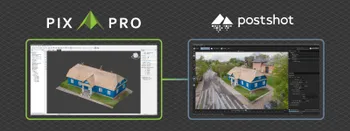
Pixpro to Gaussian Splatting: How to Export Your Project to Postshot
Gaussian splatting is no longer a curiosity. People are using it for walkthroughs, marketing visuals, virtual environments, and increasingly as a pretty companion to a scan they already flew.
Pixpro Team

The Top 10 Pixpro Blog Articles So Far
We have been publishing on this blog every week for years now, on everything from stockpile volumes and coordinate systems to scanning a cake. So it seemed like a good time to look at the numbers and see which posts people actually read, rather than which ones we enjoyed writing.
Pixpro Team
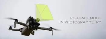
Portrait Orientation in Photogrammetry: When It Actually Helps
Is there anything to gain by scanning in portrait instead of the usual landscape? Sometimes, a little. But orientation is one of the least important decisions you make on a scan, and it is worth understanding why before you give it any more thought than that.
Pixpro Team
Ready to get started with your project?
You can choose from our three different plans or ask for a custom solution where you can process as many photos as you like!
Free 14-day trial. Cancel any time.