.svg@webp)
DJI Mavic 4 Pro Photogrammetry – Pixpro Waypoints
 Lukas
Zmejevskis
Lukas
Zmejevskis
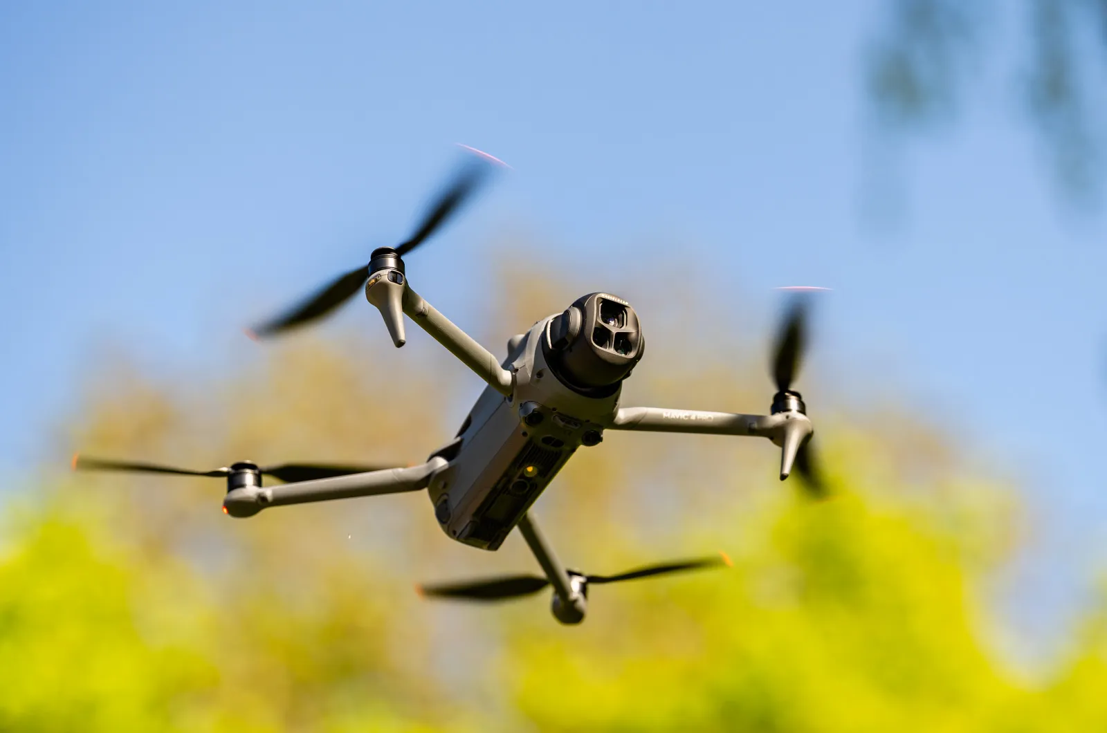
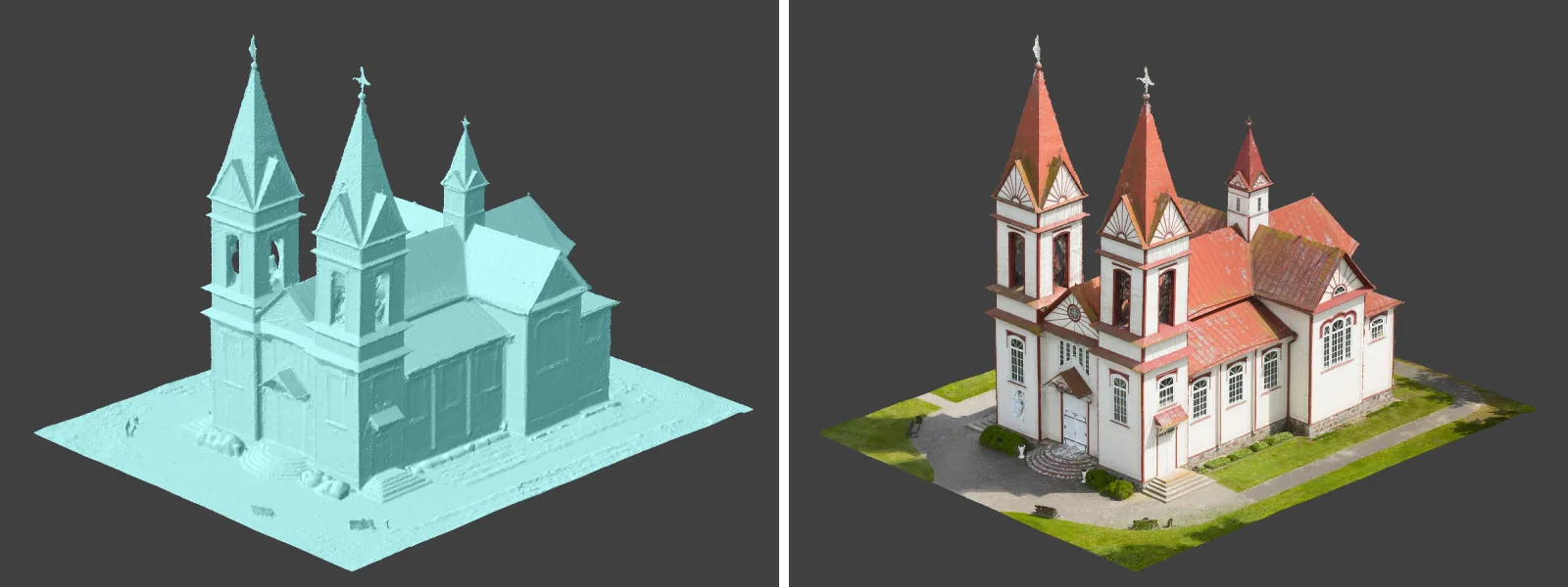
DJI Mavic 4 Pro is the flagship foldable consumer drone from DJI. It will become a workhorse for many creators in the next few years, including some of us in photogrammetry. It has become the norm that DJI FLY app-based drones do not have a publicly available SDK, so no automated flight planning exists via third-party apps. But of course, we have a good workaround solution that makes the drone way more usable for photogrammetry. In this article, I will detail how I used Pixpro Waypoints to obtain a couple of 3D scans using the now-supported DJI Mavic 4 as well.
 Pixpro Waypoint Service
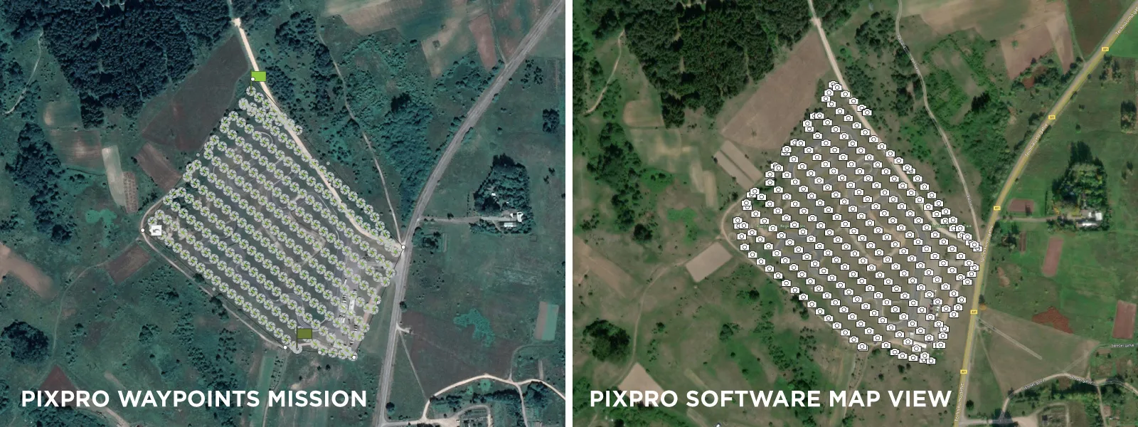
Pixpro Waypoints is undoubtedly a workaround that replaces an existing waypoint .kmz file with one we generate on the web service. Here is an abridged version of the Pixpro Waypoints workflow:
Step 1. Create as many placeholder waypoint flights as possible and save them. This is done by connecting the drone to the RC and using the waypoint features to create and save some flights. We do not need to do anything specific—tap a few times on the screen to add a waypoint on the map and save that. That creates a file on the remote, which we will replace.
Step 2. Plan and download a flight from the Pixpro Waypoints website. The service is available to you if you have a trial or Pixpro license.
Step 3. Replace the file by connecting the remote or your Android phone to another device where the file has been downloaded. The replacement procedure involves copying the file into a specific directory and renaming it to the same name as the placeholder one.
After completing this, you will find the waypoint plans with replaced flight paths. All you need to do is execute the flight and start the Timed Shot capture mode with the interval you selected during the planning phase. The waypoint mission will control the drone's trajectory, speed, and altitude, while the capture trigger is up to you. Start the capture when the drone starts moving on the mission trajectory and finish when it is complete.
If everything goes as planned, you will get photos with proper side and front overlap—perfectly suitable for photogrammetric 3D reconstruction. A more detailed workflow explanation can be found in the dedicated waypoint article:
Pixpro Waypoints - Automated Photogrammetry Flights for Newest DJI Drones
Photogrammetry Essentials
Photogrammetry of any kind relies on good data—precise and well-exposed photos with proper overlap and coverage. If you use Pixpro Waypoints, the overlap and coverage part is taken care of. The main job here is to ensure that photos coming out of the drone are not blurry. And because the drone is moving while taking pictures, motion blur is a risk if the shutter speed—how "fast" the camera takes a photo—is too low.
This is usually not an issue during bright days, but if there is less light, we need to take exposure at least partially into our hands. The safest way is to use the S mode. S stands for shutter priority, which means you choose the shutter speed. The camera will select other exposure variables (aperture and ISO sensitivity). If you are flying slow or high up—never go below 1/200th of a second for the shutter speed. If you are flying fast or low—never go slower than 1/500th of a second. A very general approximation but a decent rule of thumb.
Mavic 4 Pro Specifics
Mavic 4 Pro has no differentiating features when using Pixpro Waypoints or photogrammetry in general when compared to other DJI drones. It is another flying camera that is incrementally better than the last one. It is the same DJI Fly app and mostly the same features. There is the new fancy controller with a rotating screen, but that still runs the same software. In practice, everything I discussed in previous waypoint-related articles will apply to the Mavic 4 Pro.
Most Asked Questions - Pixpro Waypoints
Pixpro Waypoints Update - Multi Grids
Pixpro Wayoints - Automated Photogrammetry Flights for Newest DJI Drones
DJI Mini 4 Pro Photogrammetry - Pixpro Waypoints
Multi-battery Scans with Pixpro Waypoints
Commercial Roof Scan and Inspection
Pixpro Waypoints v2 - Orbitals and Height Offset for DJI Drones
Examples
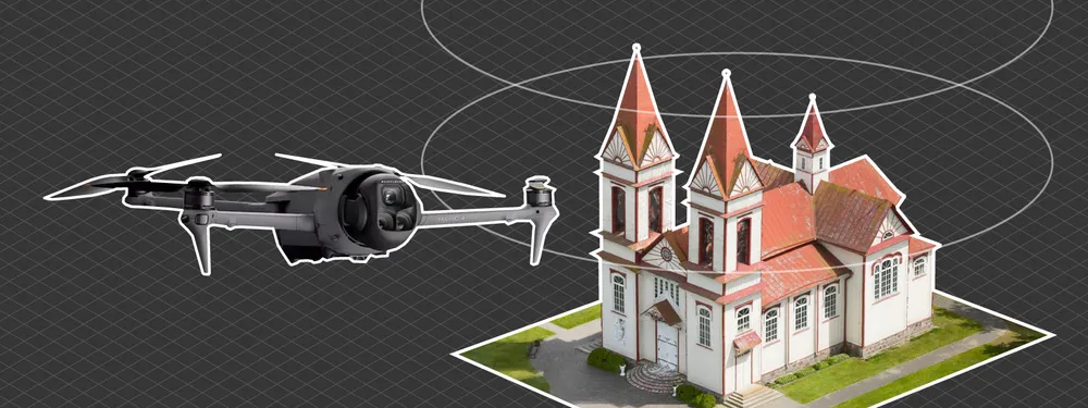
I have made a couple of examples using Pixpro Waypoints. The first one is a hybrid orbital flight example. I made three orbits using Pixpro Waypoints, with two camera orientations and altitudes adjusted to cover the entire building. I combined that with a hyperlapse orbit from afar for a more environmental context.
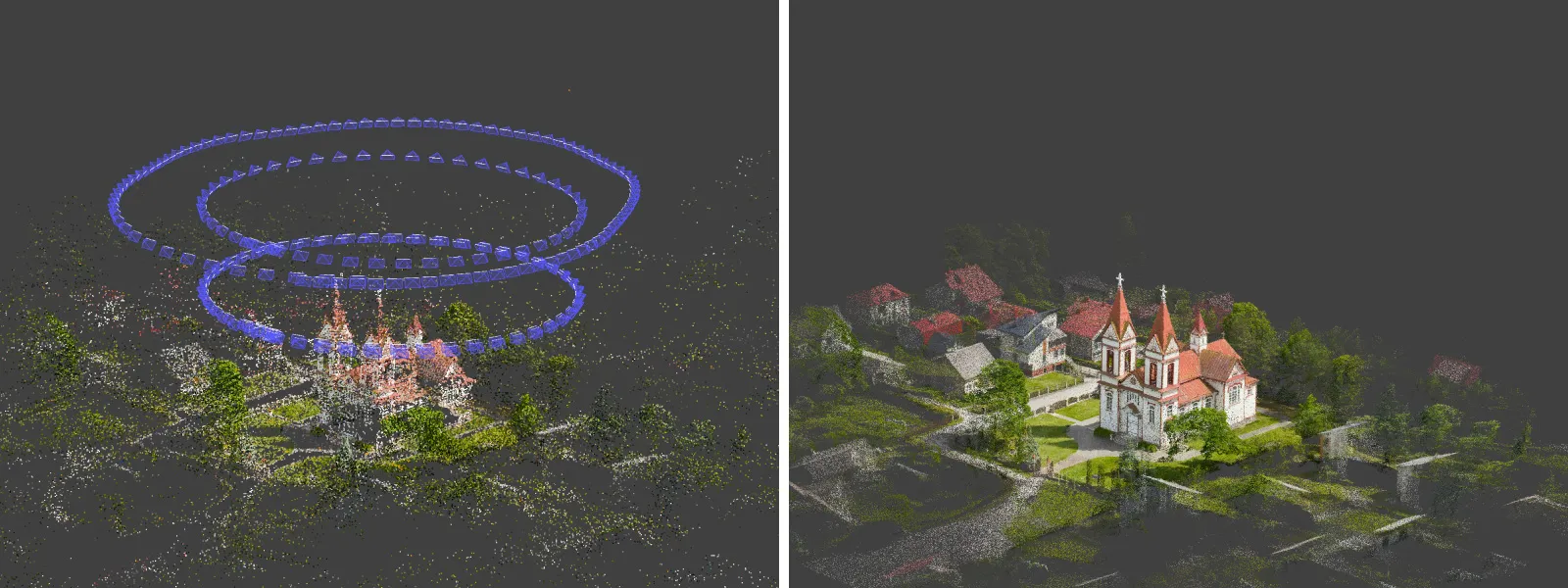
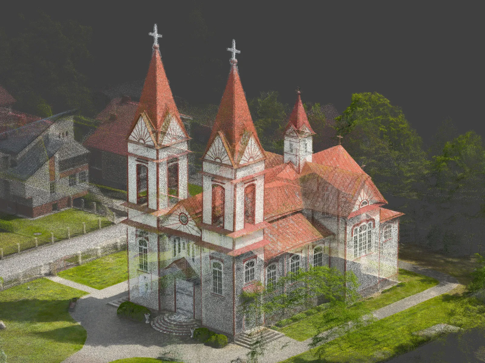
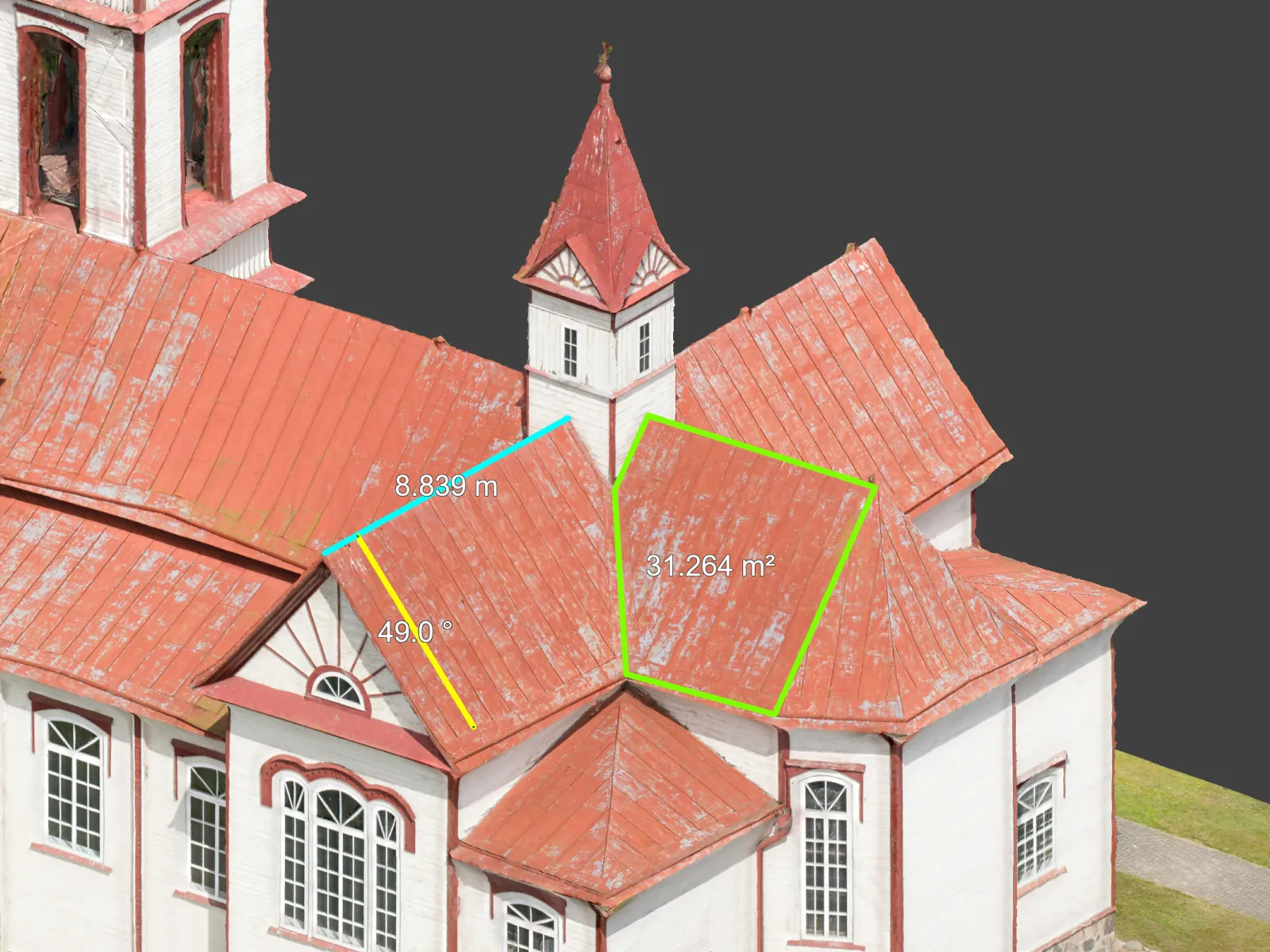
With Pixpro photogrammetry software, we always have all of our data analysis tools and measurements.
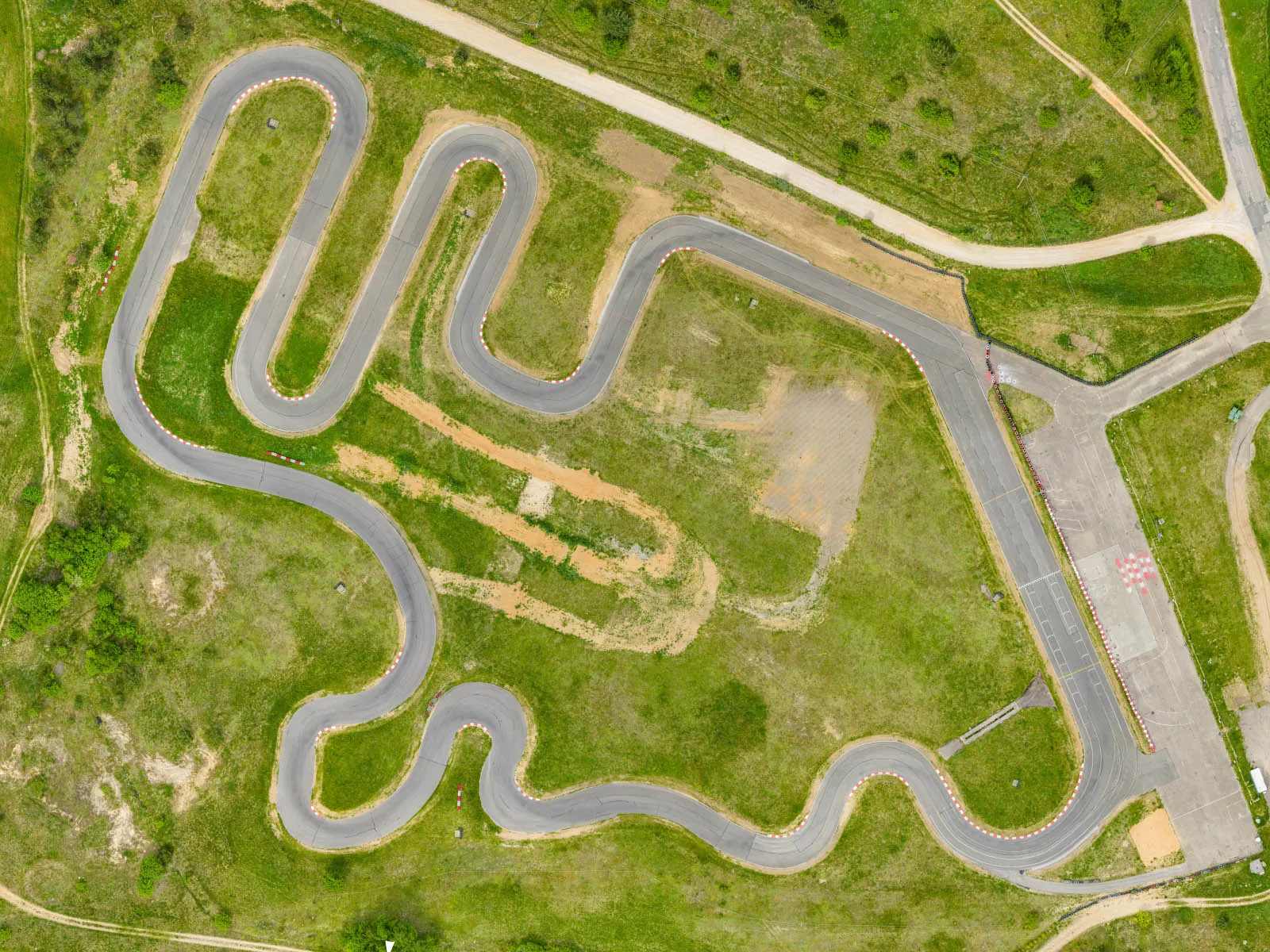
Another example is a grid scan of a racetrack—it's just a standard grid scan affair, the bread and butter of many photogrammetry cases.
 Conclusion
Overall, the Mavic 4 Pro is a good drone, and it will be my workhorse for photogrammetry from now on. With hyperlapse tracking modes, some manual flying, and Pixpro Waypoints for most tasks, there is little that we cannot do with this combination. Process those photos in Pixpro photogrammetry software, and there is the complete workflow without entering the enterprise product world. In the future, I will explore the feasibility of the 100-megapixel mode and maybe even use the 6x camera for 3D reconstruction and inspection.
Photographer - Drone Pilot - Photogrammetrist. Years of experience in gathering data for photogrammetry projects, client support and consultations, software testing, and working with development and marketing teams. Feel free to contact me via Pixpro Discord or email (l.zmejevskis@pix-pro.com) if you have any questions about our blog.
Related Blog Posts
Our Related Posts
All of our tools and technologies are designed, modified and updated keeping your needs in mind
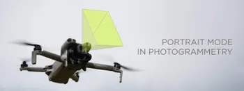
Portrait Orientation in Photogrammetry: When It Actually Helps
Is there anything to gain by scanning in portrait instead of the usual landscape? Sometimes, a little. But orientation is one of the least important decisions you make on a scan, and it is worth understanding why before you give it any more thought than that.

Better Photogrammetry Results Without Buying New Gear
Every time a new drone or camera comes out, the same thought appears: this is the upgrade that will finally fix my results. Sometimes it is even true. But in my experience, the gap between a mediocre scan and a great one is rarely the hardware.

Workstation PC 2026 – PC Build Hardware Advice
Another year, another look at the workstation PC market. The thing is, last year's advice still mostly stands, and that tells you everything about 2026. Almost nothing got faster, and almost everything got more expensive.
Ready to get started with your project?
You can choose from our three different plans or ask for a custom solution where you can process as many photos as you like!
Free 14-day trial. Cancel any time.