.svg@webp)
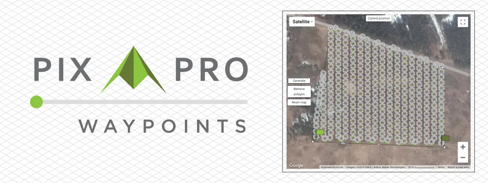
Pixpro Waypoints - Automated Photogrammetry Flights for Newest DJI Drones
 Lukas
Zmejevskis
Lukas
Zmejevskis
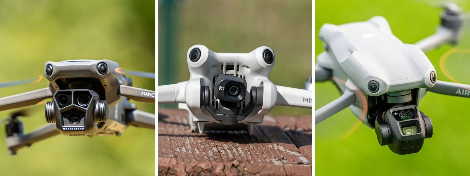
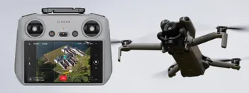
The latest DJI drones are the most capable flying cameras on the market. If you need a tool like that or a competent machine for casual creation - DJI Mavic 3, DJI Mini 4, and DJI Air 3 series drones are the best. However, due to SDK limitations, the latest generation consumer-grade drones do not have any automated flying capabilities; thus, their applicability for photogrammetry has diminished. In this article, we will describe our service, which we call Pixpro Waypoints, which is a workaround to give actual automated photogrammetry flights for drones, as mentioned earlier.
Current capabilities
Since their introduction, we have been exploring waypoint features, which came with firmware updates to the original Mavic 3. Waypoints are meant to have repeatable flights for video makers wanting to match shots, create huge repeatable time-lapses for transitions from day to night, and many other creative applications. Once you place down waypoints, the drone executes the flight autonomously. This functionality is similar to what more expensive enterprise drones offer. Still, the grid flight feature set is not on consumer drones.
Quite a while ago, we wrote this article about using waypoints for photogrammetry, and since then, we have started developing workaround solutions for those who are willing to take a few extra steps and get consistent photogrammetry flights on their drones, which are capable of making regular waypoint flights.
Our solution can generate a waypoint flight with a set height and overlap on any simple polygonal shape you draw on the map. You can also change the orientation of your flight and the angle of your camera—core features of a grid flight. For the future, we have plenty of ideas for adding intelligent oblique flights, orbitals, and other flight types that would cover most use cases.
 Workflow
General workflow has a few critical steps in this order:
Step 1. Create any waypoint flight in the DJI fly app with your drone and save it.
Step 2. Plan a flight using our Pixpro waypoints service.
Step 3. Replace the flight file you created in the app with the one from our service.
Step 4. Execute the flight.
These are pretty straightforward, but let us go deeper on how to do each step.
Creating and Saving A Waypoint Flight
To create a waypoint file on your device, you must have at least one saved waypoint flight in the DJI Fly app. Open the app, tap on waypoints on the left side, and enter a map view. Tap to make a few waypoints and save the flight. You can do this at home with the drone turned on and connected. The workflow is identical to all devices running the DJI Fly app. Below is a short screen capture video of us doing just that.
Planning Pixpro Waypoints
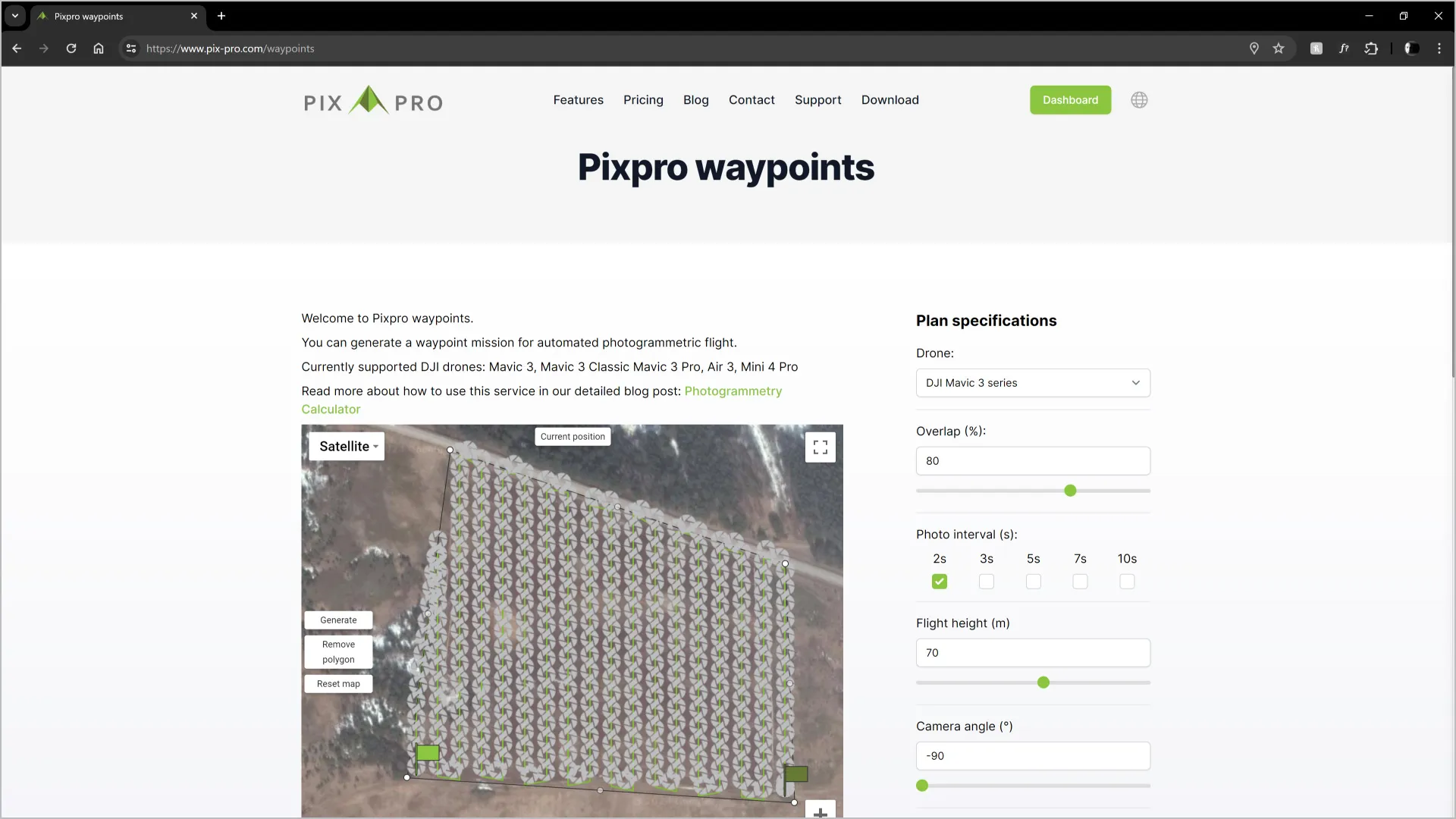
To use the Waypoints service, you need to log into the Pixpro website and have an active license or a free trial. Go to your dashboard on the website and click Waypoints on the left. This will take you to the https://www.pix-pro.com/waypoints URL, and if all conditions are met, the service will be available for you.
To plan a flight, select your drone and your desired flight parameters. Draw a polygon area on the map and click generate. You can adjust flight parameters in real-time and see the changes on the map. You also get the basic statistics of your flight. Once you are satisfied with the choices - click download, and a KMZ file will be presented for download.
TIP: Remember which photo interval you choose — you must set that later in the field. Write it down somewhere, or take a screenshot of the setting.
Replacing the File
This is the most complicated part of the process and the part where it becomes clear that this is a workaround rather than an official workflow. The method also differs depending on your device running the DJI Fly app.
Android devices - connect your Android device to a computer in file transfer mode using a USB cable. Go to your devices Internal shared storage\Android\data\dji.go.v5\files\waypoint directory. Here, you will find an oddly named folder for each waypoint plan you have saved. Go inside that folder, copy the file you downloaded from us, and replace the existing KMZ file with ours by giving it the old name. That is it for the workflow; below is a short screen capture of how it is done.
But Android devices have a caveat. You cannot plan, download, and replace the KMZ flight plan file entirely with your mobile device unless you have a rooted system. So your only option is to use another device for plan file replacement, such as a PC, Laptop, or even another phone or tablet connected via a USB cable.
Apple Devices
Apple devices do not have access issues, so you can do everything on your device or work via Mac or PC. The directory will be a little different: On My iPhone/Files/DJI Fly/Wayline missions/ or something very similar. Replace the oddly named KMZ file with ours in one of the directories, and your plan is ready to use.
Remote Controllers
If you have the new remote controller with a screen - DJI RC2, the workflow is identical to an Android device. Connect the RC with a USB cable and it will automatically connect in file transfer mode. Then you can find and replace the waypoints file in the same directory as with Android phones or tablets.
If you have the older DJI RC which comes with any of the Mavics - you need to put your file on a SD card and insert into the controller. Copy the file from there using the interface of the RC controller and rename it. The directory will be the same as with other Android devices.
Executing the Flight
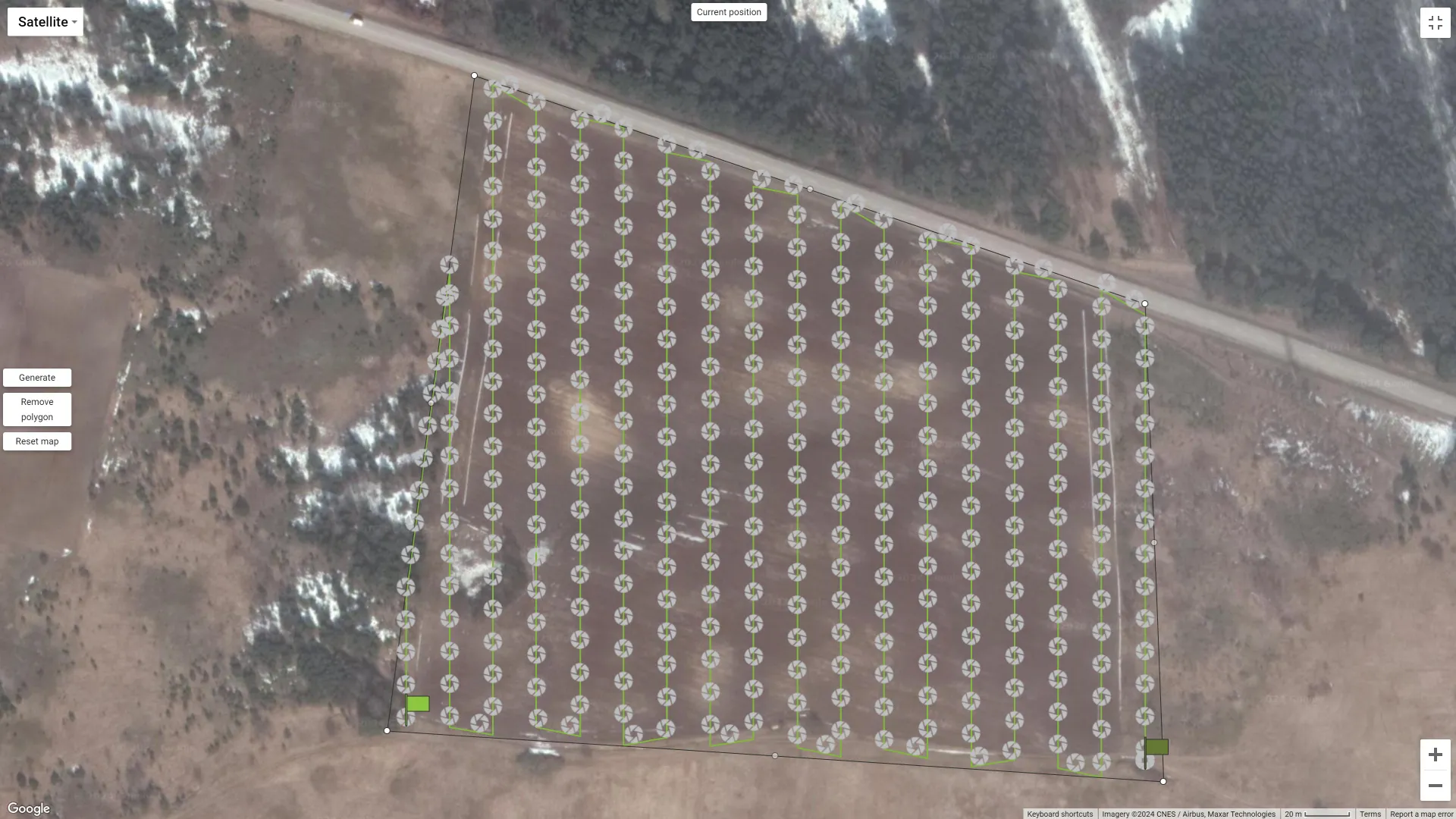
Go to your destination, select the waypoint flight you replaced with one from Pixpro Waypoints, and inspect it. The flight path should be a perfect grid covering your designated area.
Before executing the flight, go back and check your camera settings. We recommend fully manual exposure or shutter priority mode at decent speeds such as 1/500th of a second, wide open aperture if applicable, and JPEG or RAW photos according to your preference. We have discussed aerial capture settings in numerous blog posts before.
You will need to shoot photos in timed shot mode and choose the interval you selected while planning the flight using the Pixpro Waypoints service. Choose a safe spot to start and execute the flight. After the flight, the drone will hover, and you can fly home at your leisure. Below is an entire screen capture from the DJI Fly app, from start to finish.
Example
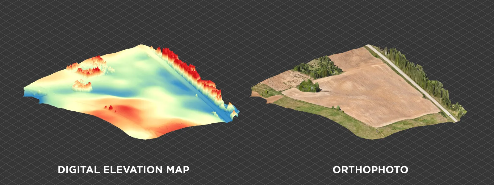
This is the example you saw above, a field scan for agricultural inspection purposes. This kind of use case requires nadir grid capture of a decently sized area. While manual capture is possible, fully automated flights are just more convenient for such a subject.
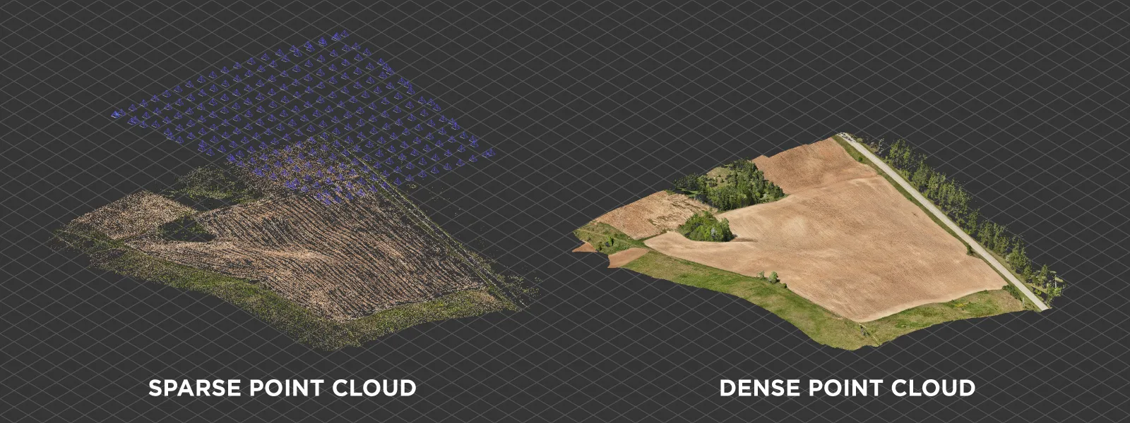
This is an actual use case where we evaluate the number of stones and boulders in an arable field. For that, we require a good-quality orthophoto image. Usually, we would recommend and require an enterprise-grade drone, specifically the DJI Mavic 3E, but in this case, our consumer-grade Mavic 3 Pro sufficed and provided results identical to those of the more expensive drone, albeit without RTK data, which was unnecessary for this particular case.
Conclusion
Pixpro waypoints bring professional photogrammetry grid flights for DJI Mavic 3, Mini 4, and Air 3 drones, ensuring set overlap and consistency. Once you get used to it, it is easy to use, and the results do not differ in any meaningful way from those of more expensive enterprise drones. We will expand and update Pixpro Waypoints and make an instructional video in the future.
Photographer - Drone Pilot - Photogrammetrist. Years of experience in gathering data for photogrammetry projects, client support and consultations, software testing, and working with development and marketing teams. Feel free to contact me via Pixpro Discord or email (l.zmejevskis@pix-pro.com) if you have any questions about our blog.
Related Blog Posts
Our Related Posts
All of our tools and technologies are designed, modified and updated keeping your needs in mind
DJI Mini 5 Pro: Timed Shot During POI Tracking for Orbital Photogrammetry
Being able to run timed shot during POI tracking is a genuinely handy way to make quick orbital scans. Let me explain.
How to Make a Clean Roof Orthophoto for Solar Installations
Most roof scans are for a 3D model or a quick inspection. Every so often an engineer or a solar designer asks for something more specific: a true orthophoto of the roof, a straight top-down image they can measure and pull into their CAD workflow.
Portrait Orientation in Photogrammetry: When It Actually Helps
Is there anything to gain by scanning in portrait instead of the usual landscape? Sometimes, a little. But orientation is one of the least important decisions you make on a scan, and it is worth understanding why before you give it any more thought than that.
Ready to get started with your project?
You can choose from our three different plans or ask for a custom solution where you can process as many photos as you like!
Free 14-day trial. Cancel any time.