Pixpro Waypoints – Frequently Asked Questions Part 2
 Lukas
Zmejevskis
Pixpro Waypoints service is a workaround solution providing automated photogrammetry flights for the latest DJI drones. The service came about when DJI officially discontinued SDK support — and therefore third-party app development — for consumer-grade drones. However, the built-in Waypoint feature, which all recent drones now support, essentially offers the same technical functionality.
We took advantage of that and created a workaround that allows users to replace basic waypoint flights with ones optimized for photogrammetric 3D scanning. The service has already been used by hundreds of our clients, and this time I have compiled the most frequently asked questions based on direct support experience.
1. I have a distorted path in the preview of the flight plan. What does it mean?
I already addressed this in the first part of the Waypoints FAQ, which was based on testing and initial impressions. Still, it remains the most asked question — and understandably so.
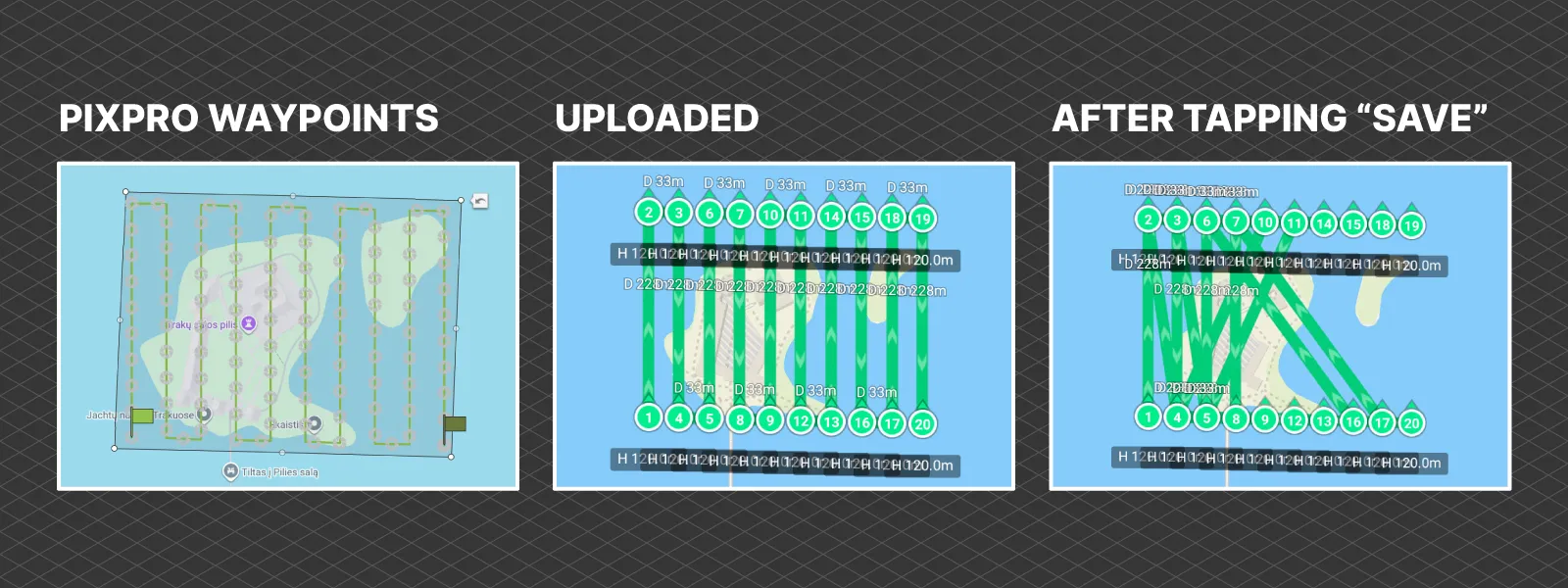
The scrambled path appears when a flight from the Pixpro Waypoints service is opened in the DJI Fly app, inside the waypoint interface, and then closed again. It is especially common if the “Save” button is tapped when exiting the waypoint flight.
The answer is that this is just a visual bug that does not impact your flight. The drone will fly between the waypoints exactly as you see them on the map, in the correct numbered sequence and orientation. If you see strange black preview paths — ignore them. During the actual flight, you will quickly realize that those preview lines do not reflect what the drone will do.
 2. How can I save waypoint flights?
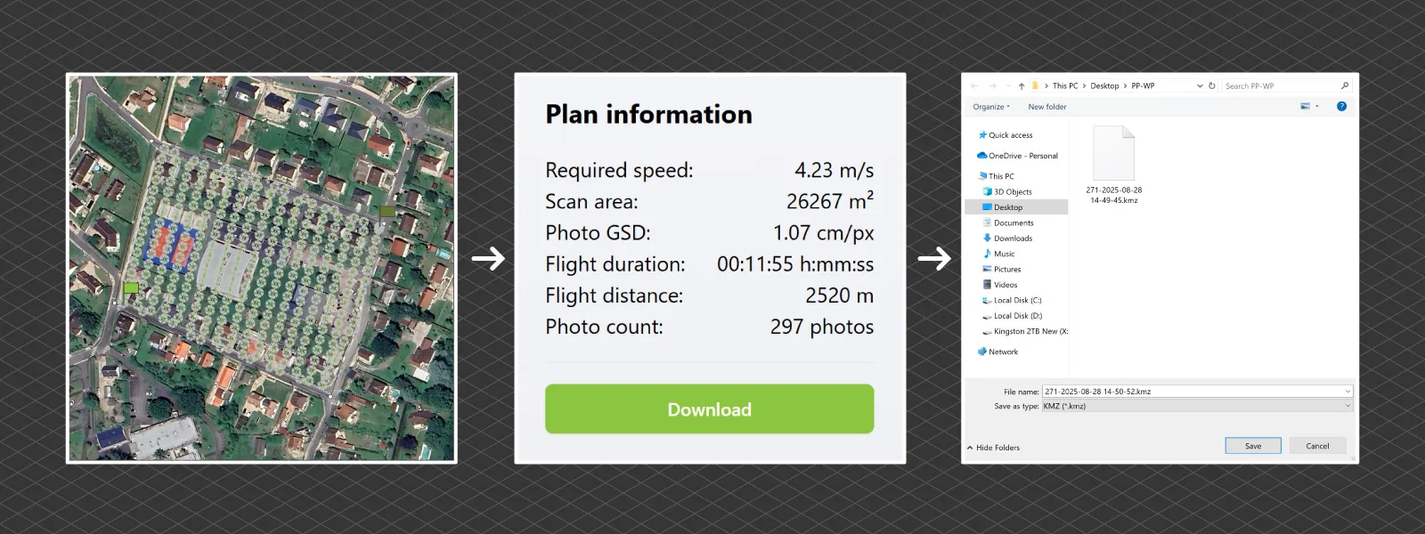
Currently, the only way to save waypoint flights is to store the .kmz files on your mobile device, RC controller, or computer.
However, saving and editing features before downloading the waypoint plan is at the top of our upcoming feature list, and we are actively working on it.
 3. Can I shoot RAW with waypoints?
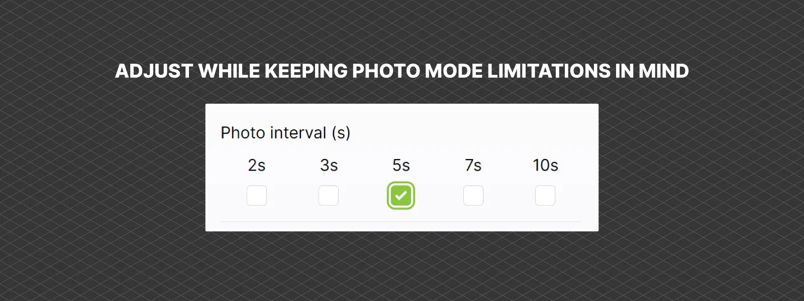
Yes. You can use any and all camera settings that are compatible with interval shooting.
That said, you may run into limitations when using high-resolution modes. For example, the 100-megapixel mode on the Mavic 4 Pro imposes a significant 10-second capture interval. In contrast, all regular photo modes on supported drones allow shooting with up to a 2-second interval.
So yes — RAW works, but be mindful of your resolution and interval settings.
 4. Can I edit the waypoint flights?
The only way to edit a waypoint flight is through the DJI Fly app’s Waypoint interface. Here you can adjust everything as usual, and even apply changes to all waypoints in one action.
However, the real question is: why would you edit the plan?
Manual editing makes sense only in very specific cases — such as adjusting the altitude of an orbit or changing the gimbal angle slightly. I highly recommend refraining from arbitrarily editing plan specifications. The point of Pixpro Waypoints is to control overlap and camera positioning in a logical flight path based on properly configured variables. Changing them without knowing the consequences undermines that.
Orbital plans are the exception — tweaking those is usually safe.
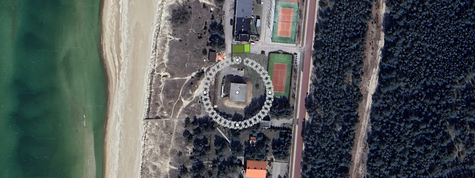 5. Can I view waypoint flights on a computer?
No. Although the waypoint file uses the common .kmz format, its contents are coded specifically for DJI software and firmware.
At the moment, no desktop software can preview or display the DJI waypoint flight structure. It is a closed ecosystem.
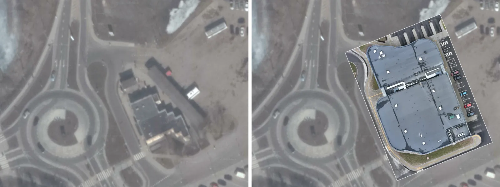
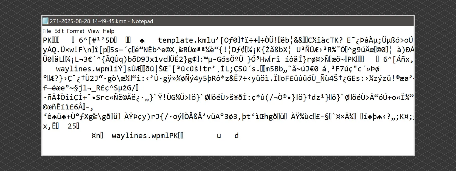 6. Can I upload data into the Pixpro Waypoints service?
No, not yet. Uploading your own data or imagery is not currently supported.
However, we are considering adding the ability to upload your area map — especially in cases where Google Maps or orthophoto imagery is outdated or missing. This would allow for better positioning of the scan area in future service versions.
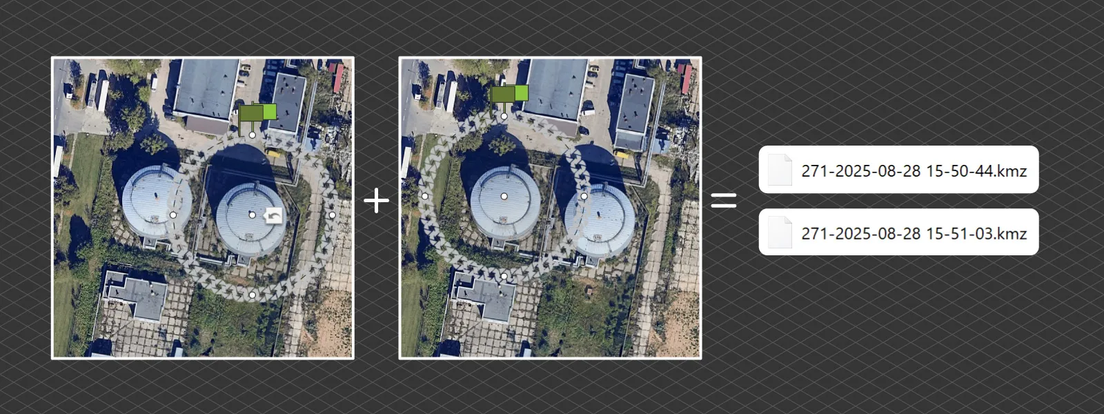
 7. Can I combine multiple flights into a single waypoint file?
No. Each .kmz file represents a single waypoint flight. To run multiple flights, simply run all the waypoint plans one after another in the field. Then, combine the resulting photos in your photogrammetry software like any standard dataset.
Combining several flights into a single .kmz would overcomplicate the structure. DJI also imposes a 101-waypoint limit, which further restricts the number of paths that can be embedded in one file. For this reason, the multi-grid flight is automatically split into four separate parts.
 8. Which drone and remote combo is the best to use with Pixpro Waypoints?
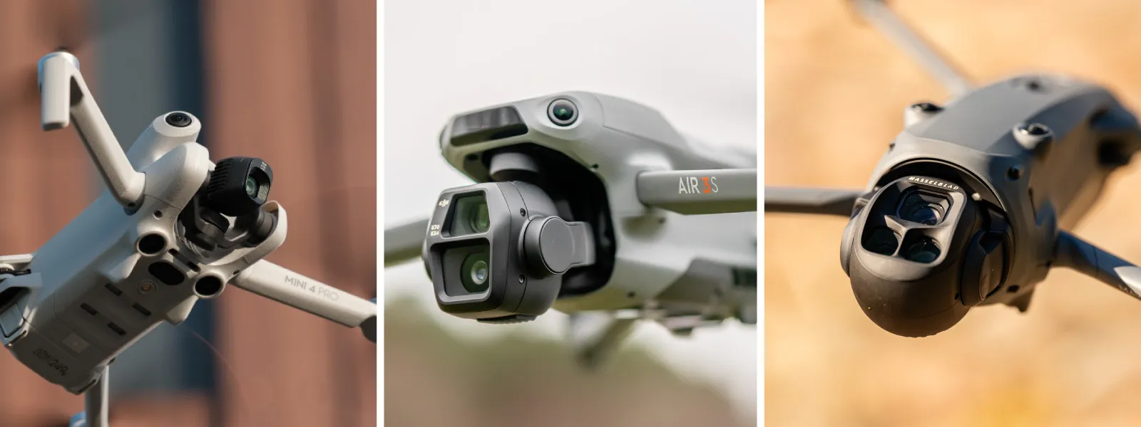
These are the top three supported combos, all of which work best with the DJI RC2 remote (with screen):
-
DJI Mini 4 Pro – best option when you need a sub-250g drone
-
DJI Air 3S – C1 class drone, ideal middle-ground option
-
DJI Mavic 4 Pro – C2 class, high-end flagship with top image quality
They also go up in size and price in that order. All are fully compatible with Pixpro Waypoints.
 9. Which camera angle should I use in the multi-grid flight plan?
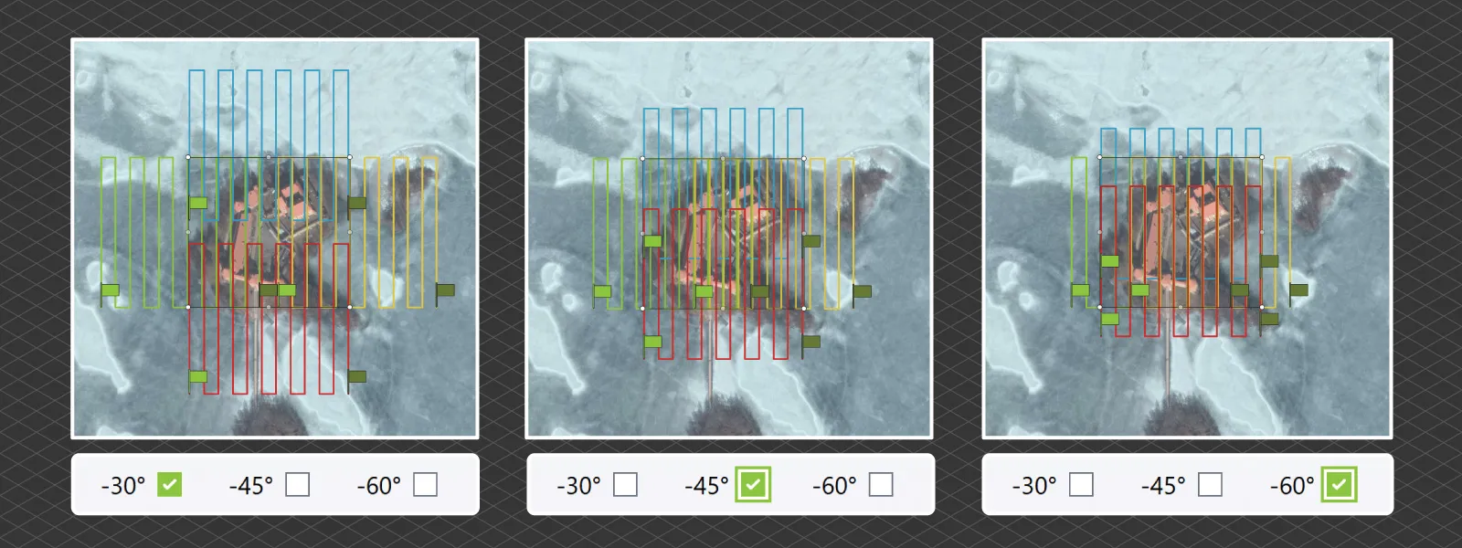
The default is -45 degrees, which offers a balanced capture: decent wall detail in urban areas, while keeping flight time and area coverage reasonable.
If you want more detailed oblique data, select -30 degrees, but this comes at the cost of slightly longer flight time. If you want a more compact and efficient flight — or are limited in how far you can fly — the -60 degree option saves time and keeps the drone closer to the mapped area, but this comes at the cost of some oblique surface detail.
You should choose the angle based on the wall coverage you need and the distance the drone is allowed to travel.
 10. What can I do if I see curved lines?
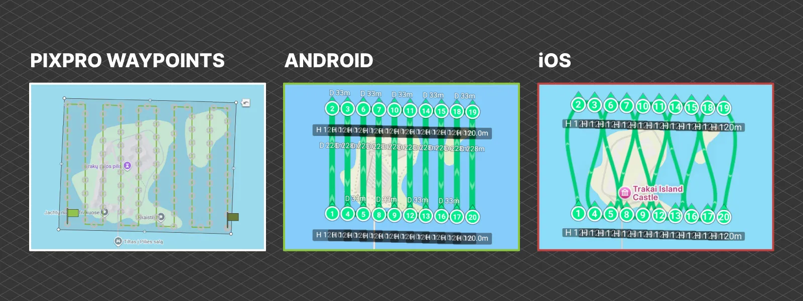
This is normal if you are using an iOS device.
Due to unexplained differences in the DJI Fly app, the waypoint service does not behave identically across all devices. Curved waypoint paths and other glitches are common on iPhones and some rare Android variants. We strongly recommend using a DJI RC2 remote controller with a built-in screen.
The dedicated DJI remotes with built-in displays have proven to be the most reliable platform for using Pixpro Waypoints with full functionality.
 Conclusion
Pixpro Waypoints has become a no-brainer choice for photogrammetry enthusiasts and professionals. If you do not require RTK-level precision or already have access to a GPS rover for GCP collection, there is little reason to invest in DJI’s much more expensive enterprise drone lineup for basic 3D scanning.
The Pixpro Waypoints service is available to all Pixpro subscribers at no additional cost. When paired with manual scanning techniques and our Pixpro photogrammetry software, you have a complete end-to-end solution — all in one place.

Photographer - Drone Pilot - Photogrammetrist. Years of experience in gathering data for photogrammetry projects, client support and consultations, software testing, and working with development and marketing teams. Feel free to contact me via Pixpro Discord or email (l.zmejevskis@pix-pro.com) if you have any questions about our blog.
Related Blog Posts
Our Related Posts
All of our tools and technologies are designed, modified and updated keeping your needs in mind
DJI Mini 5 Pro For Photogrammetry – Aerial Scanning With Pixpro Waypoints
DJI Mini 5 Pro is a 250-gram flying camera equipped with a 1-inch type sensor. Nine years ago, the Phantom 4 Pro was released as the first consumer drone to feature the same sensor format.
DJI Mavic 4 Pro Photogrammetry – Pixpro Waypoints
DJI Mavic 4 Pro is the flagship foldable consumer drone from DJI. It will become a workhorse for many creators in the next few years, including some of us in photogrammetry.

Video Frames vs. Photos for Photogrammetry
Photogrammetry uses raster data to calculate a 3D scene. Raster is just another word for images made out of pixels. So, taking photos is the fundamental first step of creating a scan.
Ready to get started with your project?
You can choose from our three different plans or ask for a custom solution where you can process as many photos as you like!
Free 14-day trial. Cancel any time.
.svg@webp)