.svg@webp)
Why use Photogrammetry for Surveying and Mapping?
Photogrammetry used to be a process involving the generation of precise measurements from photographs. However, in recent times, photogrammetry has evolved into a multipurpose technique that has been readily integrated into an array of modern applications.
Photogrammetry incorporates remote sensing and accelerated photography to create accurate measurements that are capable of processing 2-dimensional photographs into 3-dimensional models. This unique ability of photogrammetry has produced an intense level of interest from a large collective of businesses, programs, and individuals.
Concurrently, with the rapid rise in popularity of drones, photogrammetry has enjoyed a similar rise in consumer interest, with many buyers attracted by the advantages presented by the accessible photogrammetry use via increasingly affordable unmanned aerial vehicles. Let’s talk about the benefits of photogrammetry in surveying more.
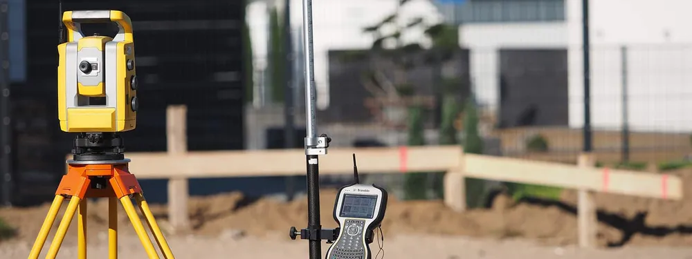
Drones for surveying purposes – the new norm
The ongoing evolution of drone technology has transformed the photogrammetry industry by rendering it accessible for a wide variety of individuals and interests. Once relegated for use by highly trained professionals, photogrammetry is now a user-friendly process. With drones becoming more and more affordable, consumers are able to use them as a vehicle for their photogrammetry projects.
Photogrammetry – a matter of taking simple photos
Photogrammetry only requires users to have a camera along with a compatible photogrammetric software.
Pixpro is a cutting-edge photogrammetric software targeted at solving various challenges of surveying and facilitating multiple on-site and off-site work stages. It offers innovative methods and provides the most efficient, sustainable and cost- effective surveying solutions.
If you have at least 3 photos taken from a different angle, you can already reconstruct the 3D model of the object with photogrammetric software (provided camera positions are correct). However, the more pictures, the more likely the 3D model will be realistic. Photographic data is uploaded into Pixpro software to generate the 3D model. Using the software, one can go from having a bunch of pictures to dense point clouds, meshes and digital elevation maps.
The 3D modeling process with Pixpro consists of 4 main steps that generate:
- Sparse point cloud;
- Dense point cloud;
- 3D mesh;
- DEM.
With the processing complete, all the necessary analysis and calculations can be performed.
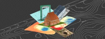
Photogrammetry – easy data gathering for 3D scanning
Photogrammetry has experienced a significant evolution since its inception. Today it is a multi-functional process that is ideal for any application requiring high-resolution imagery.
As we are specializing on the scene reconstruction for the surveying industry, it is enough to have at least 12 MP camera, use 90-degree camera angle (downwards) and single grid track. In this way, you will save time and won’t harm the quality of the object reconstruction in a 3D mode.
Photogrammetry is an accurate and economical solution. The drone market has a vast array of entry-level budget models that easily incorporate photogrammetry processes and provide high-resolution images for all manner of interests.
Photogrammetry – cheap surveying method in general
Photogrammetry is incredibly affordable. Conversely, a high-quality drone can be had for under along €800 with a good camera costing €400 and below. Pixpro lets you create realistic highly detailed 3D models.
Aerial photogrammetry available for everyone
Historically, photogrammetry was very unattainable due to its formerly common use on airplanes equipped with costly aerial cameras. In today’s modern times, professionals and small businesses are able to employ photogrammetry via drones and photogrammetric software solutions. The end result is easy to operate and affordable means to achieve the kind of precision surveying and mapping imagery that the only photogrammetry can provide.
Surveying solution for tomorrow
Photogrammetry has existed for decades but has only become readily accessible to regular citizens. In contemporary times, the robust availability of photogrammetry has been heavily reliant upon the evolving drone market, featuring an array of professional and entry-level models that easily incorporate high-powered cameras for photogrammetry projects.
Completely versatile, and the optimal choice of those seeking a means to achieve surveying and mapping data, photogrammetric software is an integral part of daily lives of surveying industry.
Related Blog Posts
Our Related Posts
All of our tools and technologies are designed, modified and updated keeping your needs in mind
DJI Mavic 4 Pro Photogrammetry – Pixpro Waypoints
DJI Mavic 4 Pro is the flagship foldable consumer drone from DJI. It will become a workhorse for many creators in the next few years, including some of us in photogrammetry.

Video Frames vs. Photos for Photogrammetry
Photogrammetry uses raster data to calculate a 3D scene. Raster is just another word for images made out of pixels. So, taking photos is the fundamental first step of creating a scan.
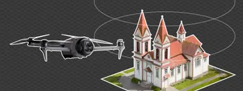
Where do we use Photogrammetry? A list of 3D scanning use cases.
Photogrammetry has revolutionized numerous industries by transforming real world scenes into 3D models, using only simple photographs and processing algorithms.
Ready to get started with your project?
You can choose from our three different plans or ask for a custom solution where you can process as many photos as you like!
Free 14-day trial. Cancel any time.