.svg@webp)
How Much Area Can You Scan on a Single Drone Battery?
 Lukas
Zmejevskis
Lukas
Zmejevskis
The Short Version
If you only have a minute:
-
A single battery does not cover a fixed area. Altitude and overlap set the ceiling, the drone's usable flight speed decides how close you get to it, and a stack of smaller factors trims the rest.
-
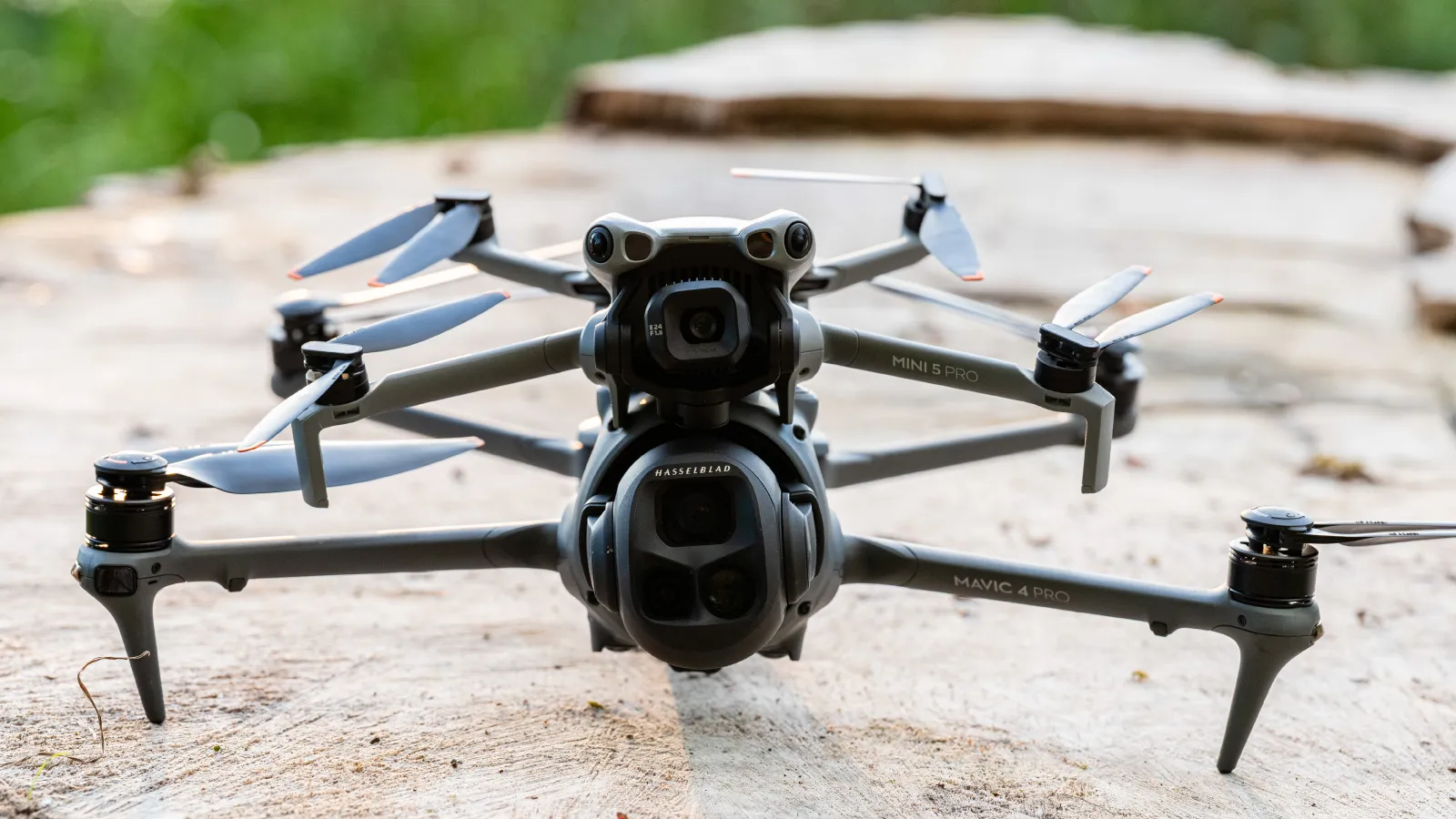
To put numbers on it, I flew a standard nadir grid to empty with two drones, a Mavic 4 Pro and a Mini 5 Pro, both at 120 meters and 80 percent overlap through Pixpro Waypoints.
-
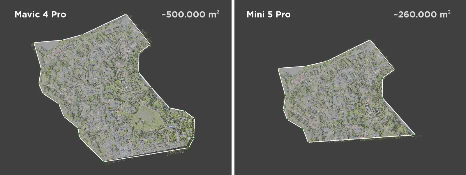
On one charge the Mavic covered about 500,000 square meters (50 hectares, roughly 124 acres) and the Mini about 260,000 (26 hectares, roughly 64 acres).
-
The gap is mostly speed. The Mini could not hold the grid's 12 meters per second (about 27 mph), so it flew at 8.6 (about 19 mph) with a longer photo interval and covered less ground per minute.
-
Everything else, starting charge, battery health, wind, cold, the return-to-home reserve, and even your memory card, is a modifier on top.
"How much ground can I cover on one battery?" is one of the more practical questions we get, usually from someone quoting a job or deciding how many batteries to pack. The honest answer is that it depends, which is true but useless on its own, so I went and flew it. This article is about setting expectations for the scale of scan a single battery realistically gets you. It is not a contest between two drones, they are just two reference points that bracket the gear most people are flying.
How I Flew It
I kept both flights identical so the numbers mean something. Both were a standard single nadir grid at 120 meters (about 394 feet) altitude with 80 percent overlap, planned and flown through Pixpro Waypoints. I shot JPEG with the ISO locked and the rest of the camera settings on auto, then processed each set quickly in Pixpro on the fast settings, just to confirm the coverage reconstructed into a clean grid.
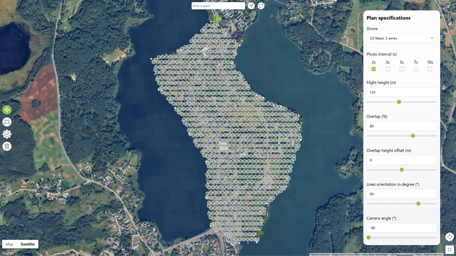 Both batteries were relatively fresh, under 20 cycles each, so the numbers reflect healthy cells rather than tired ones. The Mini 5 Pro battery I charged to a true 100 percent. The Mavic 4 battery would only sit at about 90 percent despite reading full, for the reason in the charge note below, so its already-large result is if anything a slight underestimate of a true full charge. I flew each drone until it decided it was time to come home, and measured the ground the resulting scan covered.
What One Battery Covered
At 120 meters and 80 percent overlap, here is what a single charge got me:
| Drone | Altitude | Overlap | Ground speed | Photo interval | Area on one battery |
|---|---|---|---|---|---|
| DJI Mavic 4 Pro | 120 m 394 ft |
80/80 | 12 m/s 43 km/h 27 mph |
2 s | ~500,000 sq m 50 ha 124 acres |
| DJI Mini 5 Pro | 120 m 394 ft |
80/80 | 8.6 m/s 31 km/h 19 mph |
3 s | ~260,000 sq m 26 ha 64 acres |
A note on the batteries behind those figures: the Mavic ran from about 90 percent down to 15, and the Mini from a true 100 percent down to 18. So the Mavic covered nearly twice the ground while actually using a little less of its battery. That points straight at the real difference, and it is not the one people expect.
Why the Mini Covered Half: Flight Speed
The two drones flew identical settings, yet the Mavic covered close to double the area. That is not mainly the battery, and it is not the sensor. It is speed.
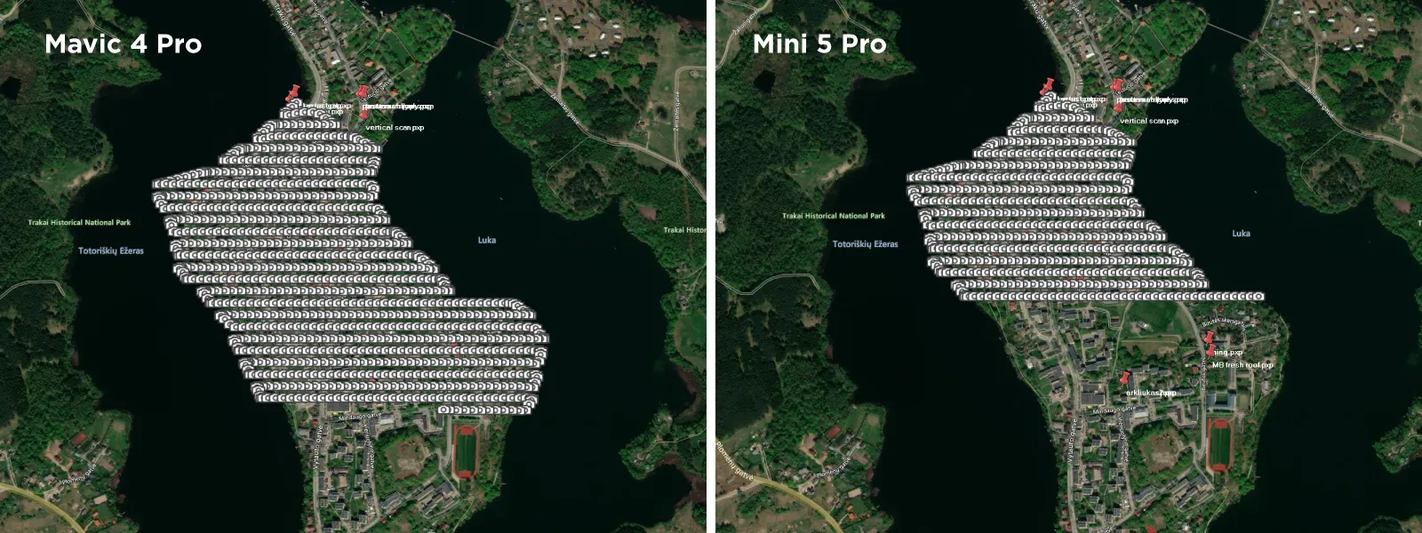 At 120 meters and 80 percent overlap, the grid wants a certain ground speed to keep the photos spaced correctly, around 12 meters per second (27 mph) here. The Mavic 4 Pro held that comfortably with a 2 second photo interval. The Mini 5 Pro could not sustain 12 meters per second on this mission, so Pixpro Waypoints flew it at 8.6 meters per second (19 mph) with a 3 second interval instead. Slower speed and a longer interval mean less ground covered per minute of battery, and that is most of the difference between 50 hectares and 26.
The lesson is that a more capable drone covers more area at the same settings, simply because it can actually fly the grid faster. When you are estimating coverage, the drone's real cruising speed at your altitude matters as much as its flight time.
 One more thing to keep in mind when you push flight speed: your shutter speed has to keep up. Fast flight with a slow shutter gives you motion blur, which ruins the photos for photogrammetry. My flights were on a bright day, so the auto exposure held a fast shutter and it was a non-issue. In dimmer light, though, you can reach a point where you cannot fly any faster without blurring the photos, and the light, not the drone, becomes the limit on your speed and your coverage.
Altitude and Overlap Set the Ceiling
Before anyone quotes these numbers, remember they are a "120 meters, 80 percent" result, and those two settings decide the ceiling that speed then chases.
 Altitude is the big lever. Higher up, each grid line covers more width and the drone can fly faster, so area per battery climbs steeply. Come down for a finer ground sampling distance and you cover dramatically less, since you are lower, slower, and spaced tighter. Overlap is the other lever: 80 percent is the sensible default, but looser overlap stretches the area and tighter overlap shrinks it. So treat the table above as a starting point for these settings and scale it to whatever your job actually needs. There is more on the overlap side in the post on overlap between perspectives.
What Else Moves the Number
Once altitude, overlap, and speed are set, a stack of smaller factors decides how much of that potential you keep.
Starting charge. DJI batteries self-discharge over time to protect the cells, so a "full" reading is not a true 100 percent. My Mavic 4 battery lit all four indicator lights but was actually at 90 percent, a tenth of the flight gone before takeoff. The catch is that the charger will not top up a battery that high, so you have to fly it down a little and then recharge to a real 100, which is what I did with the Mini. If you are chasing maximum area, check the actual percentage, not the lights.
Battery health. Cells age and lose capacity with cycles, so an old, well-used battery covers less than a fresh one. Both of mine were near-new here, so read the figures as what healthy batteries do.
Memory card. On a long timed-shot mission you write hundreds of photos in one flight, and I ran into issues where a slower microSD card could not keep up with the sustained capture. A fast, good-quality card is worth it for these longer scans, or you risk dropped or delayed shots.
Weather. Wind is the big drain, since fighting it and correcting for gusts burns power the whole flight. Cold reduces usable capacity and causes voltage sag, and thinner air at high-elevation sites makes the drone work harder just to stay up.
The reserve and the transit. You do not fly to zero. The drone keeps a return-to-home buffer, and reaching the far edge of a big grid and coming back eats into the time that actually covers new ground, along with the climb and the landing.
Propellers and weight. Nicked or worn props lose efficiency, low-noise props trade a little away, and anything you bolt on adds drag.
Conclusion
A single battery is not a fixed amount of coverage, it is whatever your altitude, overlap, speed, and conditions add up to on the day. At 120 meters and 80 percent overlap, even the little Mini covered 26 hectares (64 acres) on one charge, and the Mavic hit 50 (124 acres), which is enough for most residential and small commercial sites in a single flight. Fly higher and you cover far more. Come down for detail and you cover less. And as the near-double gap between the two drones showed, a faster aircraft covers more at the same settings simply because it flies the grid quicker.
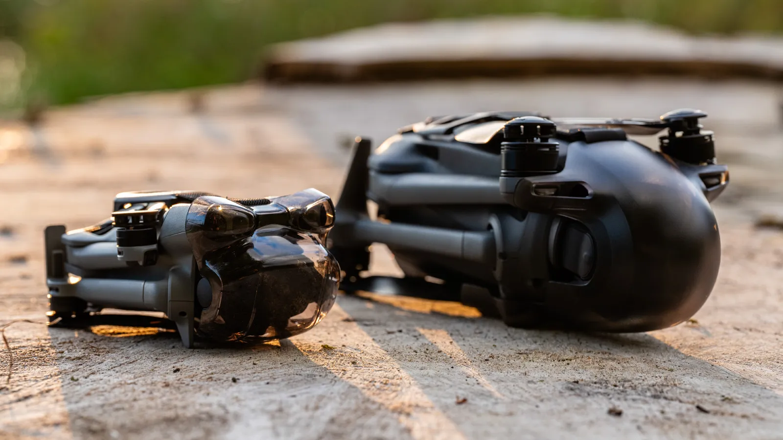 The practical takeaway is to know roughly what your own setup gets you at your working altitude, then pack batteries accordingly, with margin for wind and the reserve. For anything larger than a battery or two can handle, plan a multi-battery mission and stop guessing. The number is knowable, it just is not printed on the box.
Frequently Asked Questions
How much area can a drone cover on one battery?
There is no fixed figure, because it depends mostly on your altitude, overlap, and the drone's flight speed. In my test at 120 meters and 80 percent overlap, a Mavic 4 Pro covered about 50 hectares and a Mini 5 Pro about 26 hectares on a single charge, a reasonable ballpark for consumer drones at that height.
Why did the Mini cover so much less than the Mavic at the same settings?
Flight speed. The grid needed about 12 meters per second, which the Mavic held, but the Mini could only manage 8.6 meters per second, so it covered less ground per minute of battery. It was not the battery capacity or the sensor.
Does flying higher let me cover more ground per battery?
Yes, and by a lot. Higher altitude means wider grid lines and a faster flight, so area per battery rises steeply. The trade is a coarser ground sampling distance, so you fly as high as your required detail allows.
How many batteries do I need for a large site?
Work out roughly what one battery covers at your planned altitude and overlap, then divide the site area by that and add margin for wind and the reserve. For large jobs, plan a multi-battery mission rather than improvising in the field.
Photographer - Drone Pilot - Photogrammetrist. Years of experience in gathering data for photogrammetry projects, client support and consultations, software testing, and working with development and marketing teams. Feel free to contact me via Pixpro Discord or email (l.zmejevskis@pix-pro.com) if you have any questions about our blog.
Related Blog Posts
Our Related Posts
All of our tools and technologies are designed, modified and updated keeping your needs in mind
Stockpile Volume Measurement With Drone Photogrammetry: A Practical Guide
Measuring a stockpile sounds trivial until you actually have to do it on a real site. You need a number you can defend at the end of the month, and you would rather get it without sending somebody to climb up a 10 meter mountain of gravel with a GPS pole.
 Pixpro Team
DJI Lito X1 for Photogrammetry
Can the Lito X1 be used for photogrammetry? Yes it can. Can it produce good results? Yes it can. How to do it? Yes it… well, that is what the rest of this article is for.
Pixpro Team
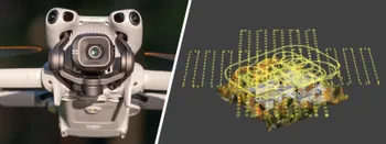
DJI Mini 5 Pro For Photogrammetry – Aerial Scanning With Pixpro Waypoints
DJI Mini 5 Pro is a 250-gram flying camera equipped with a 1-inch type sensor. Nine years ago, the Phantom 4 Pro was released as the first consumer drone to feature the same sensor format.
Pixpro Team
Ready to get started with your project?
You can choose from our three different plans or ask for a custom solution where you can process as many photos as you like!
Free 14-day trial. Cancel any time.