Most Asked Photogrammetry Questions Part 3 - Getting Deeper
 Lukas
Zmejevskis

We are continuing our FAQ series of articles with the third installment. This time, we are providing 10 answers to questions our clients often ask. Some of these questions can be specific, delving deeper into image capture or Pixpro software use. We hope our answer will provide helpful information for everyone who has stumbled upon this article.
1. Can we use thermal images for photogrammetry?
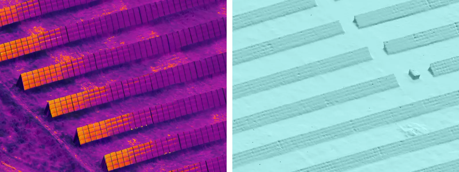
The short answer is yes. The long answer is that it is hard to do so because of low thermal camera resolution and the changing colors of a thermal palette. Extra care has to be taken when controlling overlap, and usually, you need to get close to the thermal camera so that the details of your subject appear larger and, therefore, visible with a lower resolution. Slower flights are necessary due to the inability to control thermal camera exposure and palette calibration. The final result may not make sense without making the colors of temperature representation consistent, and a uniform thermal scale will not work.
 2. Can I improve the 3D model with more aggressive settings without changing the photos?
The overall answer is no. The reconstruction quality directly correlates with the input data only - your photos. If your photos are already excellent overall, choosing more aggressive settings for photogrammetric processing, such as high-density point clouds, may give you more nuanced detail. For example, a stone wall texture may be better reflected with higher density. Still, the general quality of the 3D scene will remain the same. Scale, representation accuracy, and texture quality (not resolution) are mostly affected only by the input data.
3. When there are too many photos in a project?
There is no such thing technically as too many photos. However, we noticed that this statement may have been misinterpreted by many. This statement only applies when other photogrammetry fundamentals are considered (overlap, coverage, image quality, etc.). Making too many random and directionless photos is a real issue. If you randomly take thousands of photos, this will not mean your 3D result will be any better. A widespread problem is people taking multiple photos in the same location while neglecting other areas, which goes directly against all photogrammetry principles. Taking many photos is good if needed, but overlap, and coverage principles must remain; otherwise, you harm your project. So it means no pictures in the same spot, 80 percent overlap between photos, and the entire subject covered in the same manner with high visual quality photos.
 4. Can you refresh the software trial if I have already done one?
If a new version of Pixpro has been released in the meantime or a considerable amount of time has passed, yes. If you meet the criteria, contact us via email, and we can refresh your trial period for free.
5. Can I set project settings when using the Pixpro cloud computing service?
Not yet. We are working on this functionality, but at the time of writing this article, our cloud processing service will provide results based on using our default processing settings when doing the full workflow (generating all layers). For custom settings, you will need to use local processing.
 6. Why are some photos taken into the reconstruction and others not?
If a part of your photo set is “ignored” by the software it usually means a significant difference in the photos used for the 3D reconstruction. The most common differences are image quality degradation, changing subject, or lack of overlap between image clusters. Image quality might degrade due to changing lighting conditions or incorrect camera settings. Subject change is often associated with taking photos of an unscannable part of the project; for example, if you are flying a property with a lake, pictures above the water are unusable for photogrammetry. Lastly, groups of photos may not have enough “connective tissue” between them, making two split regions. Pixpro can only process one of the regions, and the software automatically chooses the larger one. A solution to that is to take more photos between the separated clusters.
7. Why does my project not line up perfectly on the map?
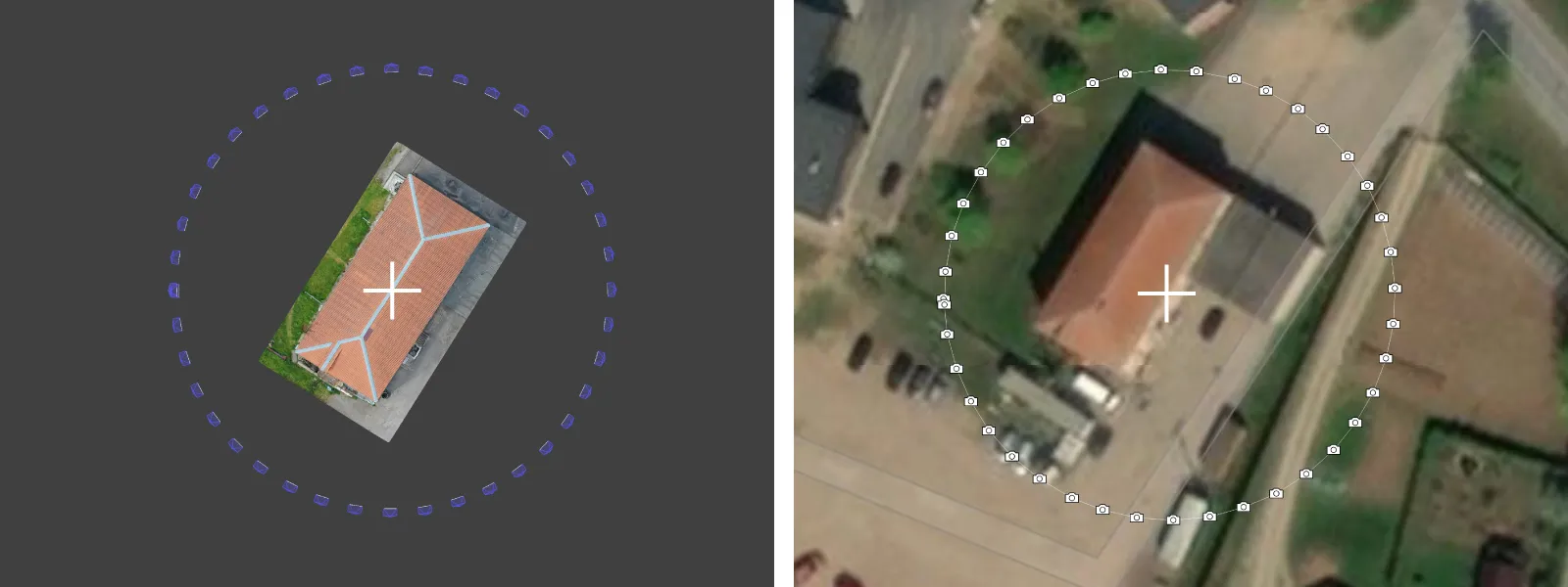
A map service is never perfectly accurate. If you use RTK GPS data with an RTK drone or survey-grade GCPs, chances are your data is more precise than the map service on which it is displayed.
 8. Can I choose which hardware Pixpro uses for processing?
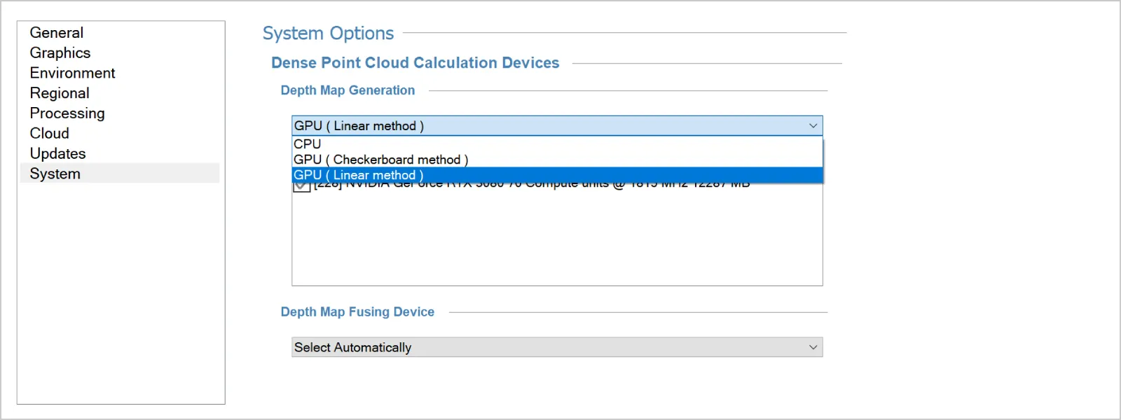
You can change some things in our options form, which is found in the tools tab. But Pixpro is set up by default to use GPU and CPU where it can, so it is the fastest it can be right out of the box. Unless you are having issues related to specific hardware, you do not need to change anything.
 9. Why does my hardware ID keep changing?
Hardware ID helps us identify our users and is unique for each computer. If our license activation pops up every time you launch Pixpro, you may notice that the hardware ID is changing, which is why it is popping up. Reasons for that will be related to hardware connected or disconnected to your computer or internal components being enabled or disabled by the system. If this issue prevents you from using the software - contact us via email, and we will help.
10. What can I import into Pixpro?
You can import almost every layer Pixpro can create from an external source. This includes dense point clouds, 3D meshes, DEMs, Orthophotos, Points, Lines, and Polygons. The main issue when importing 3D data into Pixpro software is the referencing information of said data. The referencing information (coordinate system and its values) has to be precisely the same, so currently, present data corresponds to the stuff you are importing. If the data is off - it will not work.
Check out our blog post, 'Surface Comparison Part 2' to learn a method for equalizing the referencing of two different projects using fake GCP's.
Conclusion
These questions came directly from our Discord server, where people can ask questions about Pixpro software and photogrammetry in general. If you did not find the answer you were looking for, join our server or write a comment below, and maybe we can help. Also, check out our previous articles in this series and the entire blog in general. Most entries are inspired by real-world questions and use cases we encounter on a daily basis.
Most Asked Photogrammetry Questions - Our Answers Part 1
Most Asked Photogrammetry Questions Part 2 - Pixpro Software

Photographer - Drone Pilot - Photogrammetrist. Years of experience in gathering data for photogrammetry projects, client support and consultations, software testing, and working with development and marketing teams. Feel free to contact me via Pixpro Discord or email (l.zmejevskis@pix-pro.com) if you have any questions about our blog.
Related Blog Posts
Our Related Posts
All of our tools and technologies are designed, modified and updated keeping your needs in mind

Photogrammetry 202 - Pixpro Blog Index
In our final blog post of the year, we are indexing Pixpro photogrammetry blog posts from the last two years. After publishing regularly for a while, things tend to scatter: posts about workflows, Pixpro features, hardware tests, random experiments, use cases, comparisons.
Travel Photogrammetry - More Fun than 2D Photos
Sometimes a 2D photo does not do justice to a moment or a place, and you wish you had something more… dimensional. Something that captures shape, texture, and the little details that flat images tend to flatten even more.

Budget in Photogrammetry - Affordable to Medium to Premium
Photogrammetry, like many other professions, hobbies, or disciplines, can have different budget tiers. In this article, I will provide my opinion on what I consider to be photogrammetry gear, ranging from affordable to premium to high-end tiers.
Ready to get started with your project?
You can choose from our three different plans or ask for a custom solution where you can process as many photos as you like!
Free 14-day trial. Cancel any time.
.svg@webp)