.svg@webp)
Pixpro Tutorial Videos Part 1 - Essentials
 Lukas
Zmejevskis
Lukas
Zmejevskis

Our Pixpro photogrammetry software is relatively easy to use, but everyone needs a starting point. We created a series of short videos that demonstrate how to begin using Pixpro even if you have never used the software before. This blog will serve as a playlist with some additional information for all of the videos.
If you prefer watching videos directly on YouTube, go to this playlist. You will find similar information in video descriptions. However, these videos are about software only and do not provide information about data capture. Our blog has many articles about that.
If you do not have a sample set ready for testing, no worries. You can download a very simple data set here on our website, or you can get a couple of more different sets we used in these videos. We also uploaded already processed projects with dense point clouds if you do not wish to test out processing capabilities yourself.
Local Project Creation
Cloud Project Creation
Point Cloud Cropping
Point Cloud Editing
Point and Line Measurements
1. Point Formats: .dm .dxf .gpx .kml .kmz .laz .las .ply .pxg .shp
2. Line Formats: dm .dxf .gpx .kml .kmz .pxg .shp
Relative vs Absolute Accuracy
Polygons - Area and Volume Measurements
1. Polygon Formats: dm .dxf .kml .kmz .pxg .shp
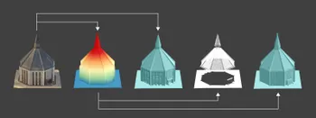
Baseplanes in Photogrammetry
Digital Elevation Map Editing Tools
Projections and Snapping
Cloud Downsampling and Mesh Decimation
Export Clouds and 3D Meshes
Export Point, Lines and Polygons
Point Formats: .dm .dxf .gpx .kml .kmz .laz .las .ply .pxg .shp
Line Formats: dm .dxf .gpx .kml .kmz .pxg .shp
Polygon Formats: dm .dxf .kml .kmz .pxg .shp
Export Dem, Orthophoto and Contour Lines
Digital Elevation Map Editing Tools
True Orthophoto - Orthorectified Imagery and Pixpro Workflow
Conclusion
The next step for us is to create a video series for more advanced users, delving into topics like ground control points and other types of referencing, project comparison, DEM baseplanes, post-processing filters, etc. You can download the Pixpro photogrammetry software trial for free and start using Pixpro right away with the help of these videos and the samples we provided. If you still have questions, use our support channels or comment below.
Photographer - Drone Pilot - Photogrammetrist. Years of experience in gathering data for photogrammetry projects, client support and consultations, software testing, and working with development and marketing teams. Feel free to contact me via Pixpro Discord or email (l.zmejevskis@pix-pro.com) if you have any questions about our blog.
Related Blog Posts
Our Related Posts
All of our tools and technologies are designed, modified and updated keeping your needs in mind

Why Choose Pixpro Photogrammetry Software? Practical Comparison
There is no shortage of photogrammetry software today. From well established industry tools to newer cloud based solutions, the choice is not exactly obvious, especially for someone just getting started. Most options promise high accuracy, automation, and ease of use, and to some extent they all del
3D Point Clouds in Pixpro: How to Convert and Export Spatial Data
Photogrammetry software produces several types of spatial outputs, but the dense 3D point cloud is the foundation of them all. In Pixpro, the dense point cloud acts as the base dataset from which every other derivative is generated.

How to Create and Import a KML File in Pixpro Waypoints
We are continuing our improvements to the Pixpro Waypoints service and bringing a few small updates. Pixpro Waypoints is a service that allows automatic photogrammetry flights with consumer grade DJI drones using a bit of workaround magic.
Ready to get started with your project?
You can choose from our three different plans or ask for a custom solution where you can process as many photos as you like!
Free 14-day trial. Cancel any time.