.svg@webp)
Individual Property Architecture - Photogrammetry Use Case
 Lukas
Zmejevskis
Lukas
Zmejevskis
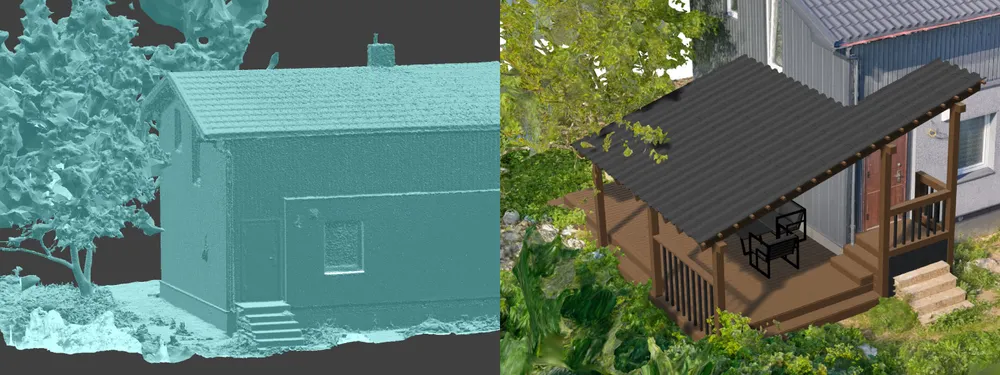
If you love doing your own small-scale renovations, planning, and building—this use case is for you. Photogrammetry can provide a framework that allows you to eliminate dozens of questions, replace traditional time-consuming methods, and reach a better result. In this scenario, we have a small home under construction, and a wooden terrace is being drawn up. I will share the short and easy process of how I got the 3D model of the property and how it helps to achieve this specific renovation goal.
Use Case
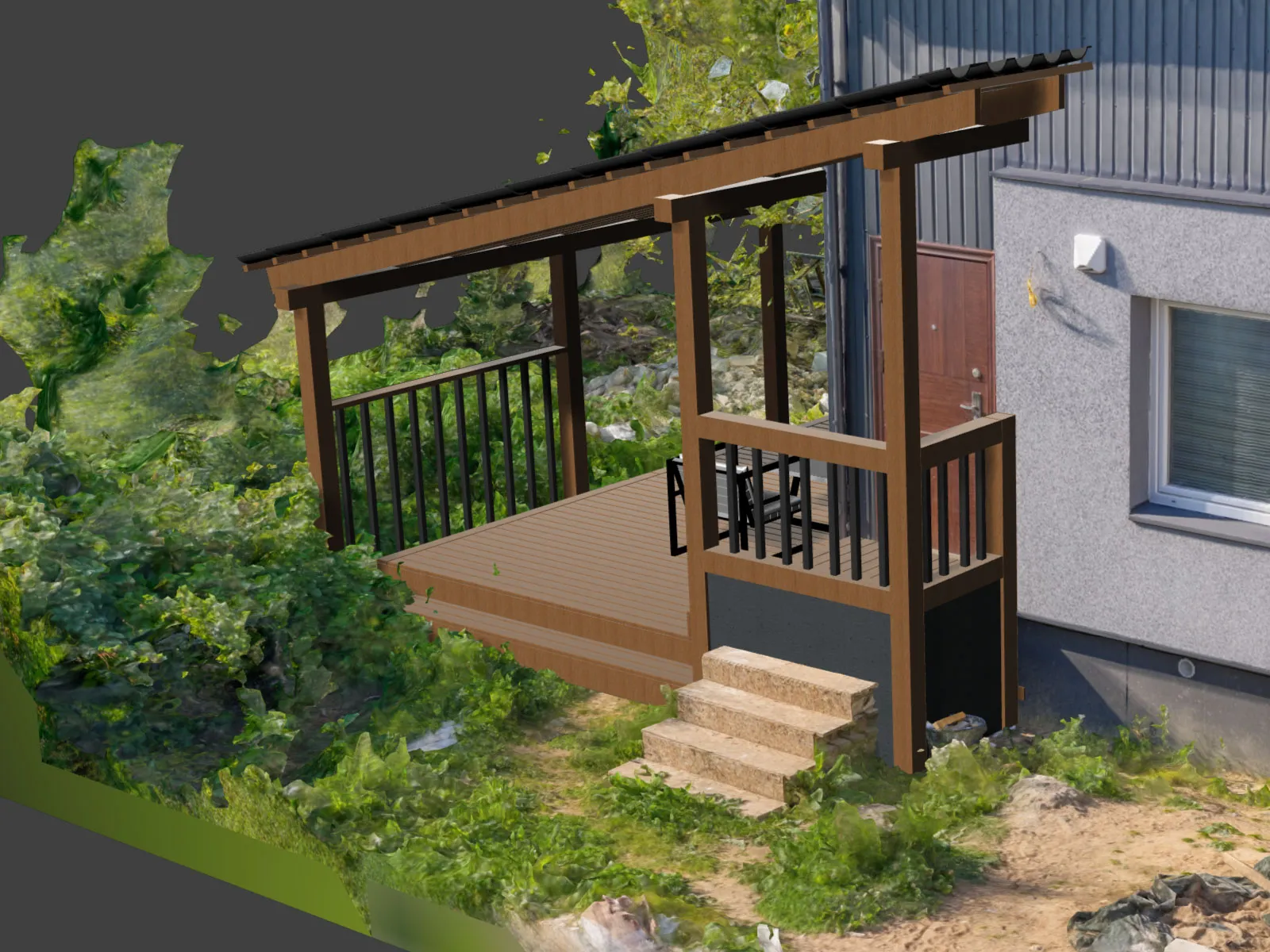
This project aims to build a terrace that will fit seamlessly into the bounds of the property while saving a family tree, which directly intervenes in this process. The tree has both emotional and practical value, providing memories and a better and nicer living environment in the tiny plot of land. Saving the walnut tree is a priority, and we need to plan the terrace accordingly.
Creating a digital twin of the area in question is the obvious choice, and photogrammetry is the obvious tool. In this case, we are dealing with a small-scale job where we could wing it and start building the terrace with rough measurements, somewhat estimated construction materials, and building around the tree as we go. But the point is to be intelligent while remaining efficient. Hiring a laser scanning service would not be economically viable, while photogrammetry is easily accessible.
3D Scanning
I used a camera and a drone for this use case and combined the photos in a single project. Yes, the scope of the scan is small. Still, there were a few challenges—none particularly unique or severe—but things of note you should keep in mind if you plan to replicate a similar workflow. These are:
-
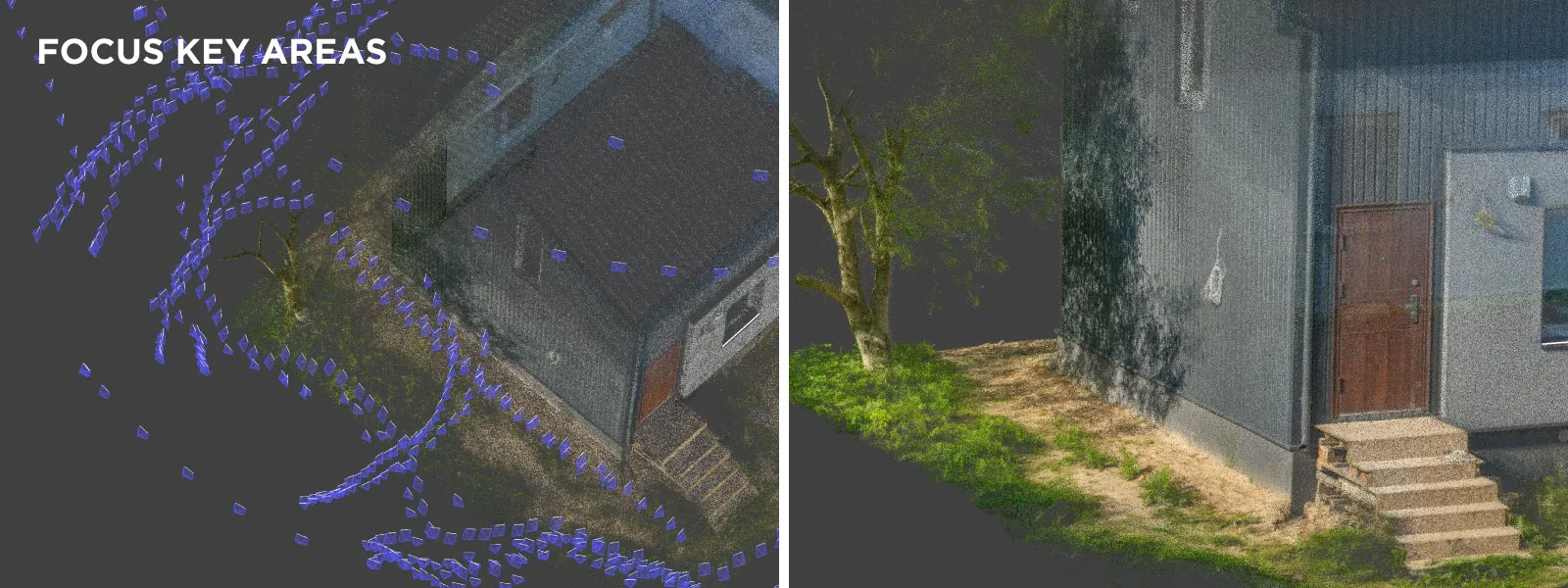
Confined space. There was not a lot of space to move around on foot due to the ongoing nature of the construction. To mitigate this, I used a wide-angle lens—a 20-millimeter full-frame lens with a field of view of 92 degrees. An even wider lens would have also been suitable, but a 24-millimeter lens seemed too narrow.
-
Hazardous space. Not only was there not much room to move, but it was also a bit hazardous, meaning I could not choose the scan path as I would have wished. However, I had to stick to small paths and accessible spaces where possible. It is not a huge deal, but it definitely affects the scanning workflow.
-
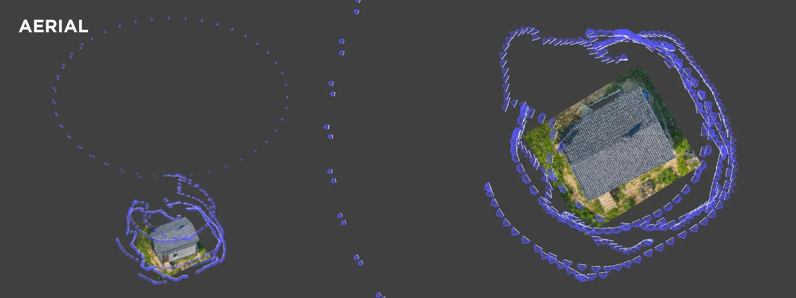
Close neighbor proximity. Aerial space was confined as well. Flying around meant flying above neighboring properties, buildings, and people. For that reason, we need to inform people around us of what we are doing and that our capture subject is, in fact, the client's property. I also stuck close to the scanned property at lower altitudes. I only flew above neighboring plots at a higher, safer altitude.
-
Vegetation. A general nuisance in photogrammetry. However, because our goal was to capture a tree for its preservation, we had to choose a calm day for a scan so the wind would not move the branches. And, of course, ensure the coverage of stable features like the main trunk and branches.
Capture Techniques
The inconveniences described above meant I approached this case with a more quantity-oriented philosophy rather than thinking too much about precision. I took every possible path with a camera pointed up, straight, and down at the subject—the house. I also did some tunnel-type scanning, walking with my camera pointed straight and taking pictures. By adding these, I ensured that different sections of the scan would definitely connect to each other. All terrestrial photos were made by taking a small step for each picture, with overlap managed totally by instinct.
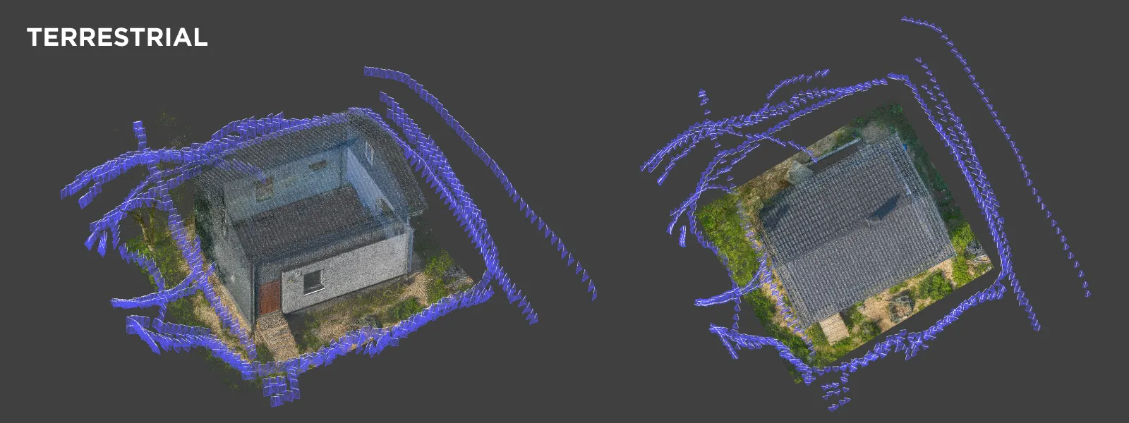 However, before doing the scan, I looked at the viewfinder. I very roughly estimated the size of the step I needed to take to keep a close to 80-percent overlap at a reasonable distance. And when I started to take photos walking around the house, I counted them and evaluated what numbers I was getting. Getting around a small house and obtaining about 40 pictures per perimeter seemed reasonable, so I kept at it.
 I needed photos containing GPS data to have a scale for the scan. I flew the drone manually using the same fundamentals described above, just taking photos roughly to keep a high overlap, counting how many I took, and evaluating if that number sounded reasonable. Additionally, I walked around with a drone raised above my head for the transitional images, making really low-altitude images to serve as connective tissue between the aerial photos up higher and terrestrial camera photos.
 I shot in aperture priority for most of the photos, keeping ISO low and shutter speed in auto mode, continuously focusing in the center of the frame. I got 1,153 raw images, which is quite a lot for a seemingly small scan. But keeping in mind the unideal conditions and the requirement of the tree being visible, it is an amount we must prepare to deal with. I processed the photos in Lightroom with light adjustments, turning them into JPEGs.
 Results
The entire bunch of photos was processed in one go. Only 9 photos were skipped from the reconstruction, which is not bad. I made those a bit blurry by moving the camera too much in the shade where shutter speeds dropped—always something to keep in mind when shooting in semi-automatic modes. Filtering them before reconstruction would have been better, but 9 out of a thousand-plus is just fine.
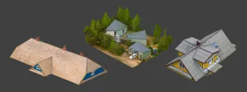
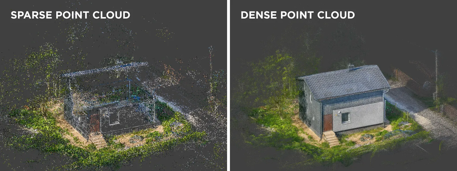 The final 3D mesh model was processed with a specification of a million triangles and a single 16k texture, much lower than the native amount of data we had and what could have been done.
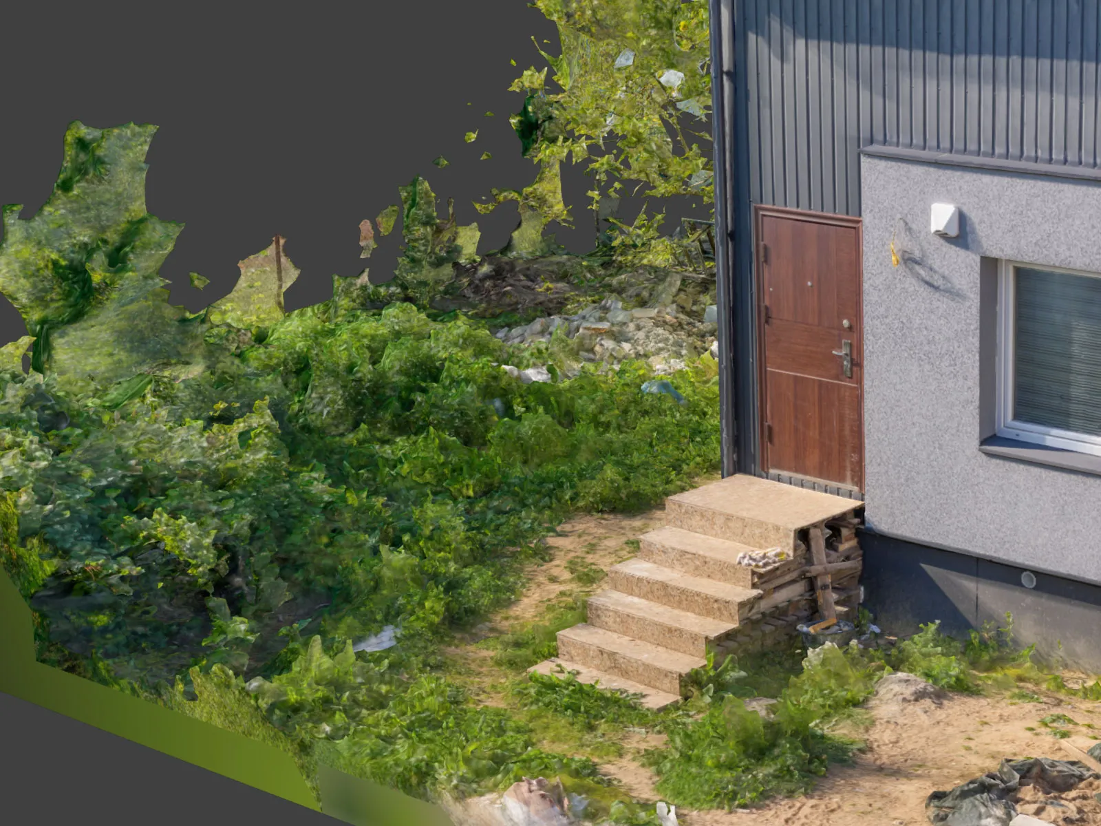
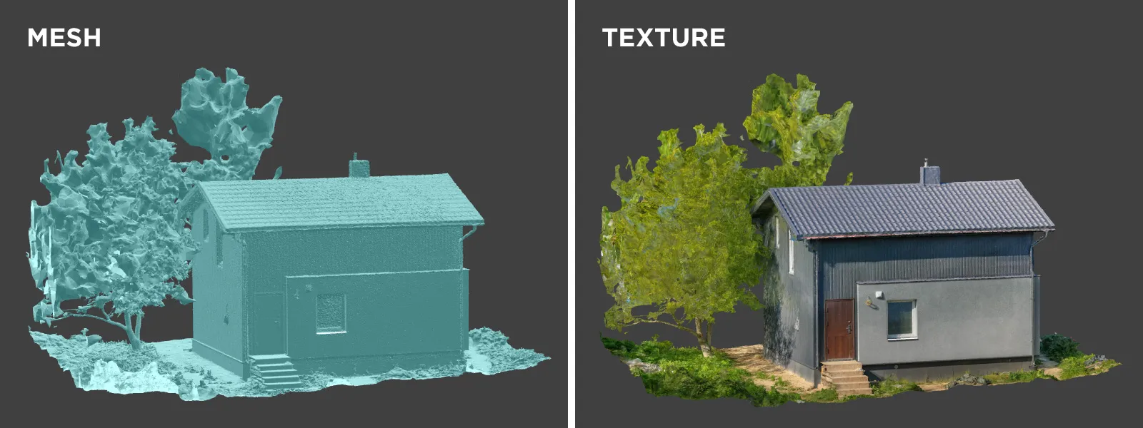 Triangle amount, however, does not equal quality, while non-photogrammetry software is often not designed to deal with vast amounts of mesh triangles. The 1-million model was used in Rhinoceros CAD software for further work. The homeowner built the terrace in 3D at the proper scale, which was the final goal of this scan.

From such a model, we can determine the amounts of construction material we will need, the solutions for preserving the tree we can explore, the final look and integration of the terrace, and provide the data to subcontractors if necessary. No guesswork.
 Conclusion
Simple and effective—summary of what photogrammetry is. Accessible enough for personal but professionally made projects like this, which will always provide better results than just winging it. All of this could have been done with a single smartphone, too, if we dropped a few scale bars around for scale reference, but admittedly, having a drone is always helpful in property scanning. We will use this scan later for solar panel efficiency simulation and installation to get two birds with one stone.
Photographer - Drone Pilot - Photogrammetrist. Years of experience in gathering data for photogrammetry projects, client support and consultations, software testing, and working with development and marketing teams. Feel free to contact me via Pixpro Discord or email (l.zmejevskis@pix-pro.com) if you have any questions about our blog.
Related Blog Posts
Our Related Posts
All of our tools and technologies are designed, modified and updated keeping your needs in mind
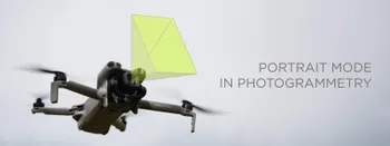
Portrait Orientation in Photogrammetry: When It Actually Helps
Is there anything to gain by scanning in portrait instead of the usual landscape? Sometimes, a little. But orientation is one of the least important decisions you make on a scan, and it is worth understanding why before you give it any more thought than that.
DJI Lito X1 for Roof Photogrammetry: Solar and Inspection Use Case
Small drones are the best tool for residential and even commercial roof photogrammetry. They are quiet, attract less attention, are easier to fly fully within regulations, and they are affordable.
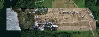
Large Property Photogrammetry – Real Estate Development Use Case
Property scans are one of the most common use cases, especially for our software. Pixpro is affordable and works well with RTK data and ground control points when necessary.
Ready to get started with your project?
You can choose from our three different plans or ask for a custom solution where you can process as many photos as you like!
Free 14-day trial. Cancel any time.