.svg@webp)
Pixpro vs Agisoft Metashape (2026): Which Photogrammetry Software Fits Your Work?
 Lukas
Zmejevskis
Agisoft Metashape is one of the most established names in photogrammetry, and one of the last major packages still sold the old way: pay once, keep it. That alone makes the comparison with Pixpro, which is a subscription, more interesting than a feature checklist.
The disclosure first: I am a long term Pixpro partner, so I have an interest here. Every fact about Metashape below links to Agisoft's own pages, checked in November 2026, and I say plainly where Metashape is the better choice. If you spot something that has changed, tell me and I will correct it.
The Short Version
- Metashape is a desktop application sold as a perpetual license in two editions. Professional, USD 3,499 once, is the one with georeferencing, orthomosaics, elevation models and measurements. Standard, USD 179, makes 3D models but not maps.
- Pixpro is a subscription from EUR 5 a month on annual billing, with the full output toolkit, cloud processing and Pixpro Waypoints flight planning in every plan.
- Metashape runs on Windows, macOS and Linux. Pixpro runs on Windows.
- Metashape covers specialized data that Pixpro does not: multispectral, thermal, LiDAR and satellite imagery, plus Python scripting and network processing.
- For drone mapping, roofs and stockpiles, the real comparison is Pixpro against Metashape Professional, not Standard.
Pixpro vs Metashape at a Glance
| Pixpro | Agisoft Metashape | |
|---|---|---|
| License | Subscription, monthly or annual | Perpetual, node-locked; floating licenses for Professional |
| Price | EUR 5, 25 or 50/month billed annually (Solo, Solo Plus, Premium) | Standard USD 179; Professional USD 3,499 |
| Mapping outputs and measurements | Every plan | Professional only |
| Updates and support | Included while subscribed | Free updates up to version 2.x, 12 months of e-mail support |
| Cloud processing | Included in every plan | Agisoft Cloud for Professional, pay per use from USD 4.25 per processing hour |
| Photos per project | 150 / 300 / 2,000 by plan; unlimited on Enterprise | No fixed limit; mainly limited by RAM |
| Flight planning | Pixpro Waypoints for consumer DJI drones, included | Mission planning for complex structures (Professional) |
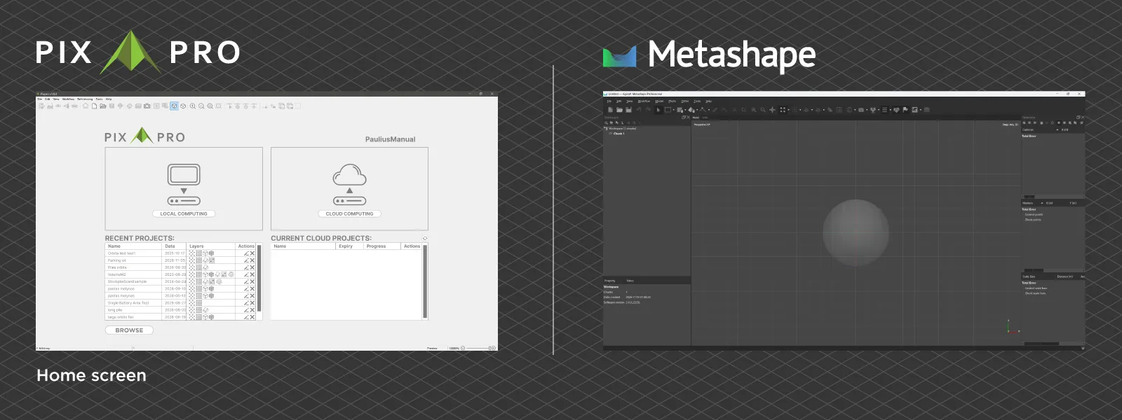
| Operating system | Windows | Windows, macOS, Linux |
| Free trial | 14 days | 30-day trial, plus a demo mode without save and export |
| Multispectral, thermal, LiDAR | No | Yes (Professional) |
Sources: Agisoft online store, Metashape edition comparison, Agisoft licensing options, Agisoft Cloud, Pixpro plans and pricing. Pixpro quotes prices in euros and Agisoft in US dollars. I have not converted them, and prices exclude taxes.
Perpetual License vs Subscription
This is the real fork between the two. Metashape is not time-limited: you pay once and the version you bought keeps working. The license includes 12 months of e-mail support and free updates up to version 2.x. The current version is 2.3.2, so a license bought today is covered for the rest of the 2.x series, and a future version 3 would be a separate upgrade. A node-locked license runs on one computer at a time and can be moved to another one. Floating licenses for teams are available for Professional only, through resellers.
Pixpro is a subscription. Updates, support and cloud processing are included for as long as you pay, and stop when you stop.
Neither model is better in general. If you process regularly for years and do not need cloud processing, a one-time license usually works out cheaper. If your work is occasional or seasonal, or you would rather not commit a large sum upfront, a subscription is the rational choice. I went through the arithmetic in more detail in the 2026 photogrammetry software price guide.
Which Metashape Edition You Would Need
The edition matters more than people expect. According to Agisoft's edition comparison, Standard builds dense point clouds and textured 3D models. Everything a mapping job depends on is Professional only: georeferencing with GCPs or flight logs, markers and scale bars, DSM and DTM, orthomosaics, contour lines, DEM editing, and coordinate, distance, area and volume measurements.
 So for drone mapping, roof work or stockpile volumes, the comparable product is Metashape Professional at USD 3,499 once, against Pixpro Premium at EUR 600 a year on annual billing. Standard at USD 179 is a good tool for 3D models of objects, but it cannot measure or scale a model on its own.
On the Pixpro side the plans differ by project size and processing, not by features. Every plan, including Solo, has the full output suite, unlimited GCPs and unlimited measurements. Solo processes in the cloud only; Solo Plus and Premium add local processing on your own Windows PC with manual control over each processing stage.
Local and Cloud Processing
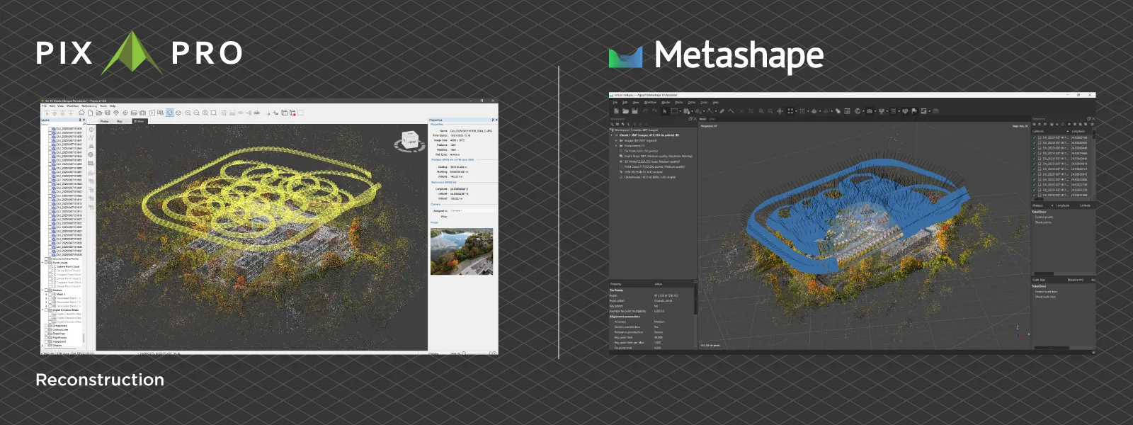
Both process locally. Metashape runs on Windows, macOS and Linux, and Agisoft states that the maximum project size is limited mostly by the amount of RAM, with no fixed photo limit. Pixpro runs on Windows and needs at least 16 GB of RAM for projects under about 500 photos and 32 GB above that. An SSD and a dedicated GPU are recommended but not required.
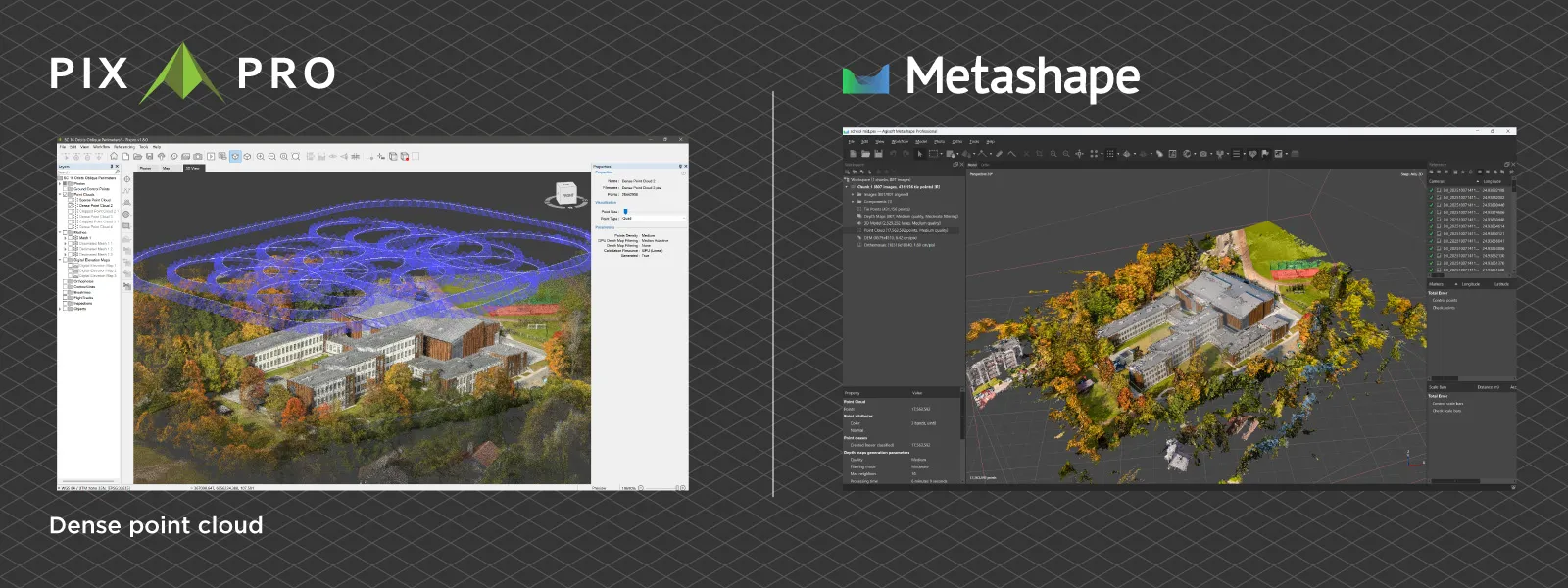
In the cloud they work differently. Agisoft Cloud processing needs an activated Metashape Professional license and is charged per minute of use, from USD 4.25 per processing hour, with storage from USD 10 a month for 100 GB. A limited free plan for trial and education use includes 50 GB and 20 processing hours a month. Pixpro includes cloud processing in every plan, and with memory prices where they are this year, that is worth more than it used to be. There is more on that in the 2026 workstation build.
Flight Planning
Pixpro includes Pixpro Waypoints with every license and the free trial. It plans grid, multi-grid and orbital missions for consumer DJI drones with the built-in waypoint feature: Mavic 3 series, Air 3, Air 3S, Mavic 4 Pro, Mini 4 Pro, Mini 5 Pro and Lito X1.
Metashape Professional takes a different approach with its Plan Mission tool, built for objects with complex geometry. You fly a simple overview first, build a rough model, and Metashape generates a detailed flight plan around it, exported as KML or CSV for apps such as Litchi or DJI Pilot. It is a capable tool for towers and structures, but it needs a third-party flight app to actually fly.
Specialized Data and Workflows
This is where Metashape Professional clearly goes further. It processes multispectral and thermal imagery, LiDAR data, satellite imagery and multi-camera rigs, calculates NDVI and other vegetation indices, classifies dense point clouds, detects power lines and builds hierarchical tiled models for city-scale projects. It can be scripted in Python, run headless and spread processing across several computers.
Pixpro focuses on photos from drones and cameras and does not cover these workflows. If your work depends on any of them, Metashape is the better choice.
Outputs and learning curve
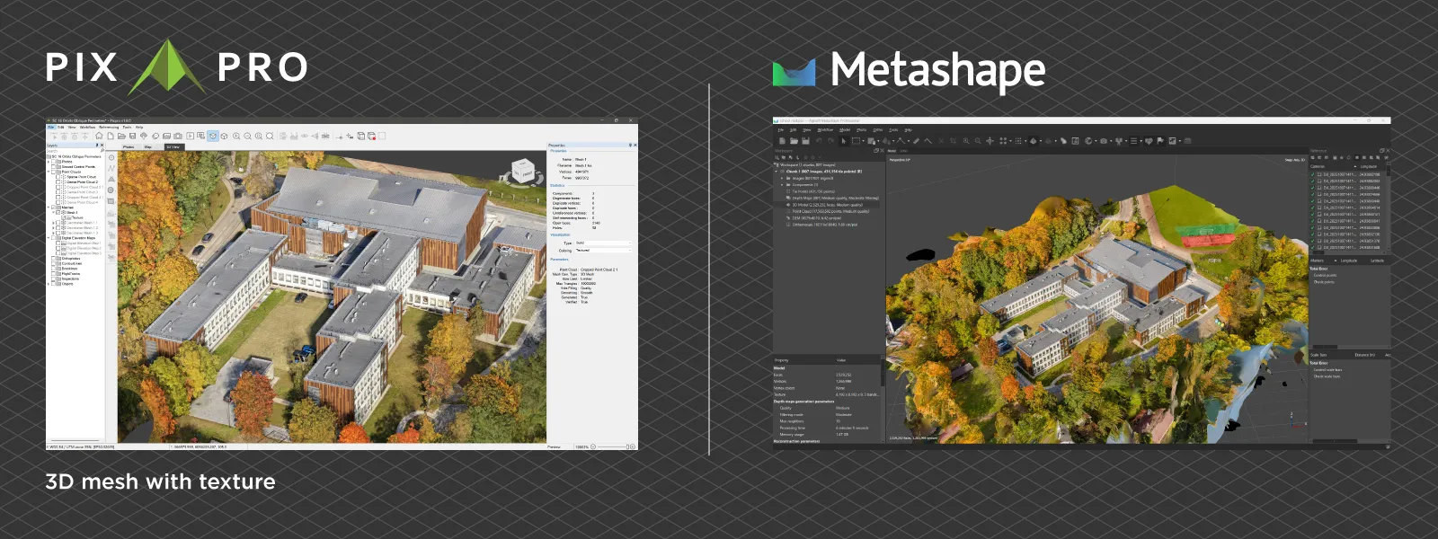
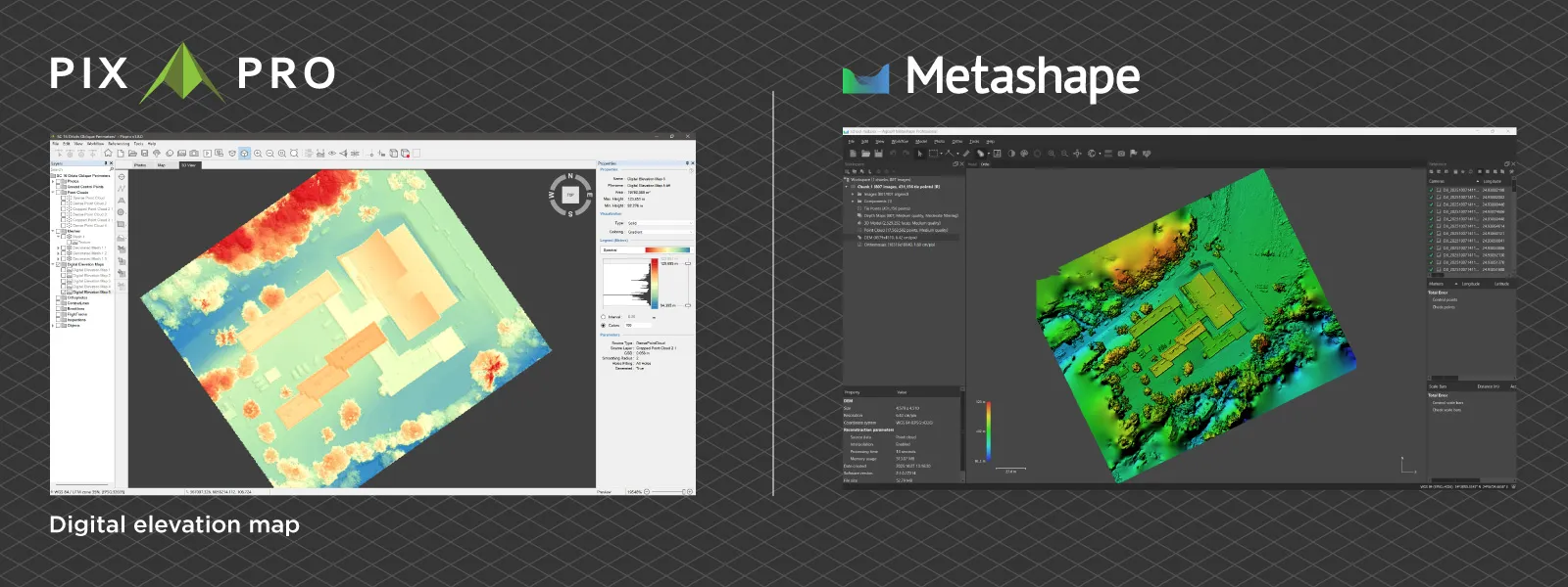
Both produce point clouds, orthophotos, elevation models and textured meshes. Pixpro exports point clouds in LAS, LAZ, XYZ and PLY, meshes in OBJ and PLY, DEM and orthophoto in GeoTIFF, and drawn objects in SHP, DXF and KML.
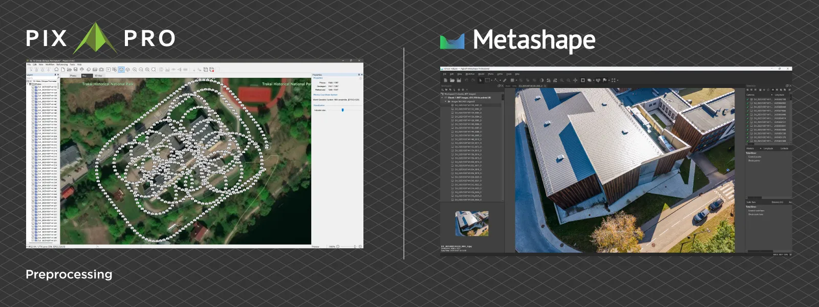
The bigger difference is how you get there. Pixpro is built for users without a photogrammetry background: a setup wizard, a one-click full workflow and a layer-based project view. Metashape gives detailed control over every processing step, which experienced users value, and it has a steeper learning curve for the same reason.
Which One Should You Choose?
Choose Metashape if you:
- prefer to pay once and own a perpetual license
- work on macOS or Linux
- need multispectral, thermal, LiDAR or satellite data, or city-scale tiled models
- want to automate processing with Python or spread it across several computers
- only need 3D models of objects, in which case Standard at USD 179 covers it
Choose Pixpro if you:
- run small to mid-size mapping, inspection, roof, facade or stockpile jobs
- want mapping outputs and measurements without a USD 3,499 upfront cost
- fly a consumer DJI drone and want automated grid and orbital missions without a third-party app
- want cloud processing included rather than paid per hour
- want results without a steep learning curve, as a solo operator or small team
Metashape Alternatives
| Software | Price | Best for |
|---|---|---|
| Pixpro | EUR 5 to 50/month, billed annually | Small to mid-size mapping, inspection and measurement with consumer DJI drones |
| Pix4D (PIX4Dmatic) | Standard plan USD 332.50/month, billed yearly | Large-scale and specialized mapping, photogrammetry combined with LiDAR |
| RealityScan | Free under USD 1M annual revenue; USD 1,250 per seat per year above | High-detail 3D reconstruction and visualization |
| DroneDeploy | From USD 1,908/year (Ag Lite); USD 4,188/year (Individual) | Cloud-based mapping with team collaboration |
| WebODM / OpenDroneMap | Free, open source | Technical users who can host and maintain it themselves |
| 3DF Zephyr | Free (50 photos) to EUR 4,200 one-time | Perpetual license with a free entry tier |
The Pix4D price was checked in November 2026 for the Pixpro vs Pix4D comparison. The others were checked in September 2026 for the photogrammetry software price guide.
Conclusion
Metashape and Pixpro answer different questions. Metashape is for people who want to own their software, work across operating systems, and reach into multispectral, LiDAR or scripted pipelines. Pixpro is for people who want to get from drone photos to measurements with as little friction and upfront cost as possible, with the cloud and the flight planning already in the box.
The thing to check before comparing prices is the edition. Metashape Standard looks cheap, but mapping and measurement are Professional features, so the fair comparison for a drone mapping job is USD 3,499 once against a yearly subscription. Work out how many years you will use it and whether you need the cloud, and the right choice usually becomes obvious. You can try Pixpro free for 14 days with the same photos you would use in Metashape.
Frequently Asked Questions
Is Pixpro cheaper than Metashape?
It depends on how long you use it. Metashape Professional, the edition with orthomosaics, elevation models and measurements, costs USD 3,499 once. Pixpro costs EUR 5 to 50 per month on annual billing, with cloud processing included. Pixpro has the lower entry cost; a perpetual license can work out cheaper over many years if you do not need cloud processing.
What is the difference between Metashape Standard and Professional?
Standard, USD 179, builds point clouds and textured 3D models. Professional, USD 3,499, adds georeferencing, ground control points, scale bars, orthomosaics, DSM and DTM, measurements, multispectral and LiDAR data, Python scripting and cloud processing.
Is Metashape a one-time purchase?
Yes. Metashape licenses are perpetual and not time-limited. They include free updates up to version 2.x and 12 months of e-mail support.
Does Metashape run on Mac?
Yes. Metashape runs on Windows, macOS and Linux. Pixpro runs on Windows only.
Is Pixpro as accurate as Metashape?
Both use the same family of methods, structure from motion and multi-view stereo. In practice accuracy depends far more on capture: overlap, ground sampling distance and ground control. There is more on that in what actually affects photogrammetry accuracy.
Can I move a project from Metashape to Pixpro?
You can import the same original photos and ground control points into Pixpro and reprocess them. Processed Metashape project files cannot be opened directly.
Photographer - Drone Pilot - Photogrammetrist. Years of experience in gathering data for photogrammetry projects, client support and consultations, software testing, and working with development and marketing teams. Feel free to contact me via Pixpro Discord or email (l.zmejevskis@pix-pro.com) if you have any questions about our blog.
Related Blog Posts
Our Related Posts
All of our tools and technologies are designed, modified and updated keeping your needs in mind
Pixpro vs Pix4D (2026): Which Photogrammetry Software Fits Your Work?
Choose Pix4D for large-scale, specialized or LiDAR-combined workflows, or if you work on a Mac. Choose Pixpro for small to mid-size mapping, inspection and measurement jobs where cost and ease of use matter most.
 Pixpro Team
Pixpro 1.8.0 - New Reconstruction Core, Adaptive Mapping and Slope Maps
It has been a while since the last version post on this blog. Pixpro 1.8.0 is the first new major version since 1.7.0, and the biggest change sits right at the start of every project: how the cameras get placed and the sparse point cloud gets built.
Pixpro Team
Why Choose Pixpro Photogrammetry Software? Practical Comparison
There is no shortage of photogrammetry software today. From well established industry tools to newer cloud based solutions, the choice is not exactly obvious, especially for someone just getting started. Most options promise high accuracy, automation, and ease of use, and to some extent they all del
Pixpro Team
Ready to get started with your project?
You can choose from our three different plans or ask for a custom solution where you can process as many photos as you like!
Free 14-day trial. Cancel any time.