.svg@webp)
Closed Copper Mine Maintenance
| Industry | Mining, Environmental Protection, Insurance |
| Objective | Measure the quarry capacity; predict the rainwater paths; project drainage pathways |
| Drone | DJI Phantom 4 pro |
| Flight Data | Camera angle: 90o - 45o Horizontal double grid Height: 40 m Duration: 14 min |
| Dataset Size | 297 images |
| Data Processing | 45 min using medium software settings |
| Hardware | Intel i7 8700, 16 GB of RAM, dual Radeon rx580, SSD drive |
Prevention of poisonous substance spills from quarry
Mining activities have a tangible impact on the social surroundings and environment. Even after the mine closure, the environmental issues remain and proper mine maintenance is crucial for sustainable closure.
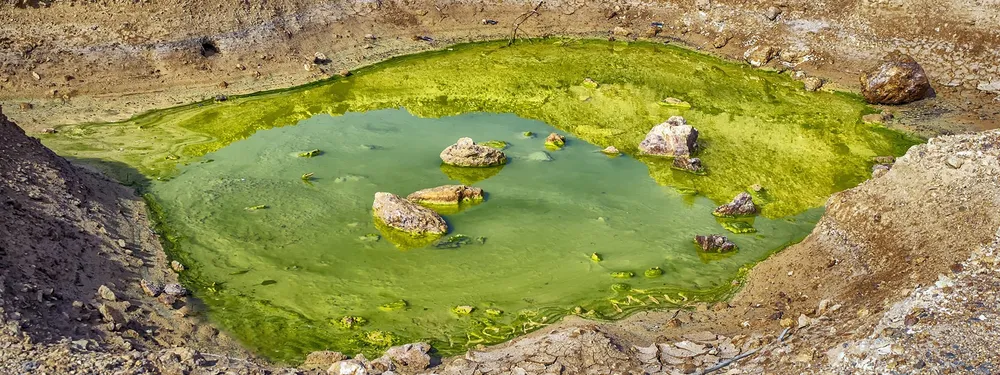
One of the main contamination issues in the abandoned metal and coal mines is the drainage of acidic elements from reservoirs. In most cases, the drainage under the acid accumulations is too permeable, and the capacity of such repositories are too shallow to prevent the accumulation and leakage of the hazardous sediments, especially during the rainy seasons.
The waste waters saturated with the heavy metals and chemical substances may cause environmental disasters by contaminating the surface water and the groundwater, thus causing a threat to lose biological diversity in the region and infer harm to the aquatic life. This is the reason why it is so important to continuously monitor and examine the territories of the abandoned metalliferous mines as well as design the safest solutions for the drainage of the acid waste.
Data gathering for mine maintenance
The 3D reconstruction of this closed copper quarry was generated from 297 photos. For this purpose, a DJI Mavic Pro drone with 12-megapixel sensor camera was employed. The drone was piloted using the flight planner with the generated horizontal double grid flight pattern at the altitude of 40 meters. The whole flight took 14 minutes.
Data processing mine maintenance
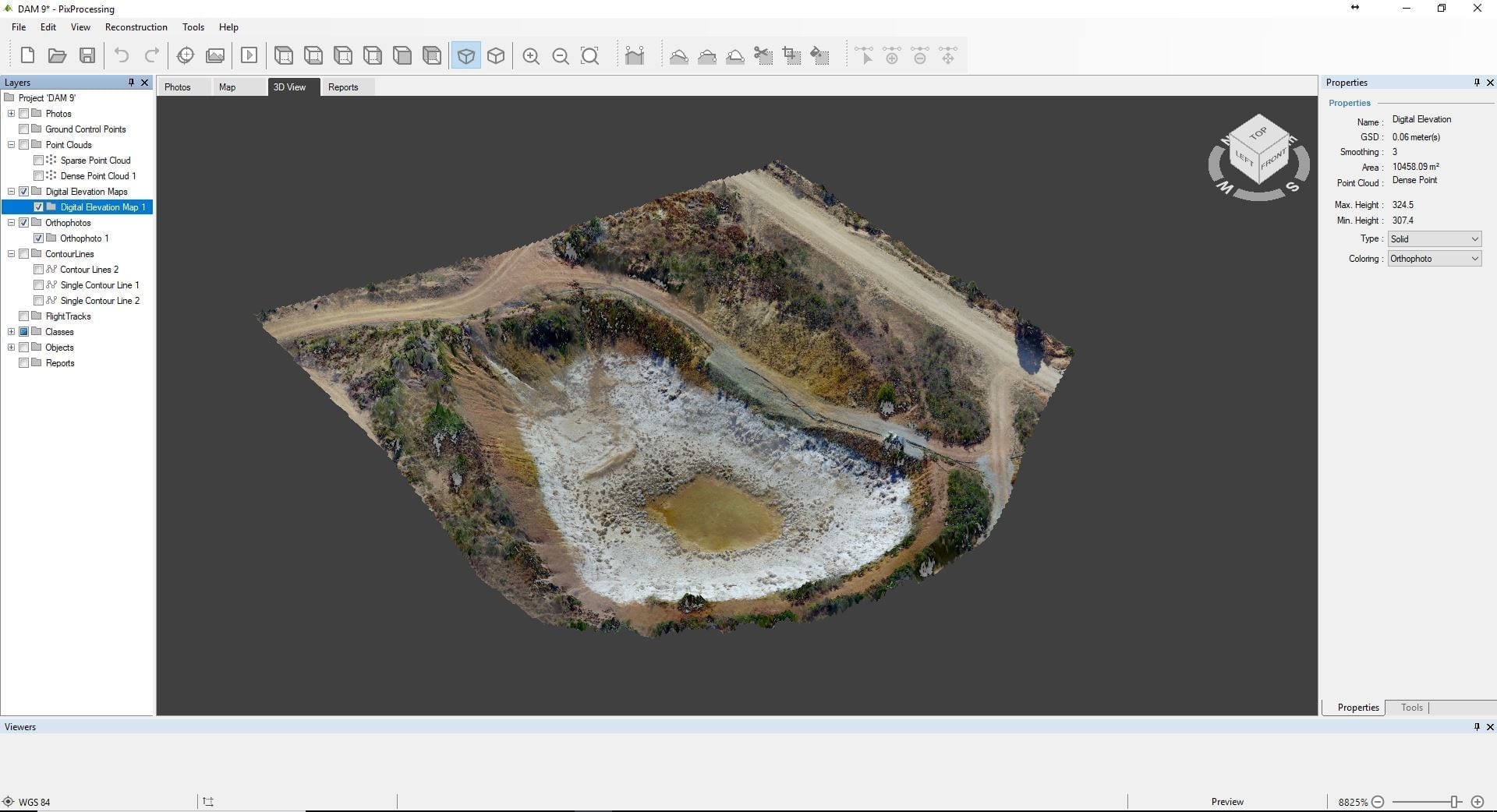
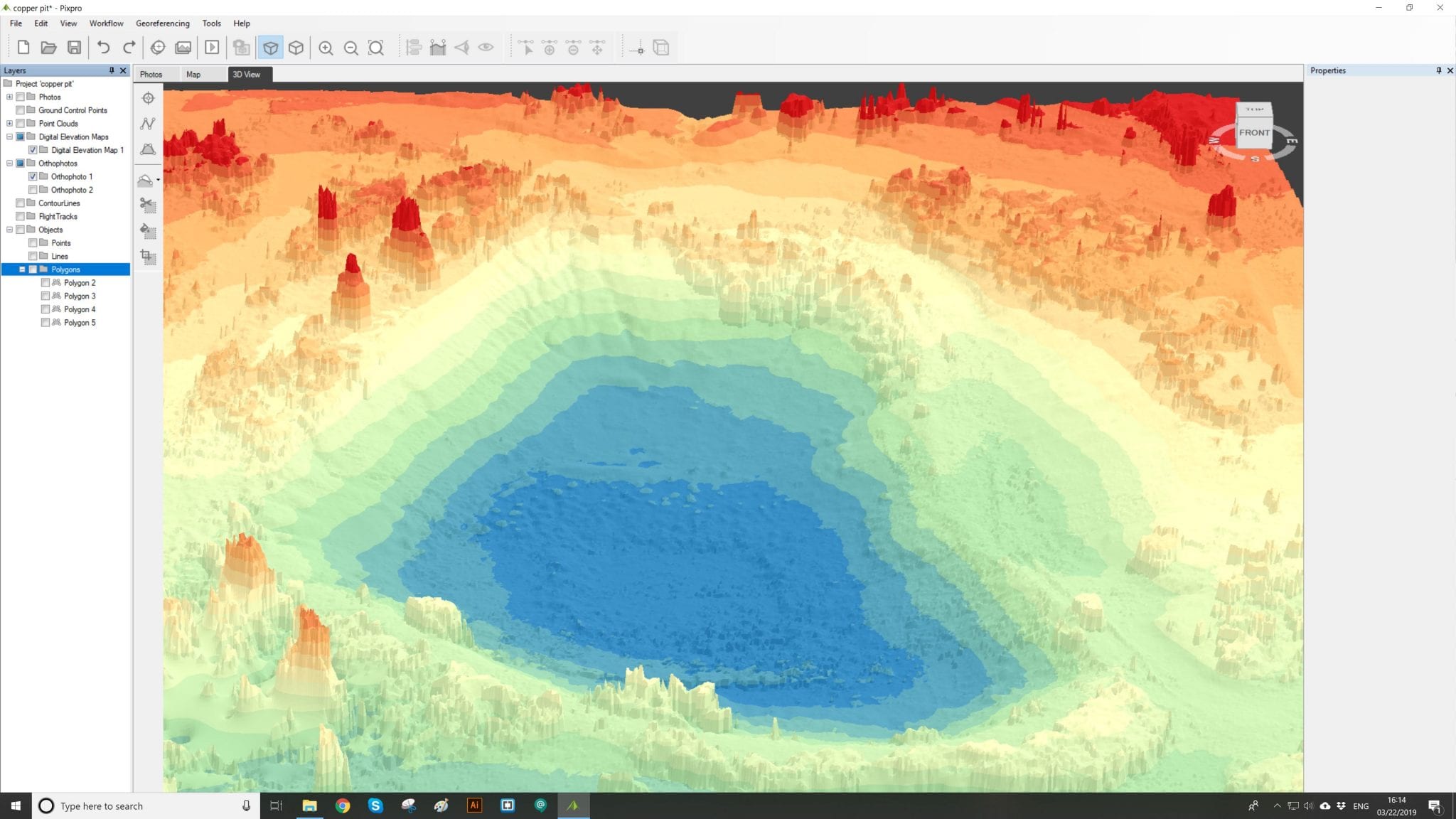
The reconstruction of the copper mine 3D model using the Pixpro software took 45 minutes. The object is analyzed using the DEM, i.e. digital elevation map, of the object.
Data Analysis
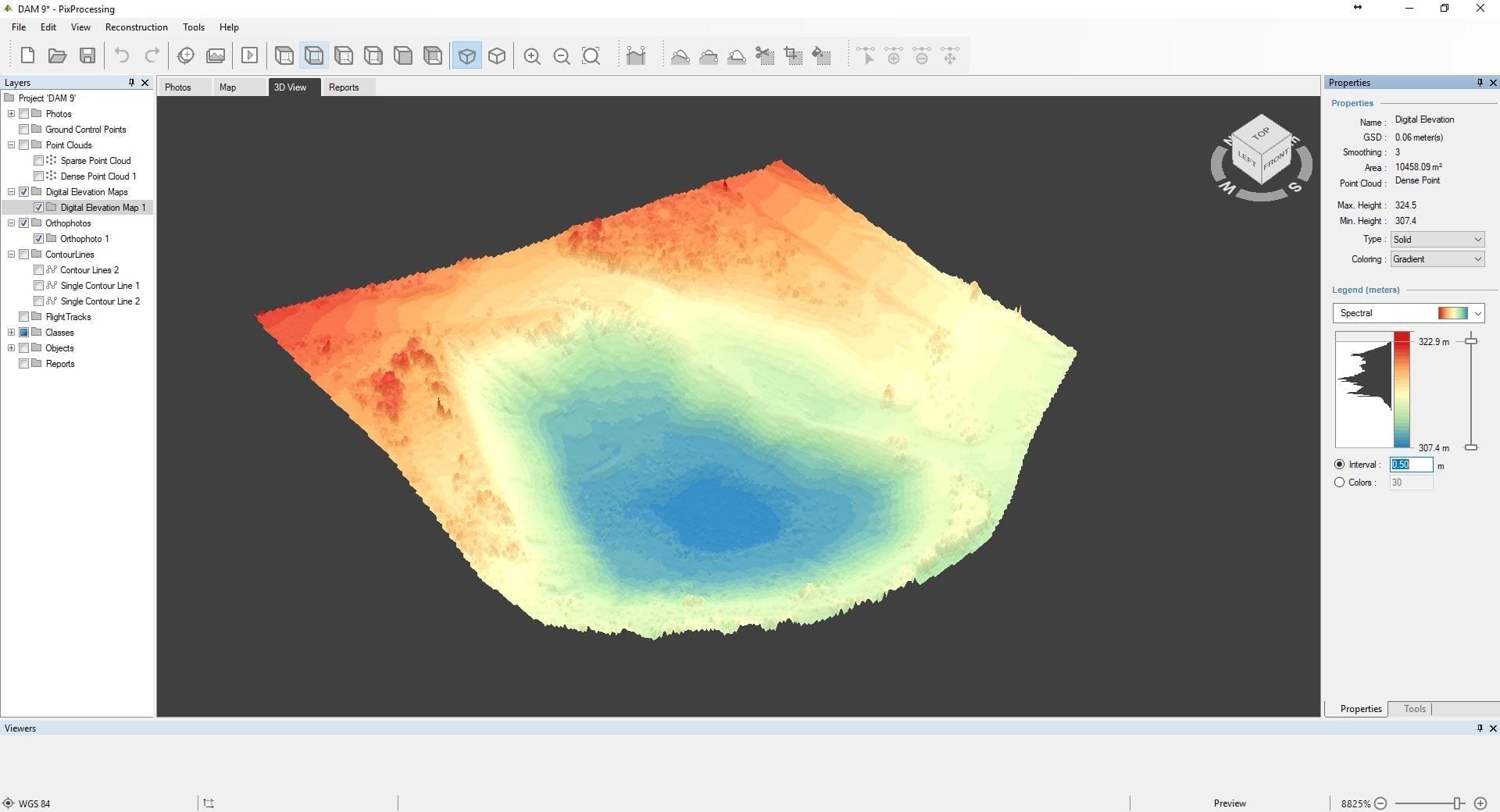
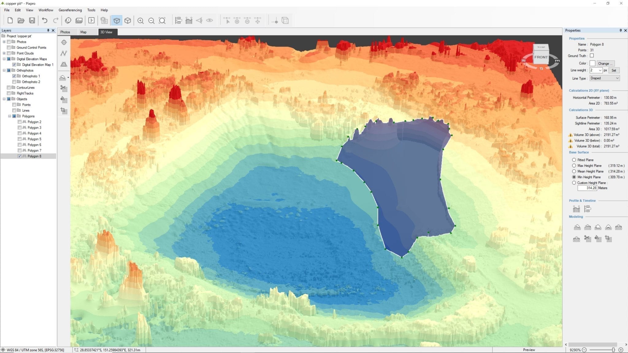
An even surface was generated from a dense point cloud, which was used to analyze the safety of the copper mine. The first objective was to determine the maximum level of toxic water in the pit. Single contour line function allows you to select just the required level. By moving the contour line higher/lower you can clearly see at which point the quarry will start to leak.
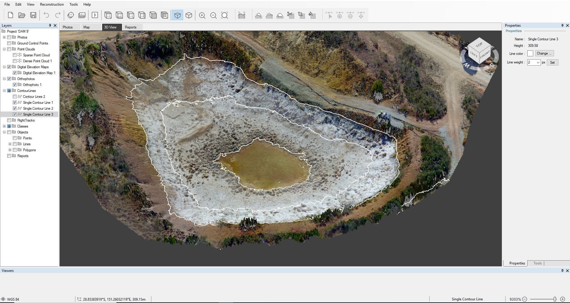
Using the marked contour line, we can create a polygon with a single click and measure the cubic capacity of the ravine. That way you can check the quarry capacity and safety as well as predict the tolerable volume of rainfall in the area.
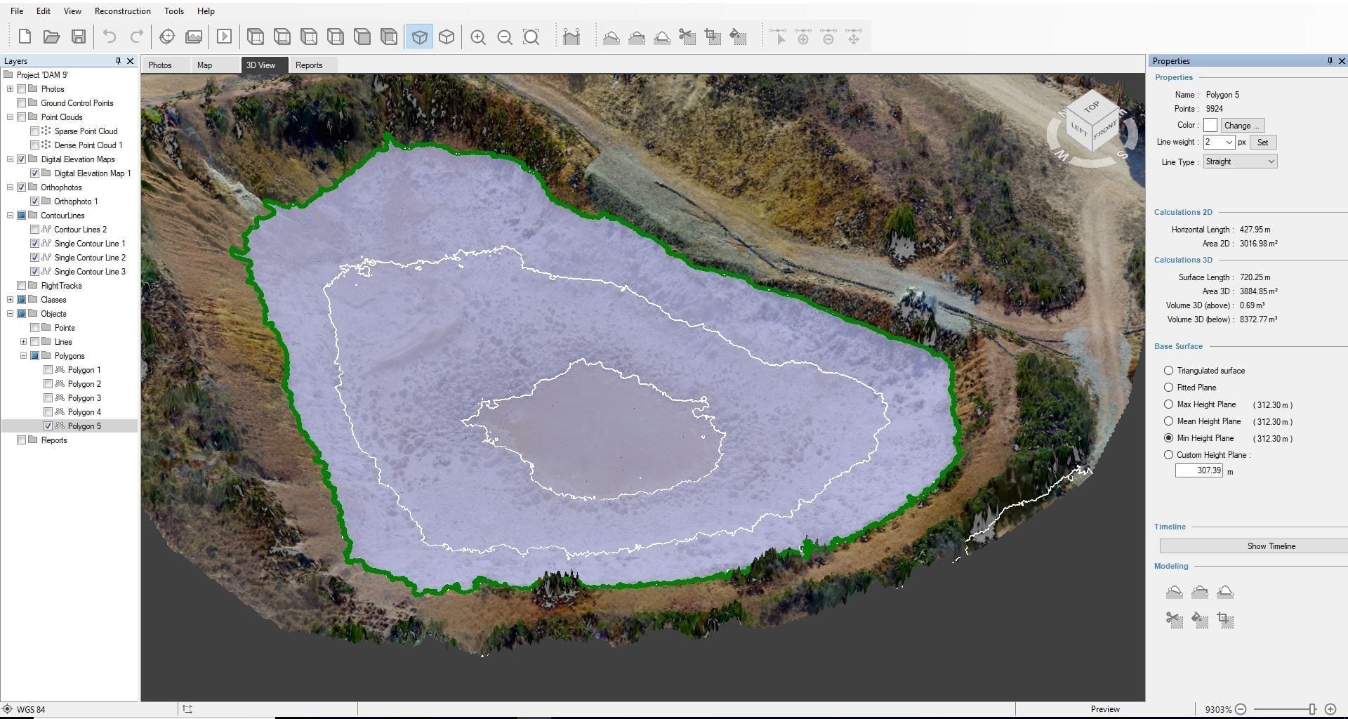
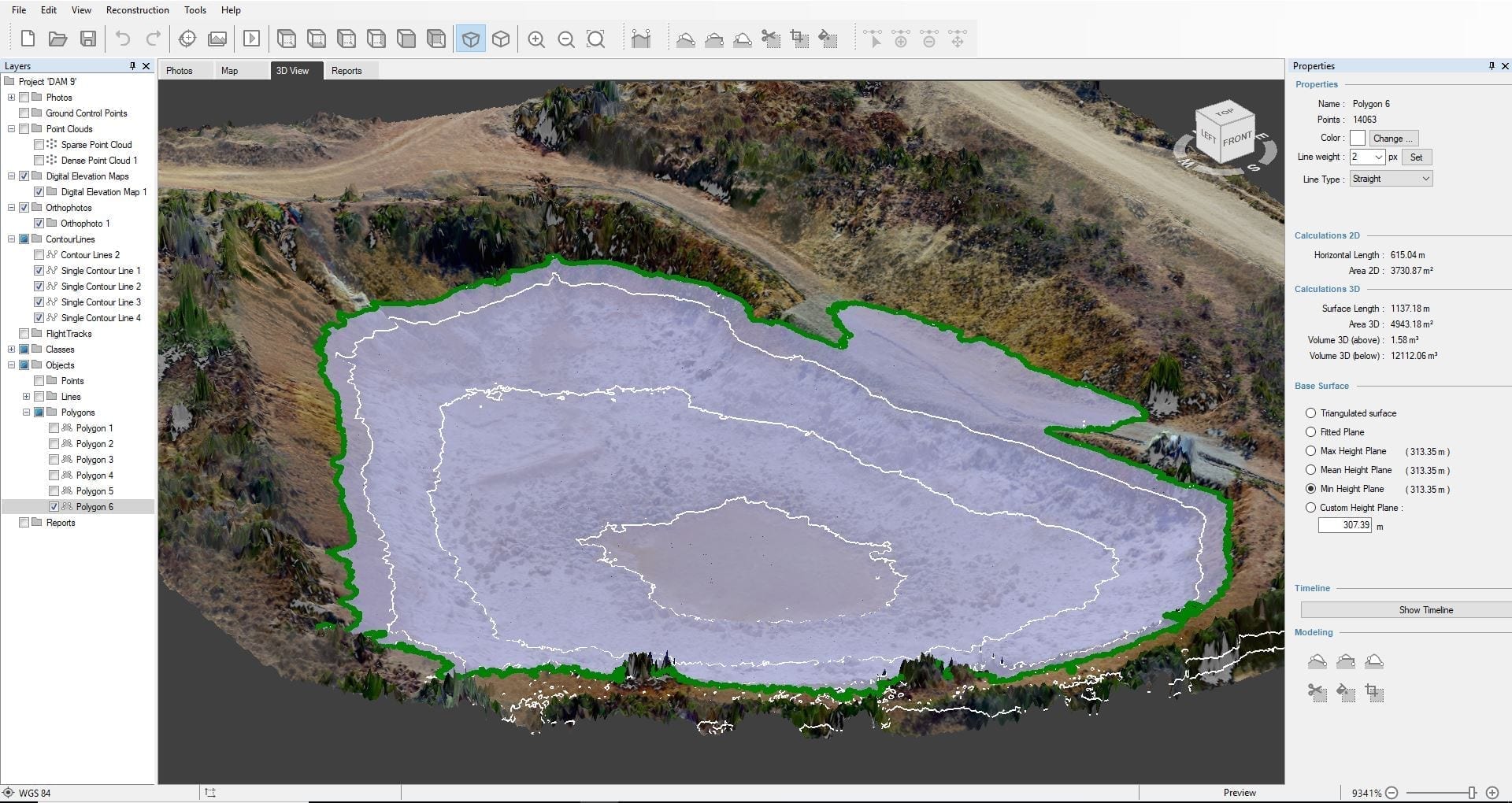
Using the drawn contour line, you can check the cross-section of the surrounding slopes and evaluate if there are any cracks that would allow the contaminated water to leak to the surrounding area before even reaching the critical point.
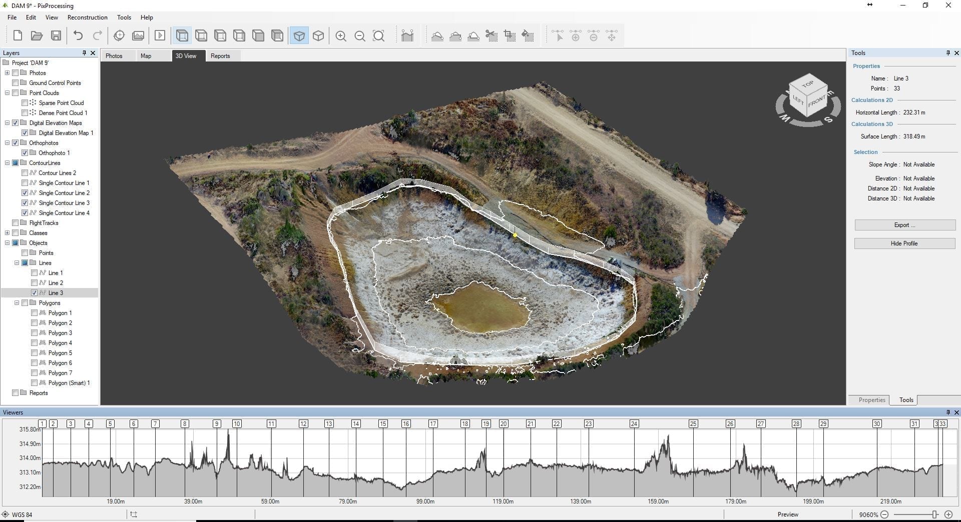
The full 3D view of the quarry allows for a fast and simple method of evaluating the area and predict where to project the pathways to redirect the toxic water. The drawn line will not only show the distance between two selected points but will also give you the full length of different segments connected by the same line. That line will also show if the surface is even or the sloping angle, highest/lowest points, distance between selected points.

Irreplaceable assistance, while projecting the pathways, is provided by the Pixpro modeling tools. Just add / remove hypothetical barriers, dig virtual pathways. In order to track changes over time you can use the Compare in Time function, where you can combine a newly generated DEM with a previous version and receive measured volume changes in places of interest.

Mine monitoring and closure – safe and sound with photogrammetry
It’s an accurate, time saving and most importantly – safe solution for mine maintenance.
A detailed 3D model of the copper quarry achieved just over 1 hour (excluding the logistics to the location time).
Since the closed mine is toxic, utilizing drones provides health and safety for the surveyor. Analyzing objects with this innovative method, eliminates any need for physical contact with the toxic environment.
Usually, the abandoned mines are hard to access, so the drone solves this problem as well.
The reconstructed 3D model of the mine reveals a lot of valuable information, and a wide range of Pixpro functionalities allows analyzing as well as model the hypothetical situations and calculate the hypothetical solutions.
The collected and processed information has an enduring value. It is very important when we aim at the monitoring of the changes in the abandoned/ closed mine.
Related Blog Posts
Our Related Posts
All of our tools and technologies are designed, modified and updated keeping your needs in mind

Buying a Used Drone - Mavic 2 Pro in 2024
Buying used gear is an excellent way to save money and obtain something that may not be on sale anymore. With drones reaching the 4th or 5th technological generation, the used drone market is becoming more extensive.
Quick Vehicle Accident Documentation with Photogrammetry
Photogrammetry is the ultimate form of documentation. If you are adept at doing photogrammetric scans, you can gather photographic data, resulting in a 3D scene that you can measure. Invaluable when the dependability of the data means solving disputes between people during legal processes.
Weather Conditions for Photogrammetry - Rain and Fog
Winter in the northern hemisphere can be a severe limiting factor for millions of jobs. Including us - photogrammetrists who do aerial photogrammetry. In this blog post, we push the limits of wet weather and do some tests in heavy fog conditions and during light rain.
Ready to get started with your project?
You can choose from our three different plans or ask for a custom solution where you can process as many photos as you like!
Free 14-day trial. Cancel any time.