Weather Conditions for Photogrammetry - Rain and Fog
 Lukas
Zmejevskis
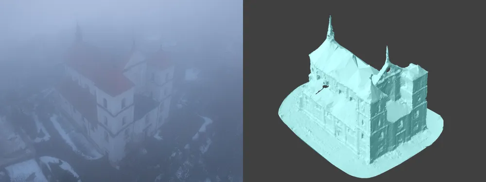
Winter in the northern hemisphere can be a severe limiting factor for millions of jobs. Including us - photogrammetrists who do aerial photogrammetry. In this blog post, we push the limits of wet weather and do some tests in heavy fog conditions and during light rain. We will use a consumer-grade drone, the DJI Mavic 3 Pro, with weather-sealing ratings. We will do some simple orbital scans to evaluate how much bad weather is too much for an excellent 3D reconstruction.
Image Quality in Fog
For photogrammetry - image quality is essential. Even if everything else, like overlap and coverage, is perfect, the entire image set will only be valid if the image quality is there. In poor weather or lighting conditions, image quality will become a limiting factor, even with the best drone on the market. We tested in foggy conditions, with a heavily overcast sky and at the brink of sundown in winter. It is the worst combination of lighting and weather you can imagine.
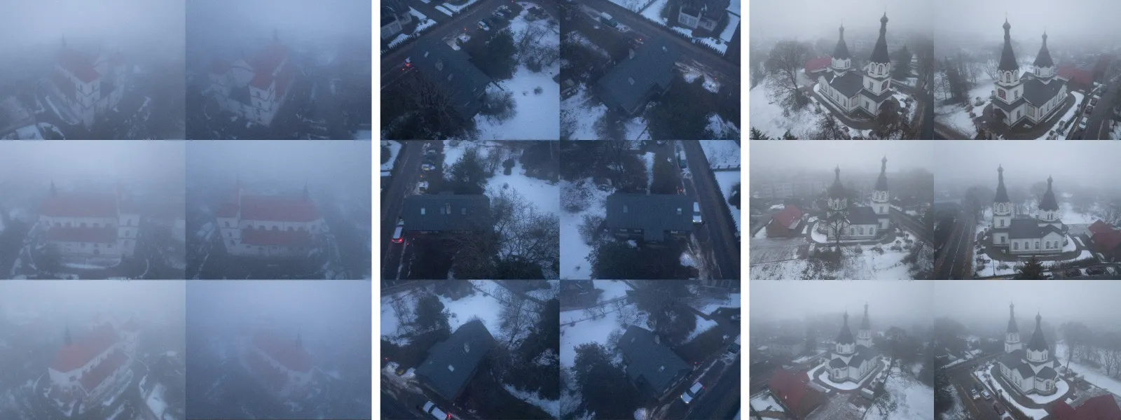 We took photos where we had to push ISO values to compensate for the lack of light. We made the shutter speed as low as possible. We flew slowly to gather as much light as possible without introducing motion blur. For the horrendous conditions - we got acceptable photos.
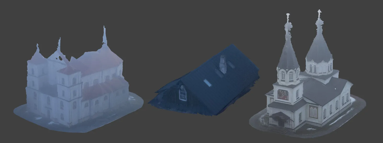
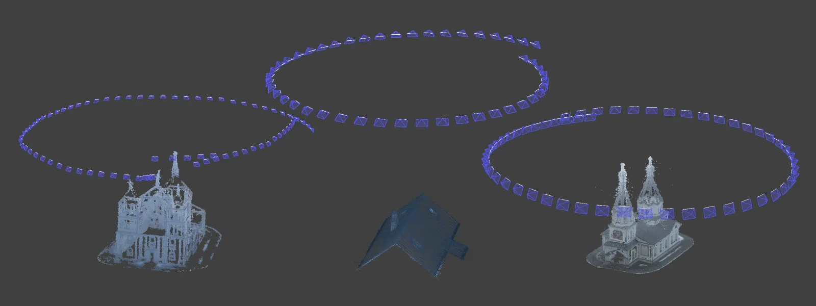 After doing hyperlapse orbital scans in these conditions, we ran the photos through Pixpro photogrammetry software. We created 3D models in our usual workflow. The results, as expected, are not impressive.
 Flight Safety in Adverse Weather
Drone malfunction due to water ingress is another risk you will take if you decide to fly in the rain. How moisture-resistant are drones? A tricky question to answer. If there is no official IP rating for the drone you are using - it will depend on many factors. We have some practical advice on evaluating the weather in terms of moisture:
-
No rain, but 100 percent humidity is generally acceptable for many drones. However, operating in 100 percent humidity for many flights in a row could be detrimental.
-
Light drizzle, which barely registers on surfaces, is also acceptable.
-
Freezing rain - liquid raindrops in freezing temperatures - is a no-go in any case, even if the volume of the rain is meager.
-
Very light snow with little wind - safe for many drones.
-
Rain or drizzle that registers on puddles or covers surfaces with tiny drops is the cutoff point when you should consider not flying.
-
Any snow or rain with lots of wind is also hazardous.
-
Heavy fog covers your drone in moisture, which is okay for many drones if they are not flying for long periods.
Raindrops Falling on Your Lens
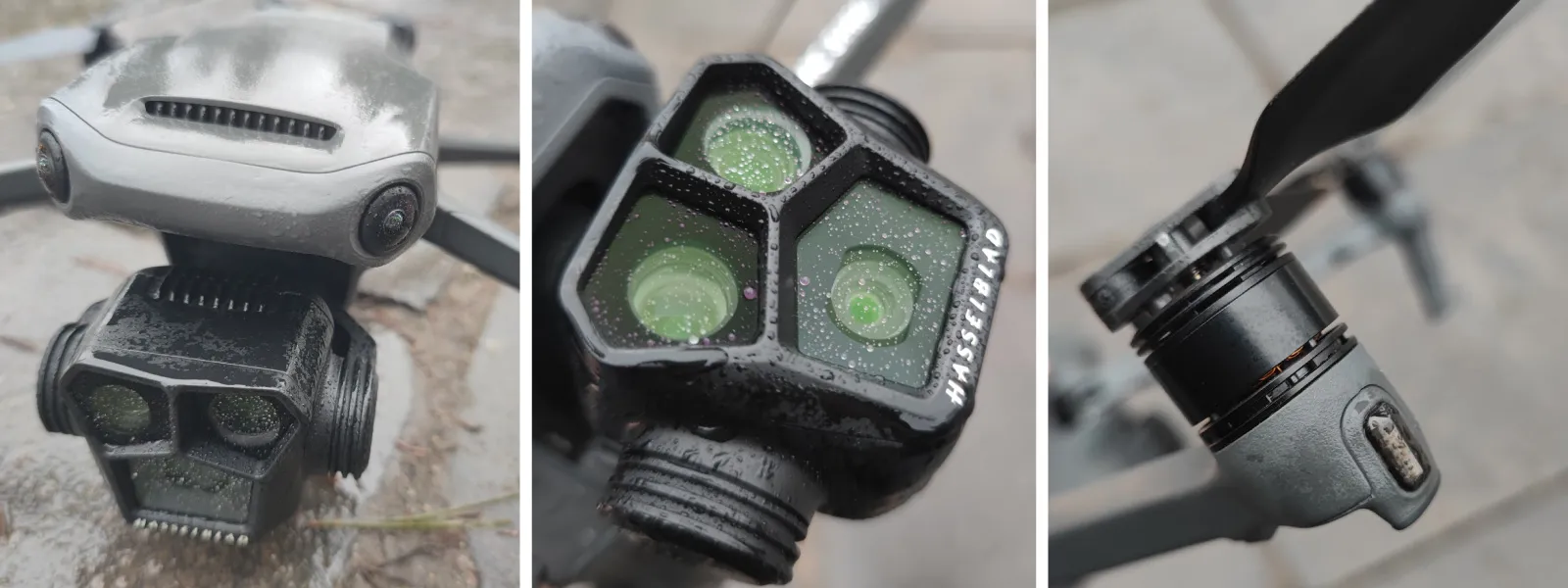
The one factor that most people forget. Even if you consider the conditions safe to fly and the lighting sufficient - one or few stray drops on your camera lens may ruin the image quality beyond usability. Of course, you will see that in the live feed of your drone, but that is something to keep in mind. You may need to land, clean your lens, and get back up there, which will pause your mission and reduce the available battery resources.
 Atmospheric Haze and Tele Lenses
If you have a drone with an excellent telephoto camera, such as DJI Mavic 3 Pro or DJI Air 3 - you may be tempted to use the 3X lens combo for your scans. And as we tested before - it is a perfectly viable option if you want to increase the distance to your subject. But if you do - you put more atmosphere between the lens and the subject. It means that particles in the atmosphere become more of a factor, creating atmospheric haze. To test this, we made two scans in rainy conditions with the Mavic 3 Pros 1x and 3x camera combinations.
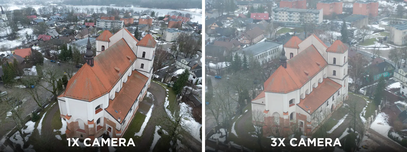 While you can see a clear difference between the photos caused by atmospheric haze and droplets on camera lenses, 3D reconstruction was still quite good with the hazy set from the 3X lens-sensor combo. For this example, we did not use any post-processing. With some raw development - the result would be even better.
Dimensional Accuracy
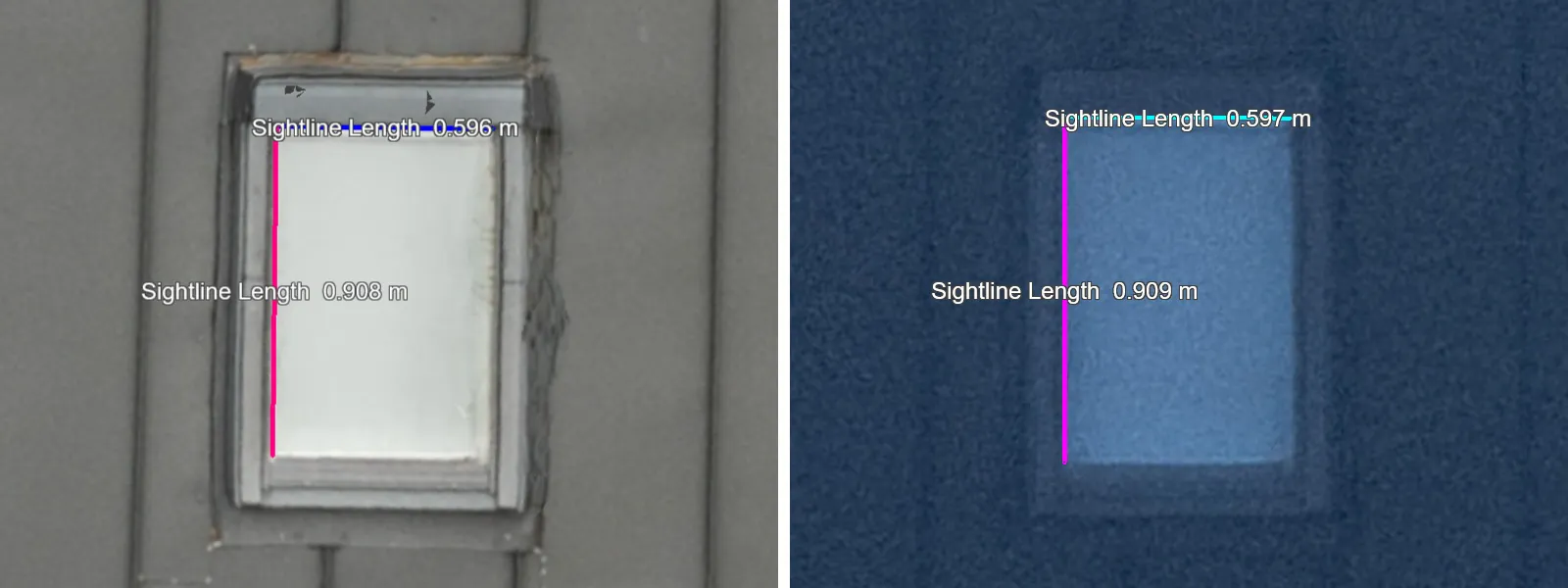
 We also tested a real-world scan example in the same atrocious foggy conditions - a roof scan for measurements. We did a scan later in excellent condition of the same roof and had some known roof window measurements as control. Surprisingly, the seemingly poor scan retained dimensional accuracy, and we can still measure the scene reliably. The 3D model looks terrible visually, but if your sole purpose is measurements - that might not be a huge issue.
 Raw Processing and Lightroom Dehaze
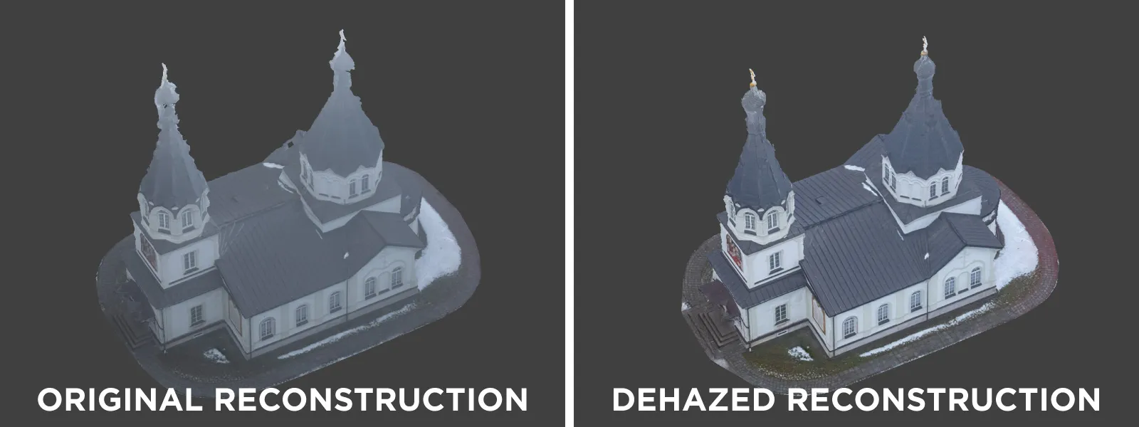
Finally, we tried raw post-processing for the foggy test sets to improve the image quality. We used the dehaze slider in Adobe Lightroom Classic, which is meant for precisely these situations, alongside other contrast and exposure adjustments. Our usual raw post-processing workflow can be found in a previous blog post; this time, we followed the same logic but added more exposure because the dehaze tool darkens the image a bit. We also did not use any noise reduction.
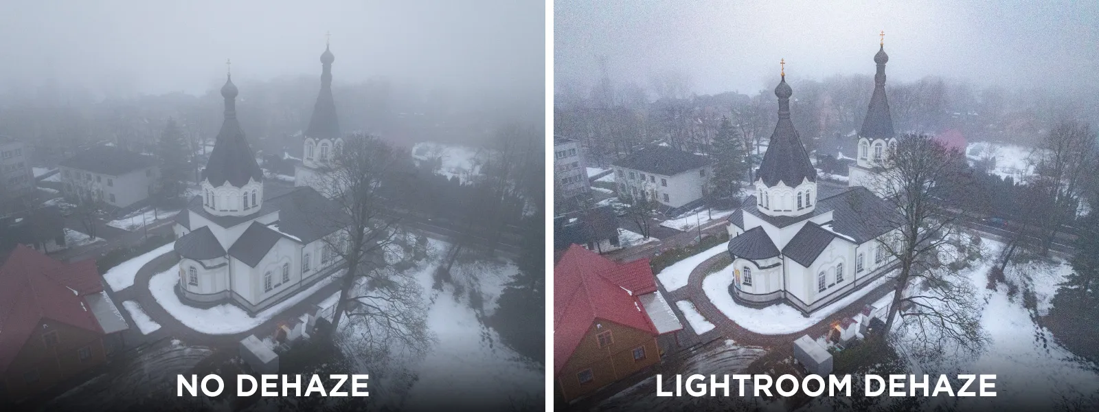 For one of the examples, we managed to visibly and noticeably improve the 3D reconstruction results, which is splendid. Another positive point for capturing your photosets in raw format is when the conditions are not ideal. However, this applies only to the one least affected set; other more hazy sets saw only slight improvements.
 Conclusion
You can push the limits of drones and photogrammetry. Do it safely, according to our guidelines and experience - and you may turn a seemingly lost situation into good results. We were surprised how dimensional accuracy remains unaffected even if the photos are hazy and incredibly noisy. Overlap, coverage, and lack of motion blur remain the pillars of image quality - and if you have those - you can always try to combat every other condition working against you.

Photographer - Drone Pilot - Photogrammetrist. Years of experience in gathering data for photogrammetry projects, client support and consultations, software testing, and working with development and marketing teams. Feel free to contact me via Pixpro Discord or email (l.zmejevskis@pix-pro.com) if you have any questions about our blog.
Related Blog Posts
Our Related Posts
All of our tools and technologies are designed, modified and updated keeping your needs in mind
Handheld Photogrammetry Construction Interior Scan Use Case
Interior 3D scanning can be useful in a myriad of ways. In this article, I present a scan of a residential building construction site, with its foundation walls and roof almost complete. Further construction will require some visualizations and design according to “the fact.”
Event Planning with Photogrammetry – Use Case from A to Z
Photogrammetry for event planning was the first use case I wrote about on this blog. Now we are back with another venue and an event that will take place in a couple of months.
Individual Property Architecture - Photogrammetry Use Case
If you love doing your own small-scale renovations, planning, and building—this use case is for you. Photogrammetry can provide a framework that allows you to eliminate dozens of questions, replace traditional time-consuming methods, and reach a better result.
Ready to get started with your project?
You can choose from our three different plans or ask for a custom solution where you can process as many photos as you like!
Free 14-day trial. Cancel any time.
.svg@webp)