.svg@webp)
Natural Pathway Formation - Measurement and Monitoring Aerial Photogrammetry
 Lukas
Zmejevskis
Lukas
Zmejevskis
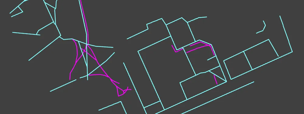
People do not like inefficiency. Sometimes, it is such a subconscious drive that we do not even think about it. A good manifestation of that is "naturally" occurring paths. People do not like wasting time walking in circles, even if the infrastructure says otherwise. A promising sign of urban planning is when there are no such paths, but this is not the case where I am from. Analyzing such paths for development, urban, and park planning is a perfect use case scenario for photogrammetry. We are dealing with scaled, spatial data that needs decent resolution and precision. You know where this is going.
Why There are Beaten Paths?
Paths form because of human nature, and it is absolutely understandable. Walking around without a real reason is against evolutionary signals in our brains. Yes, walking is good and healthy, and truthfully, modern humans do not get enough of it—but 100,000 years of evolution in our brains say otherwise.
Yes, I am overexplaining the concept of "convenience." We are drawn to the path of least resistance unless we consciously fight against it. So, rather than forcing everyone's brain to adapt to such conditions, we must change our environment. And let me say, former Soviet planning or even modern architects do not always get it right. I have an example where an alarming number of formed paths signify inefficient space utilization, lack of logic, and "human" design.
Photogrammetric Data Collection
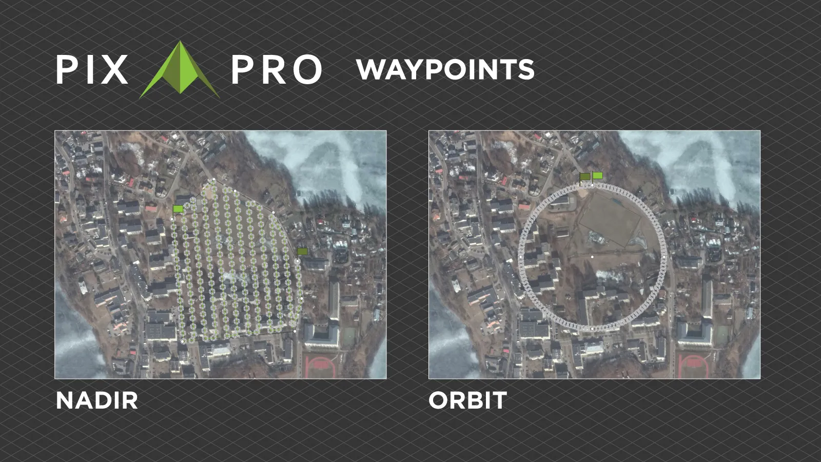
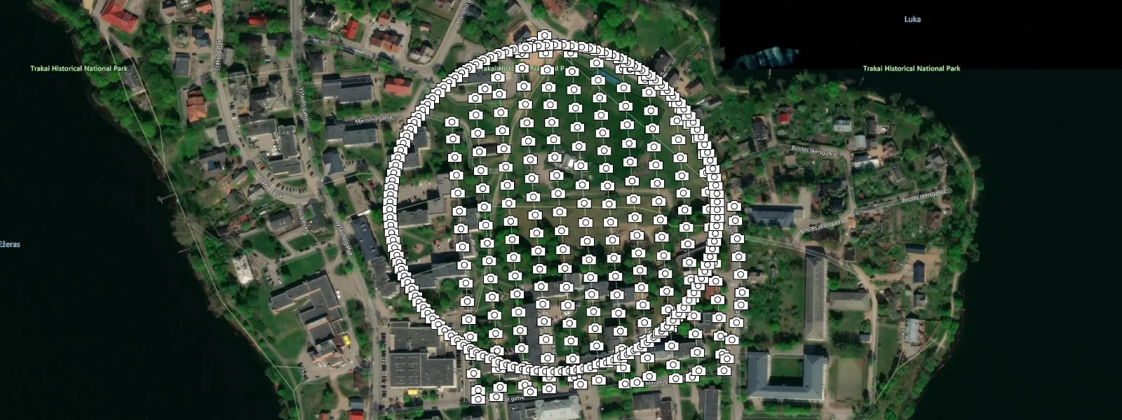
For data collection, I am using the DJI Air 3S—my current favourite drone for all content creation—and, of course, the Pixpro Waypoints service for automated flight planning. We are taking our bread-and-butter approach: combining a nadir grid flight for orthophoto creation with a huge orbit around the center of the area for oblique data calibration.
 Oblique orbit data allows better photo bundle adjustment, ensuring we have a well-calibrated set. There are no distortions, which, in turn, means that our measurements will be accurate and that the 3D scene is true to life. We are not using any RTK data, but that is often unnecessary, as relative accuracy is achieved with solid photogrammetry and a regular GPS framework. RTK data and GCPs are only necessary when absolute accuracy is critical.
 Example Data Processing
I acquired 358 photos in about 30 minutes of flying in ridiculously cold, windy spring conditions. I shot in 50-megapixel mode with the Air 3S and in RAW format. I processed the RAW images in Adobe Lightroom Classic with conservative, neutral settings—just enough to accurately represent the conditions in real life.
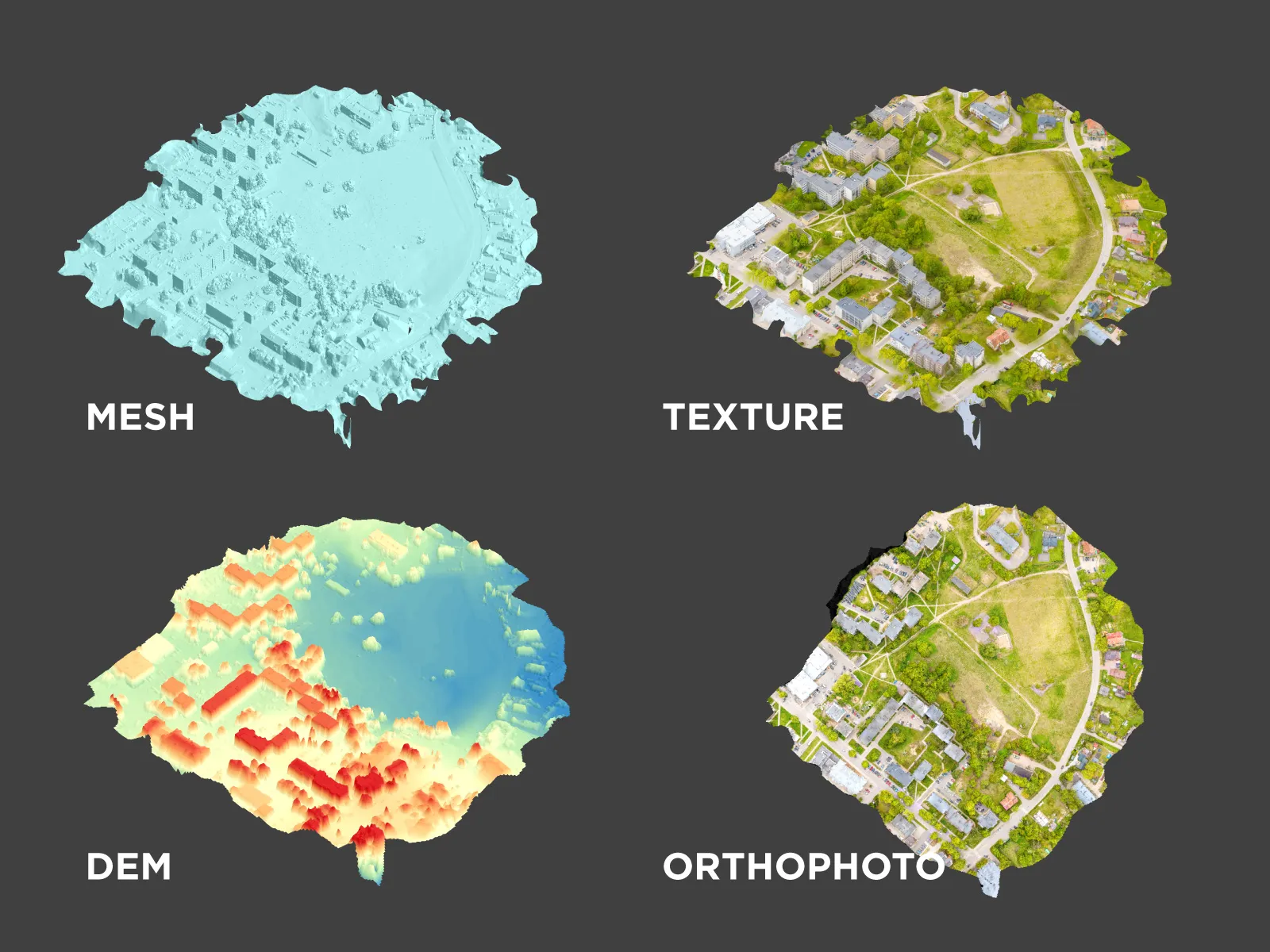
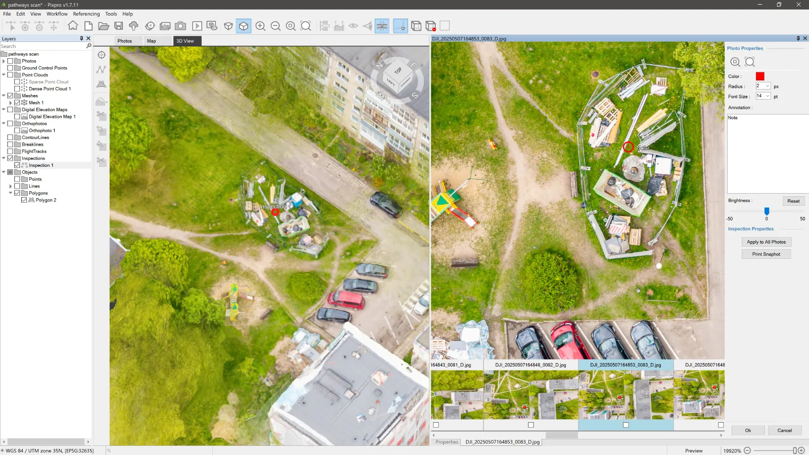
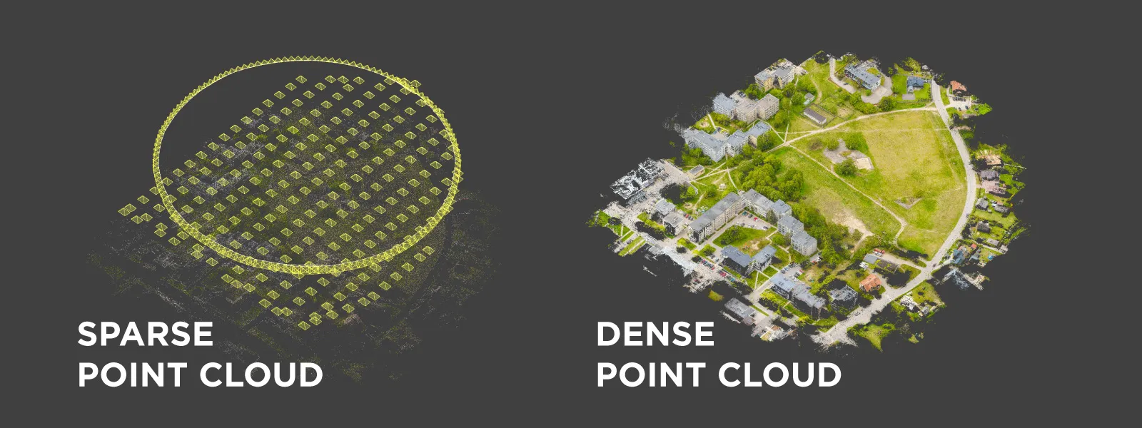 After conversion, all photos were processed in Pixpro photogrammetry software, mostly using default settings. I generated a dense point cloud, 3D mesh, texture, digital elevation map, and orthophoto image at 2-centimeter GSD resolution. All in all, processing 350 50-megapixel photos took about 3 hours while I was away from my machine.
 Example Data Analysis
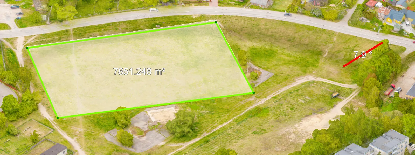
It is a real web of paths in this part of town. We can analyze them in Pixpro in many fundamental ways. We focus on and provide good workflows for obtaining measurements. Here are a few examples of linear measurements acquired by drawing lines on your 3D model. In Pixpro, this can be done on any of the 3D layers.
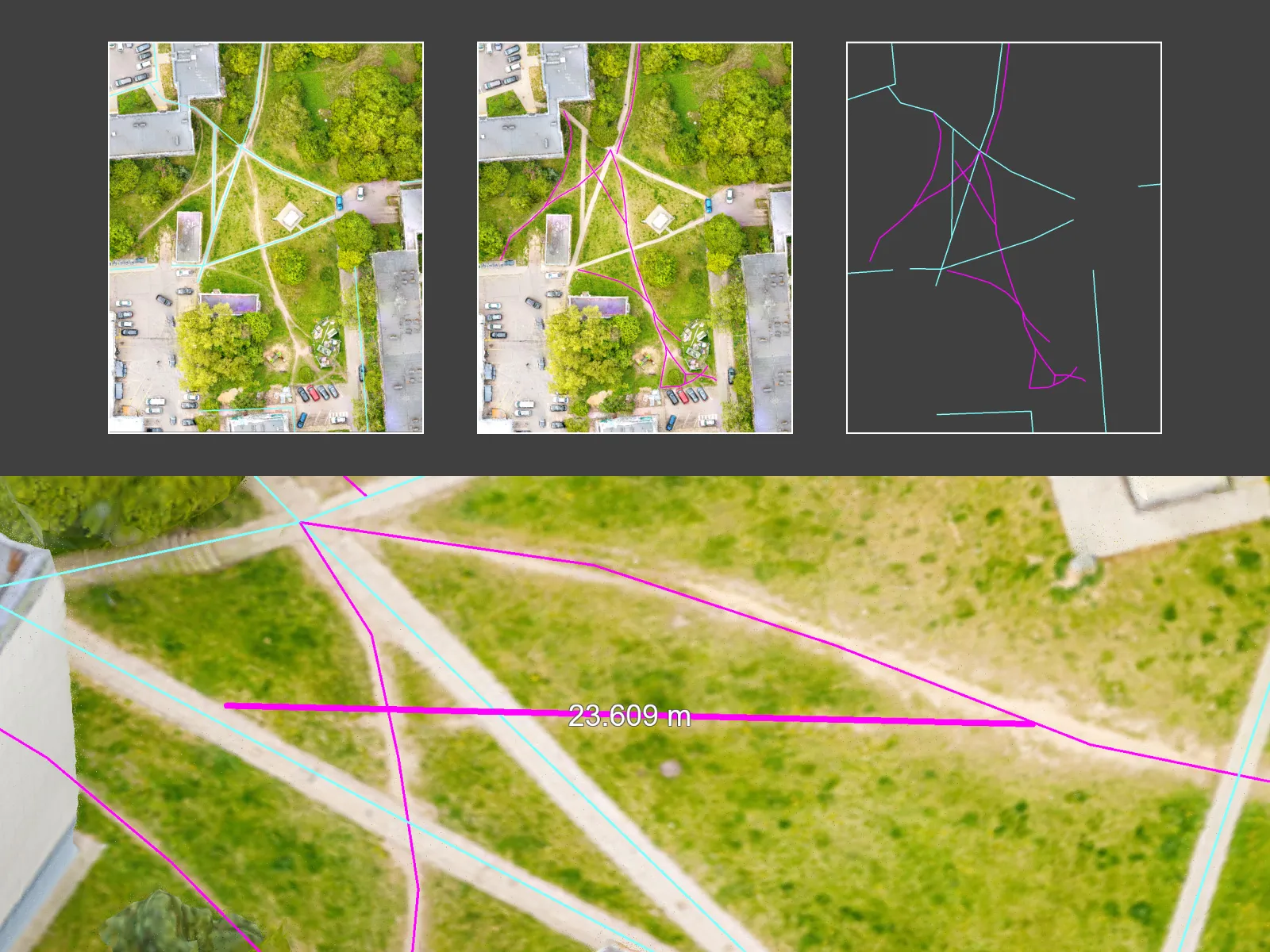
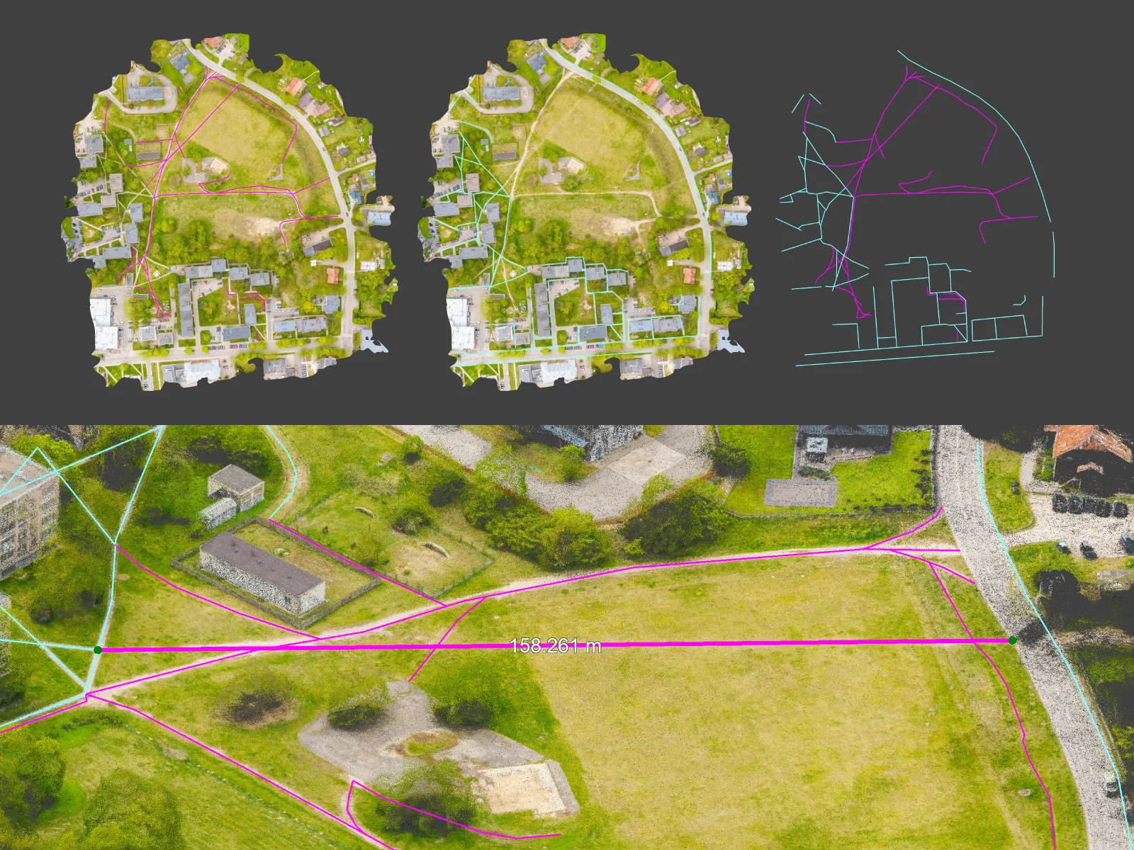
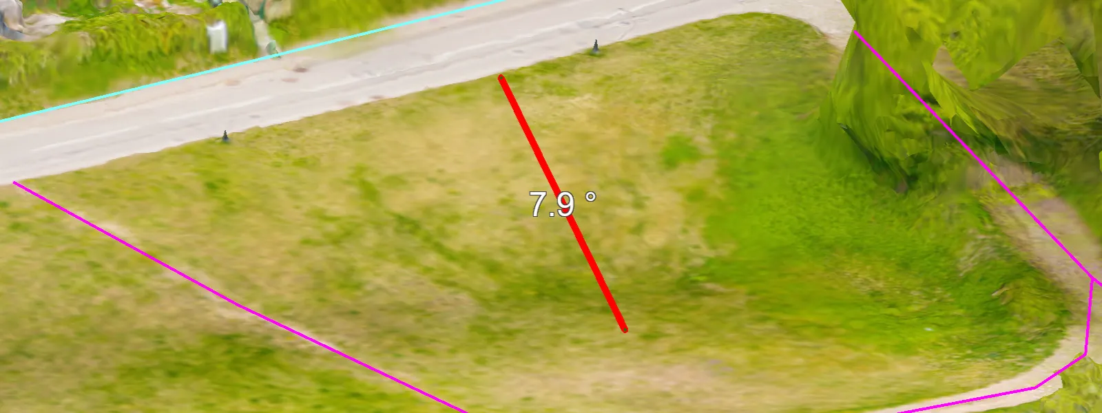
Of course, we also have the Z-axis to measure. So, we can measure the slopes of all pathways to determine which parts may be too extreme for comfortable walking. Local regulations seem to dictate that the longitudinal slope of a sidewalk should not exceed 5 percent for safe and comfortable walking (so, less than 3 degrees of slope). This can be easily measured in Pixpro using line profile measurements.
 Of course, we also have area and volumetric measurements. These might not be as important in this use case. However, if some earthworks or construction is already in process, volumetric measurements from aerial scans are by far the easiest way of obtaining stockpile, pit, or excavation volumes. The accuracy of such measurements will depend on how detailed the scan is.
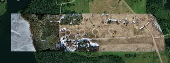
 Finally, there is always the invaluable, accurate, high-resolution visual inspection from a birds-eye view. This perspective shows an entirely different view of the area compared to our usual human height. You can immediately see the patterns and possible detailed reasons why people naturally form each path.
 Conclusion
Four hours of total work, and we have a decently accurate digital twin with some data analysis. Photogrammetry embodies efficiency, just like the paths we see in the area. In the hands of competent urban planners, this is all the data they would need, even without ever visiting the area. We can always export this data to specialized software like Autodesk's Civil 3D or similar. The data will retain all the referencing information, and Pixpro supports the most popular export formats. There is no reason whatsoever to use more outdated, less visual, and less efficient urban planning methods.
Photographer - Drone Pilot - Photogrammetrist. Years of experience in gathering data for photogrammetry projects, client support and consultations, software testing, and working with development and marketing teams. Feel free to contact me via Pixpro Discord or email (l.zmejevskis@pix-pro.com) if you have any questions about our blog.
Related Blog Posts
Our Related Posts
All of our tools and technologies are designed, modified and updated keeping your needs in mind
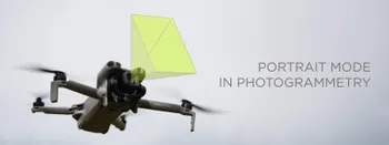
Portrait Orientation in Photogrammetry: When It Actually Helps
Is there anything to gain by scanning in portrait instead of the usual landscape? Sometimes, a little. But orientation is one of the least important decisions you make on a scan, and it is worth understanding why before you give it any more thought than that.
DJI Lito X1 for Roof Photogrammetry: Solar and Inspection Use Case
Small drones are the best tool for residential and even commercial roof photogrammetry. They are quiet, attract less attention, are easier to fly fully within regulations, and they are affordable.
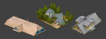
Large Property Photogrammetry – Real Estate Development Use Case
Property scans are one of the most common use cases, especially for our software. Pixpro is affordable and works well with RTK data and ground control points when necessary.
Ready to get started with your project?
You can choose from our three different plans or ask for a custom solution where you can process as many photos as you like!
Free 14-day trial. Cancel any time.