.svg@webp)
Ground Control Points. The Cornerstone Of Accuracy
 Lukas
Zmejevskis
Lukas
Zmejevskis
Ground control points (aka GCPs) are the cornerstone that makes the highest accuracy mapping possible. With sleek coloring, well-laid shading, and realistic 3D modeling in photogrammetry, GCPs are the tool used to bring the photogrammetric project to a precise absolute position and scale.
What is the Ground Control Point?
GCP is a mark on the target surface linked with a known precise geographical coordinate point. Usually, a surveyor places a black-and-white checked mat or any bright object to state the ground control point. The GCPs are used for accurate georeferencing to indicate coordinates of a point on the surveyed surface, thus resulting in the most lifelike 3D model in the end. GCPs are widely used when processing photogrammetric image sets.
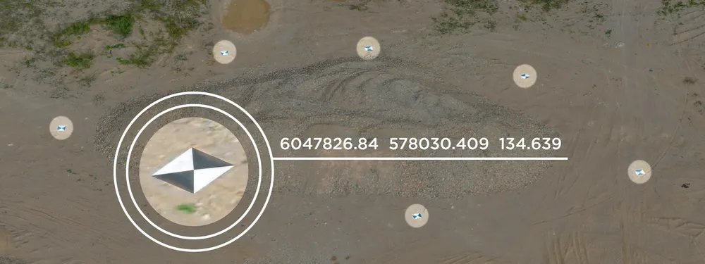
Ground Control Point examples
GCPs are acquired using professional, survey-grade georeferencing devices. It is necessary to have at least 3 GCP points on a target object for an acceptable result. Any key point on the reconstructed 3D model or mesh may be used as a georeferencing point and linked with the separately provided coordinates.
GCP Acquisition Techniques
Ground control points are defined using professional georeferencing equipment, e.g., RTK capable devices. RTK is an abbreviation for the Real-Time Kinematic. RTK devices provide satellite GPS corrections using ground base stations as reference. In cases of high-end equipment, the coordinates may be as accurate as 1 cm in value. This type of coordinate acquisition allows constant rectification/amendment of coordinate data to maintain positional accuracy.
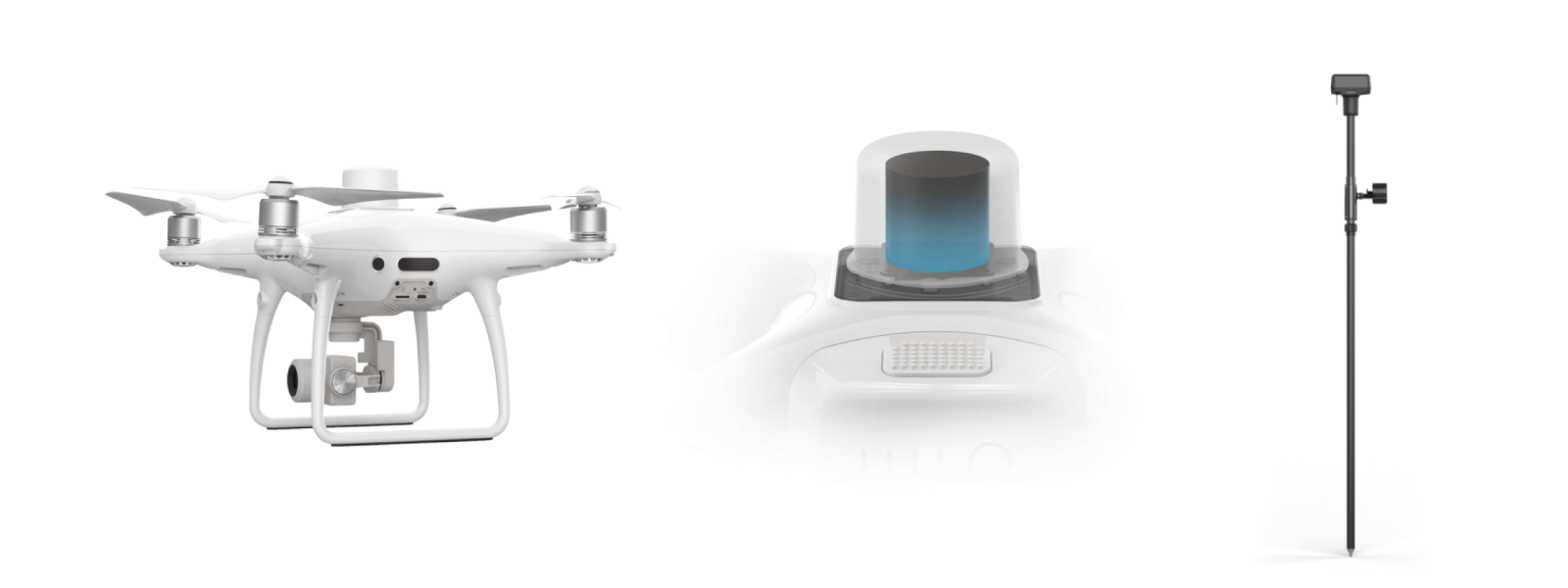
DJI Phantom 4 RTK with D-RTK 2 GNSS mobile station
The second way to ensure positional accuracy is to use PPK. PPK stands for post-processing kinematic, and the term suggests post-processing techniques complement the coordinates data after collecting the imagery. PPK technique is used as a supporting data source to the RTK method to boost the precision of the acquired data.
So, surveyors can use combinations of the following devices to achieve desired levels of accuracy:
- Consumer or RTK grade GPS data in the UAV or a camera.
- PPK workflow to increase the RTK data accuracy in the acquired images.
- Professional GCPs on the field made with survey-grade data.
In some simple cases, any Maps’ georeferencing data may also serve as a tool to make the 3D model more related to an actual object in reality. It all depends on the surveyor’s budget, work requirements, and desired accuracy of the future 3D reconstruction.
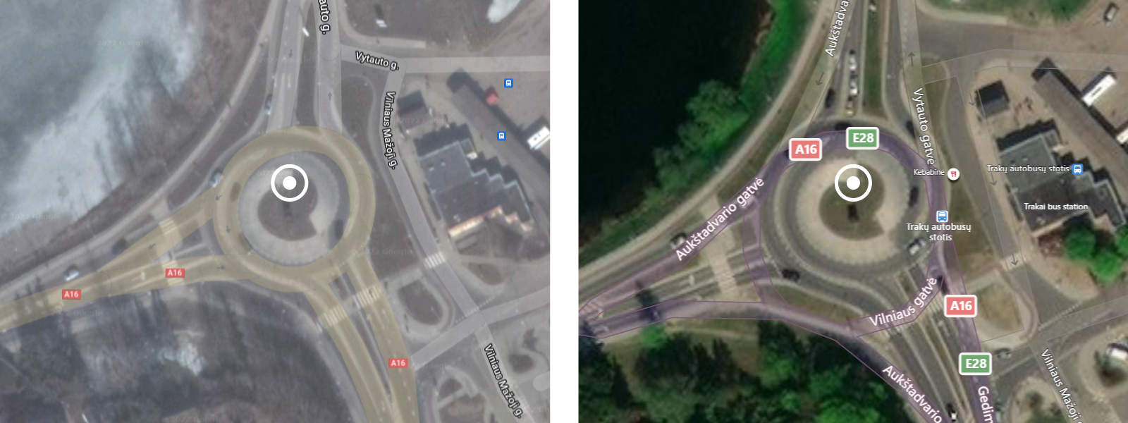
Google, Bing or other map services could be used for georeferencing your project
In cases of low accuracy of UAV GPS devices, a drone pilot may use ground control points to get professional results. In many cases, this is the most popular workflow that requires a good number of GCPs to be made. Professionals, who perform the imagery processing, upload the acquired GCP coordinates into the project and manually pick the key points (projections) on the point cloud to indicate the geo-coordinates on the reconstructed 3D object. Having RTK or PPK level data does reduce the amount of GCPs needed. Still, the ultimate accuracy required for professional surveying tasks always involves producing ground control points.
Placing the Ground Control Points
Depending on the project’s purpose, surveyors apply different strategies in placing the checkerboards on the ground surface. In some cases, marking the perimeter may be the best option to ensure accurate georeferencing. When the most important thing is producing the 3D map, i.e., the calculations are expected to be made on the 2D level, while the volume and elevation levels are not of great importance, perimeter placement may prove to be the best solution.
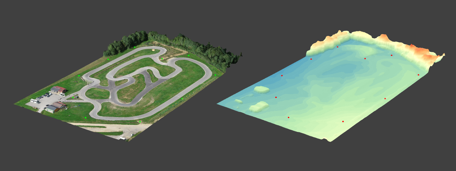
Ground Control Points on an object with minimal elevation change
On the second thought, in cases of a need to make elevation and surface inclination measurements, one will find it trustworthy to place the checkerboards both on the perimeter and scatter them all over the target area equally for scanning the ground surface with the RTK or any alternative device. Thus, pondering on the checker location strategy can add value and ease to your project in terms of the accuracy of the reconstructed model.
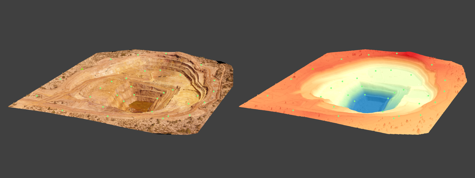
Ground Control Points on different elevation levels
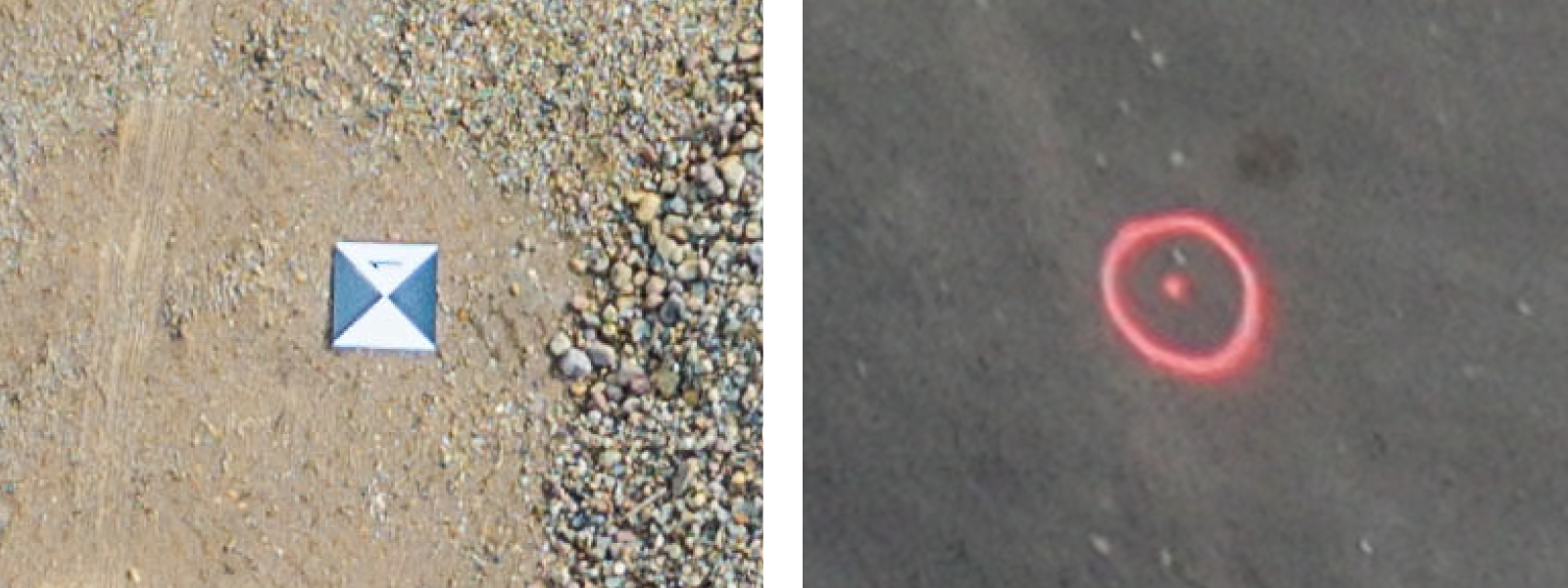
One more thing to decide before the UAV flight is the size of the checker or a mark, be it a static object on the ground or a bright plate to denote the exact point for the coordinate. In the case of the nadir flight plan, one should think of the height and visibility of the marker from the planned elevation. What is more, the shadowing or illumination of the terrain can infer inaccuracies due to the low contrast between the GCP tag and the coloring of the soil, greenery, gravel, etc. Thus, in any case, it is good to select the marker color which will be well different from the sunlit ground or shadowy pavement in the evening.
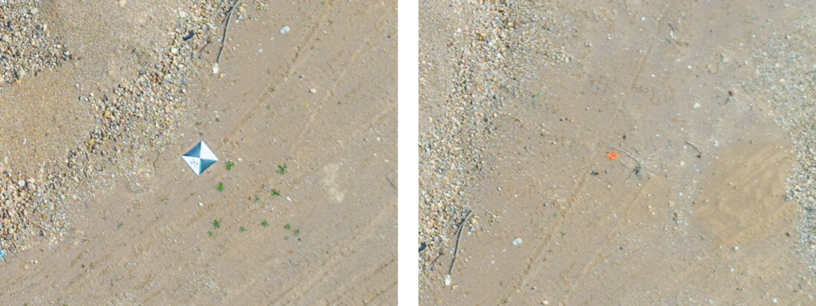
Clearly visible standard GCP target marker vs hard to see sprayed down dot
To Georeference or not to Georeference?
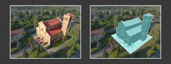
The use of the GCPs highly depends on the project and its aims. When working with location measurements, the correct and exact geodata will bring many benefits, ensuring a higher quality of calculative results. The more valid the reconstructed 3D model is, the better accuracy it brings. Whereas, in cases of the requirement for neat and clean object reconstruction, GCPs are unnecessary. I.e., when the 3D object must replicate the coloring, shadowing, and texture of the target object, georeferencing will not help. Hence, whether to use GCPs or not is in the hands of the professional only.
Our Pixpro photogrammetry software has a number of ways of using GCPs with refined workflows for every situation. Try unlimited ground control point features in a free Pixpro trial.
Photographer - Drone Pilot - Photogrammetrist. Years of experience in gathering data for photogrammetry projects, client support and consultations, software testing, and working with development and marketing teams. Feel free to contact me via Pixpro Discord or email (l.zmejevskis@pix-pro.com) if you have any questions about our blog.
Related Blog Posts
Our Related Posts
All of our tools and technologies are designed, modified and updated keeping your needs in mind
Overlap Between Different Perspectives
Photogrammetry can be simple and rigid or complex and adaptable. Combining different scan patterns adds complexity to the work but improves detail and coverage. We often use examples of combined flights, of which the orbital + nadir grid is a classic. They provide great 3D structure while being easy

Pixpro Waypoints - Automated Photogrammetry Flights for Newest DJI Drones
The latest DJI drones are the most capable flying cameras on the market. If you need a tool like that or a competent machine for casual creation - DJI Mavic 3, DJI Mini 4, and DJI Air 3 series drones are the best.

Accuracy of Your Photogrammetry Project
Accuracy in photogrammetry is a multifaceted point of discussion. We can talk about absolute, relative, or even geometric accuracy, to name a few. No tool or technique can really prove anything beyond reproach.
Ready to get started with your project?
You can choose from our three different plans or ask for a custom solution where you can process as many photos as you like!
Free 14-day trial. Cancel any time.