Quick Roof Solar Power Plant Inspection - Pixpro Photogrammetry and Waypoints
 Lukas
Zmejevskis

Medium-sized solar power plants on commercial roofs are popular for businesses to utilize their existing assets. We are seeing more and more of them, which are excellent clean energy supplements for industry and environmental sustainability. In this article, we have a use case of documenting and inspecting a newly built solar array that began operating recently. We will go through our process of aerial photogrammetry from start to finish.
Subject and Use Case
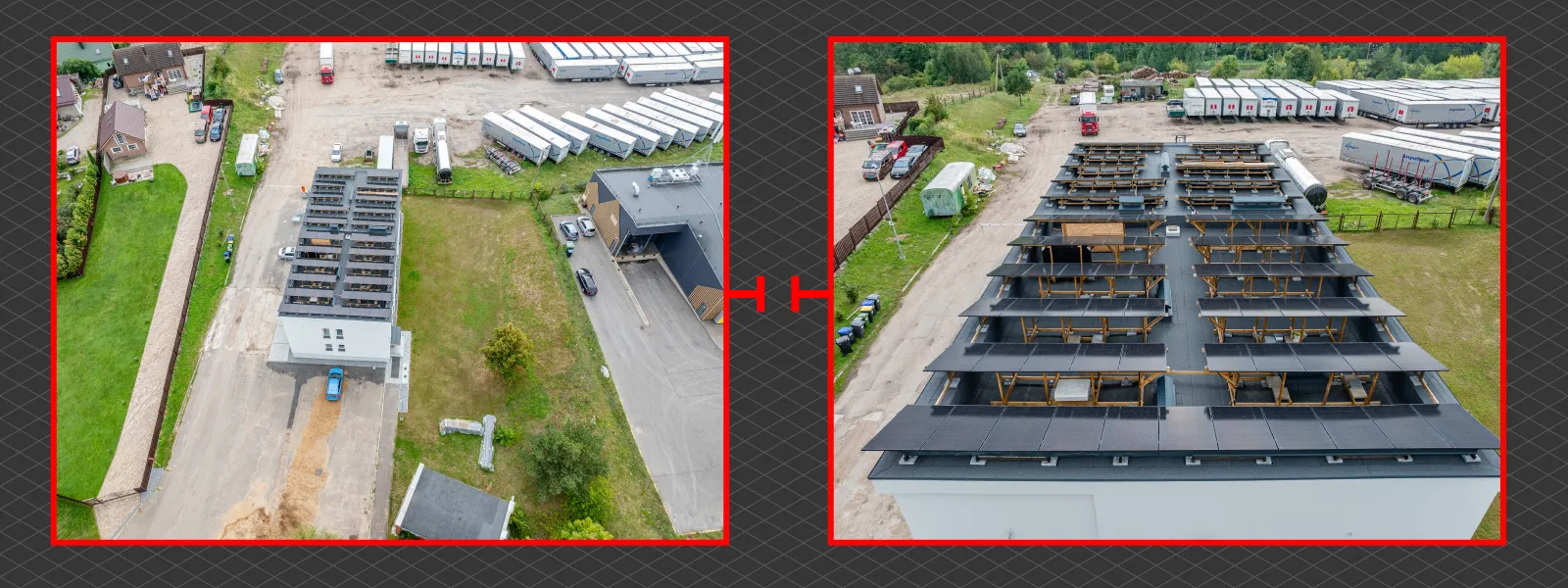
Our subject is a familiar building which has changed quite a bit over the years. We are scanning this particular building for a 3rd time during its various phases. As a flat roof replaced a more traditional sloped shingle roof for this small commercial building, a very accessible space for a medium-sized solar power plant became available. Our previous scans helped to do the initial measurements, while we see the final solar array construction in this one. Our purpose is to capture the current state of things with some capability of more close-up inspection.
Flight Planning
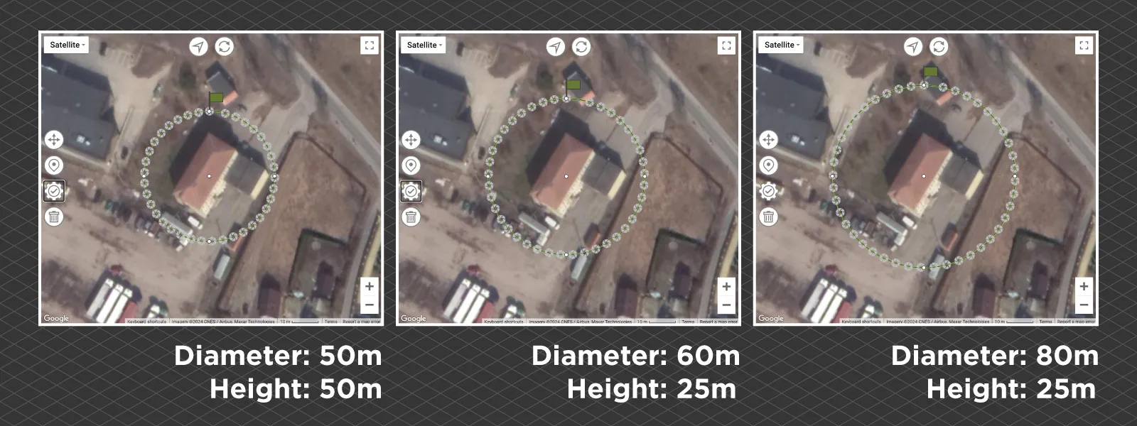
For this capture, we combined Pixpro Waypoints service orbitals with a few manual photos for a closer inspection. We did three orbits with different specifications: one orbit for the roof, with the camera pointing more downward, and two more orbits for more wall and close-up detail at lower altitudes. Walls of freshly renewed buildings are more problematic to scan because they are clean, white, and relatively featureless. This is why new and pristine buildings are usually a downgrade in the eyes of a photogrammetrist.
 However, our main subject is the roof and the solar panel arrangement on top of it. This is why we added three manual passes over the roof, flying quite close to the panels, in case we need to inspect any particular spot in more detail. In this use case, we do not require highly detailed digital inspection because the roof is easily accessible if we notice something wrong with the initial aerial scan.
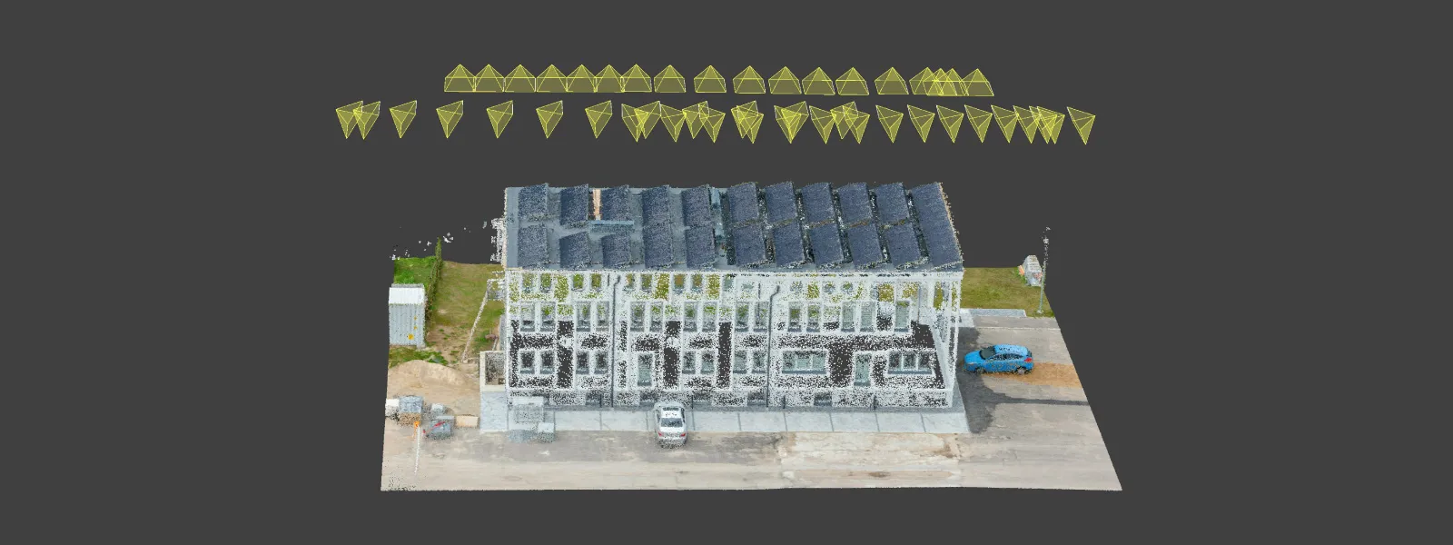
In total, we took 183 photos in 10 minutes using our DJI Mavic 3 Pro, using its main camera only. Each orbit from Pixpro Waypoints service has the optimal number of photos for the circumference you choose, so each orbit has a great balance of detail and efficiency. If you ever want to add more detail using our orbitals, just take more of them at different altitudes and locations, as we did in our overlapping orbitals article.
Adding Manual Photos
The methodology of adding manual, specific-purpose photos to an otherwise standard orbital or grid scan is quite simple. There are two main rules to follow if you want to do that:
1. Add photos with a clear visual connection to the standard ones (orbitals in our case). If you are taking pictures and doubt they do - add some "connective tissue" before or afterward. What this means is that the photos you wish to include in a single scan cannot be too different from the ones "already there." For example - if you have a very far orbital scan and include an extreme close-up - this will not work, even if you took care of everything else. The perspective has to be within some degree of similarity; otherwise, technically, you are doing two different scans and not a single coherent scan.
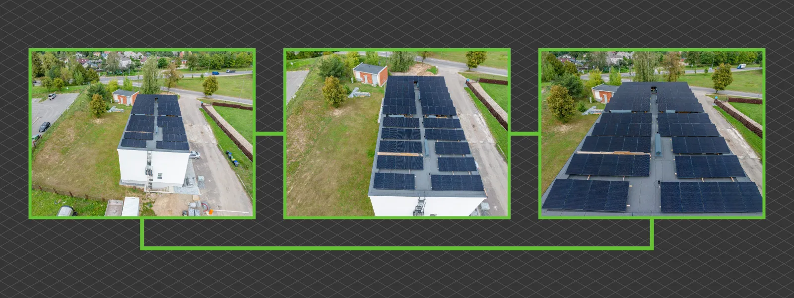 2. Each subset of pictures needs to have enough overlap. In our case, we added three passes over the solar panels, each with a good amount of overlap between photos. Think of it this way - if such a subset of photos would work in a vacuum - you are doing a good job. Photogrammetry software may have issues with such data if you only sprinkle around photos without proper overlap within the additional clusters. Pixpro photogrammetry software will automatically filter out and not use pictures that do not mesh with a larger robust cluster of photos.
Results
Despite the white facade walls, the overall result is okay. We have a general reconstruction of an entire building, and a decent 3D model can be exported if we need it for sharing. But if you want to share a whole project, Pixpro provides quite a unique proposition with the cheapest subscription plan. Our cheapest subscription tier is limited to processing photos but does not limit opening already-made projects. This is why our clients often get the cheapest licenses, so they give them out so their clients can view, measure, and inspect the projects themselves.
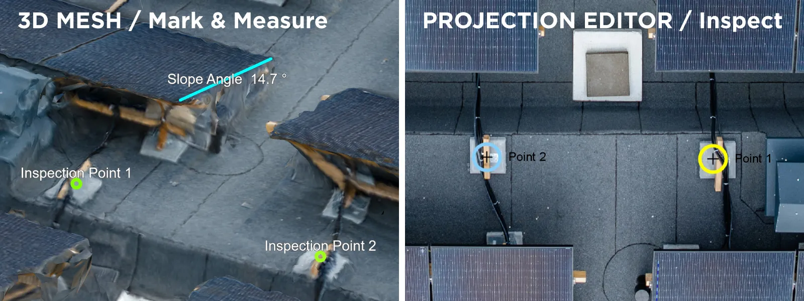
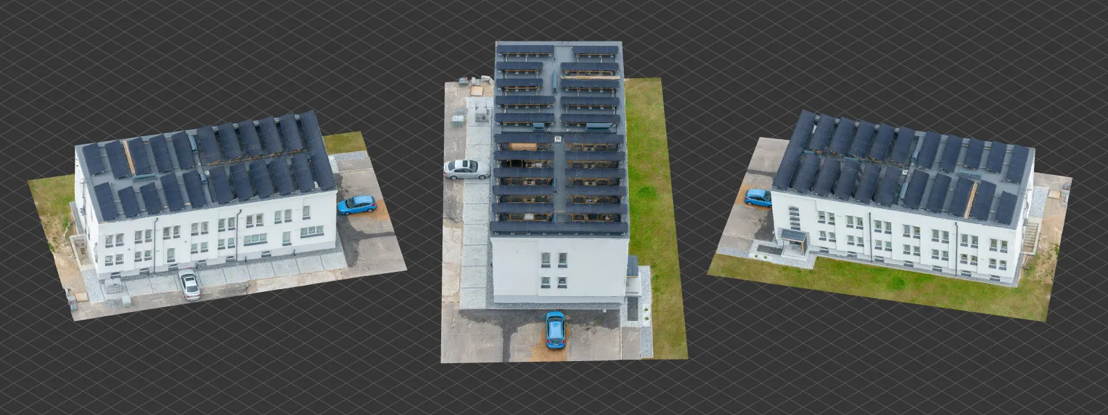 We use point projections to do inspections in Pixpro software, and it is super easy. Inspect the 3D model in the 3D view, designate a spot you want to look closely at with a point and double-click that point. You will be taken into the point projections view, where you can see that point in each photo that contains the view. This will provide the highest resolution representation of that spot you can get in this project. If you find something interesting, you can save that point, label it, and change its graphical properties so it is visible in the project. The same can be done with lines and polygons.
Conclusion
A quick and efficient way to satisfy a routine use case in the solar energy industry. The clear benefit is that the visual data we obtained is indisputable and easy to archive and look back at any time. If you are considering using aerial photogrammetry in this industry - this is the essential entry-level work you will probably do. With Pixpro waypoints and Pixpro photogrammetry software, you can do all this quickly and efficiently.

Photographer - Drone Pilot - Photogrammetrist. Years of experience in gathering data for photogrammetry projects, client support and consultations, software testing, and working with development and marketing teams. Feel free to contact me via Pixpro Discord or email (l.zmejevskis@pix-pro.com) if you have any questions about our blog.
Related Blog Posts
Our Related Posts
All of our tools and technologies are designed, modified and updated keeping your needs in mind
Handheld Photogrammetry Construction Interior Scan Use Case
Interior 3D scanning can be useful in a myriad of ways. In this article, I present a scan of a residential building construction site, with its foundation walls and roof almost complete. Further construction will require some visualizations and design according to “the fact.”
Event Planning with Photogrammetry – Use Case from A to Z
Photogrammetry for event planning was the first use case I wrote about on this blog. Now we are back with another venue and an event that will take place in a couple of months.
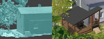
Individual Property Architecture - Photogrammetry Use Case
If you love doing your own small-scale renovations, planning, and building—this use case is for you. Photogrammetry can provide a framework that allows you to eliminate dozens of questions, replace traditional time-consuming methods, and reach a better result.
Ready to get started with your project?
You can choose from our three different plans or ask for a custom solution where you can process as many photos as you like!
Free 14-day trial. Cancel any time.
.svg@webp)
