.svg@webp)
Pixpro photogrammetry blog
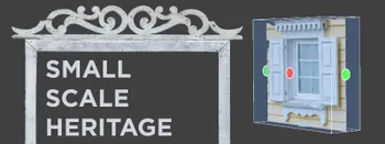
Architectural Heritage Photogrammetry - Preserving Small Details
Architectural heritage preservation is a critical component of cultural heritage conservation. Preserving small details of historic buildings has always been a challenge for conservationists. Photogrammetry is a non-destructive technique helpful in documenting architectural heritage by creating high
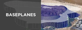
Baseplanes in Photogrammetry
Baseplanes are a fundamental part of any volumetric measurement system. Each photogrammetry software has to deal with selecting, approximating, and modifying a base plane to allow the user to get an accurate volume measurement.
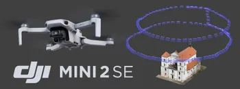
DJI Mini 2 SE and Mini 2 for Photogrammetry
DJI Mini 2 series drones are the most affordable means of getting aerial photos and videos. It also means the same thing for photogrammetry. If you want to explore the capabilities of aerial photogrammetry or already have a vision of how to utilize it in your area - the DJI Mini 2SE is the most acce
DJI Mini 2 SE Review and Comparison
Drones have become favored by hobbyists and professionals, offering a new perspective on the world and capturing stunning aerial footage. But not all drones are created equal, and finding the right one for your needs can be challenging. This article will look closer at the DJI Mini 2 SE, the latest

Vertical Photogrammetry Part 1 - Outdoor Walls
Walls, facades, and geological outcrops are examples where the scanned subject is entirely vertical. For some - it may be the focus of their work and the most common use case. This article begins a series on vertical scanning techniques for different subjects and situations.
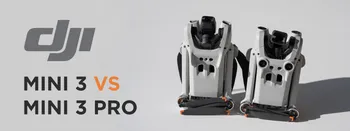
DJI Mini 3 Pro vs. Mini 3
DJI Mini 3 Pro is a sub-250-gram drone with a capable camera. Since its launch, it quickly became one of the most popular drones for many professionals and hobbyists. A few months later, DJI released the Mini 3 without the Pro designation - a cheaper and less feature-rich alternative with almost the

Handheld Photogrammetry with a Drone
Drones are cameras with wings and propellers. The aerial perspective often makes a drone their first dedicated imaging device for many people. Most drones can be used as good terrestrial cameras as well.
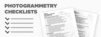
Photogrammetry Checklists - Aerial - Terrestrial - Processing
Checklists are among the most common and practical tools for organizing and completing tasks. Whether you need to plan a project, prepare for a trip, or remember your daily chores, a checklist can help you stay on track and avoid forgetting anything important.
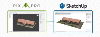
From Pixpro to Sketchup
SketchUp is a 3D design software that lets you create and edit 2D and 3D models with a simple interface. You can use SketchUp for various purposes, such as architecture, interior design, landscape architecture, asset design, and more.
Ready to get started with your project?
You can choose from our three different plans or ask for a custom solution where you can process as many photos as you like!
Free 14-day trial. Cancel any time.
Welcome to Pixpro
Sign in
And access your account.