.svg@webp)
Software
Use cases and blog posts specifically about Pixpro software usage.

Why Choose Pixpro Photogrammetry Software? Practical Comparison
There is no shortage of photogrammetry software today. From well established industry tools to newer cloud based solutions, the choice is not exactly obvious, especially for someone just getting started. Most options promise high accuracy, automation, and ease of use, and to some extent they all del
3D Point Clouds in Pixpro: How to Convert and Export Spatial Data
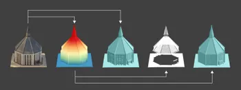
Photogrammetry software produces several types of spatial outputs, but the dense 3D point cloud is the foundation of them all. In Pixpro, the dense point cloud acts as the base dataset from which every other derivative is generated.

How to Create and Import a KML File in Pixpro Waypoints
We are continuing our improvements to the Pixpro Waypoints service and bringing a few small updates. Pixpro Waypoints is a service that allows automatic photogrammetry flights with consumer grade DJI drones using a bit of workaround magic.
Pixpro 1.7.11 - Seamless Model Sharing
We are keeping the development cycle relatively short these days, so here is a new update to our photogrammetry software. Update 1.7.11 brings improvements related to our cloud service.

Pixpro Version 1.7.10 - New Feature - Inspections
Another new Pixpro version is here, and it brings a singular new feature - an inspection module. Inspections are a large part of photogrammetric scanning because it is the most convenient and long-lasting way of visual remote sensing.

Most Asked Photogrammetry Questions Part 4 - Pixpro Support Picks
I help my team support Pixpro photogrammetry software users on a daily basis and often get forwarded more technical or specific questions. This gives me a good idea of what people ask the most, so I am writing these blog posts to get ahead of many questions.

Pixpro version 1.7.9 and our 2025 Goals and Expectations
In this blog post, we have a small update to our Pixpro photogrammetry software and a bit of speculation and planning for the upcoming orbit around our G-type main sequence star.

Pixpro Cloud Processing - Layer Settings Explained
In the latest version of Pixpro, we have more cloud processing options. We can choose which layers to process and some settings for them. I will go through the entire cloud computing workflow in this article, including layer selection and settings.

DJI Air 3S for photogrammetry? Automatic Flights with Pixpro Waypoints
The camera is excellent, possibly the best on the market for any fixed-camera drone. And indeed, the best of anything of this size and price. And a good camera means we have to talk about photogrammetry. Because with a great camera comes a great 3D scanning… responsibility.
Ready to get started with your project?
You can choose from our three different plans or ask for a custom solution where you can process as many photos as you like!
Free 14-day trial. Cancel any time.
Welcome to Pixpro
Sign in
And access your account.