.svg@webp)
Pixpro photogrammetry blog

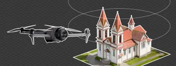
Observation Tower Inspection – Dual Lens Hyperlapse
Orbital flights are fundamental in photogrammetric scanning, especially when working with isolated structures such as towers, chimneys, monuments, or small buildings. They allow for detailed, wrap-around imagery of a subject using relatively simple flight paths and minimal setup.
Event Planning with Photogrammetry – Use Case from A to Z
Photogrammetry for event planning was the first use case I wrote about on this blog. Now we are back with another venue and an event that will take place in a couple of months.

Top 10 Photogrammetry Misconceptions
There are many misconceptions about photogrammetry, especially for those just getting into it. That is entirely understandable. This field is not exactly mainstream, and it blends elements of photography, surveying, modeling, and data processing — so confusion is common.
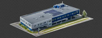
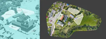
Industrial Building and Roof Scan - Use Case Details
For this use case, I have an industrial building requiring a reasonably detailed 3D reproduction for inspection, solar panel expansion, and general documentation.
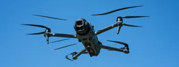
DJI Mavic 4 Pro – Sensor Readout Speeds Tested
The Mavic 4 Pro is the most capable consumer drone available today. Naturally, it gets pulled into all the usual debates — including the decade-old mechanical vs. electronic shutter discussion. Sensor technology has come a long way, and the Mavic 4 Pro's fast readout speed means you are unlikely to
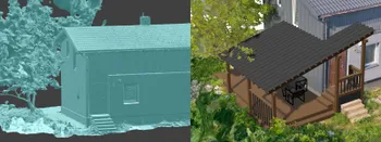
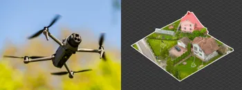
Individual Property Architecture - Photogrammetry Use Case
If you love doing your own small-scale renovations, planning, and building—this use case is for you. Photogrammetry can provide a framework that allows you to eliminate dozens of questions, replace traditional time-consuming methods, and reach a better result.

Premium vs. Budget - Viltrox vs. Sony GM - Landmark Lens Comparison
Professional photography has to be distinguished by creativity and results obtained from cameras and lenses that clearly can provide technically better photos than any phone. As a photographer, I should get the best camera gear or not bother at all. But what does it mean to get the best?
3D Roof Photogrammetry with DJI Mavic 4 Pro
3D roof photogrammetry is the best way of measuring, inspecting, and evaluating roofs in many use cases. Our most common use case is either inspection for renovation or solar panel installation and energy simulation.
DJI Mavic 4 Pro Photogrammetry – Pixpro Waypoints
DJI Mavic 4 Pro is the flagship foldable consumer drone from DJI. It will become a workhorse for many creators in the next few years, including some of us in photogrammetry.
Ready to get started with your project?
You can choose from our three different plans or ask for a custom solution where you can process as many photos as you like!
Free 14-day trial. Cancel any time.
Welcome to Pixpro
Sign in
And access your account.