.svg@webp)
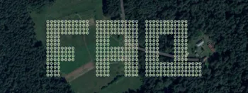
Surveying and Mapping
Blogs posts and use cases regarding the Surveying and Mapping activities.

Stockpile Volume Measurement With Drone Photogrammetry: A Practical Guide
Measuring a stockpile sounds trivial until you actually have to do it on a real site. You need a number you can defend at the end of the month, and you would rather get it without sending somebody to climb up a 10 meter mountain of gravel with a GPS pole.
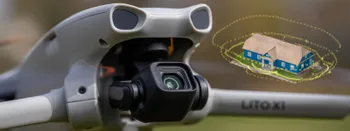
DJI Lito X1 for Photogrammetry
Can the Lito X1 be used for photogrammetry? Yes it can. Can it produce good results? Yes it can. How to do it? Yes it… well, that is what the rest of this article is for.
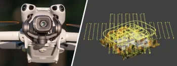
DJI Mini 5 Pro For Photogrammetry – Aerial Scanning With Pixpro Waypoints
DJI Mini 5 Pro is a 250-gram flying camera equipped with a 1-inch type sensor. Nine years ago, the Phantom 4 Pro was released as the first consumer drone to feature the same sensor format.

Pixpro Waypoints – Frequently Asked Questions Part 2
Pixpro Waypoints service is a workaround solution providing automated photogrammetry flights for the latest DJI drones. The service came about when DJI officially discontinued SDK support — and therefore third-party app development — for consumer-grade drones.
DJI Mavic 4 Pro Photogrammetry – Pixpro Waypoints
DJI Mavic 4 Pro is the flagship foldable consumer drone from DJI. It will become a workhorse for many creators in the next few years, including some of us in photogrammetry.

Video Frames vs. Photos for Photogrammetry
Photogrammetry uses raster data to calculate a 3D scene. Raster is just another word for images made out of pixels. So, taking photos is the fundamental first step of creating a scan.
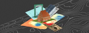
Where do we use Photogrammetry? A list of 3D scanning use cases.
Photogrammetry has revolutionized numerous industries by transforming real world scenes into 3D models, using only simple photographs and processing algorithms.
Most Asked Questions - Pixpro Waypoints
We have been receiving a lot of questions about our waypoint service. Pixpro Waypoints allow users to use the latest DJI drones for automated photogrammetry scans.
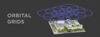
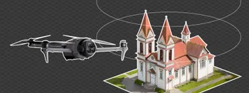
Multiple Overlapping Orbits - Pixpro Waypoints
Orbital flights are an effective and straightforward way of obtaining good-quality scans of isolated or more homogenous objects. However, if we overlap many orbits side by side, it becomes just as efficient in capturing oblique data for quite large, multifaceted areas.
Ready to get started with your project?
You can choose from our three different plans or ask for a custom solution where you can process as many photos as you like!
Free 14-day trial. Cancel any time.
Welcome to Pixpro
Sign in
And access your account.