.svg@webp)
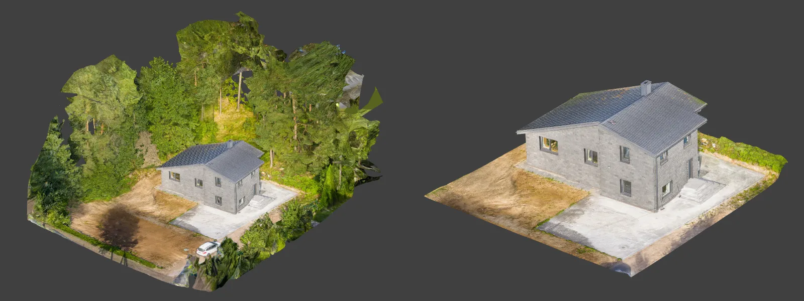
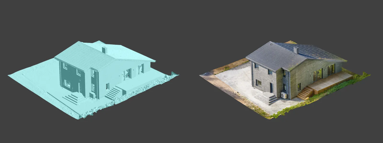
Residential House Scan Use Case - Complete Exterior
 Lukas
Zmejevskis
Lukas
Zmejevskis
Another day – another photogrammetry use case. This time, we are dealing with a moderately complex request: a brand-new home building scan for documentation and solar panel installation planning. I had no opportunity to preplan any flights – just grab the drone and head to the location, with only a few listing photos as reference. This was not an extremely complex subject, but the entire scan relied on thinking on the spot, with a limited one-hour window alongside the homeowner. Site unseen beforehand - just come and scan – here is my thought process.
Common Photogrammetry Challenges
If you have enough experience, you will not find anything extraordinary with this task. However, as always, a few notable issues had to be addressed on location. Below is a short list of the challenges I encountered:
-
Close proximity to tall trees. The house is at the edge of a forest, with the tree line close to the building. The trees are much taller than the roof, so complete coverage from a consistent low altitude is impossible.
-
Shadow areas. Due to the height of the trees and their position relative to the sun, parts of the building were heavily shadowed depending on the time of day. This is a typical challenge, but it has to be kept in mind during capture to avoid low-contrast photos.
-
Directional lighting. The sun was at a relatively low angle during the scan, creating strong directional shadows and uneven lighting. These must be managed carefully during shooting, ideally keeping light behind the camera and avoiding the sun in the frame when possible.
-
Tight flight space. The property is close to the forest and neighboring buildings and fences, which limited the available airspace, especially for low-altitude orbits and manual pass-by flights.
-
No orthophoto in maps. The building is brand new and does not appear in orthographic imagery on major map services. This made automated flight planning impossible. All flights had to be decided in the moment.
Manual Aerial and Terrestrial Photogrammetry
For me, an entirely impromptu scan means relying on a combination of hyperlapse orbit modes, slow manual flight, and some walking around the subject with the drone. There are no automated flights or Pixpro Waypoints—just pilot instincts and real-time decisions.
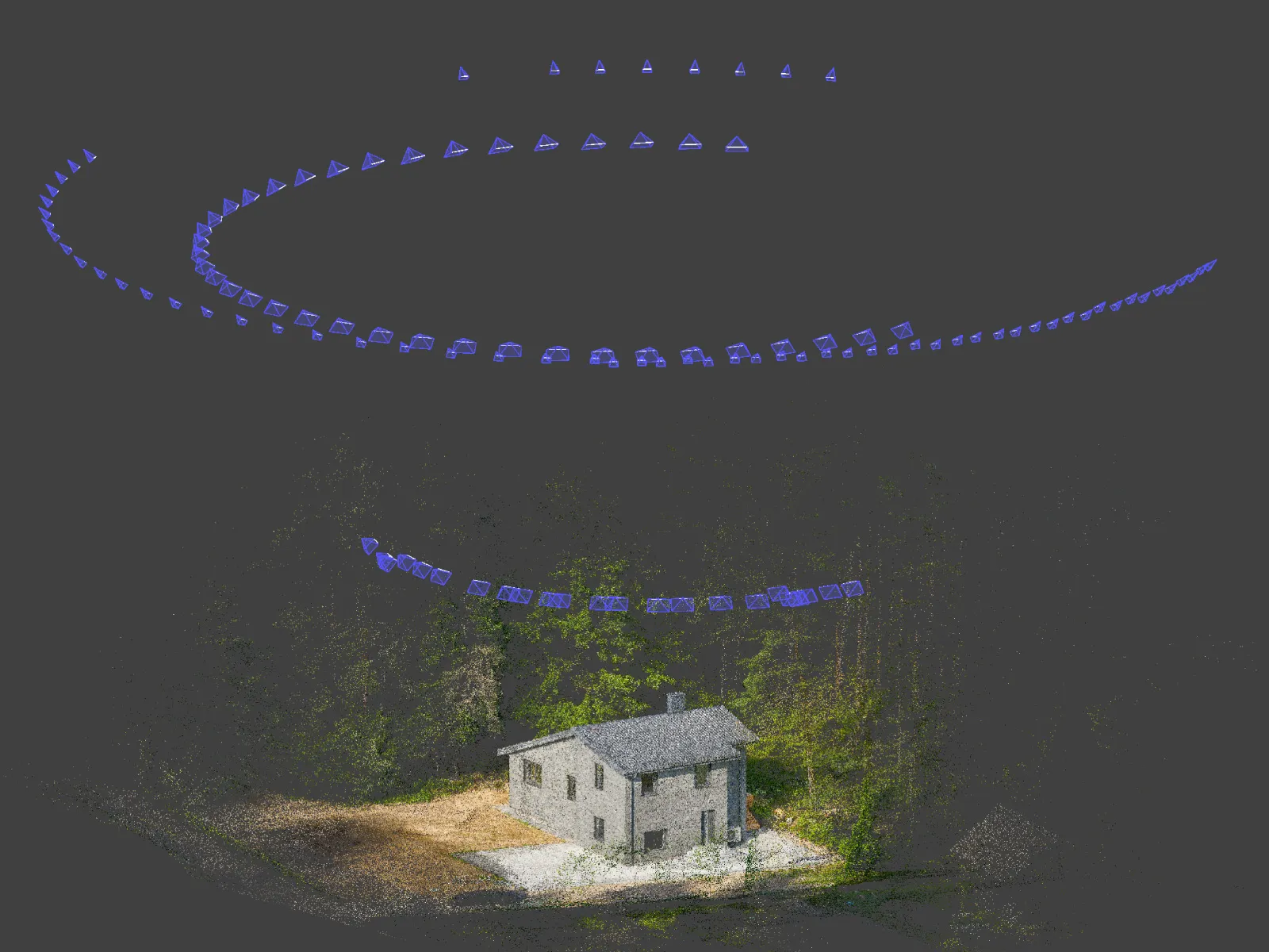 I began with a couple of circular orbits at different altitudes. The first was flown as close to the roof as possible – similar to my typical solar-focused orbital scans. The second orbit was flown higher to capture more surrounding context and provide a wider baseline for the reconstruction.
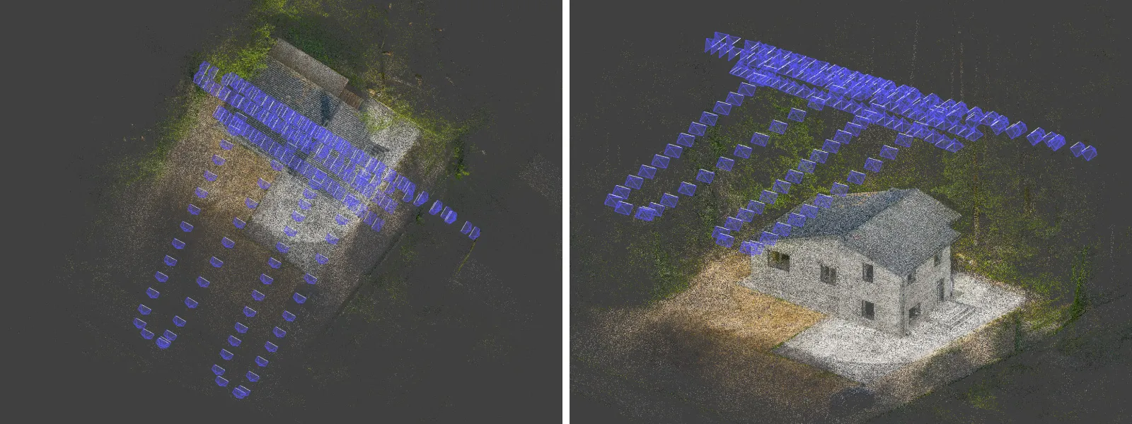 After the orbits, I performed a few grid-style flights directly above the house. These were freehand – no grid planner, just slowly moving in overlapping patterns while manually triggering photos regularly. I made sure to avoid capturing redundant angles or repeating the exact same location multiple times.
 For safety I added a few low altitude flights around the perimeter of the building, to serve as connective tissue with the terrestrial part.
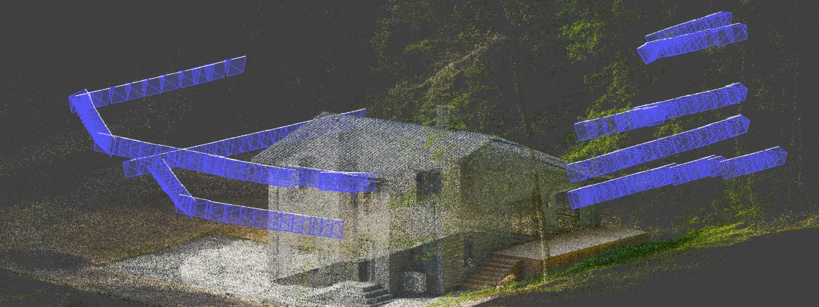
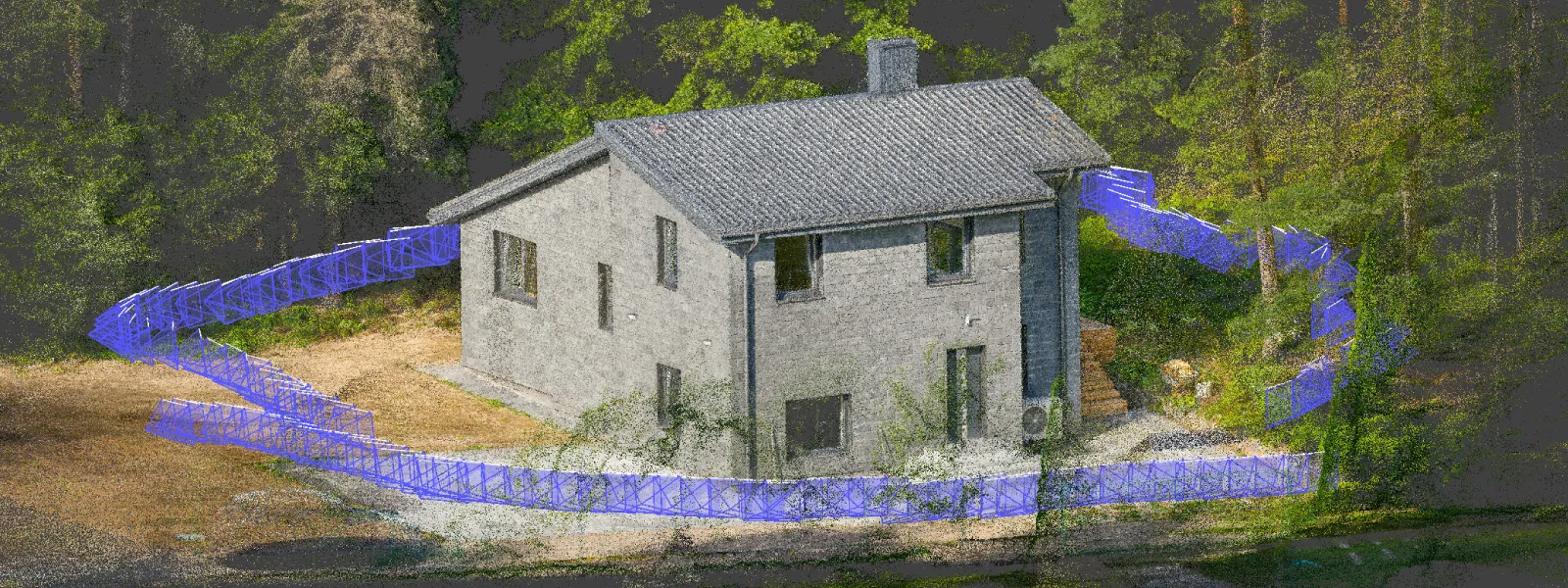 I did a round of low-altitude terrestrial-style shots by walking around the house's perimeter with the drone. These images help fill in wall details, overhangs, and harder-to-see lower geometry that can often get lost if only aerial imagery is used.
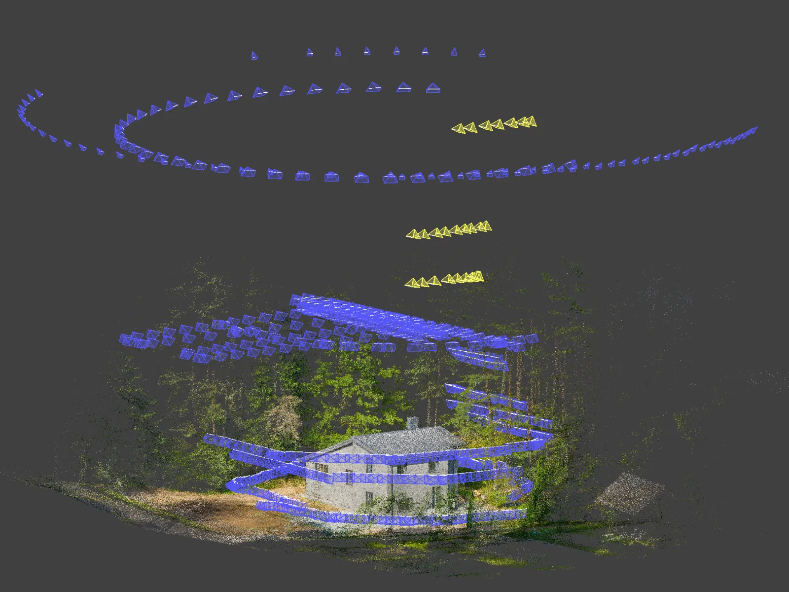 Lastly a few manual oblique shots from the tree side of the property, to fill in the small data gap in the higher altitude perimeter.
Photo Data Processing
Of course, I captured the photos in RAW using my DJI Mavic 4 Pro. The first step is to convert to JPEG. My tool of choice is Adobe Lightroom Classic. I used a conservative processing approach, focusing only on necessary corrections: neutral white balance, soft contrast adjustment, reduced highlights, and lifted shadows. Nothing was too aggressive—the goal was consistency and clarity.
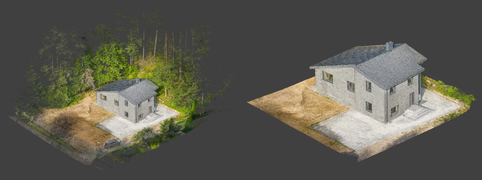 After conversion, I manually went through all the photos in Windows Explorer. I deleted photos where the house was partially obscured by trees or branches. I also removed blurred images, pictures with major exposure issues, or irrelevant shots between passes. After filtering, I was left with 714 selected photos.
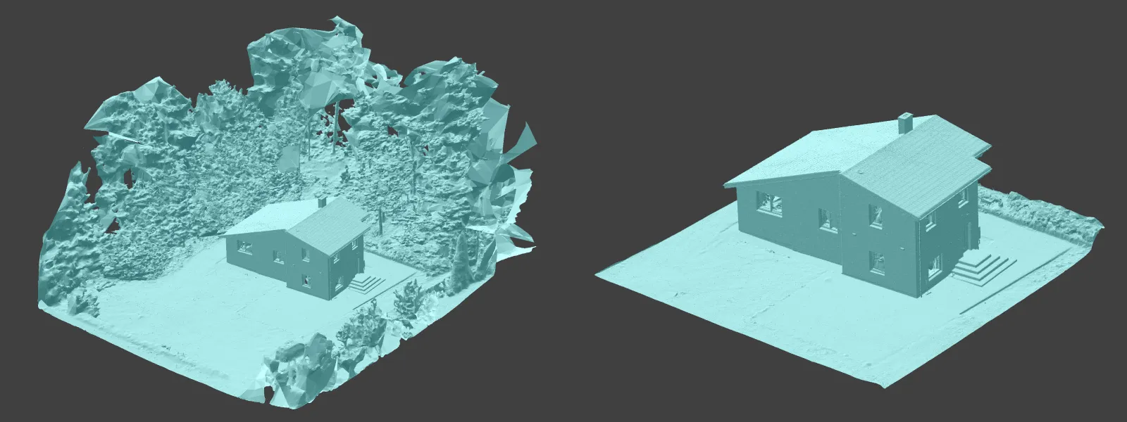 These were imported into a single Pixpro project for reconstruction. All images aligned successfully on the first run, requiring no manual intervention. Sparse cloud, dense cloud, 3D mesh, and texture layers were all generated in sequence without issues. The capture angle variety and careful photo overlap paid off.
 Data Analysis in Pixpro Photogrammetry Software
Pixpro includes analysis tools for basic inspection, measurement, and data export. For this scan, the most relevant features were the measurement and inspection tools, as well as options for integration with other software.
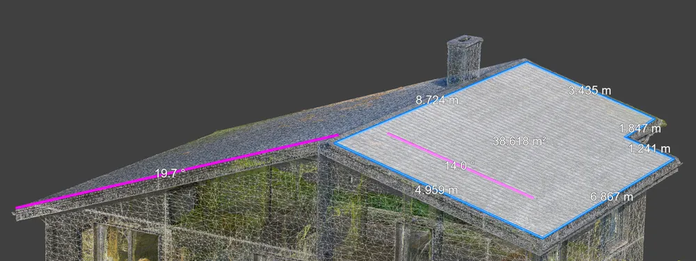
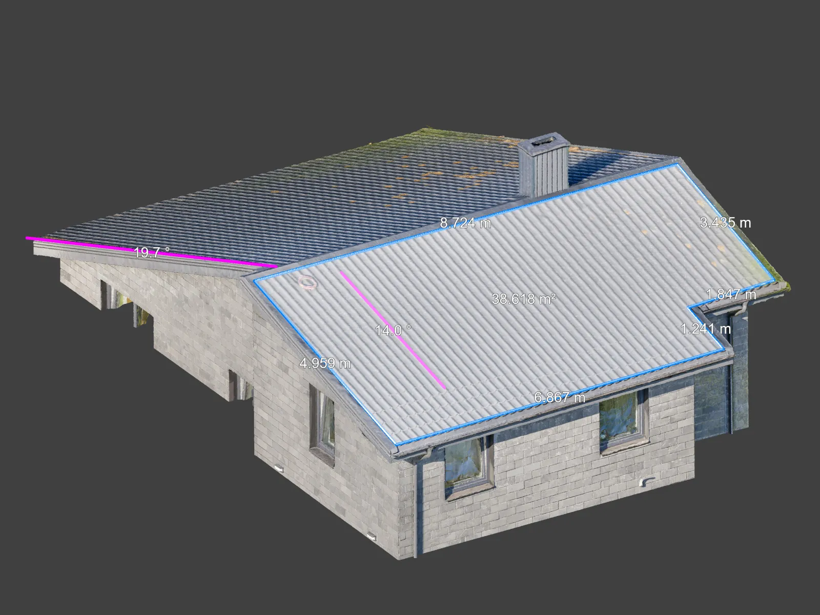 Measurement tools allow drawing lines, paths, or polygons on any model's surface and instantly retrieving accurate dimensions in 3D space. All essential spatial values can be extracted with a few clicks, whether it is roof slope, surface area, or height differences.
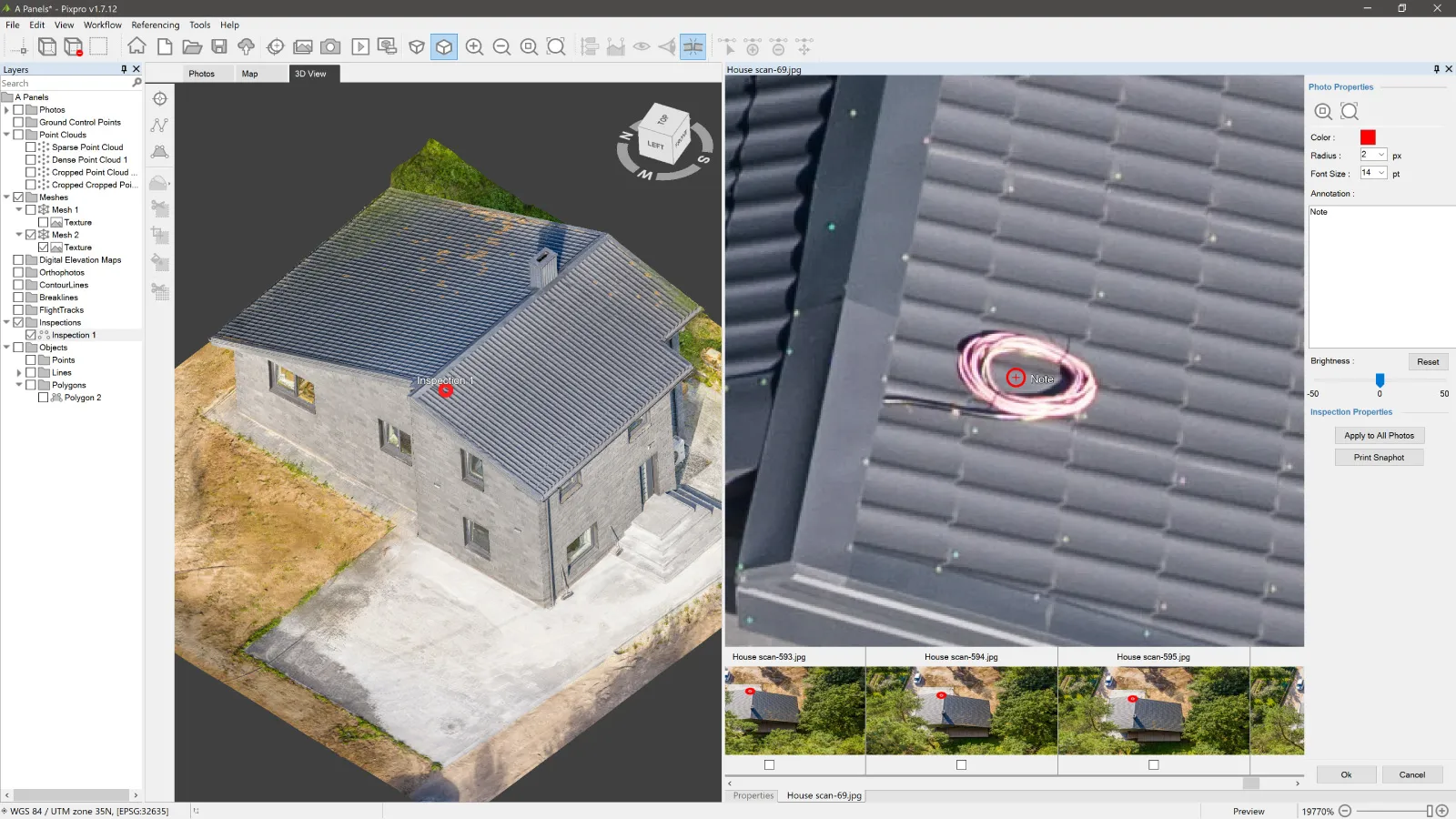 For inspection, you can place reference points anywhere on the model to examine details using the original photo projections. This makes it easy to zoom into specific problem areas and verify what each camera saw from that location, with maximum resolution.
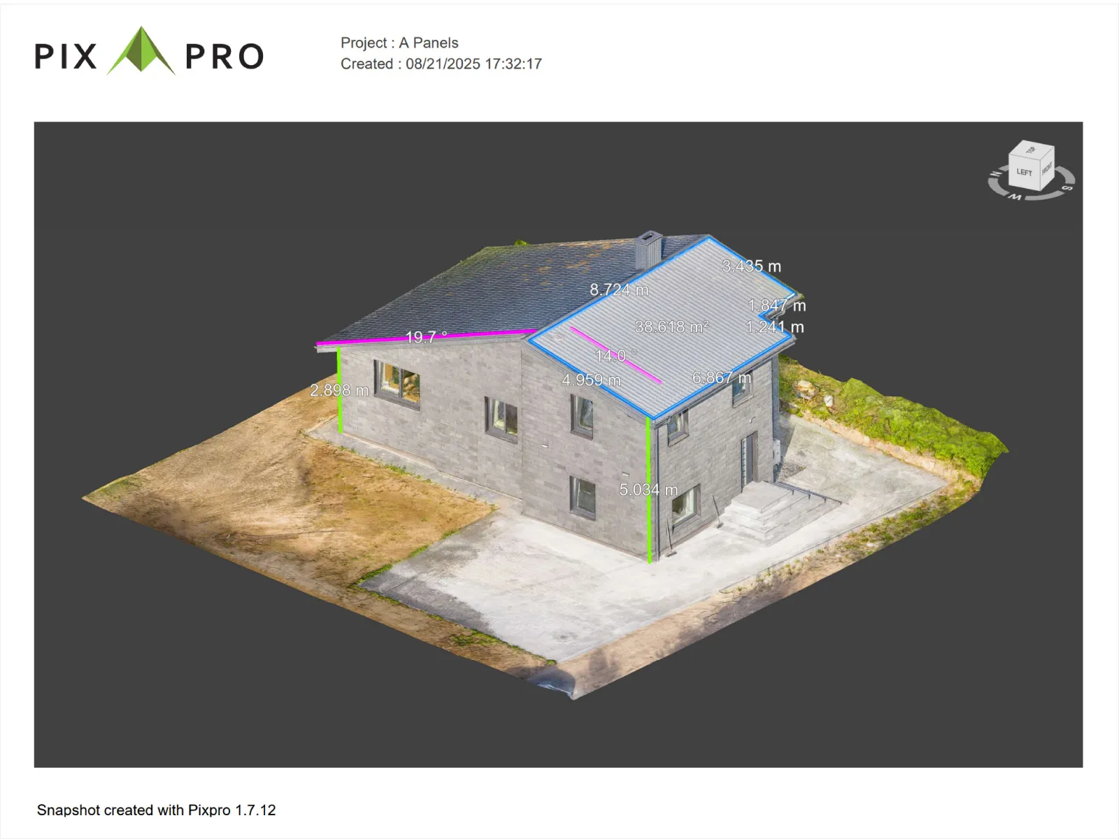 Export options include saving the textured 3D mesh for use in more advanced solar simulation or modeling tools. Vector-based layers and drawn elements can also be exported to CAD-compatible formats. Reports can also be generated from within Pixpro, making it easy to communicate measurements or observations to other teams without additional software.
Conclusion
A simple, practical, and real-world use case that is quickly becoming a staple of property documentation and solar plant simulation. With nothing more than a reliable drone, fast thinking, and Pixpro, even a site-unseen one-hour window can produce a complete, usable 3D dataset. No automation required. No preplanning. Just a good grasp of fundamentals and solid execution on the spot. I hope my simple description of what I did paints a clear picture of what you can do in a similar situation.
Photographer - Drone Pilot - Photogrammetrist. Years of experience in gathering data for photogrammetry projects, client support and consultations, software testing, and working with development and marketing teams. Feel free to contact me via Pixpro Discord or email (l.zmejevskis@pix-pro.com) if you have any questions about our blog.
Related Blog Posts
Our Related Posts
All of our tools and technologies are designed, modified and updated keeping your needs in mind
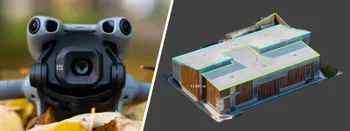
3D Roof Scanning with the DJI Mini 5 Pro
Another entry in our ongoing exploration of roof photogrammetry workflows. This time, the subject is the DJI Mini 5 Pro — DJI's latest 250g drone with a 1-inch sensor, omnidirectional obstacle avoidance, and Pixpro Waypoints support.
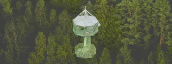
Observation Tower Inspection – Dual Lens Hyperlapse
Orbital flights are fundamental in photogrammetric scanning, especially when working with isolated structures such as towers, chimneys, monuments, or small buildings. They allow for detailed, wrap-around imagery of a subject using relatively simple flight paths and minimal setup.
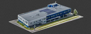
Industrial Building and Roof Scan - Use Case Details
For this use case, I have an industrial building requiring a reasonably detailed 3D reproduction for inspection, solar panel expansion, and general documentation.
Ready to get started with your project?
You can choose from our three different plans or ask for a custom solution where you can process as many photos as you like!
Free 14-day trial. Cancel any time.