.svg@webp)
Top 10 Photogrammetry Facts For Everyone
 Lukas
Zmejevskis
Lukas
Zmejevskis
Photogrammetry is a vast interconnected discipline that we can analyze on multiple levels of detail. From mathematical algorithms which make everything possible to ethical implications of digital twins in the social space. This article is our top 10 photogrammetry facts that everyone should know in a shortest possible way.
1. Photogrammetry has been around since as early as 1867
With the invention of photography came two distinct disciplines – art and technical photography. The technical side of photography, used for visual data capture and analysis, eventually became photogrammetry – a complex scientific area we recognize today. For a basic historical rundown, read more on the Photogrammetry Wikipedia page.
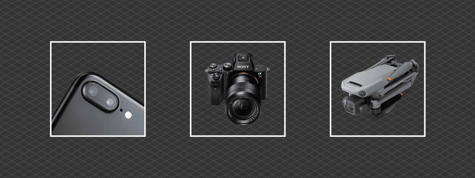
2. It all begins with a camera, any camera.
From professional cameras to smartphones, we can use any imaging device to capture photos for photogrammetry. If you know the technique, any adequate hardware will suffice. The type and quality of images you take may influence the usability and potential use cases of your created 3D results. Still, anyone can try making their 3D models now without any modeling knowledge. With Pixpro software, you can try to do that completely free.
3. Good input – good output.
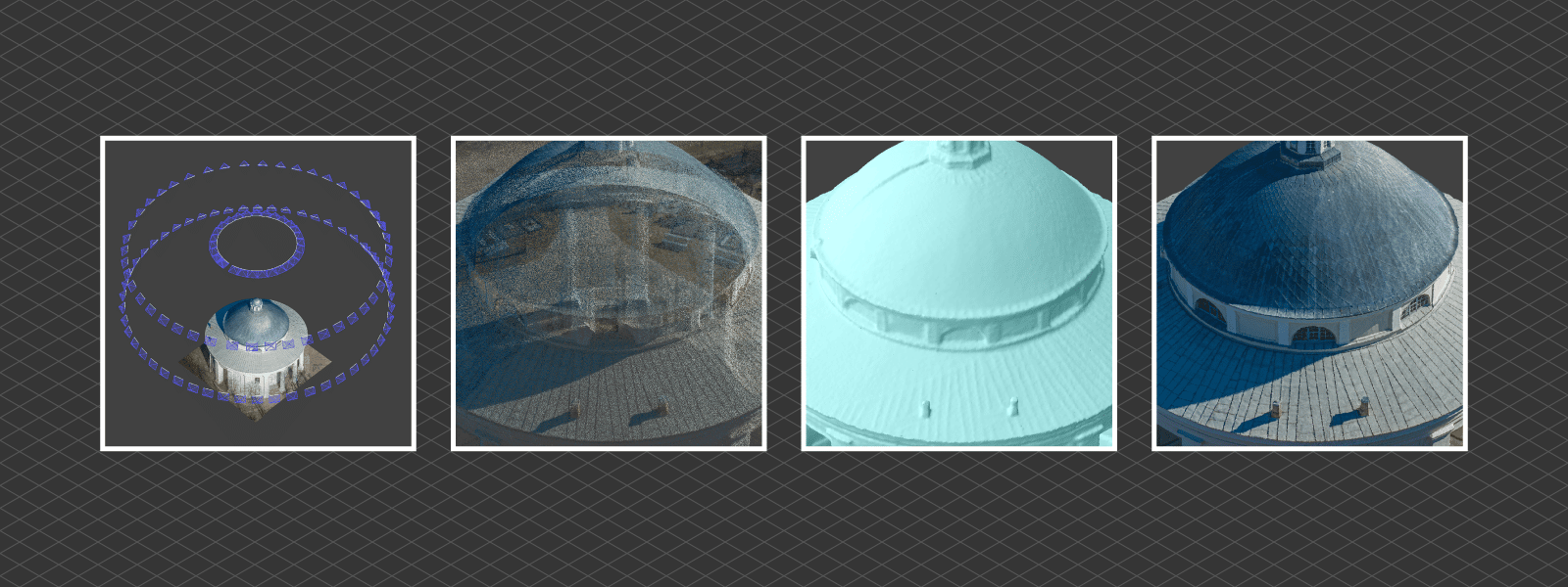
Photogrammetric 3D models and entire projects will only be as good as the input data. Sound input data are photos that do not contain extreme optical flaws or inconsistencies and follow sufficient overlap and subject coverage rules. Additionally, any referencing data used in processing must be accurate for the required use case. Specialized photogrammetric hardware does exist, so even the most demanding requirements could be met when creating a digital twin.
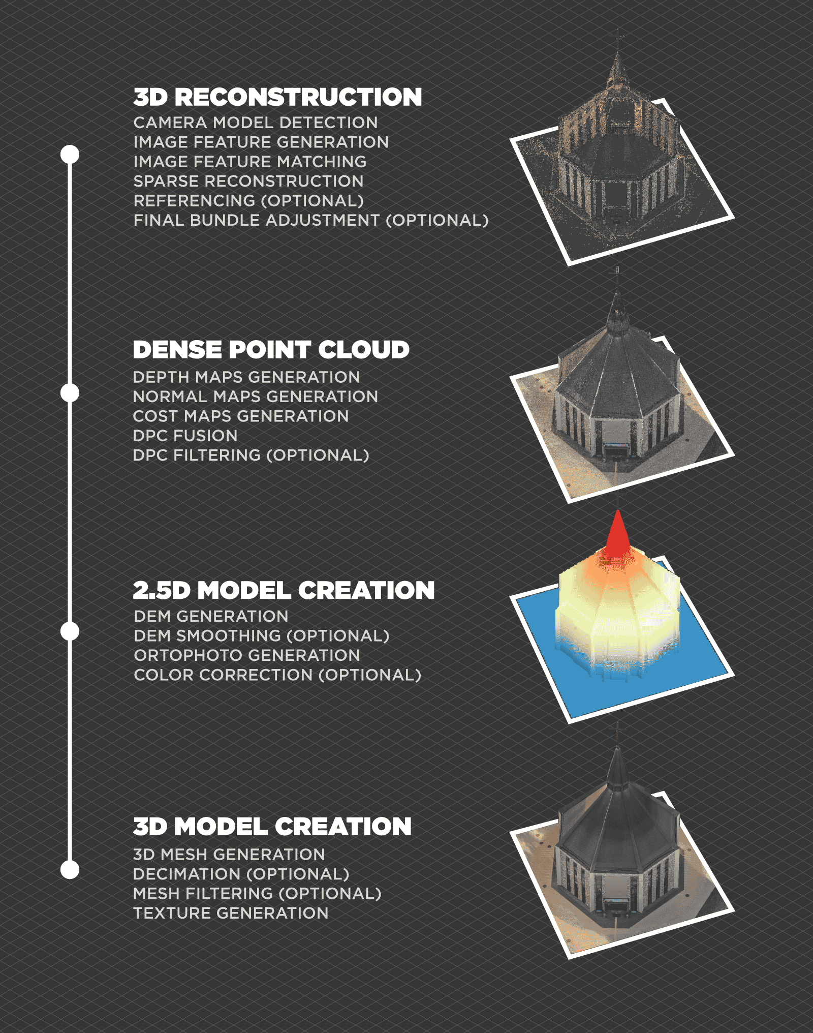
4. The photogrammetric process has many different algorithms.
Each algorithm provides a different outcome. Some outcomes are invisible to software users and only serve as intermediary data points. The creation of a Pixpro photogrammetry project involves these steps:
5. Mapping is Photogrammetry.
Accurate orthophoto images, contour lines, slope angle maps, and other types of maps are all photogrammetric results. “Mapping” may be used as a separate term, referring to a particular use case of photogrammetry with a specific way of data collection, but the fundamental principles remain the same. There is no mapping without photogrammetry and vice versa.
Read more about drone mapping here.
6. Aerial photogrammetry changed the course of human history.
Aerial photogrammetry changed the whole perspective on our environment as a species. With it, we gather and analyze data that is otherwise invisible to us. We can get a macro view of our planet or a small backyard and plan, act, and react accordingly.
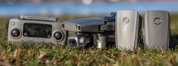
7. Drone Photogrammetry – a revolution that opened aerial photogrammetry for everyone.
With easily accessible flying cameras – drones, aerial photogrammetry has become the norm even for minor operations. Aerial data gathering used to cost hundreds of thousands while providing only lower-detail imagery from above. Nowadays, almost anyone can fly a camera and get aerial photographic data with unprecedented detail and accuracy.
Starting Your Drone Business
Drone Piloting – Best Ways to Get Experience
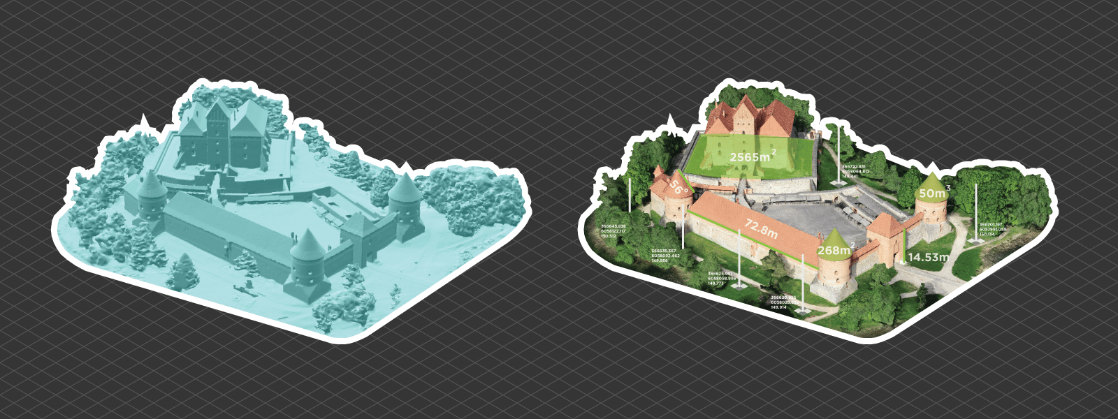
8. Photogrammetry provides scale.
With the correct data and equipment, it is easy to get a 3D model which is valid in its scale and orientation – a digital twin of the real world. Photogrammetry is becoming an essential part of surveying workflows which require measurements and accurate representation of the subject. No other process provides such detail and visual realism alongside factual accuracy.
9. Photogrammetric capture has technical limitations.
Due to fundamental limitations, we cannot capture some subjects for photogrammetric 3D reconstruction. Glass, mirrors, water, and perfectly uniform objects or patterns are impossible to reconstruct. Things in motion are impossible to reconstruct with traditional image capture as well. But this limitation is overcome with unique photo booths that take many images at once.
10. Photogrammetry use cases are boundless.
If your work can benefit from the safety and efficiency of remote sensing – you have a photogrammetry use case. Almost any industry or area of human activity has a process or a link that can benefit from photogrammetry. At the same time, some workflows are entirely dependent on it. Photogrammetry gives one the power to have an entire city in the palm of your hand or a palm-sized object scaled to the size of a city.
Photographer - Drone Pilot - Photogrammetrist. Years of experience in gathering data for photogrammetry projects, client support and consultations, software testing, and working with development and marketing teams. Feel free to contact me via Pixpro Discord or email (l.zmejevskis@pix-pro.com) if you have any questions about our blog.
Related Blog Posts
Our Related Posts
All of our tools and technologies are designed, modified and updated keeping your needs in mind

Accuracy of Your Photogrammetry Project
Accuracy in photogrammetry is a multifaceted point of discussion. We can talk about absolute, relative, or even geometric accuracy, to name a few. No tool or technique can really prove anything beyond reproach.
Buying a Used Drone - Mavic 2 Pro in 2024
Buying used gear is an excellent way to save money and obtain something that may not be on sale anymore. With drones reaching the 4th or 5th technological generation, the used drone market is becoming more extensive.

Photogrammetry Processing - Common Hardware and Software Issues
Photogrammetry requires complex processing and data crunching to turn photos into 3D models. We need a powerful machine to run the software and all its processes. Not only that, but the software within our machine may impact the performance of photogrammetry software in various ways.
Ready to get started with your project?
You can choose from our three different plans or ask for a custom solution where you can process as many photos as you like!
Free 14-day trial. Cancel any time.