.svg@webp)
Satellite, Airplane, Drone: The Three Scales of Photogrammetry
 Lukas
Zmejevskis
Lukas
Zmejevskis
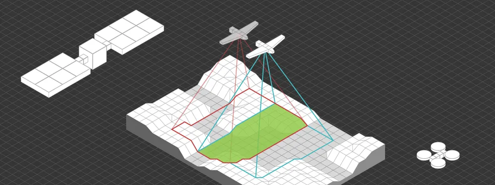
Most of what we write about here happens below 120 meters. But photogrammetry did not start with drones and it does not stop with them. The same technique runs from satellites 500 km up, from survey aircraft flying at a kilometer or two, and from a drone hovering 30 meters off a bridge. The platforms could not be more different. The math is identical.
This article is a tour of the three scales, where each came from, what it is good at, and a few facts I could not resist. There is a longer history of photogrammetry elsewhere on the blog, so I will keep the history to the good bits.
The Short Version
- All three use the same geometry: straight rays from a point on the ground, through the lens, to the sensor, solved together in a bundle adjustment.
- Resolution comes down to one equation. Ground sampling distance equals pixel size times distance, divided by focal length. Only the distance changes, from 518 km to 30 m.
- Satellites cover countries. Best commercial pixels today are 25 to 34 cm, from 500 to 600 km up.
- Aircraft cover regions. National programs fly 5 to 25 cm, and a single plane can capture a city in a day.
- Drones cover sites. Typically 1 to 3 cm, down to about a millimeter up close, and they are the only one of the three that flies under clouds.
One Equation, Three Altitudes
Every photogrammetric system rests on the collinearity condition: the point on the ground, the center of the lens and the point on the image sit on one straight line. Take enough overlapping images, write that condition for every matched point, and solve all of it at once. That solve is the bundle adjustment, worked out by Duane Brown for the US Air Force in the late 1950s, and it is still the core of every photogrammetry package, Pixpro included.
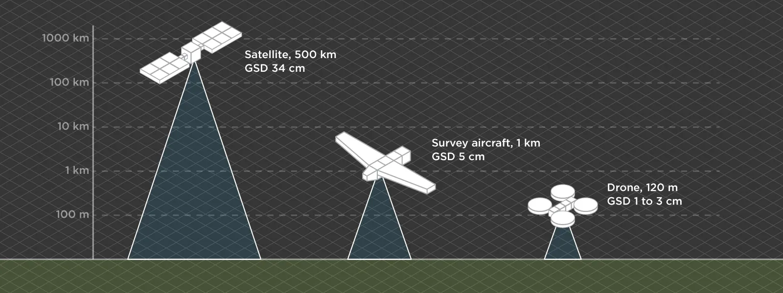 Resolution follows from ground sampling distance: pixel size multiplied by distance, divided by focal length. That single formula gives you a 34 cm pixel from a satellite at 518 km, 5 cm from a survey camera at about 940 m, and 1.3 mm from a drone with a 100 megapixel camera 30 m from a bridge. Same equation, a difference of roughly 260 times in detail, and the only thing that really changed is how far away the camera was.
Satellite Photogrammetry: Measuring From Orbit
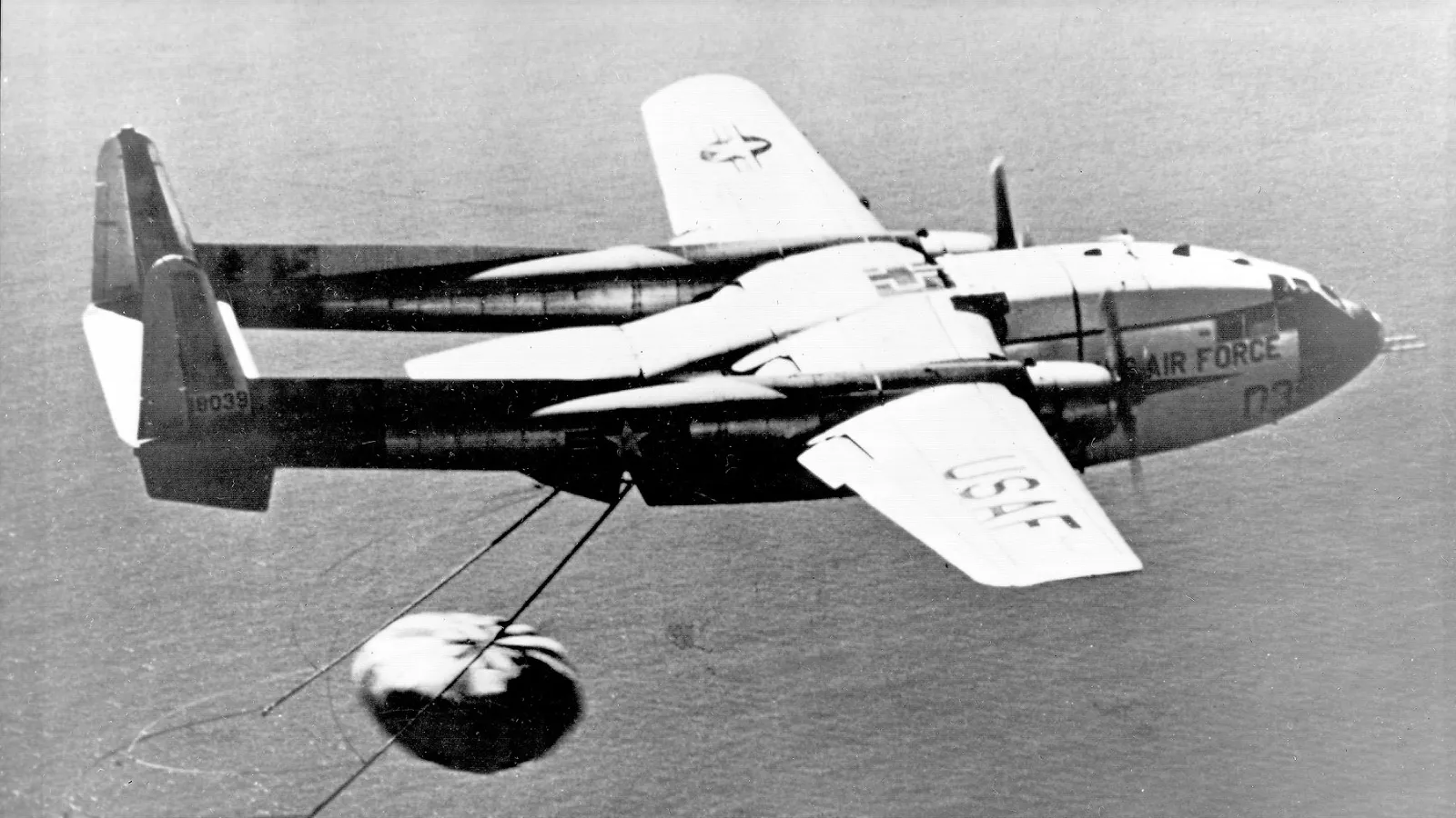
Satellite photogrammetry began as espionage. The US CORONA program ran from 1960 to 1972, launched 145 satellites and returned more than 800,000 images on physical film. The film came down in capsules, and on 19 August 1960 a C-119 "Flying Boxcar" caught the first one in mid-air over the Pacific, snagging its parachute with a trailing hook. It was the first film ever returned from orbit, and the first time anything coming back from space was caught in the air. If the plane missed, the capsule floated, but only for about two days, after which a salt plug dissolved and it sank so nobody else could fish it out.
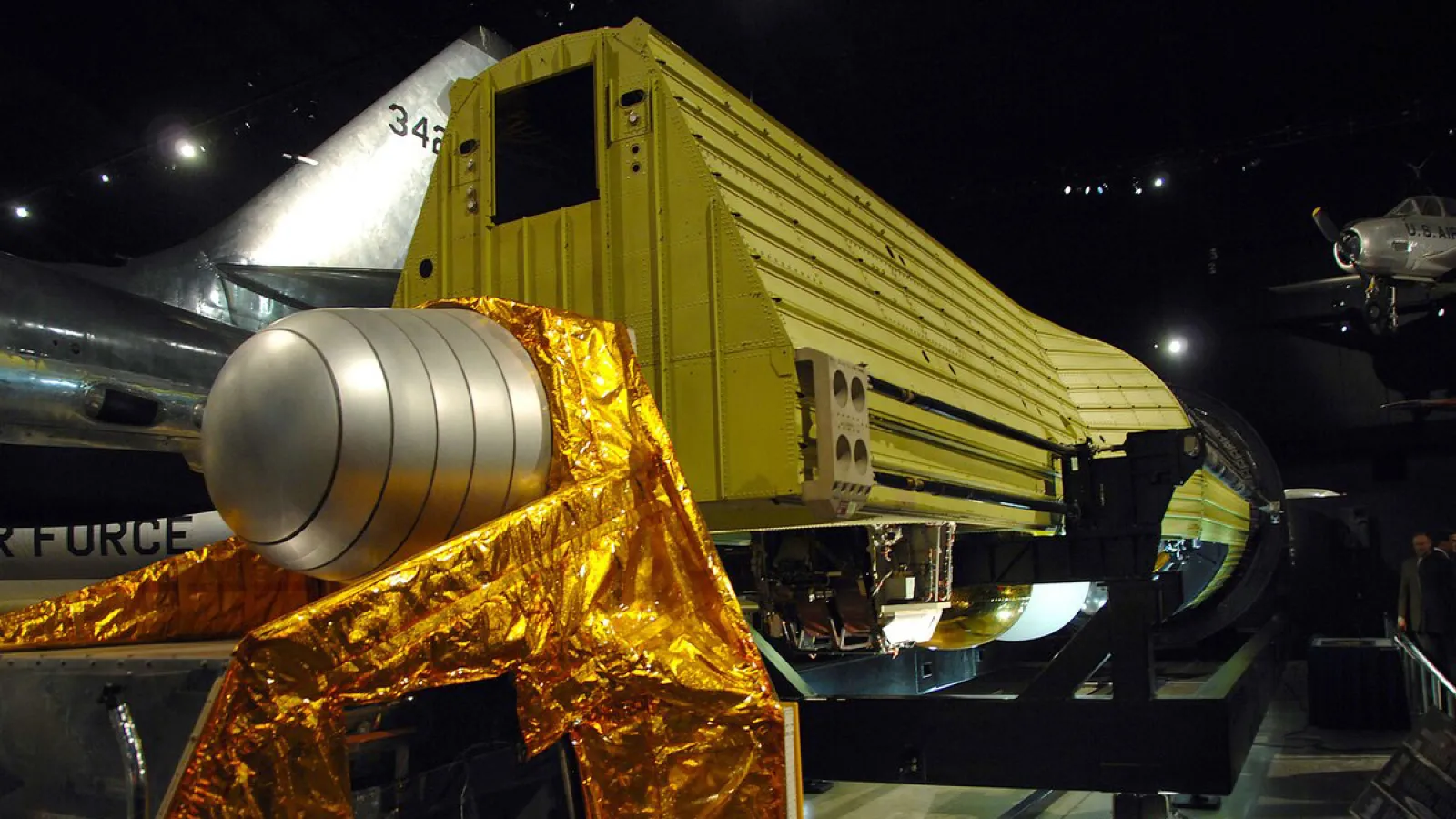
 The engineering got stranger. From 1962 CORONA carried two panoramic cameras looking forward and backward, which is stereo from space. The later HEXAGON satellites carried a dedicated mapping camera, and when one of HEXAGON's main capsules sank to about 5 km in 1971, the Navy recovered it with the deep submersible Trieste II, the deepest recovery attempted at the time. CORONA was declassified in 1995 and HEXAGON over the following sixteen years, and scientists now build glacier elevation models from 1960s spy photos to measure how much ice has gone since.
Civilian stereo arrived with the French SPOT-1 in 1986, at 10 meter pixels, and IKONOS became the first commercial satellite to sell sub-meter imagery in 1999.
How it works
A modern imaging satellite does not take photos the way your drone does. Most are pushbroom sensors: a line of detectors that builds the image one row at a time as the satellite moves. At 518 km the satellite travels at about 7.6 km/s, so each 34 cm line of ground passes under the sensor in roughly 48 microseconds. That is why these sensors sum several detector rows over the same spot, a technique called time delay integration, just to collect enough light.
Stereo comes from looking at the same spot from different angles. Modern satellites do it along track, pointing forward, down and back on a single pass, so the lighting does not change between images. Pléiades Neo can capture three views in one pass, and the extra near-vertical view fills the blind spots behind buildings. And because pushbroom geometry is messy, satellite images do not ship with a normal camera model at all. They come with rational polynomial coefficients, essentially a mathematical lookup that maps ground coordinates to pixel positions.
What it is good at
Scale, and access to places nobody can fly. One study used the full ASTER satellite stereo archive to measure about 220,000 glaciers worldwide, finding an average loss of 267 billion tonnes of ice a year between 2000 and 2019. Volcanologists measure lava flows from satellite stereo. Free global elevation models like ALOS World 3D came from satellite stereo too (the popular Copernicus 30 m model, fun fact, is actually built from radar, not photos).
What holds it back
Clouds, above all. Revisit windows. Resolution: the best commercial pixels are the Chinese SuperView Neo-1 at 25 cm, with WorldView Legion marketed as "30 cm class" while its native pixel is 34 cm. The one company that tried for 10 cm from very low orbit, Albedo, did not get there before losing contact with its satellite in 2025. And cost: US reseller price lists put 30 cm stereo at around 45 dollars per square kilometer from the archive and 65 for new tasking, with minimum orders of 25 to 100 km². Cheap per kilometer, expensive for a building site.
For scale: 34 cm from 518 km is like picking out a grain of sand from a kilometer away. Satellites are an impressive piece of engineering. They are not going to measure your stockpile.
Aircraft Photogrammetry: The Workhorse
The first aerial photograph was taken from a balloon over France in 1858 by the photographer Nadar, who developed the wet plates in a darkroom inside the basket. None of those photos survive. The oldest surviving aerial photo is of Boston, taken from a balloon in 1860.
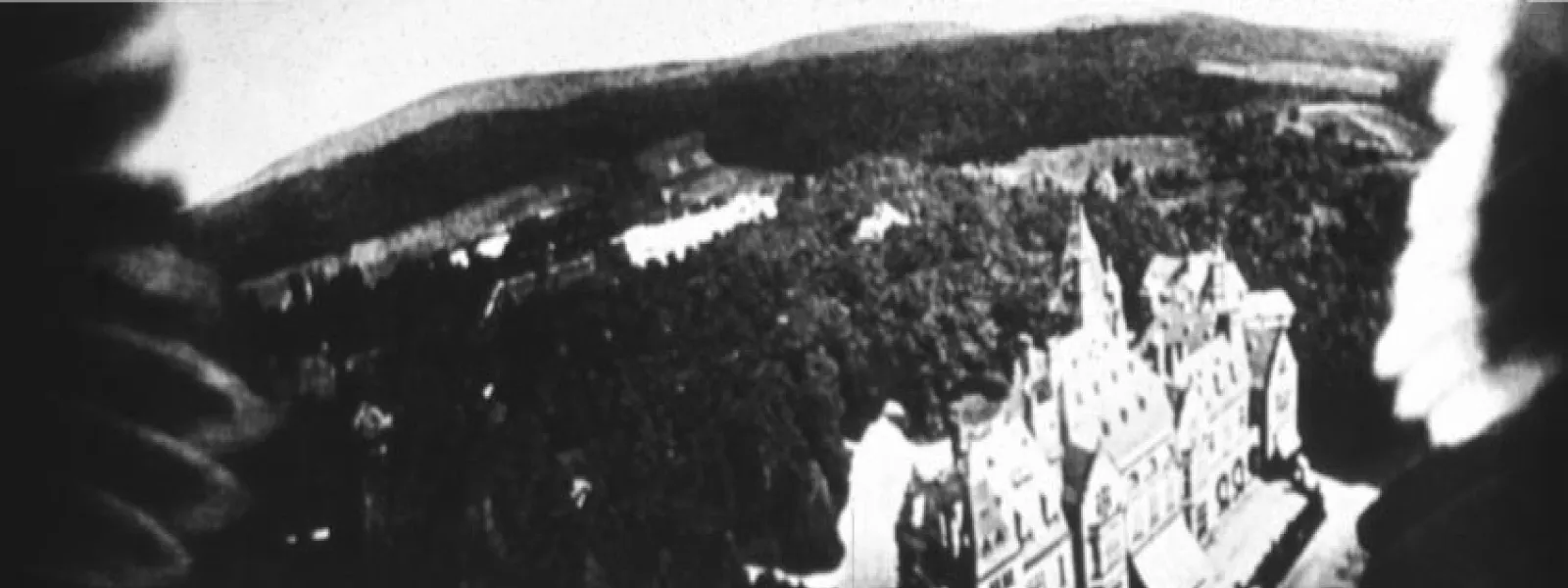
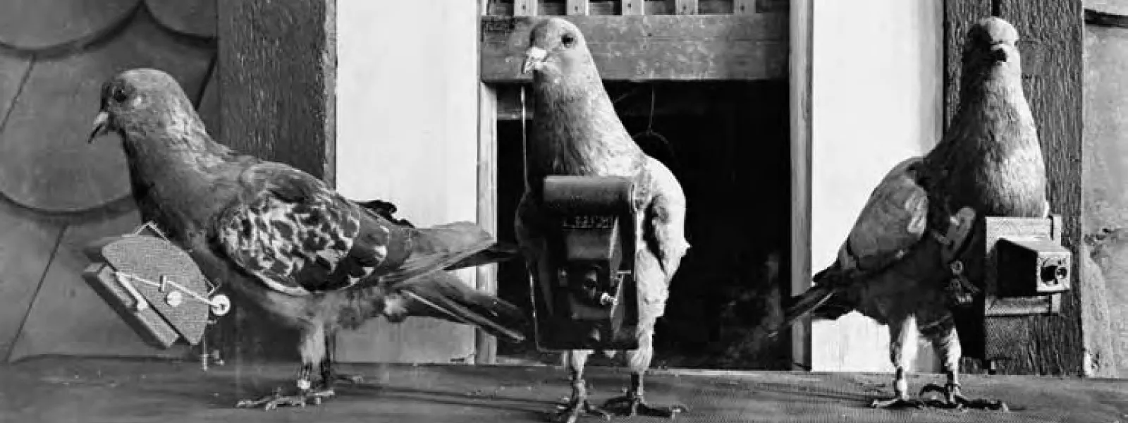 Then came the improvisers. People flew cameras on kites from the 1880s, triggered by fuses. In 1907 a German pharmacist, Julius Neubronner, applied to patent a miniature camera strapped to a homing pigeon. The patent office rejected it as impossible and only granted it in 1908 once he showed them the photos. In 1909 a cameraman flying with Wilbur Wright shot the first motion picture from an airplane.
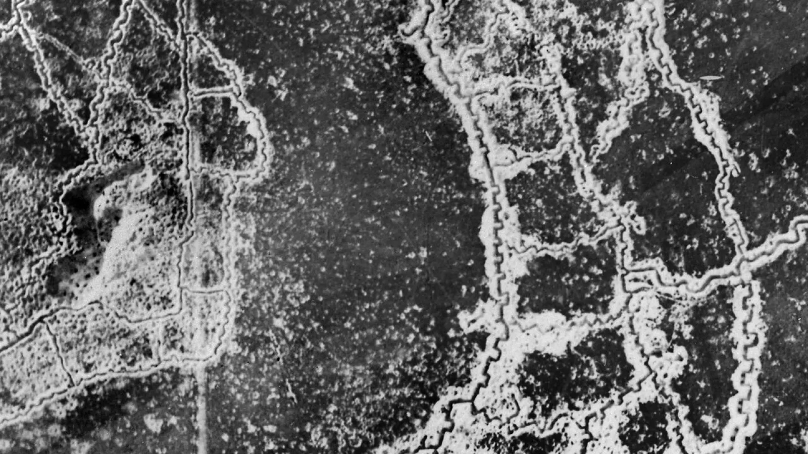
 The First World War turned all of this into an industry. In the first nine months of 1918 alone, British forces produced over 5.2 million reconnaissance photos, and by 1916 prints could reach headquarters 49 minutes after the shutter fired. Between the wars came dedicated mapping cameras and the stereoplotters from Wild and Zeiss, machines that let an operator trace contours by looking at two overlapping photos through optics. The standard 23 by 23 cm film frame survived until the switch to digital cameras around 2000 to 2003.
How it works today
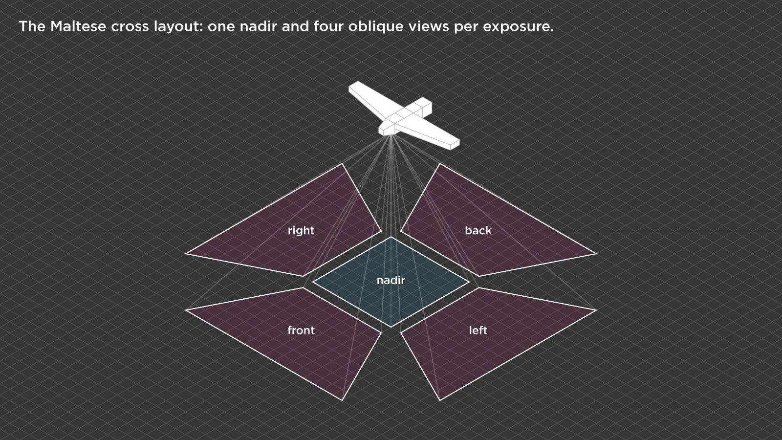
Modern large-format aerial cameras are absurd in the best way. The Vexcel UltraCam Eagle 4.1 captures over 500 megapixels per frame, 28,110 pixels across the flight line, one frame every 0.7 seconds, and flies 5 cm pixels at up to 195 knots. Two weeks ago at Intergeo Vexcel announced the UltraCam Condor 5.0, with up to 83,000 pixels across the swath. Oblique systems put one camera straight down and four more tilted around it, the "Maltese cross" layout that Fairchild used on film in the 1930s. GNSS and inertial units record where the camera was and how it pointed for every frame, and many aircraft carry LiDAR alongside the cameras.
What it is good at
Covering a lot of ground at high detail. A single Cessna carrying an oblique system flew the whole city of Graz in one day in 2022. That is why national mapping runs on aircraft: Switzerland flies 10 cm orthophotos over its plateau and valleys, France 20 cm, the Netherlands twice a year, and Latvia on a three year cycle. The 3D cities in online maps are largely built from oblique aircraft photos too. Per square kilometer over a large area, nothing beats it.
What holds it back
Mobilization. A plane, a crew, a camera worth more than a house and fuel for a transit flight are expensive to get off the ground, which is why small areas carry a steep premium. Price lists show project fees in the thousands before a single photo is taken, and industry estimates put the crossover with drones at somewhere around 13 km². Weather is strict too: survey specs typically want the sun at least 30 degrees above the horizon, no cloud shadows and no haze, which shrinks the flying season considerably. And a plane cannot fly under a bridge.
Drone Photogrammetry: The Close-Up Scale
The first UAV photogrammetry flight is usually credited to Heinz-Jürgen Przybilla and Wester-Ebbinghaus in 1979, who flew a camera on a remote-controlled model airplane. It stayed a niche for decades, because the math wanted calibrated metric cameras and precise positions that hobby aircraft could not provide.
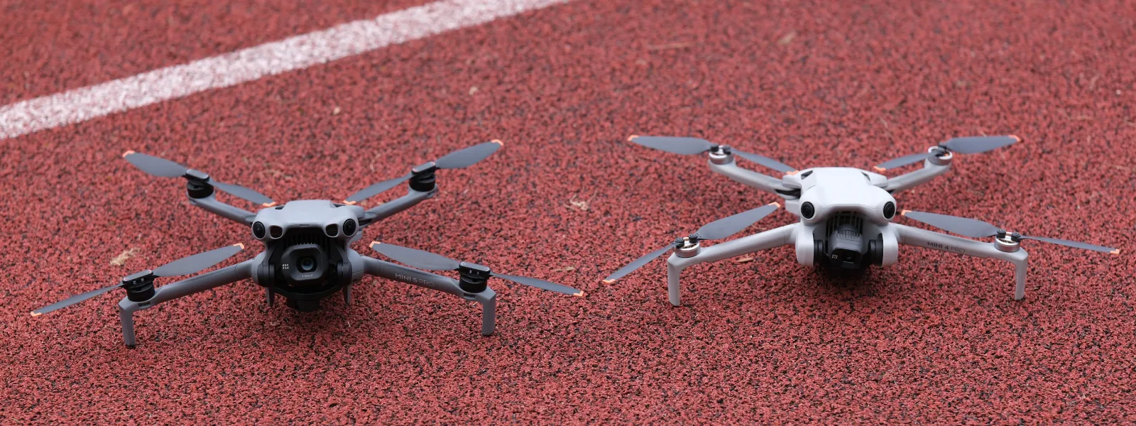
What changed it was computer vision. In 2006, Photo Tourism reconstructed scenes automatically from random internet photos, and in 2009 a team rebuilt Rome from 150,000 Flickr images in 21 hours. Structure from motion meant an ordinary uncalibrated camera could now produce a measurable model, because the software solves the camera calibration along with everything else. The DJI Phantom arrived in January 2013, without even a built in camera. Six years later the Mavic Mini weighed exactly 249 grams, one gram under the registration threshold, and in 2021 the EU capped the open category at 120 m. You know the rest, because it is what this blog is about.
What it is good at
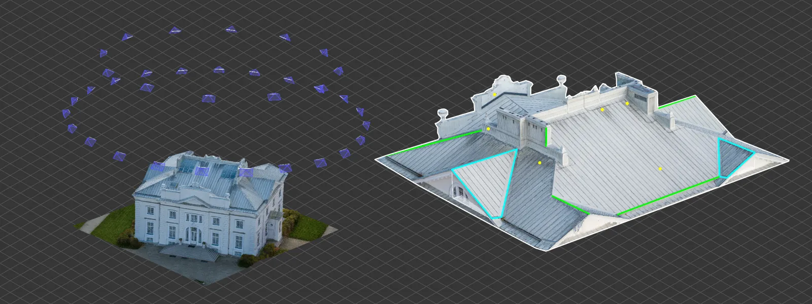
Detail and angles. Flying at 120 m gives about 1 to 3 cm per pixel, and flying close gets you to millimeters: one bridge inspection reached 1.3 mm from 30 m, and measured deformation within a millimeter of physical sensors. Drones capture orbits and obliques around a single structure that no plane or satellite can match, and they fly under clouds. Deployment is the same day. With good ground control and overlap, accuracy of one to three times the GSD is realistic, which means centimeter work.
What holds it back
Area. One battery covers tens of hectares, and a full day of flying covers perhaps 10 to 25 km² even with a fixed wing. Visual line of sight rules, the 120 m ceiling and wind all cap it. For anything bigger than a large site, the plane wins.
What It All Means
The three scales are not competing. They are nested. A mining company might use satellite stereo to find a region worth exploring, commission an aircraft survey of the concession, and fly a drone over the pit every week. A city might use aircraft for an orthophoto every three years and drones for individual buildings. Choosing between them is really a question of two numbers: how much area, and how much detail. Everything else, cost included, follows from those two.
The edges are blurring, too. Solar high altitude drones like the Zephyr sit at around 21 km, between aircraft and satellites, and one stayed airborne for 67 days in 2025. Satellite companies are chasing very low orbits for sharper pixels. And drone docks now fly the same mission automatically on a schedule, which is essentially satellite style revisit at centimeter resolution. The geometry underneath all of it has not changed since the 1950s.
Conclusion
Photogrammetry is one idea applied at three distances. Satellites trade detail for reach, aircraft trade flexibility for efficiency, and drones trade area for detail and angles nobody else can get. The math that measures a glacier from orbit is the same math that measures a roof from 30 meters.
If you work at the drone scale, you are using the same technique that mapped the Cold War, only with a lot more control over where the camera goes. For planning that side of it, Pixpro Waypoints handles the grids and orbits, and the rest is overlap, light and patience.
Frequently Asked Questions
What is the difference between satellite, aerial and drone photogrammetry?
The platform and distance, not the principle. All three reconstruct 3D geometry from overlapping images using the same equations. Satellites fly 500 to 600 km up with 25 to 34 cm pixels, survey aircraft about 1 km up with 2.5 to 10 cm pixels, and drones under 120 m with 1 to 3 cm pixels or better.
What is the best resolution from a commercial satellite?
About 25 cm native from SuperView Neo-1, with WorldView Legion and Pléiades Neo around 30 cm class. Attempts at 10 cm from very low orbit have not yet produced routine imagery.
When is a crewed aircraft cheaper than a drone?
For large areas. Aircraft carry a high mobilization cost but cover hundreds of square kilometers a day, so industry estimates put the crossover at roughly 13 km². Below that, a drone is usually cheaper and faster.
Can you make a 3D model from satellite images?
Yes. Stereo and tri-stereo satellite imagery is routinely turned into elevation models and city scale 3D data. The detail is limited by the pixel size, so it suits terrain, glaciers and urban overviews rather than individual structures.
Why do drones get better detail than satellites?
Distance. Ground sampling distance scales directly with how far the camera is from the subject. A drone 50 m away is ten thousand times closer than a satellite 500 km up, which more than makes up for its much smaller lens and sensor.
Photographer - Drone Pilot - Photogrammetrist. Years of experience in gathering data for photogrammetry projects, client support and consultations, software testing, and working with development and marketing teams. Feel free to contact me via Pixpro Discord or email (l.zmejevskis@pix-pro.com) if you have any questions about our blog.
Related Blog Posts
Our Related Posts
All of our tools and technologies are designed, modified and updated keeping your needs in mind

Photogrammetry Gear Guide 2026: What a Complete Setup Actually Costs
Nobody buys a camera and then does photogrammetry with it. You need something to capture with, something to process with, and something to process on, and this year the third one is the most interesting decision of the three.
 Pixpro Team

What Photogrammetry Software Actually Costs in 2026
Pricing pages in this industry are a mess. Some publish a number, some hide behind "contact sales", some quote a monthly figure that only applies if you pay a year up front, and several sell the processing separately from the software that does the processing.
Pixpro Team

Most Asked Photogrammetry Questions Part 5 - From Capture to Delivery
We are back with another installment of our photogrammetry FAQ series. These are ten more questions we hear often, from people getting started and from users already deep into their projects.
Pixpro Team
Ready to get started with your project?
You can choose from our three different plans or ask for a custom solution where you can process as many photos as you like!
Free 14-day trial. Cancel any time.