.svg@webp)
Fast and Accurate Solar Panel Design

| Industry | Energy, Construction |
| Objective | Accurate and actual roof measurements for solar panel projection. |
| Drone | DJI Phantom 4 pro |
| Flight Data | Camera angulation: Various: 90o (top down) Grid: Manual Horizontal Height: 30 m Duration: 7 min |
| Dataset Size | 107 images |
| Data Processing | 15 min using medium software settings |
| Hardware | Intel i7 8700, 16 GB of RAM, dual Radeon rx580, SSD drive |
Solar Panel Design Challenge: Outdated Blueprints
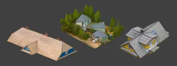
Roof-mounted solar power plants are popular in Western Europe. This clean energy solution is slowly making its way across the rest of Europe. To quickly respond to increasing demand, fast and accurate solar panel design.
The solar plants on the flat roofs are more universal and significantly easier to design as well as mount them. Moreover, such roof allows adjusting the direction of the solar plates as desired with the most convenient direction and angle, and the least concern on positioning it. But when it comes to positioning the solar plates on the pitched or matched roofs, the design requires high accuracy and consideration to the orientation of the building, angle of the roof, and the suitable area for mounting.
One of the main issues often encountered by solar panel engineers – outdated blueprints of the structure in question. Often the roof has new structures built such as chimneys, air conditioning, antennas, etc. There are times when the roof itself changes. For example, loft extensions, extra windows built in and so on.
In order to make fast and accurate solar panels design, it’s imperative to remeasure exact roof dimensions and blueprints. All of that can be achieved accurately, quickly and safely by using object analysis from photographs.
Data Gathering for Solar Panel Design
In order to reconstruct an accurate 3D model of the object, the photos should meet quality, overlap degree and quantity requirements.
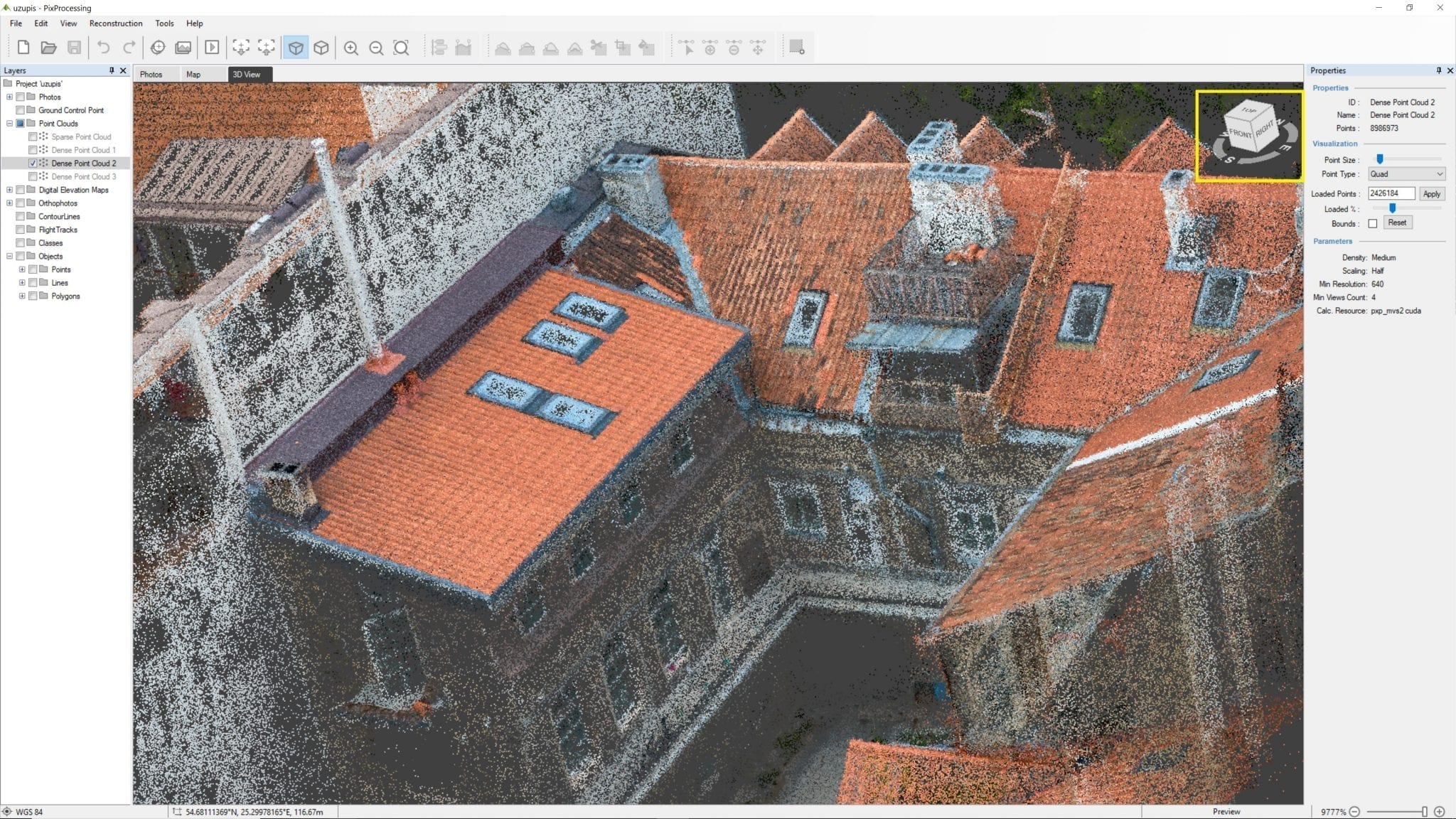
In this particular case, the DJI Phantom 4 Pro drone with 20-megapixel 1 inch imaging sensor camera was employed. The photos were taken from the altitude of 30 meters with the camera angled in 90 degrees downwards. The dataset was acquired using manual flight and took only 7 minutes. All in all, the camera captured 107 photos.
Data Processing
Using the Pixpro software the reconstruction of the 3D model of this roof took 15 minutes. It is noteworthy that the data processing highly depends on the quality of the photos and the hardware.
Data Analysis
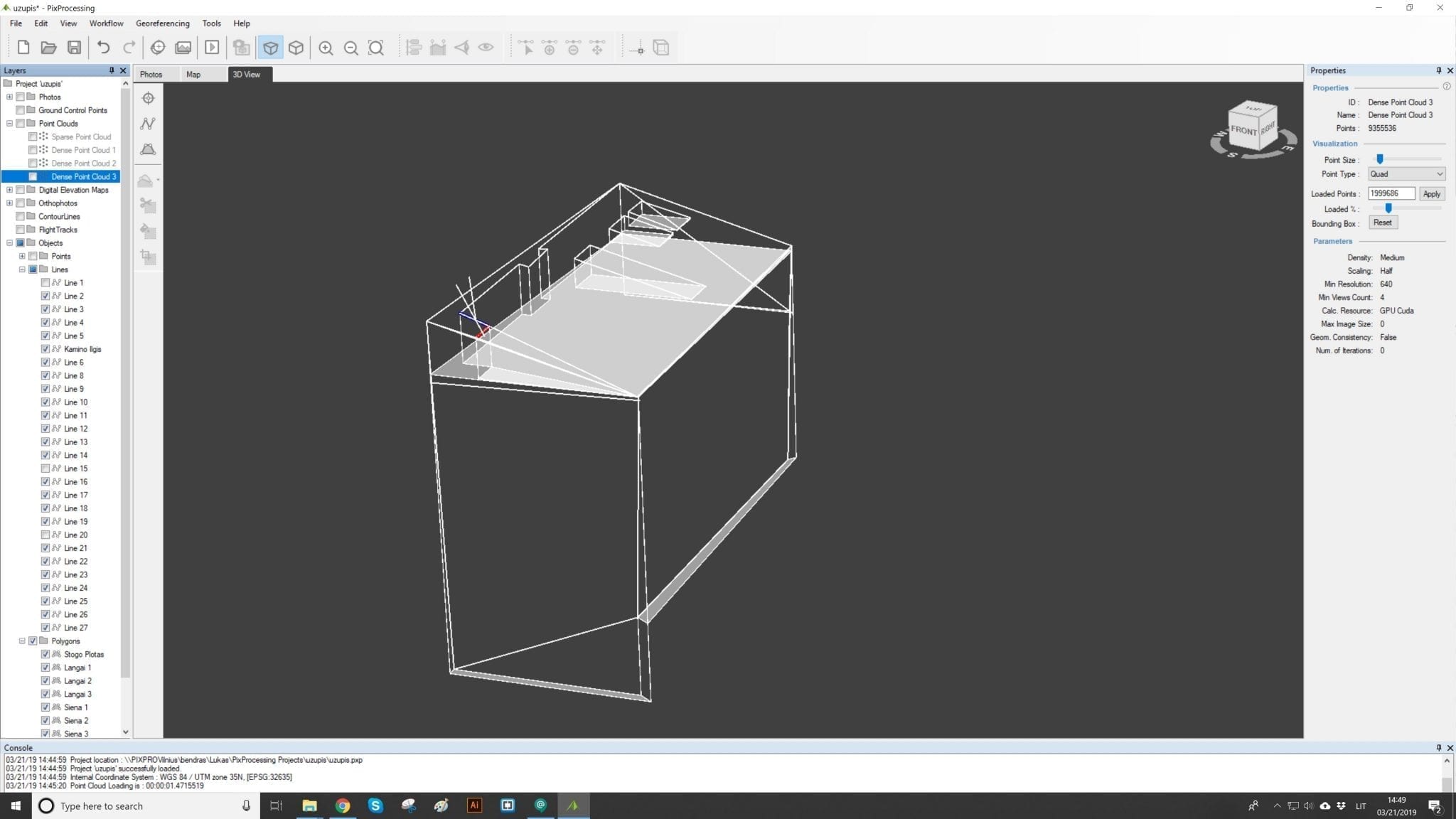
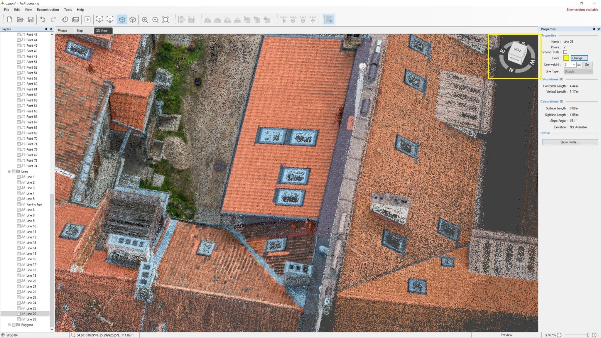
Pixpro software allows you to mark the points of an object with great precision (the accuracy is up to the centimeter).
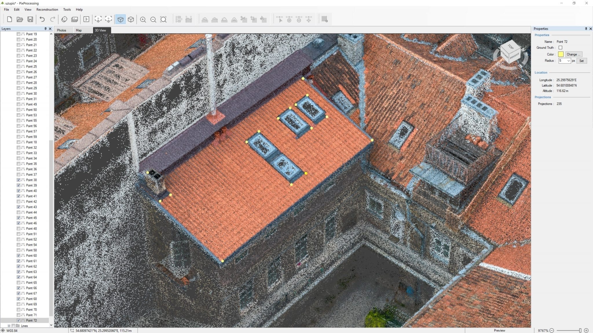
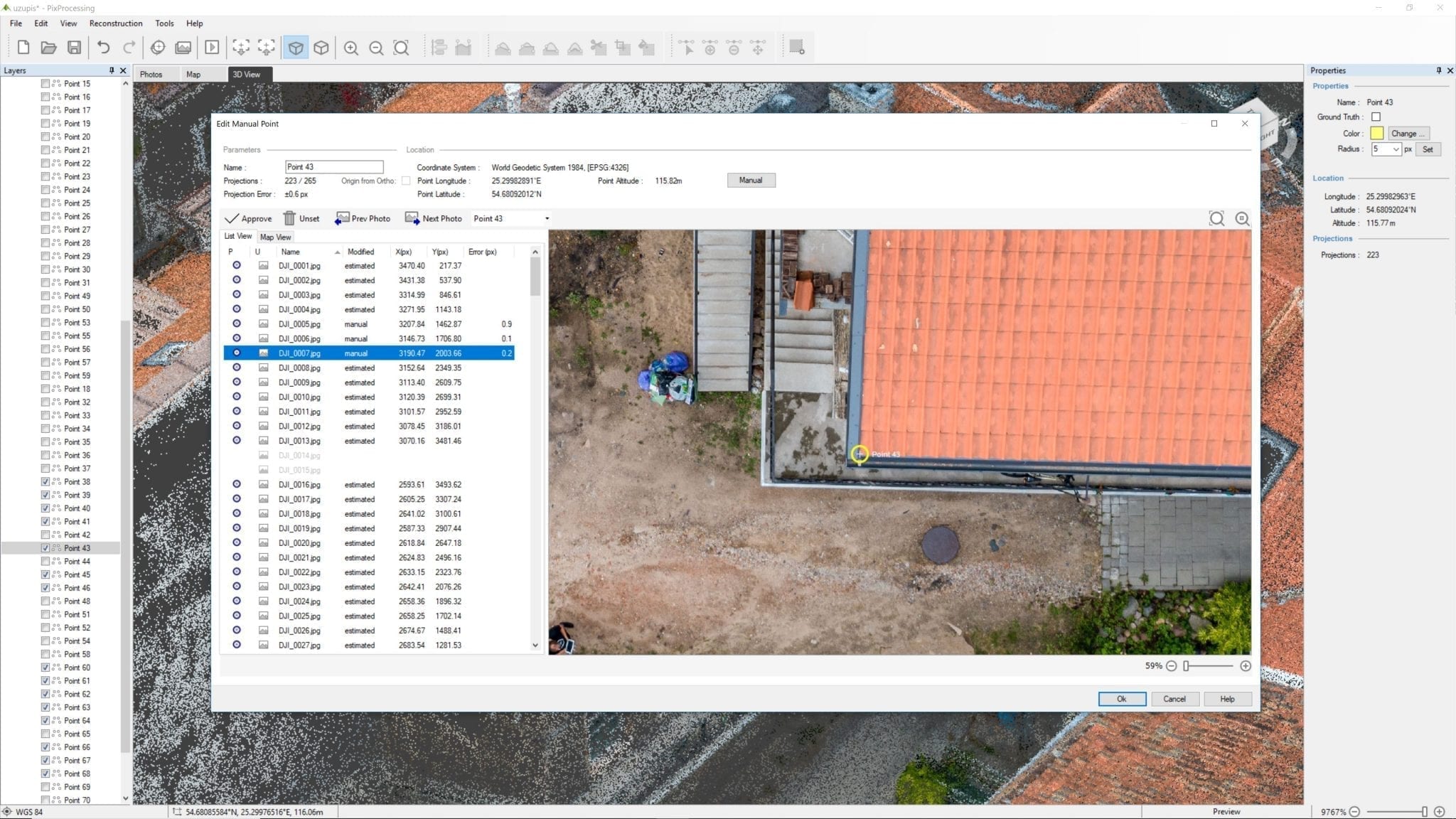
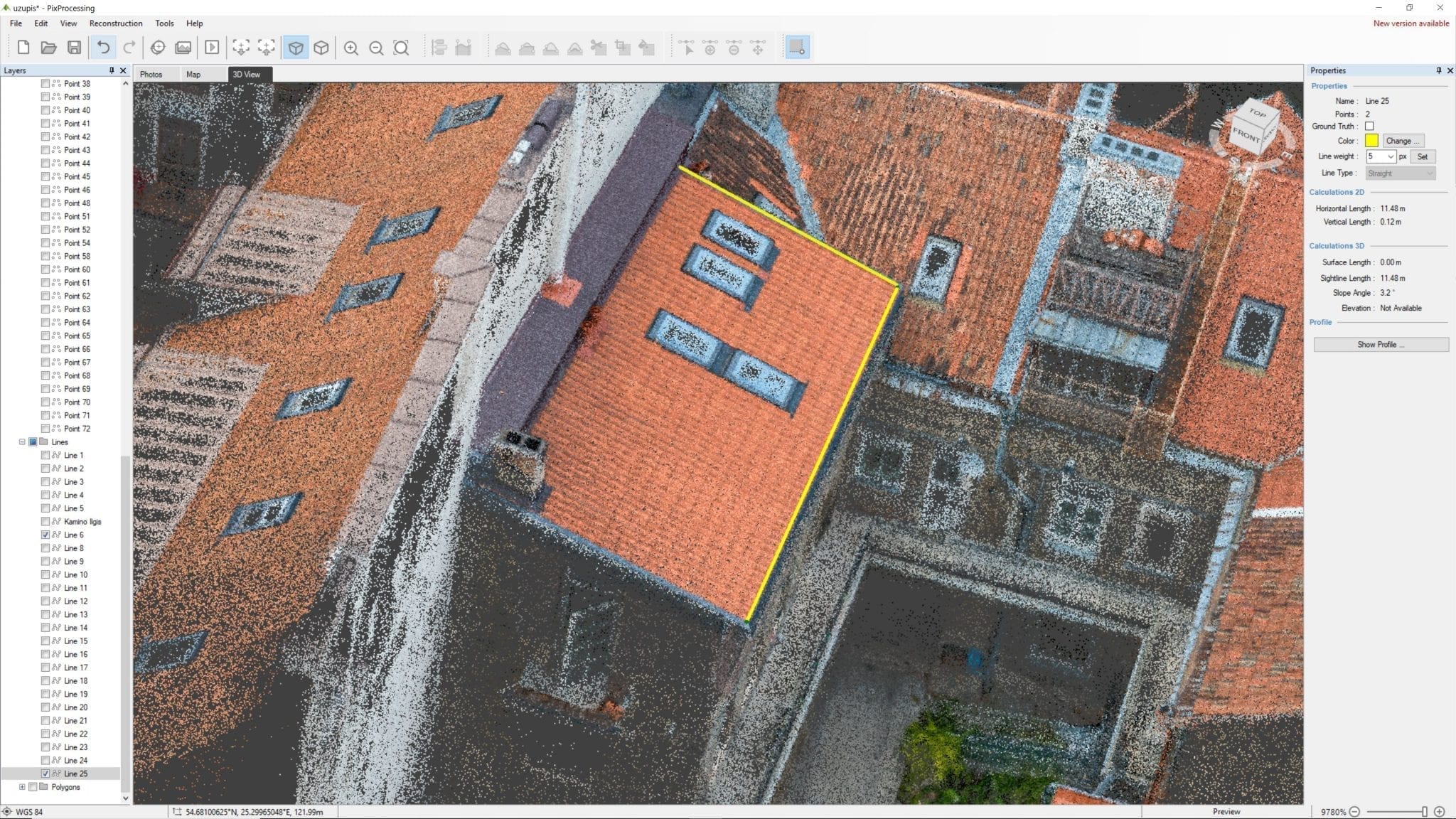
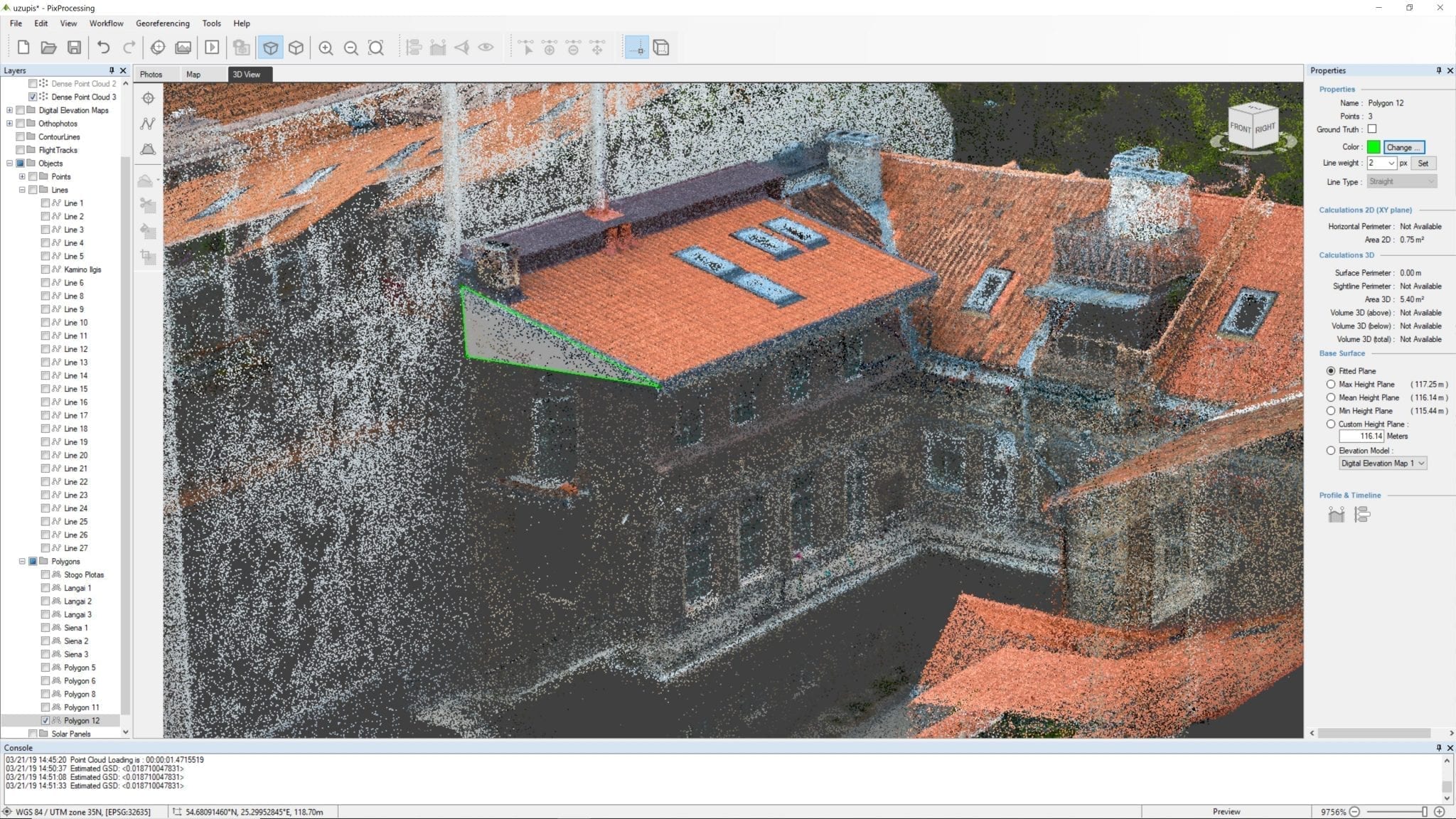
By connecting the points with a line, you receive accurate distances between those points. This method enables fast measurement of the roof and its elements with their sloping angles, but also instantly calculates the marked areas.
The accurately positioned points and lines on the 3D model can be exported into AutoCad software. No need to draw the blueprints from scratch in AutoCAD. It saves a significant amount of time. Exported data contains all necessary data, so you can start designing the solar plant on the imported file right away.
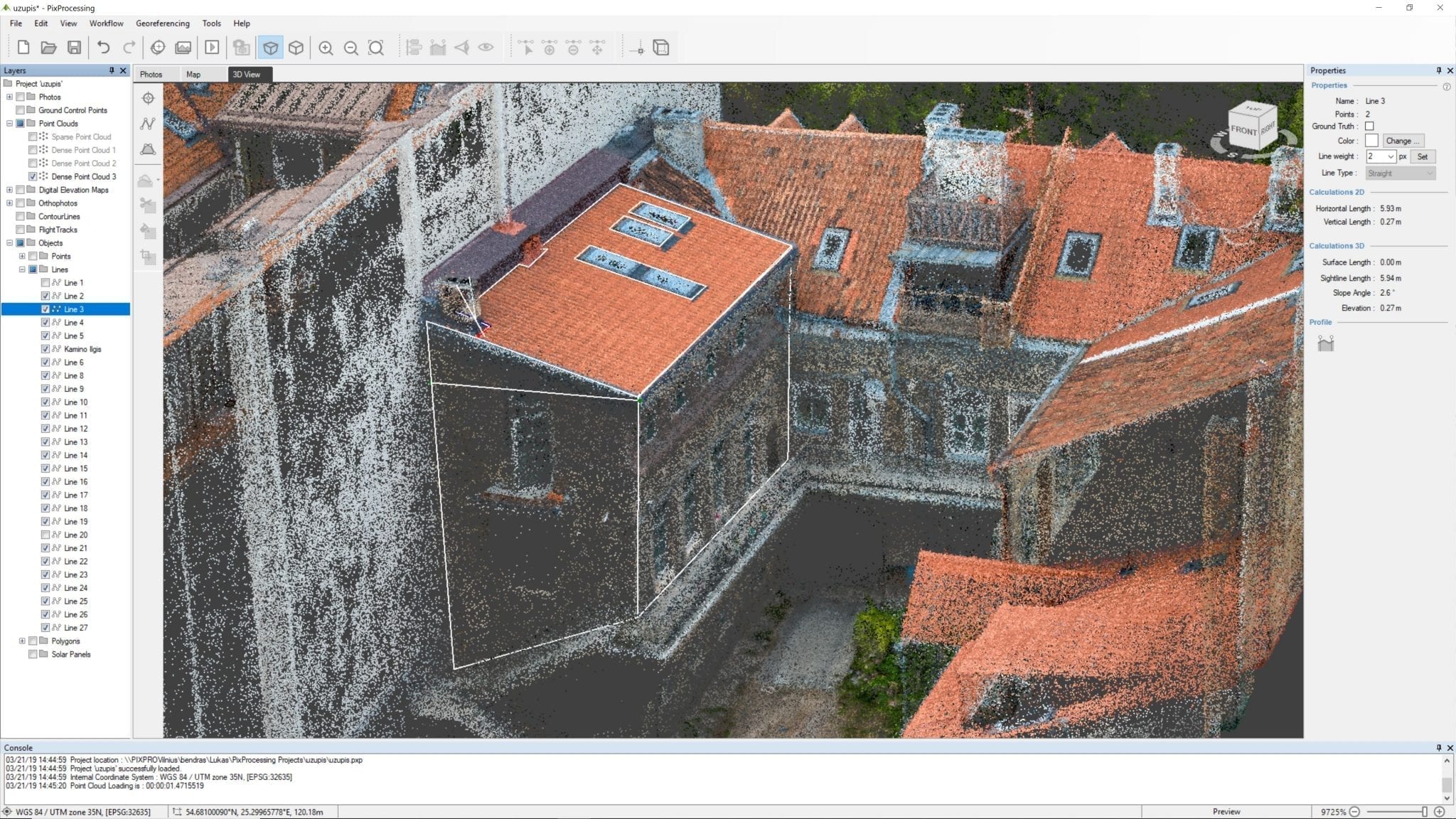
When projecting solar panels, the usable surface area isn’t the only important thing, but also their geographical orientation. Everyone knows that south-east, south facing panels are the most effective. Although only a few properties have roofs with that orientation. Pixpro software displays the objects geographical orientation and allows to estimate the effectiveness of the solar panels once they’re placed.
Solar design and photogrammetry – new standard of workflow
The solution significantly reduces the time consumption. A detailed 3D model of the roof was generated within approximately 25 minutes (travel time is not included).
Pixpro software integration with AutoCAD software facilitates and accelerates the workflow for designers and engineers.
The acquired information is highly valuable and proves to be of enduring value. In case the customer changes his mind and decided to mount the solar batteries on the other slope of the roof, there is no need to travel to the location to measure the roof once again.
The precise geographic orientation of the object allows instantly evaluate the efficiency of the solar plant, and if possible, rearrange the position of the solar plates on the roof.
This innovative method of the object analysis eliminates the direct contact of the employee with the object, thus increasing your employee’s safety which is highly important in the cases of steep pitched roofs.
Related Blog Posts
Our Related Posts
All of our tools and technologies are designed, modified and updated keeping your needs in mind
DJI Lito X1 for Roof Photogrammetry: Solar and Inspection Use Case
Small drones are the best tool for residential and even commercial roof photogrammetry. They are quiet, attract less attention, are easier to fly fully within regulations, and they are affordable.
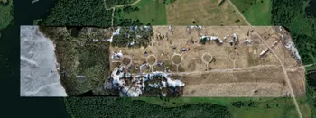
Large Property Photogrammetry – Real Estate Development Use Case
Property scans are one of the most common use cases, especially for our software. Pixpro is affordable and works well with RTK data and ground control points when necessary.
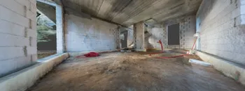
Handheld Photogrammetry Construction Interior Scan Use Case
Interior 3D scanning can be useful in a myriad of ways. In this article, I present a scan of a residential building construction site, with its foundation walls and roof almost complete. Further construction will require some visualizations and design according to “the fact.”
Ready to get started with your project?
You can choose from our three different plans or ask for a custom solution where you can process as many photos as you like!
Free 14-day trial. Cancel any time.