.svg@webp)
Stockpile Photogrammetry Without a Flight Plan: Do Multiple Orbits Work?
 Lukas
Zmejevskis
Lukas
Zmejevskis
The Short Version
If you only have a minute:
-
You do not need a preplanned flight or an enterprise drone to measure a stockpile. Orbits with good overlap are enough.
-
Orbits are the classic move for a single isolated object, but multiple offset orbits also cover larger areas and multi-pile sites. Fly one orbit per pile and process them all together.
-
It works fully manual, sticks in hand with the camera on timed shot, or with hyperlapse circle mode on a consumer drone like the Mavic 4 Pro. No grid, no plan.
-
Good for volumes and a general 3D overview. The structure is solid, the detail is only OK, and a true orthophoto still needs a nadir pass.
-
Relative accuracy from the drone's GPS is enough for a volume. Add ground control points or RTK to the orbit scan if you need absolute, survey-grade accuracy.
Most stockpile guides, including our own, assume you show up with a plan: a grid mission loaded, overlap calculated, maybe an RTK drone. That is the clean way to do it. But real jobs are not always clean. You get called to a busy, hazardous, constantly changing site and asked for a number now, with whatever drone is in the car, and no time to halt operations while you build a proper flight plan. The good news is that a few orbits with decent overlap will still get you a measurable model. Here is how far that goes, and where it stops.
Orbits Are Not Just for Single Objects
An orbit is the classic flight for a single isolated subject: a roof, a tower, a monument, a lone pile. Fly a circle around it and you get wrap-around coverage from every side, which is exactly what a 3D reconstruction wants. What people underuse is that the same idea scales up. Multiple offset orbits cover a larger area, and on a site with several piles you can fly one orbit per pile, or one per pair of piles, and process the whole set together. The software does not care that the photos came from separate circles, as long as they overlap and the coverage adds up. The sheer amount of well-overlapped data is what carries the reconstruction.
Three Quick Examples, None of Them Planned
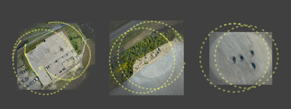
To show what this looks like in practice, here are three sites I captured with nothing but orbits and no preparation.
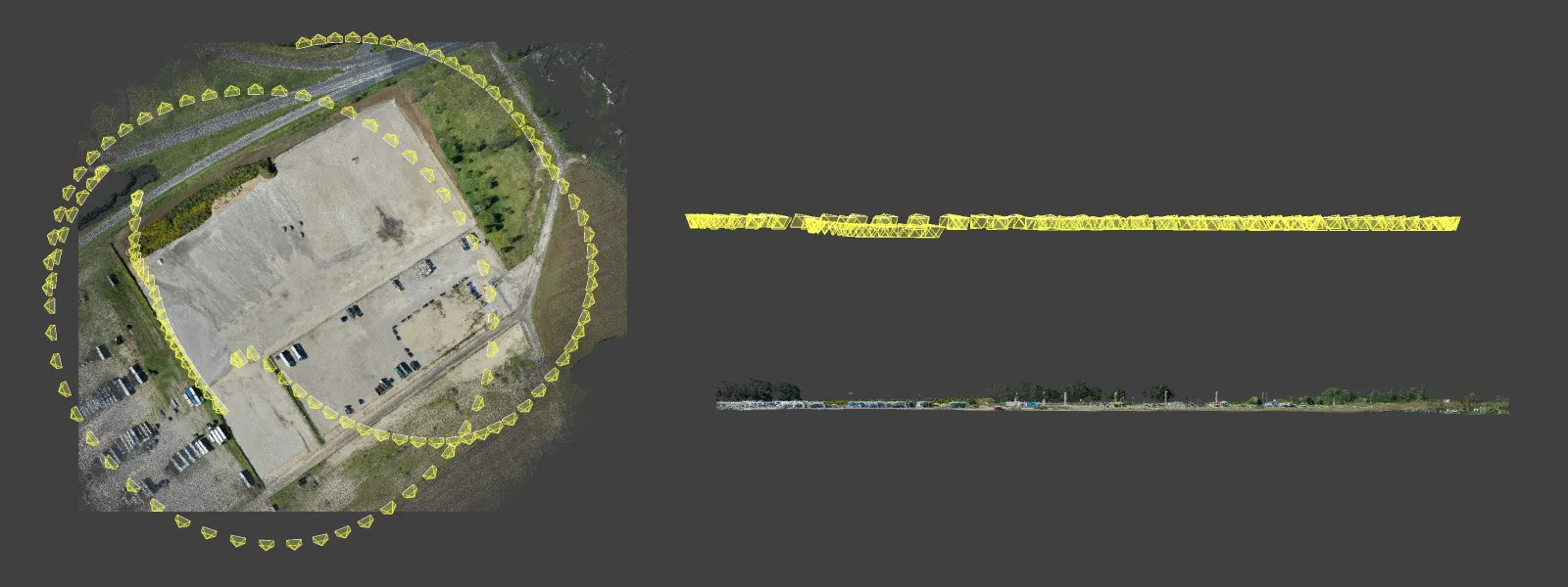
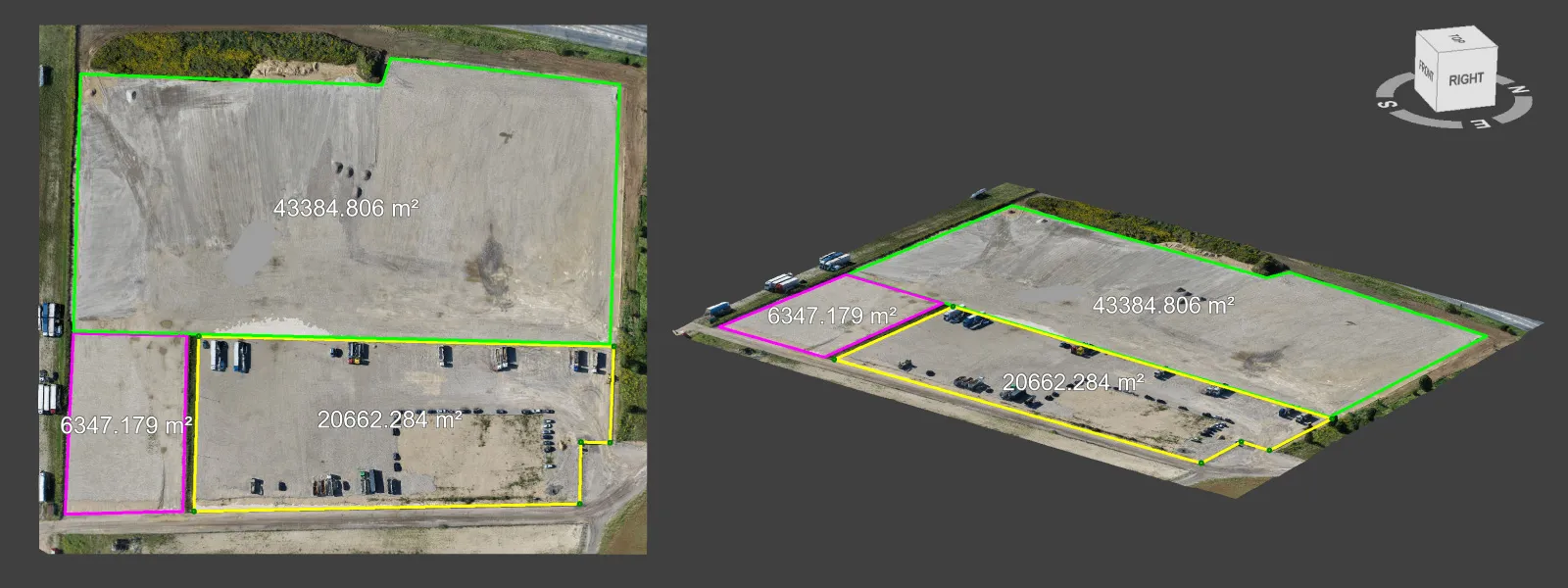
A large machinery parking lot. I flew two rough offset orbits, one around the center of each half of the lot, entirely by hand, sticks in my hands with the camera on timed shot taking a photo every couple of seconds. No automation at all. That was enough for a clean baseline scan of the whole lot with good structure.
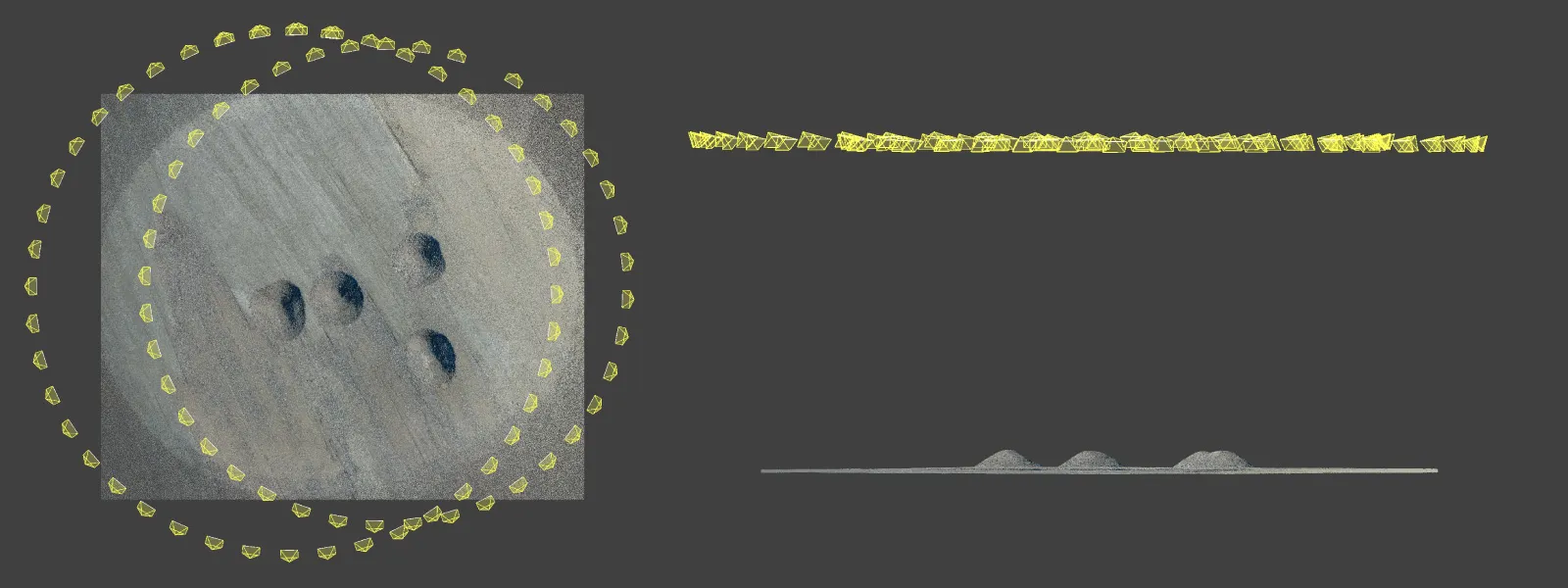
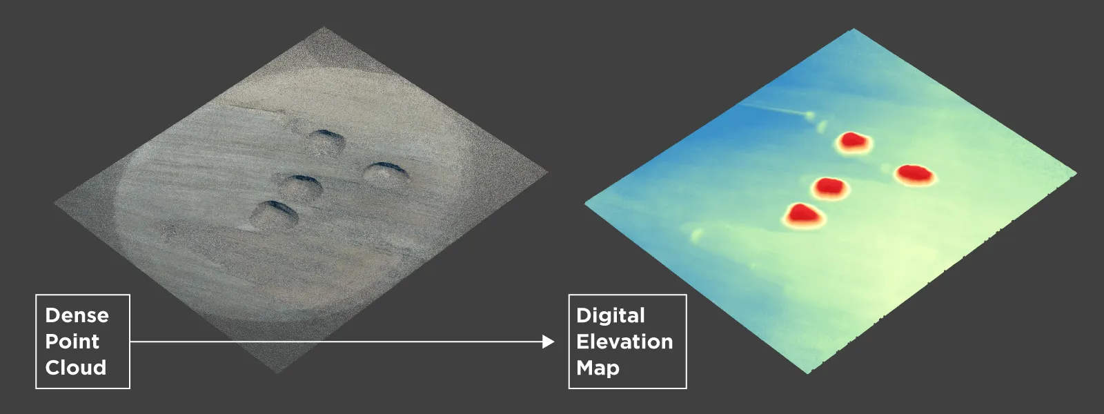
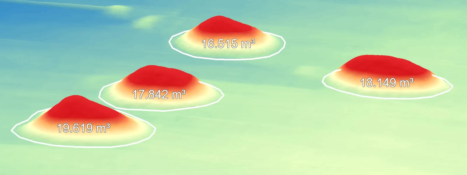
 Four small gravel piles. No plan, no grid, just two hyperlapse orbits on the Mavic 4 Pro, one circling the center of two piles and the other around the remaining two. With good overlap and sharp photos, that data reconstructs fine. Scanning a stockpile does not force you into a grid mission or one exact flight type to get a good preliminary measurement.
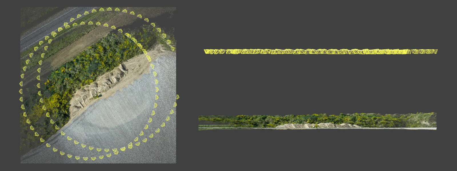
 An elongated stockpile. Gravel running along one side of a lot, an irregular, stretched-out shape, so I flew two orbits offset from each other along its length. Still good coverage, still solid 3D structure.
 What You Get, and What You Do Not
Orbits are the quickest and easiest way to a usable 3D scene, but be clear about what they deliver. The structure is good, easily good enough for volumes and a general overview. The detail is only OK, fine for measurement rather than the sharpest model you could make. And if you specifically need a true orthophoto, orbits alone will not do it, since that still wants a nadir grid pass on top. For volumes and a working overview, though, orbits are plenty, and they need no preplanning and no fussy setup.
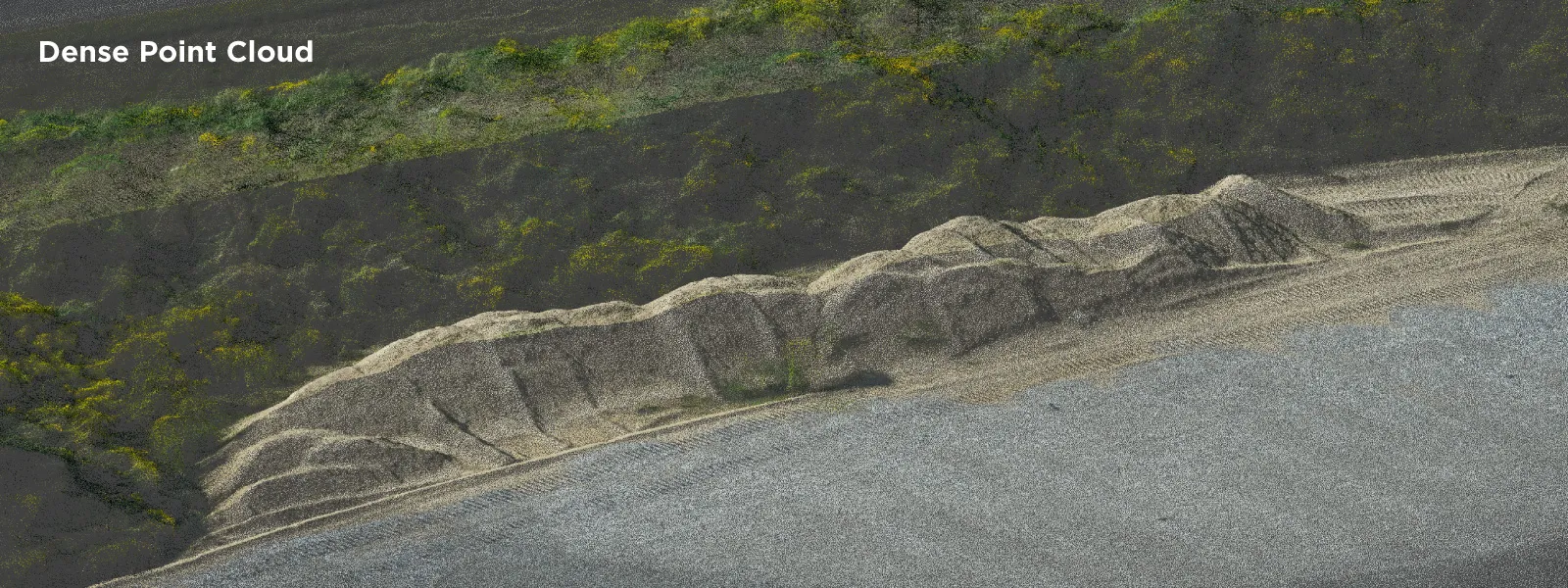
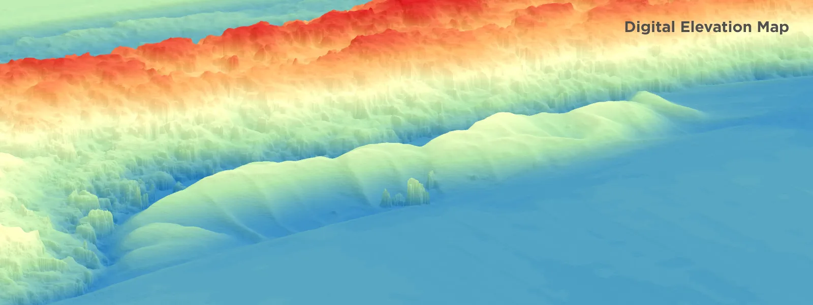
Planning still has its place. A repeatable grid mission with a planner like Pixpro Waypoints is better when you are monitoring the same pile over time, or working a large and awkward site where hand-flown circles get inconsistent. Think of the quick orbit as the tool for a one-off number under pressure, not a replacement for a proper monitoring workflow.
 Accuracy: Relative for Free, Absolute if You Add Control
For a volume you do not need survey gear. A volume is a relative measurement, it depends on the shape of the pile compared to itself, so the drone's own GPS gives relative accuracy that is good enough to measure it. And if you do need absolute, survey-grade accuracy, orbits do not shut you out of it. You can drop ground control points into an orbit scan, or use RTK photo data, exactly as you would with a grid. Orbits and ground control work together with no trouble.
Getting the Volume
Processing is the same no matter how you flew. Bring the photos into Pixpro, build the point cloud and the DEM, draw a polygon around the base of the pile, pick the base plane that matches the ground, and read the volume. The full step by step is in our stockpile volume guide. The point of this article is only that the capture in front of it does not have to be planned or fancy to feed it good data.
 Conclusion
Here is the sentiment worth taking away. When you are on short notice, on a dangerous or fast-moving site, and someone needs a number without shutting the place down for hours, you do not wait on a perfect flight plan. A few orbits with good overlap will get you there. Use multiple orbits to cover larger areas, one per pile across a whole yard if you have to, and process it all together for the full picture, because the amount of good data is what does the work.
 The quick orbit, thrown at almost anything, is a tool every photogrammetrist should carry. Planned missions are better when you have the time and the reason for them, but the humble orbit is the one that gets you a real measurement when nothing is prepared.
Frequently Asked Questions
Do I need to plan a flight to measure a stockpile?
No. A few manual or hyperlapse orbits with good overlap give you the coverage a volume needs. Planning helps with repeatable monitoring and large sites, but it is not required for a one-off measurement.
Can orbits cover more than one pile or a whole area?
Yes. Fly offset orbits across a larger lot, or one orbit per pile on a multi-pile site, then process everything together. The reconstruction does not care that the photos came from separate circles, as long as they overlap and the coverage adds up.
Do orbits give me a true orthophoto?
Not on their own. Orbits give strong structure for volumes and a general overview, but a true orthophoto still needs a nadir grid pass. For volumes and overview, orbits alone are enough.
Do I need RTK or ground control points?
Not for a relative volume, which is what most inventory work needs. The drone's GPS is good enough. If you need absolute, survey-grade accuracy, you can add ground control points or RTK to an orbit scan just as you would with a grid.
Photographer - Drone Pilot - Photogrammetrist. Years of experience in gathering data for photogrammetry projects, client support and consultations, software testing, and working with development and marketing teams. Feel free to contact me via Pixpro Discord or email (l.zmejevskis@pix-pro.com) if you have any questions about our blog.
Related Blog Posts
Our Related Posts
All of our tools and technologies are designed, modified and updated keeping your needs in mind
From Point Cloud to Report: Using Photogrammetry Software for Roof and Building Inspections
People fixate on the drone part of this, but a drone without solid processing software is just a slightly fancier camera on a stick. The value shows up once overlapping aerial photos get turned into a real, measurable 3D model.
 Pixpro Team
3D Roof Scanning with the DJI Mini 5 Pro
Another entry in our ongoing exploration of roof photogrammetry workflows. This time, the subject is the DJI Mini 5 Pro — DJI's latest 250g drone with a 1-inch sensor, omnidirectional obstacle avoidance, and Pixpro Waypoints support.
Pixpro Team
Residential House Scan Use Case - Complete Exterior
Dealing with a moderately complex request: a brand-new home building scan for documentation and solar panel installation planning. I had no opportunity to preplan any flights – just grab the drone and head to the location, with only a few listing photos as reference.
Pixpro Team
Ready to get started with your project?
You can choose from our three different plans or ask for a custom solution where you can process as many photos as you like!
Free 14-day trial. Cancel any time.