.svg@webp)
3D Roof Scanning with the DJI Mini 5 Pro
 Lukas
Zmejevskis
Lukas
Zmejevskis
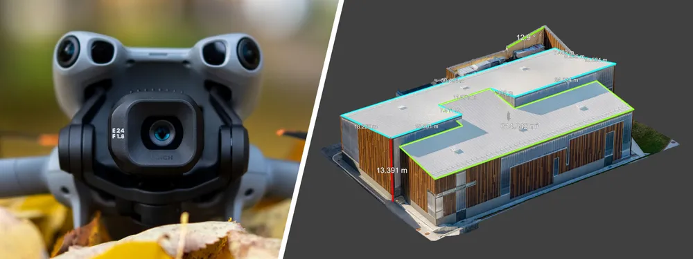
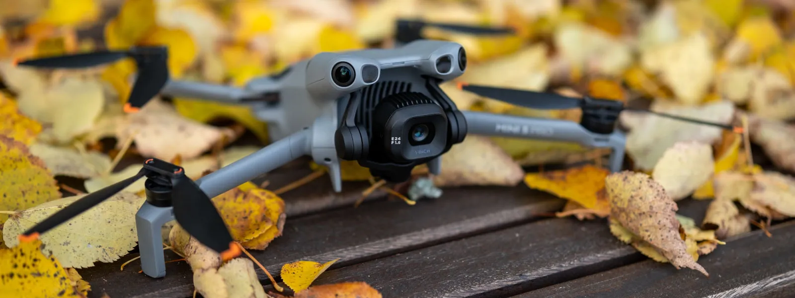
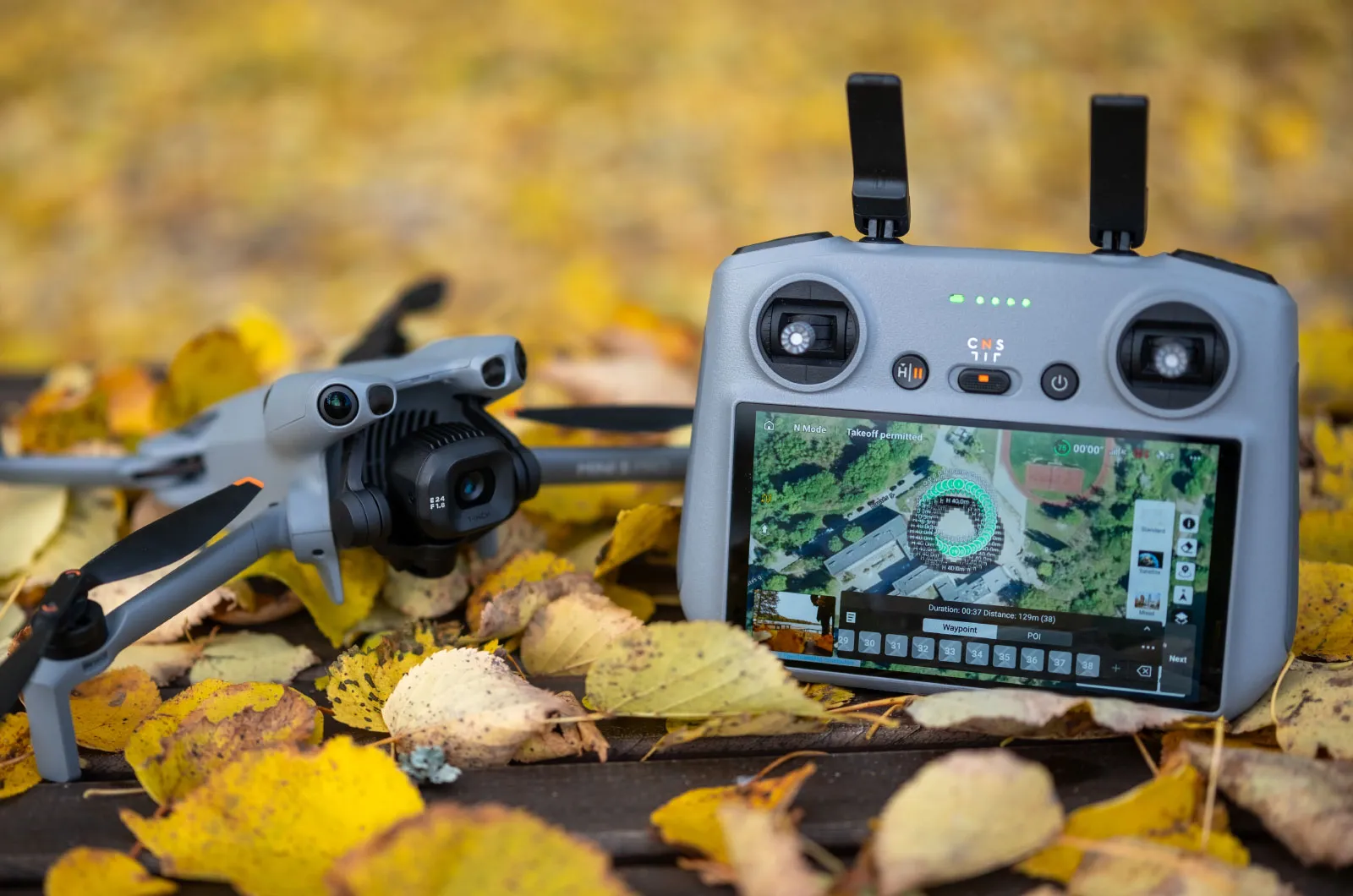
Another entry in our ongoing exploration of roof photogrammetry workflows. This time, the subject is the DJI Mini 5 Pro — DJI's latest 250g drone with a 1-inch sensor, omnidirectional obstacle avoidance, and Pixpro Waypoints support. For a tool this small, the Mini 5 manages to do almost everything right when it comes to lightweight aerial scanning.
In this article, I am using the Mini 5 Pro to scan a few rooftops for photogrammetry-based 3D reconstruction, inspection, and solar panel planning. There are no surprises or significant departures from past workflows. If you have followed my previous articles, especially the Mavic 4 Pro Roof Scanning post, the process is very familiar. This post demonstrates that the same workflow can now be accomplished using a significantly smaller, lighter, and more accessible drone.
Why Use the Mini 5 Pro for Roof Photogrammetry?
There are several clear reasons why the Mini 5 Pro is well-suited for this type of job. First and foremost, it is under 250 grams. That means fewer regulations, less paperwork, and broader flight permissions in many countries. You get the drone up and go.
 Second, image quality. Despite the size, the Mini 5 has a proper 1-inch type sensor with excellent optics. The lens is sharp across the entire frame, and the sensor produces clean, high-resolution photos even in challenging lighting conditions. The image quality difference between this and older Mini drones is substantial. It is closer to the Mavic line now than ever before.
 Third: Pixpro Waypoints. As mentioned in the full Mini 5 photogrammetry article, this drone supports the Pixpro Waypoints service natively via DJI Fly. This means you can create fully automated photogrammetry flights optimized for overlap, coverage, and angle without needing any SDK-based apps or enterprise-level drones.
Last but not least: safety and usability. The Mini 5 has omnidirectional obstacle sensors and even frontal LiDAR. That means fewer surprises, especially when flying close to trees, chimneys, antennas, or roof overhangs.
Manual 3D Photogrammetry on Roofs
For this article, I did both manual and automated flights. My go-to manual approach usually starts with a few hyperlapse orbits at various altitudes. These give me a clean set of oblique angles that wrap around the entire structure. For a roof, this means getting the pitch, ridgelines, and dormers from multiple sides.
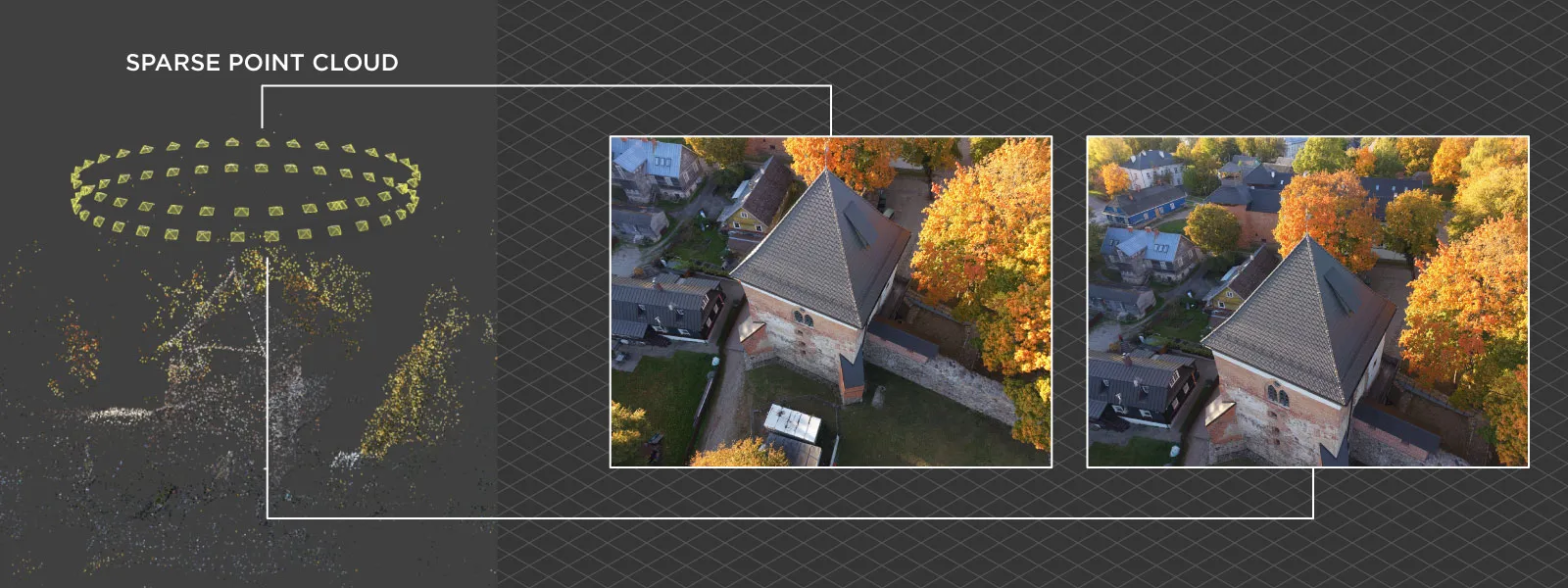 Using hyperlapse orbit mode is bread and butter around here. It is the best option when there are no preplanned flights. Select your subject, and aim for 30-50 photos per orbit in most roof scanning cases. Adjust the flight speed or trajectory as needed. Make a few orbits if you are new to this; filtering photos is easy in post-processing. More on how to use hyperlapse for 3D scanning in our previous article:
Hyperlapse Capture for Photogrammetry
Truth be told, many professionals in solar panel, roof inspection, and measurement fields rely on the hyperlapse method most of the time. This may be counterintuitive, but with experience comes trust in the smaller number of photos, which provide perfectly adequate results for 3D reconstruction and relative measurements. Provided those photos are taken with care and have excellent image quality, which is easily achieved with drones like the Mini 5 Pro.
 Suppose your goal is not just a robust 3D framework but also high-quality 3D visuals. In that case, you may need to go beyond just hyperlapse orbits. Adding manual perimeter capture, walkarounds with the drone, and lowering the orbital altitude and increasing proximity to the subject will enhance the visual fidelity of your scans. A good example of such methodology is this article from a while back.
Pixpro Waypoints Automation
Of course, I also ran a couple of automated flights using Pixpro Waypoints. Automated flights are handy for larger roofs and entire building complexes.
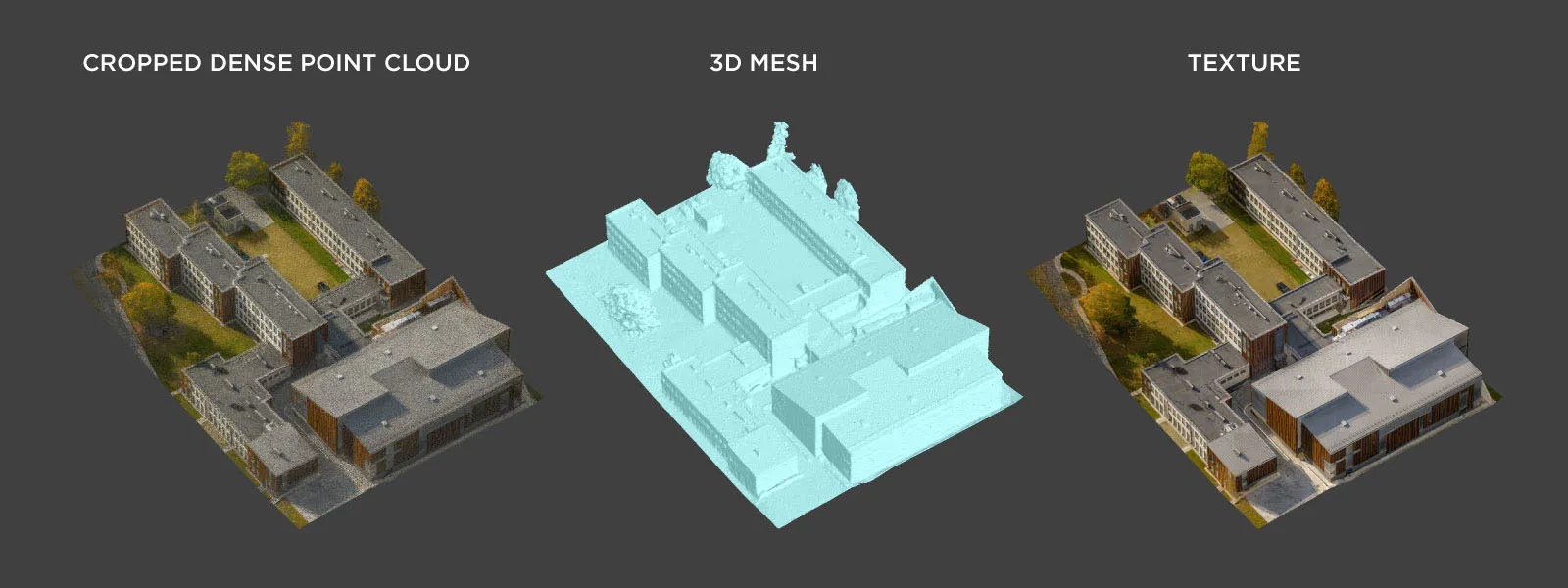
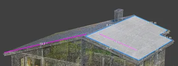
 I generated a flight plan using Pixpro Waypoints, selected the multi-grid option with the lower camera angle setting (–30 degrees), and replaced the placeholder file with my custom plan. The resulting flight yielded approximately 535 photos with high overlap and solid coverage of an entire school complex. The drone followed the plan smoothly, kept the desired heading and altitude, everything as usual with Waypoints.
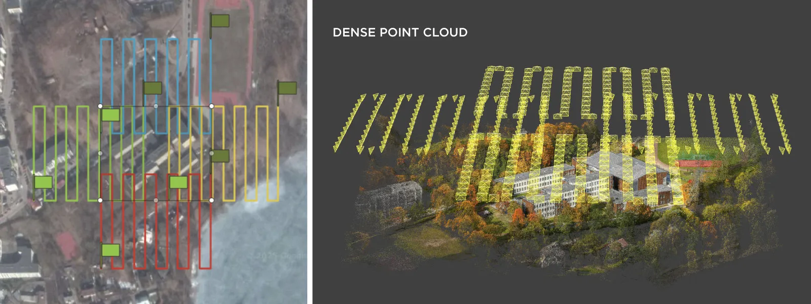 The multi-grid flight plan type is the go-to option if you do not wish to think about it. It is suitable for urban areas, roofs, intricate terrains, and other challenging environments. If you are unsure about what to do in a photogrammetric scanning setting, perform a multi-grid scan over your area, followed by a single-grid nadir scan. You will obtain a fully covered 3D scene with photos taken from five perspectives.
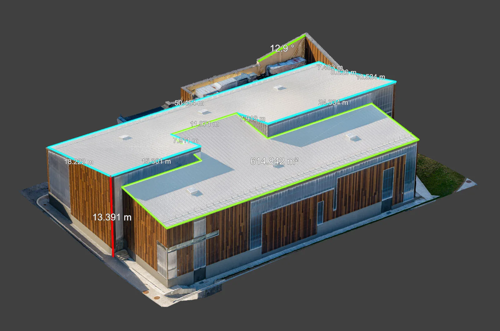
 The entire flight time was about 26 minutes, which required a single battery change. The Mini 5 does not have an enterprise-level RTK module; however, for relative model accuracy, such as measurements and inspections, the consumer GPS data is perfectly sufficient. Only the absolute positioning is not accurate for survey-grade work without Ground Control Points.
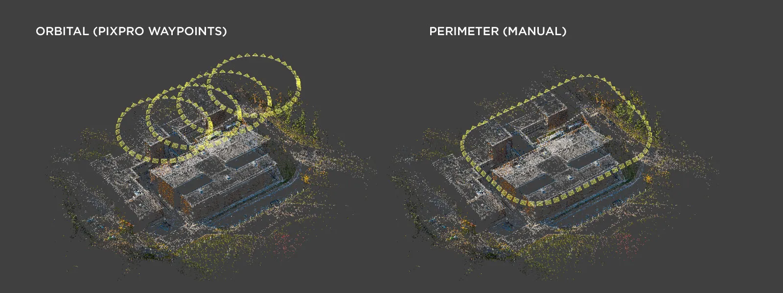 Additionally, I scanned the gymnasium roof of the school in greater detail. In this scan, I combined three orbital flights made with Pixpro Waypoints, plus an additional manual perimeter flight intended to add more detail to the walls.
 Orbital flights may be more efficient than launching a multi-grid scan. Still, those may require additional data, such as perimeters or walk-arounds with the drone. In any case, having automated options with the Mini 5 makes it a viable tool for both large and small scans alike.
Data Processing
All images were converted from RAW to JPEG using Lightroom Classic. I applied mild processing: neutral white balance, reduced highlights, and slightly lifted shadows, a bit of contrast via the curve, and that's it. Nothing fancy as usual.
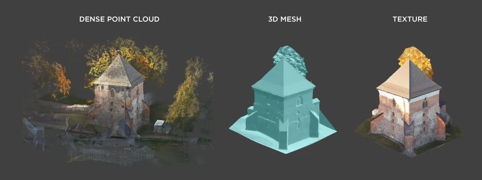
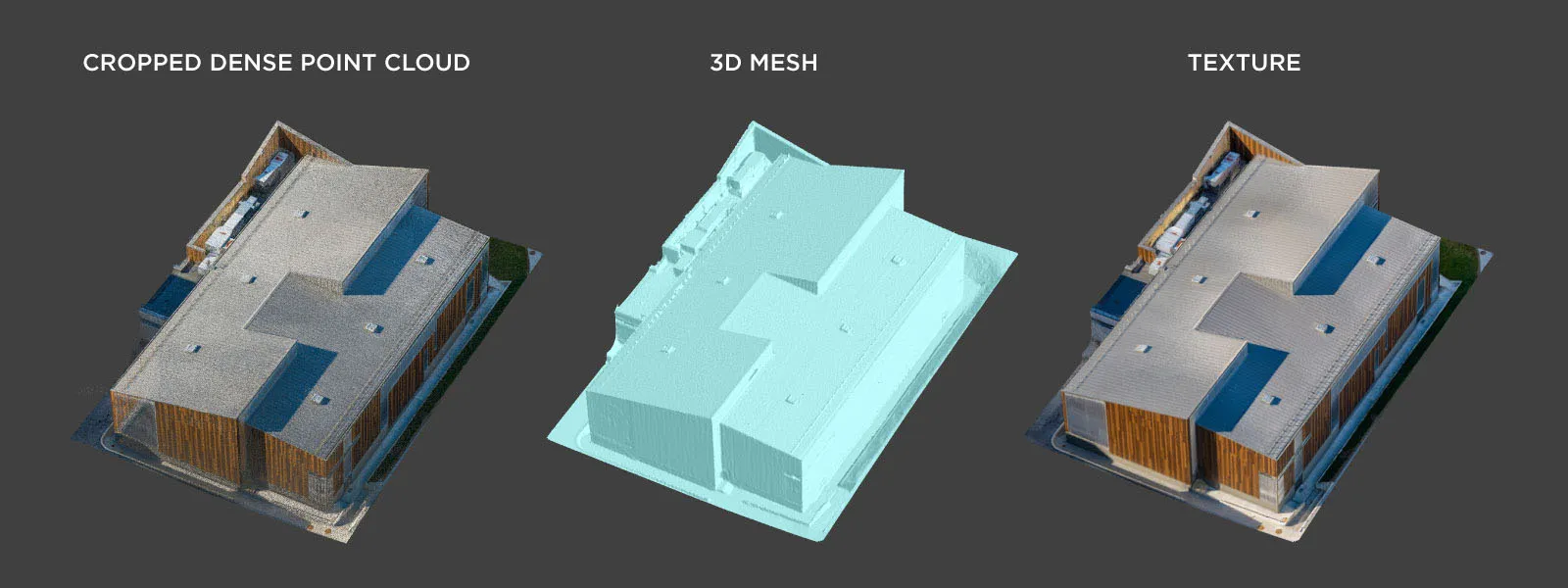
Photos were aligned in Pixpro photogrammetry software. Everything aligned on the first try; dense cloud, mesh, and texture were all generated in one go. I used default settings for everything.
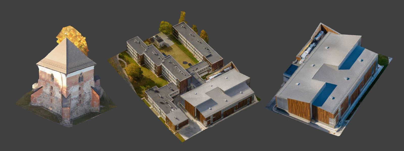 Model quality is solid in all of our examples. The Mini 5 is still "just" 12 megapixels, but those are clean and sharp 12 megapixels. If you would like to try these examples for yourself, please get in touch with us, and we can send you the image sets at your convenience.
 Conclusion
The DJI Mini 5 Pro is absolutely viable for real-world roof photogrammetry work. Its 1-inch sensor provides professional-level image quality, and Pixpro Waypoints unlocks automation in a tiny, regulation-friendly package.
This drone fills a very real need. It is not a toy, and it is not a downgrade from larger models for many typical scanning jobs. For solo operators, small business users, or anyone doing frequent roof inspections and solar planning, the Mini 5 Pro is hard to beat.
When paired with solid manual flying habits and Pixpro photogrammetry software, it becomes a complete toolkit. Simple, compact, and effective. How we like it.
Photographer - Drone Pilot - Photogrammetrist. Years of experience in gathering data for photogrammetry projects, client support and consultations, software testing, and working with development and marketing teams. Feel free to contact me via Pixpro Discord or email (l.zmejevskis@pix-pro.com) if you have any questions about our blog.
Related Blog Posts
Our Related Posts
All of our tools and technologies are designed, modified and updated keeping your needs in mind
Residential House Scan Use Case - Complete Exterior
Dealing with a moderately complex request: a brand-new home building scan for documentation and solar panel installation planning. I had no opportunity to preplan any flights – just grab the drone and head to the location, with only a few listing photos as reference.
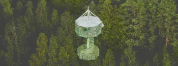
Observation Tower Inspection – Dual Lens Hyperlapse
Orbital flights are fundamental in photogrammetric scanning, especially when working with isolated structures such as towers, chimneys, monuments, or small buildings. They allow for detailed, wrap-around imagery of a subject using relatively simple flight paths and minimal setup.
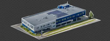
Industrial Building and Roof Scan - Use Case Details
For this use case, I have an industrial building requiring a reasonably detailed 3D reproduction for inspection, solar panel expansion, and general documentation.
Ready to get started with your project?
You can choose from our three different plans or ask for a custom solution where you can process as many photos as you like!
Free 14-day trial. Cancel any time.