.svg@webp)
Construction Site Inspection With Photogrammetry
 Lukas Zmejevskis
Safety and efficiency are two terms that construction site managers love the most. For this blog post, we have a real-world use case for a small roof construction site. Let us analyze this example and highlight how easy and efficient it is to scan and track construction work using manual drone photogrammetry. 3D scenes allow monitoring, archiving, safety, and result inspections without physically accessing the site.
Construction Site Example
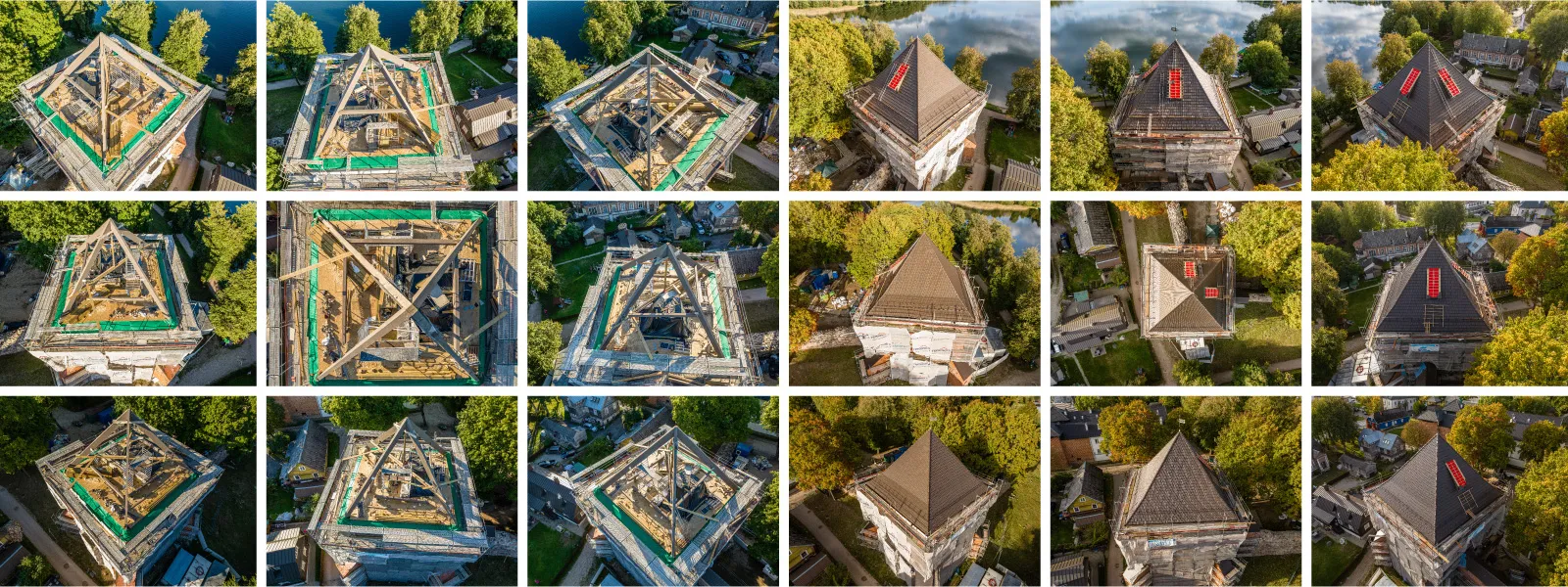
For our example, we chose a small but complex case - the restoration of a roof on a historic castle tower. The area under construction is accessible through scaffolding or the tower itself, which stands inside a closed territory. Suppose an inspector wishes to examine the roof construction site. In that case, there are dozens of safety requirements for physical access. None of this applies to aerial photogrammetry. The area has no significant obstacles or drone flight restrictions, so it is a perfect opportunity to showcase the power of remote sensing.
Data Capture
For photogrammetric scanning, we are using a DJI consumer drone. Which one - does not matter because all of the features used to obtain the photos are available on all modern DJI drones, and all of them can provide good image quality in decent conditions. It is all about the technique.
 For capture, we chose the classic orbital-nadir combo, which provides enough data for good 3D reconstruction and the ability to create an orthophoto image. It is also easily doable with fully manual photogrammetry and will not take too long to process. We have described these techniques in our previous articles here:
Photogrammetry eith DJI Mavic 3 - Nadir Scanning
Photogrammetry with DJI Mavic 3 - Orbital Scanning
We captured our scene twice. Once during the reconstruction without the old roof, with all the support beams visible. Second - with all the work close to completion with the new roof but the equipment still in place. It allows the contractor to fix errors before workers tidy up the site.
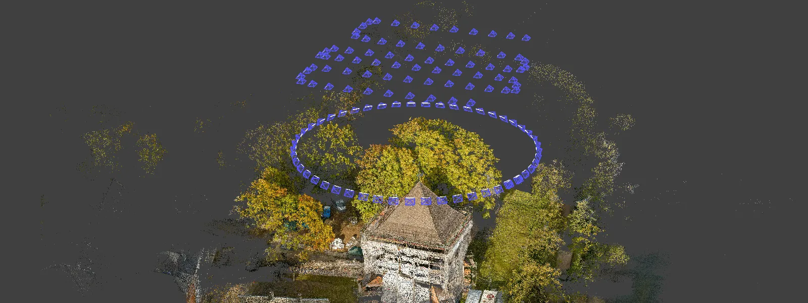
In a more extensive use case, more scans might be necessary. Now, we are using two just as an example. If you need to repeat multiple flights - enterprise-grade drones with flight planning is a more convenient option. But we would like to dispel the myth that “identical” flights are necessary for consistent scene reconstruction. It is simply not the case.
For consistency, you need to ensure that all of the fundamentals of the scan are there - good overlap, coverage, and image quality. You never need to have identical flights or camera positions for your 3D results to be consistent. Sound aerial photogrammetry scans made at similar altitudes are enough for scale and relative accuracy. If you need absolute accuracy - accurate placement on the map and height above sea level - you will need to use RTK drones or ground control points. But in this case, we are doing inspection and measurements, which do not require that.
Data Processing
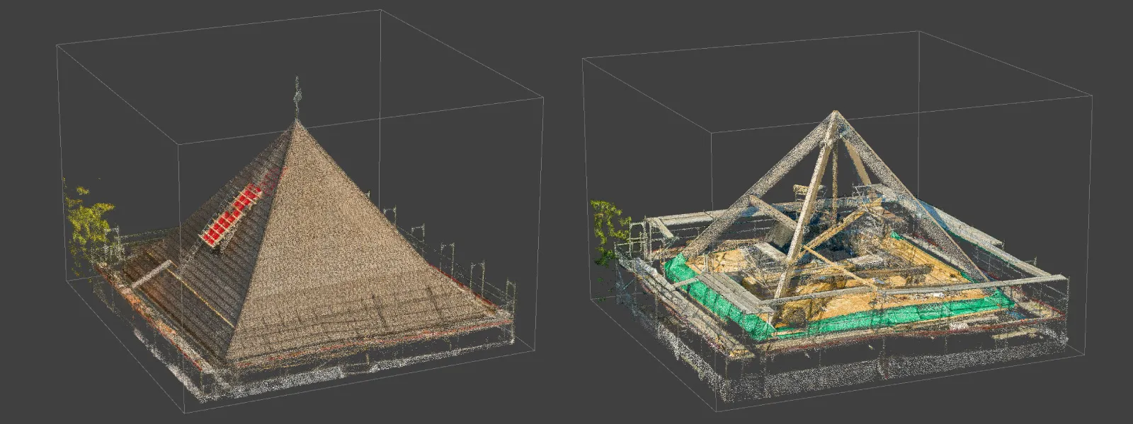
Once we captured all the photos, we ran Pixpro and made point clouds and 3D meshes. We used default settings but cropped the point cloud before creating the 3D mesh. Cropping point clouds yield better quality in our area of interest and reduce the processing time. If you do not crop your dense point cloud - the surrounding area will take up processing resources.
Data Analysis
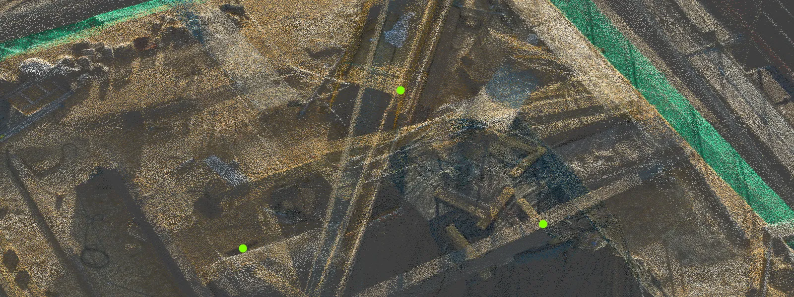
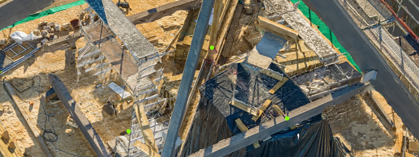
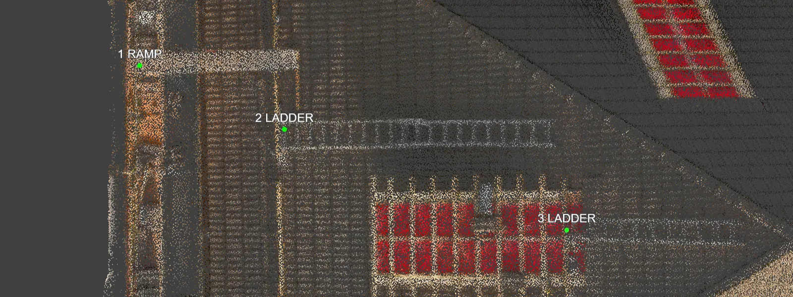
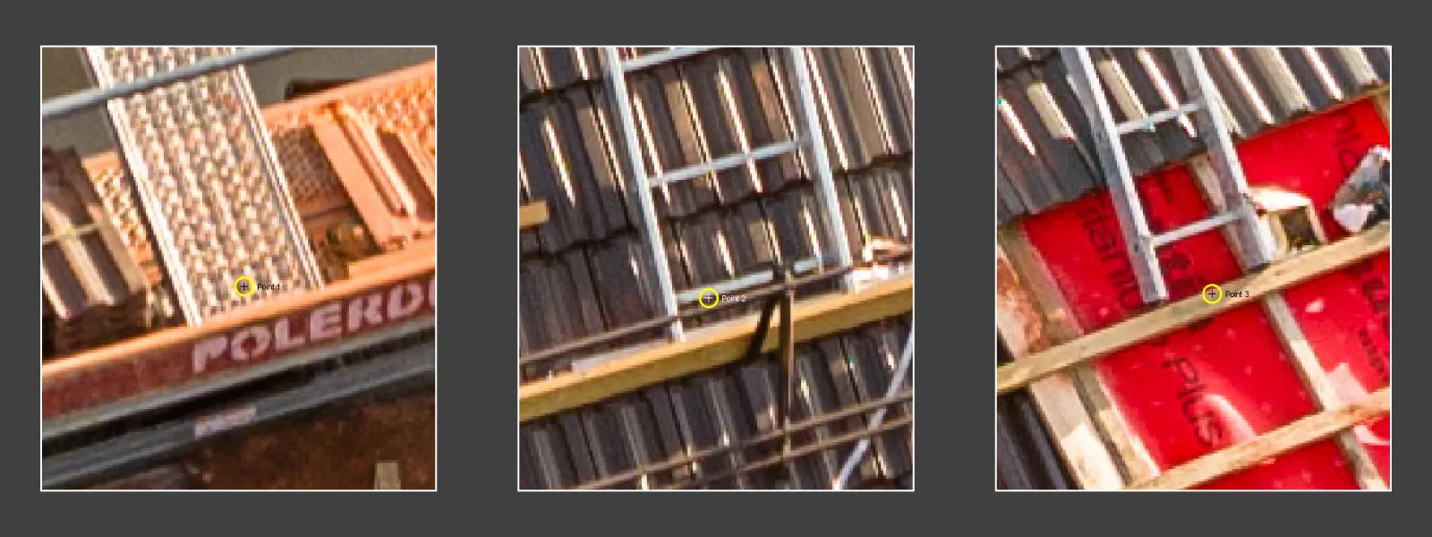
In Pixpro, we can add points in the spots of interest. By checking the point projections - you can inspect the same place in the photos, providing multiple angles of view at maximum resolution.
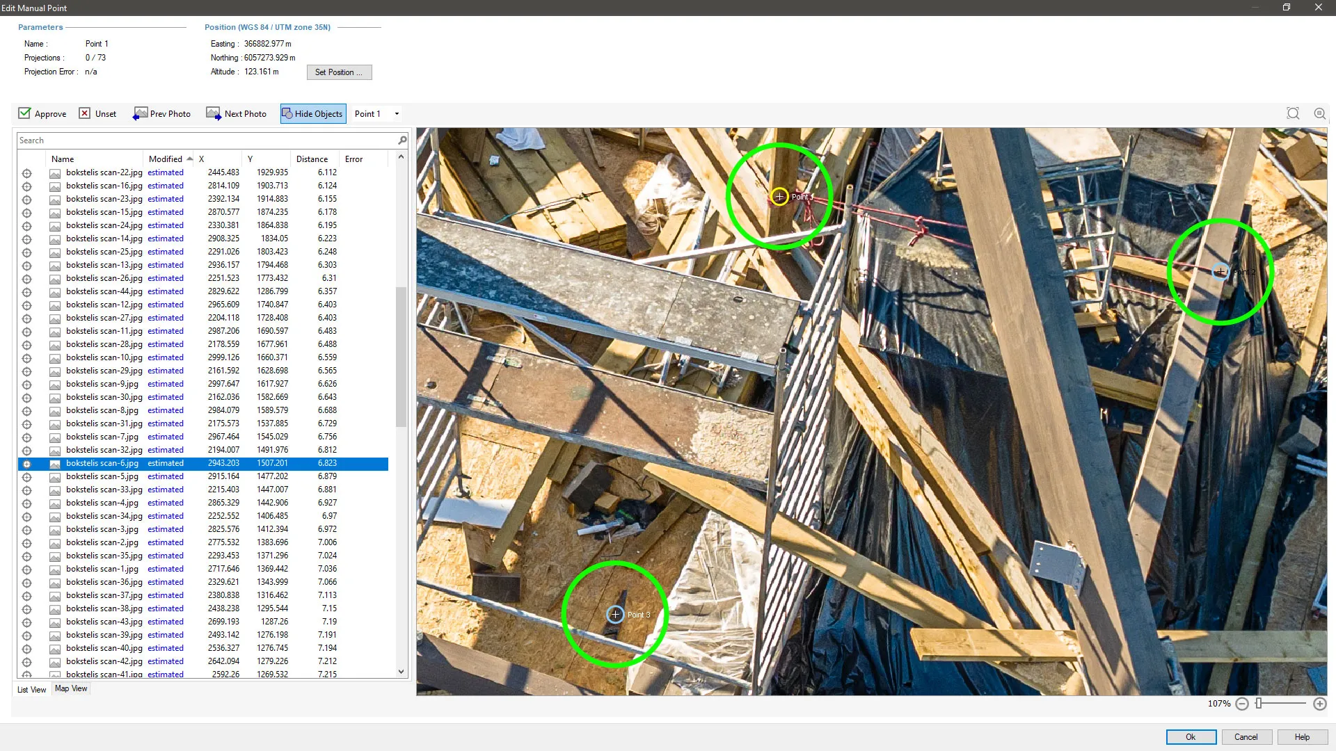
We can add annotations on the points we draw so it is clear what we are designating. These annotations will appear in any snapshots we make with our snapshot tool. Snapshots capture the current 3D view of the software and any additional information you may need. Read more about them in our previous article:
Simple and Quick Photogrammetry Reports in Pixpro Software
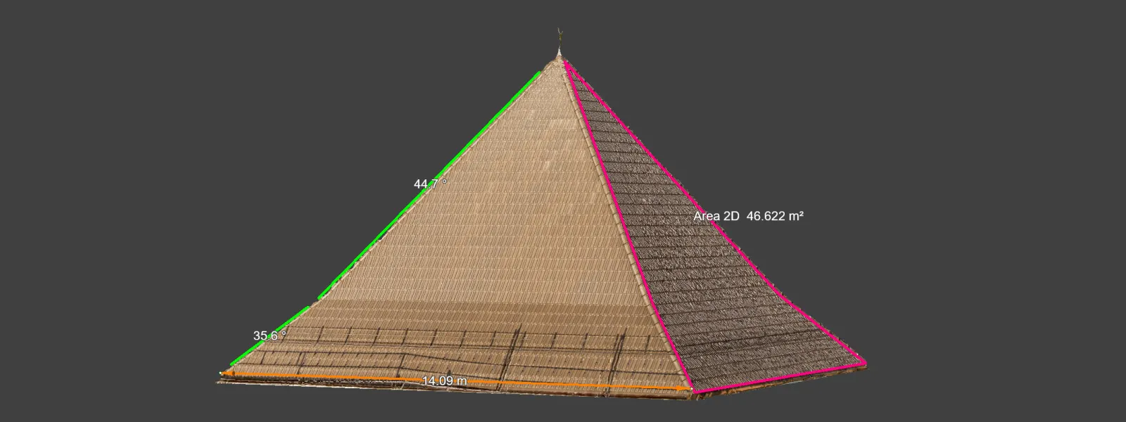
 Finally, we can add lines that provide us with measurements. The measurements appear instantly in the properties panel in Pixpro. These also can have annotations and precise projections for placement and inspection. If a line is selected, you can also export the measurements in a snapshot.
Conclusion
The main benefit of remote sensing is having a digital twin in the palm of your hand. Photos are an undeniable proof of a point in space and time. Still, with aerial photogrammetry - you additionally get 3D scenes and scale. With a good scan, there will be no questions if safety requirements were sufficient during the construction or if something was out of place on the site. You can just jump into the virtual scene on your computer and inspect it in seconds.
On top of that - the safety of not climbing scaffolding or getting close to the equipment. It also means that data capture can occur without any work stoppage at the site. And to achieve all of this - you only need a drone with a camera and Pixpro photogrammetry software.
Photographer - Drone Pilot - Photogrammetrist. Years of experience in gathering data for photogrammetry projects, client support and consultations, software testing, and working with development and marketing teams. Feel free to contact me via Pixpro Discord or email (l.zmejevskis@pix-pro.com) if you have any questions about our blog.
Related Blog Posts
Our Related Posts
All of our tools and technologies are designed, modified and updated keeping your needs in mind
DJI Lito X1 for Roof Photogrammetry: Solar and Inspection Use Case
Small drones are the best tool for residential and even commercial roof photogrammetry. They are quiet, attract less attention, are easier to fly fully within regulations, and they are affordable.
Large Property Photogrammetry – Real Estate Development Use Case
Property scans are one of the most common use cases, especially for our software. Pixpro is affordable and works well with RTK data and ground control points when necessary.
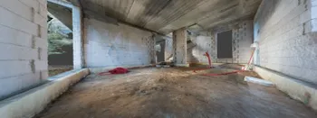
Handheld Photogrammetry Construction Interior Scan Use Case
Interior 3D scanning can be useful in a myriad of ways. In this article, I present a scan of a residential building construction site, with its foundation walls and roof almost complete. Further construction will require some visualizations and design according to “the fact.”
Ready to get started with your project?
You can choose from our three different plans or ask for a custom solution where you can process as many photos as you like!
Free 14-day trial. Cancel any time.
Welcome to Pixpro
Sign in
And access your account.