.svg@webp)
Pit Volume Measurement in Pixpro Photogrammetry
 Lukas
Zmejevskis
Lukas
Zmejevskis
Volumetric measurements are a staple use case for photogrammetry. When it comes to negative volumes such as pits, basins, or valleys - things become even more straightforward than measuring piles of mounds of material. We have a few examples from real-world use cases, and we will use them to demonstrate the simple negative volume measurement workflows in Pixpro photogrammetry software.
Volume Measurement Use Cases
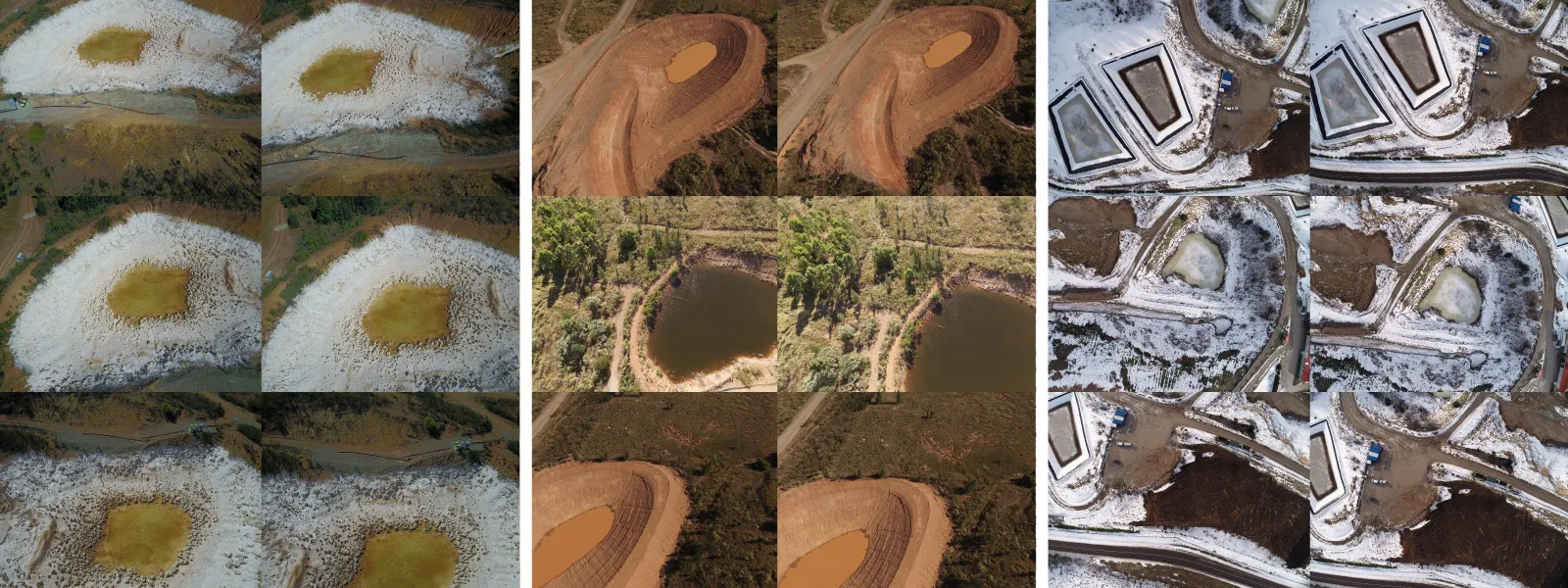
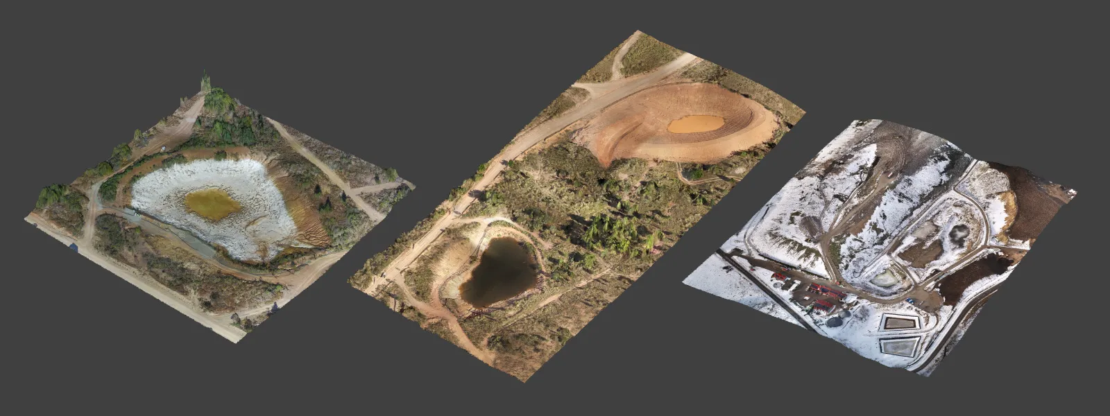
We have examples from three different use cases:
-
Active site monitoring with fluctuating levels of water in open reservoirs.
-
Closed, open-pit, copper mine monitoring use case for safety.
-
Drainage project development for long-term storage.
Objectives of these use cases are simple - to monitor the water levels in pits and basins and measure the remaining volume before spillage occurs. Visual inspection due to changes over time comes as a standard with photogrammetric scans. In the case of drainage development, the photogrammetric 3D scene was used to measure the height difference between the two sites and plan maintenance routes around these sites. We can imagine dozens of similar use cases that benefit greatly from photogrammetric scans and volume measurements in mining, surveying, and construction industries.
Photogrammetric Data Gathering and Processing
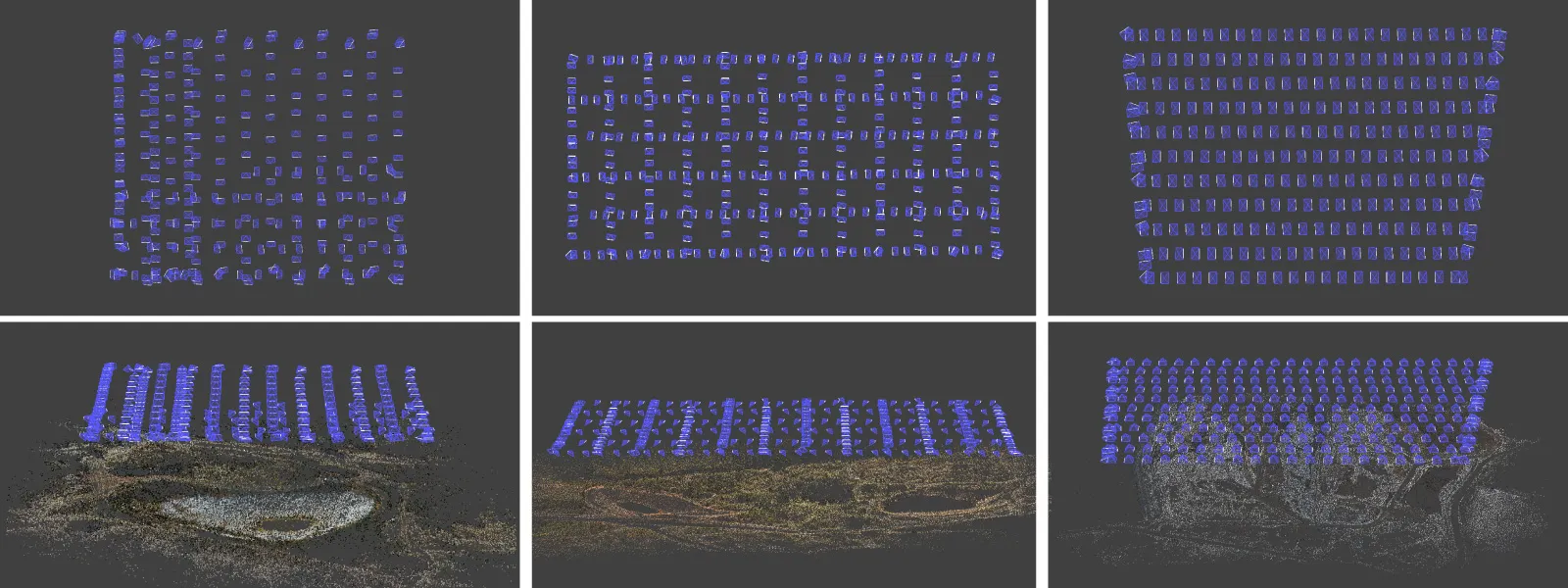
In these use cases, all of the data was gathered using drones. We did oblique and nadir missions with 80 percent overlap. We flew at reasonable altitudes to cover each object in a single battery charge flight. The other fundamentals apply - ensuring shutter speeds to avoid motion blur in photos, fixed focus on the ground, and excellent subject coverage. These practices result in high-quality 3D scenes acquired in 8 - 14 minute flights.
Processing in Pixpro photogrammetry software is simple. We focused on quick turnaround for this set, so we chose "lighter" settings for processing. Contrary to many assumptions, lower-quality settings barely affect the measurements if the scan is well-made and fundamentally sound. You get less visual detail in exchange for less processing time. These are the steps we take:
-
We launch 3D reconstruction on a "Fast" setting and Dense point cloud generation on Low density as a single step from the Full workflow menu.
-
After the processing, we crop our point cloud to reduce its size and eliminate peripheral areas.
-
Then, we create a digital elevation map and true orthophoto with default settings as a single step from the same full workflow menu.
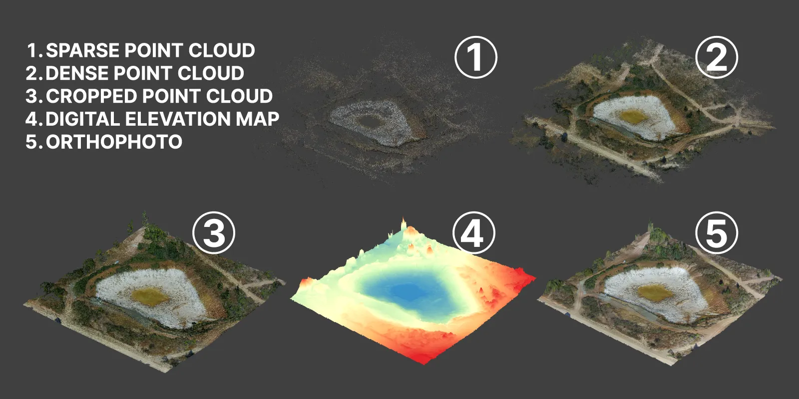 The result is a project with 4 layers - sparse point cloud, dense point cloud, digital elevation map, and orthophoto. We need the DEM surfaces to perform volumetric measurements created from the dense point clouds.
Measurements in Photogrammetry
We acquire measurements by drawing objects in Pixpro. We need to draw polygons and select the correct baseplane to get volumes. If you want a perfectly level plane, you can choose max or mean (or even minimum) base planes, which will calculate the plane's altitude by the maximum or mean height of the polygon points. Choose fitted if you need the baseplane to adjust to all drawn polygon vertices (it will not be level in most cases). These requirements will depend on what exactly you are trying to achieve. Changing the baseplanes in Pixpro is instantaneous, so you can experiment without slowing down.
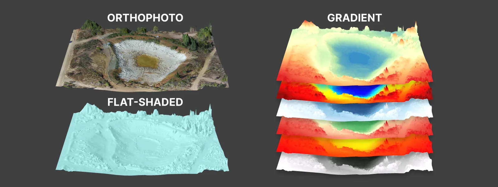
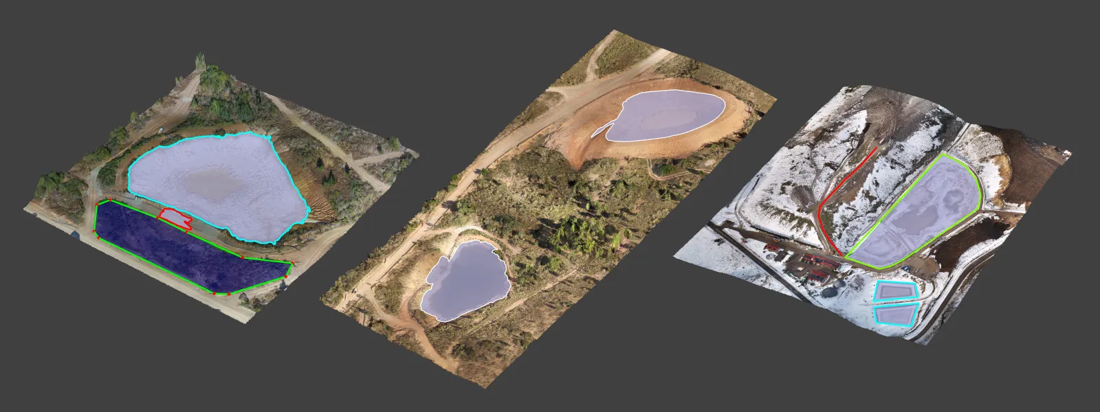 You can draw polygons on the DEM with the orthophoto enabled, which provides a realistic view of the scene. If the orthophoto imagery hides surface shape details, you can choose various shading options for the DEM.
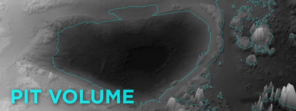
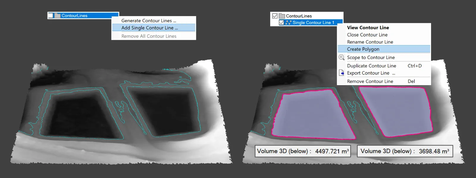
 Once we have drawn our polygons, we can instantly see the measurements in the properties panel. Because we are measuring volumes of pits, we need to look at the measurement named volume (below). This title means that we are measuring the volume of space below the baseplane (whichever type we chose) as enclosed by the DEM surface. This means we are measuring only the empty space below the baseplane.
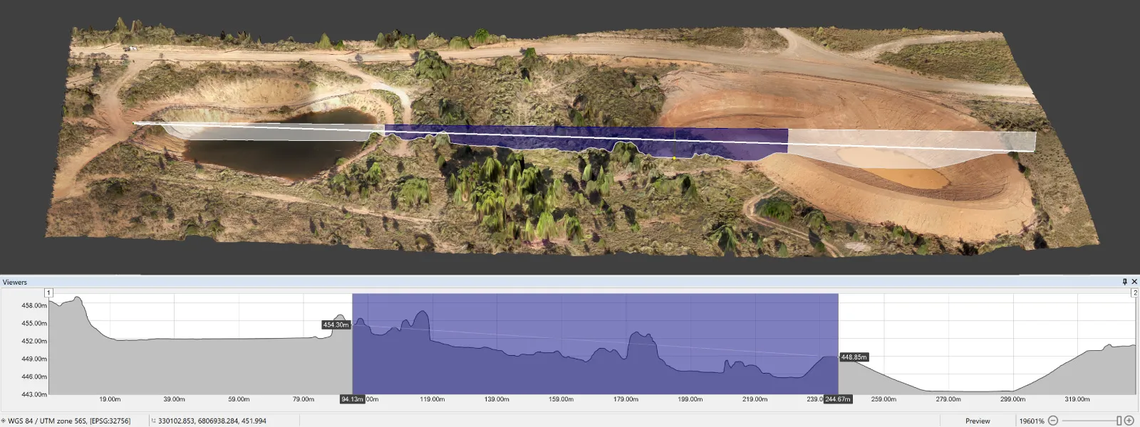
 Profile Tool
Our profile tool helps you see a cross-section of any line. This interactive tool can provide on-the-fly slopes and length measurements within the displayed profile.
Single Contour Line
In Pixpro software - we can draw a single contour line at any height we designate, and using this line, we can form perfectly shaped polygons if such a line is enclosed. This is very easy to do if we draw a single contour line around the edge of a pit. Polygons created from single contour lines will follow the contours of the surface precisely at the specified altitude. You can access the single contour line drawing by right-clicking the contour lines layer group in the layers panel. However, remember that those perfect polygons will slow down the software as there are many vertices to compute.
Conclusion
We hope this article helps understand the volume (below) measurement in Pixpro photogrammetry software and unlocks its potential use cases in various applications. Construction, surveying, mining, and other industry professionals will immediately see the added value of photogrammetry beyond what we can come up with as photogrammetrists. If you do, try Pixpro software and contact us with any data capture or processing questions.
Photographer - Drone Pilot - Photogrammetrist. Years of experience in gathering data for photogrammetry projects, client support and consultations, software testing, and working with development and marketing teams. Feel free to contact me via Pixpro Discord or email (l.zmejevskis@pix-pro.com) if you have any questions about our blog.
Related Blog Posts
Our Related Posts
All of our tools and technologies are designed, modified and updated keeping your needs in mind

Portrait Orientation in Photogrammetry: When It Actually Helps
Is there anything to gain by scanning in portrait instead of the usual landscape? Sometimes, a little. But orientation is one of the least important decisions you make on a scan, and it is worth understanding why before you give it any more thought than that.
DJI Lito X1 for Roof Photogrammetry: Solar and Inspection Use Case
Small drones are the best tool for residential and even commercial roof photogrammetry. They are quiet, attract less attention, are easier to fly fully within regulations, and they are affordable.

Why Choose Pixpro Photogrammetry Software? Practical Comparison
There is no shortage of photogrammetry software today. From well established industry tools to newer cloud based solutions, the choice is not exactly obvious, especially for someone just getting started. Most options promise high accuracy, automation, and ease of use, and to some extent they all del
Ready to get started with your project?
You can choose from our three different plans or ask for a custom solution where you can process as many photos as you like!
Free 14-day trial. Cancel any time.