.svg@webp)
Pixpro photogrammetry blog

Pixpro version 1.7.9 and our 2025 Goals and Expectations
In this blog post, we have a small update to our Pixpro photogrammetry software and a bit of speculation and planning for the upcoming orbit around our G-type main sequence star.
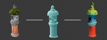
Custom Christmas with Photogrammetry and 3D printing
As we wrap up another year of our existence, as always, it ends with holidays worldwide. Whichever occasion you are celebrating. The festive mood will likely require some decorations around the house.

Pixpro Cloud Processing - Layer Settings Explained
In the latest version of Pixpro, we have more cloud processing options. We can choose which layers to process and some settings for them. I will go through the entire cloud computing workflow in this article, including layer selection and settings.
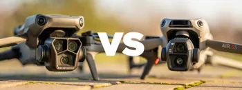
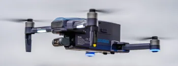
DJI Mavic 3 Pro vs. DJI Air 3S - Ultimate Flying Camera
In this article, I compare two of the best drones on the market. The Air 3S is the newer mid-range drone that comes with the latest DJI tech and some new stuff, while the Mavic 3 Pro is a tried-and-tested flagship model at the tail end of its manufacturing run.
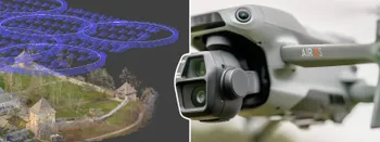
DJI Air 3S for photogrammetry? Automatic Flights with Pixpro Waypoints
The camera is excellent, possibly the best on the market for any fixed-camera drone. And indeed, the best of anything of this size and price. And a good camera means we have to talk about photogrammetry. Because with a great camera comes a great 3D scanning… responsibility.
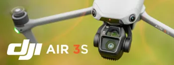
DJI Air 3S Review - The Best Middle Weight Drone Ever
DJI Air is a medium-sized drone between smaller Mini and larger Mavic drones. For many - this is the golden middle, especially after the introduction of the 3X camera with the Air 3.
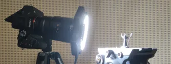
In-Camera Focus Bracketing - Sony A7 IV How To
After many years of manual focusing or using third-party solutions, we finally got the focus bracketing feature in one of the most popular full-frame cameras on the market—the Sony A7 IV.
Veeniix V11 Pro Drone Review - Far From Pro
Recently, we received a Veeniix V11 Pro drone from Rukotoys for review. As always, I am going to give our honest opinion on it. This will not be an extensive review, but we will look at the core features of this drone and see how it handles and how refined it is.

Pixpro Update 1.7.8 - Timeline and Speed
A new update to our Pixpro photogrammetry software is here. It is a small one, with only a few notable changes. However, these changes concern workflows of core features—timeline and cloud computing.
Ready to get started with your project?
You can choose from our three different plans or ask for a custom solution where you can process as many photos as you like!
Free 14-day trial. Cancel any time.
Welcome to Pixpro
Sign in
And access your account.