.svg@webp)
Pixpro photogrammetry blog

Pixpro Update 1.7.8 - Timeline and Speed
A new update to our Pixpro photogrammetry software is here. It is a small one, with only a few notable changes. However, these changes concern workflows of core features—timeline and cloud computing.

Small Scale Scan Part 2 - Cross Polarization for Difficult Objects
This time, however, we are tackling a much more difficult object as promised, which could be considered a worst-case scenario, but still scannable.

Small Scale Photogrammetry Part 1 - Main Challenges and a Best Case
Small-scale photogrammetry has the classic fundamental requirements, while the challenges and difficulties can be different and unique compared to medium-scale or aerial photogrammetry.

Manual Referencing In Pixpro - Scale Without GPS
Referencing encompasses the properties of a 3D scene that give it scale and positioning on the map. It is a core concept in photogrammetry and 3D scanning.

Property Scanning for Lawn Mowing Evaluation
Our photogrammetry software users often ask us questions about software and specific use cases, some of which we hear for the first time. One such case was property scanning for lawn mover system installation.

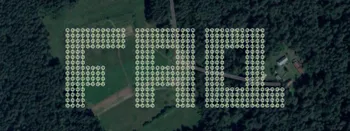
Dirt Race Track Photogrammetric Inspection and Measurement
We are back with another simple photogrammetry use case from the real world. We captured an area that contains an amateur dirt race track and is part of an entertainment complex.

Pixpro Waypoints Update - Multi Grids
We are updating our Pixpro Waypoints service with a new plan—multi grids—and a few other minor improvements.
Most Asked Questions - Pixpro Waypoints
We have been receiving a lot of questions about our waypoint service. Pixpro Waypoints allow users to use the latest DJI drones for automated photogrammetry scans.

Pixpro Version 1.7.7 - Batch Processing and New Measurements
We are bringing another update to Pixpro photogrammetry software. This article will describe the new features in the 1.7.7 version and the minor tweaks we made in the previous one.
Ready to get started with your project?
You can choose from our three different plans or ask for a custom solution where you can process as many photos as you like!
Free 14-day trial. Cancel any time.
Welcome to Pixpro
Sign in
And access your account.